Bank Quay Reach
Sea, Estuary, Creek in Lancashire
England
Bank Quay Reach

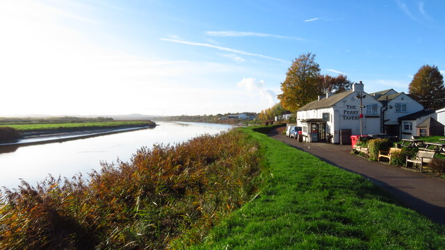
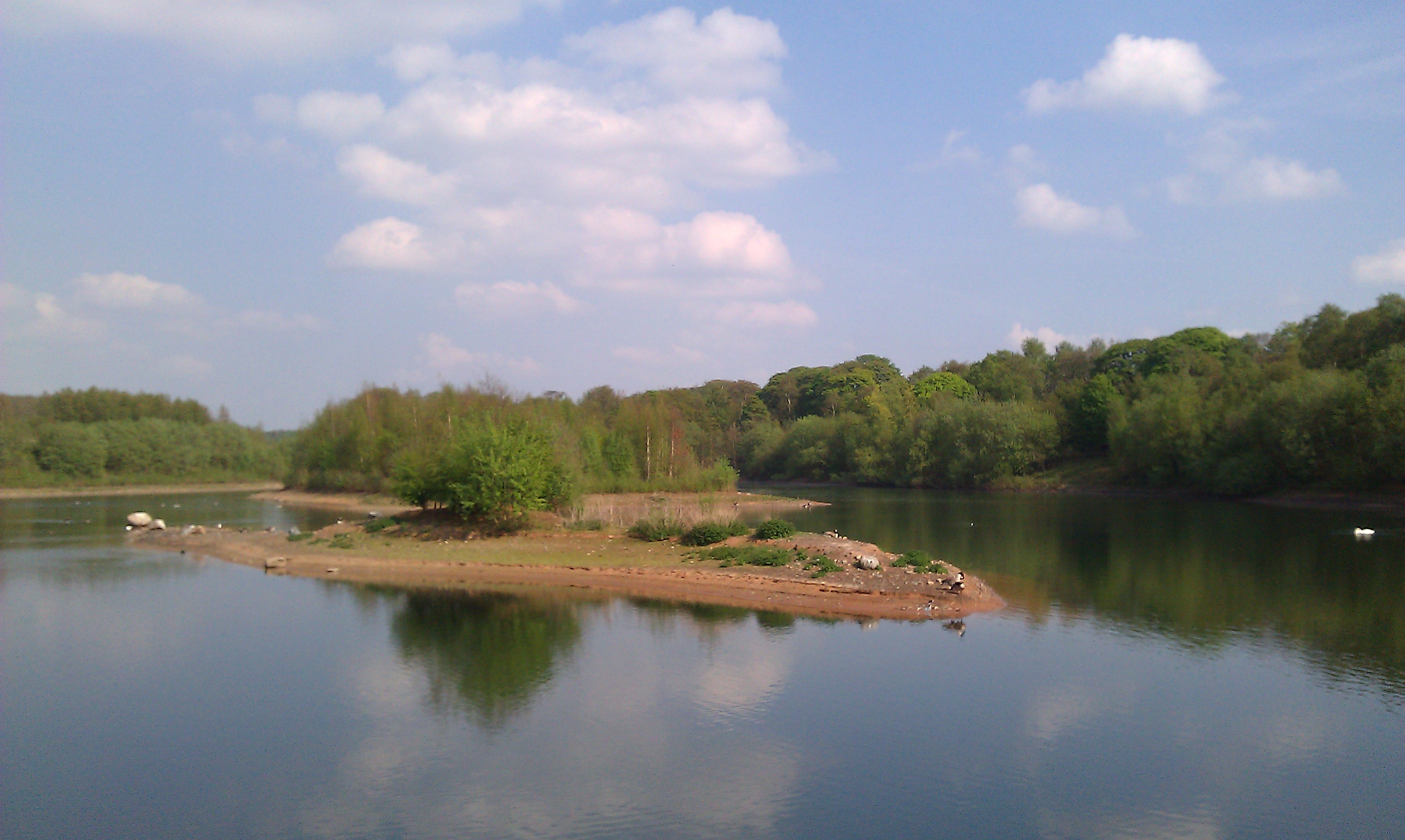
Bank Quay Reach is a small coastal area located in Lancashire, England. Situated along the banks of a sea, estuary, and creek, it offers a diverse and picturesque landscape for visitors and locals alike.
The sea at Bank Quay Reach provides a stunning backdrop with its vast expanse of blue waters. Visitors can enjoy activities such as swimming, sailing, and fishing in the sea, which is known for its rich marine life and abundance of fish species. The sandy beaches along the coast are perfect for sunbathing and picnicking, offering a serene and tranquil atmosphere.
The estuary at Bank Quay Reach is a unique feature of the area. It is formed as the river meets the sea, creating a brackish water environment that supports a variety of plant and animal species. The estuary is an important habitat for many migratory birds, making it a popular spot for birdwatching enthusiasts. The surrounding marshes and mudflats are home to a diverse range of flora and fauna, providing a haven for nature lovers.
A creek also runs through Bank Quay Reach, adding to the charm of the area. The creek is a narrow waterway that offers opportunities for boating and kayaking, allowing visitors to explore the region from a different perspective. The creek is lined with lush green vegetation, creating a peaceful and serene atmosphere for those seeking relaxation and tranquility.
Overall, Bank Quay Reach in Lancashire is a unique coastal area that offers a blend of sea, estuary, and creek. Its diverse landscape and natural beauty make it a popular destination for outdoor activities, wildlife observation, and leisurely walks along the shoreline.
If you have any feedback on the listing, please let us know in the comments section below.
Bank Quay Reach Images
Images are sourced within 2km of 53.375932/-2.6298198 or Grid Reference SJ5886. Thanks to Geograph Open Source API. All images are credited.


Bank Quay Reach is located at Grid Ref: SJ5886 (Lat: 53.375932, Lng: -2.6298198)
Unitary Authority: Warrington
Police Authority: Cheshire
What 3 Words
///ropes.gives.scar. Near Great Sankey, Cheshire
Nearby Locations
Related Wikis
Moore Nature Reserve
Moore Nature Reserve is a nature reserve in the village of Moore in Halton, Cheshire, England. Created from an area which had included a sand quarry and...

Sankey Bridges railway station
Sankey Bridges railway station was in southwestern Warrington, England. It was located immediately west of a swing bridge over the Sankey Canal. The station...
Sankey Bridges
Sankey Bridges is part of the Parish of Holy Trinity in Warrington, a unitary authority in the north-west of England. Located on the turnpike road between...
Warrington Dock
Warrington Dock was situated on the River Mersey at Warrington. Warrington was once the furthest point navigable upstream on the River Mersey. A dock evolved...
Warrington rail crash
The Warrington rail crash occurred at Walton Junction just south of the town of Warrington in Lancashire on 29 June 1867. The collision involved a passenger...

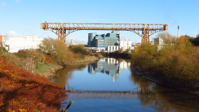
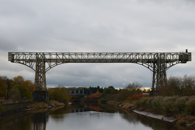
Warrington Transporter Bridge
The Warrington Transporter Bridge (or Bank Quay Transporter Bridge) is a structural steel transporter bridge across the River Mersey in Warrington, Cheshire...
Whitecross railway station
Whitecross railway station was in the Whitecross area of Warrington, England. It was built and operated by the St Helens and Runcorn Gap Railway as a temporary...
St Gregory's Catholic High School
St Gregory's Catholic High School is a committed Roman Catholic co-educational voluntary aided comprehensive school that educates approximately 970 children...
Nearby Amenities
Located within 500m of 53.375932,-2.6298198Have you been to Bank Quay Reach?
Leave your review of Bank Quay Reach below (or comments, questions and feedback).