Port Buckie

Sea, Estuary, Creek in Cromartyshire

Scotland

Port Buckie

Possible WWII Radar Station at Tarbat Ness, Cromatyshire I could find no official explanation of the purpose of this abandoned building.  An entry on the website Pastmap suggests that this might be part of the remains of a world war 2 radar station.  This would make sense given the elevated location on an east coast headland, and would fit with the style of brick built construction which is quite different from the local vernacular.
Possible WWII Radar Station at Tarbat Ness, Cromatyshire Credit: Andrew Tryon

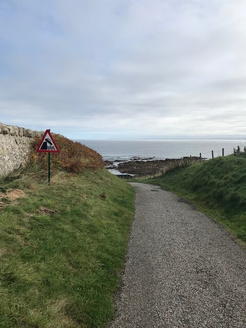
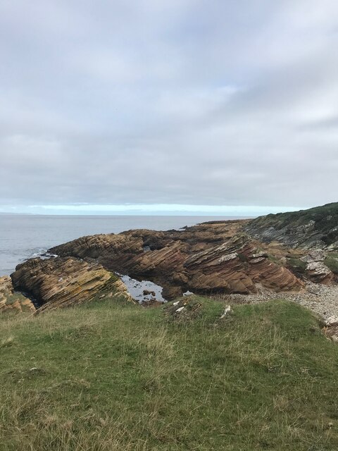
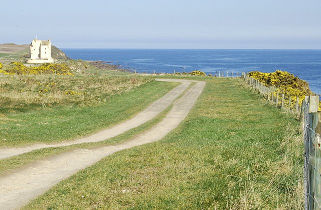
Port Buckie is a picturesque coastal town located in the region of Cromartyshire, Scotland. Situated on the eastern shore of the Moray Firth, it boasts a stunning setting with its scenic sea views, estuary, and creek. The town is built around the natural harbor of Buckie, which has long been a significant fishing port.

The sea surrounding Port Buckie provides a wealth of opportunities for both locals and visitors. It is a popular spot for water sports enthusiasts, with activities such as sailing, kayaking, and windsurfing being enjoyed along its shores. The pristine beaches offer a perfect setting for families to relax, sunbathe, or take a refreshing swim in the clear waters.

The estuary, formed by the River Spey, adds to the charm of Port Buckie. It is a haven for wildlife, attracting various bird species and marine life. Nature lovers can explore the surrounding wetlands and observe the diverse flora and fauna that call this area home.

A defining feature of Port Buckie is its picturesque creek, which winds its way through the town. The creek provides a tranquil setting, with walking paths along its banks where residents and visitors can enjoy a leisurely stroll or take in the views.

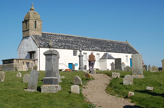
Port Buckie is not only known for its natural beauty but also for its rich maritime history. The town's fishing heritage is evident in its architecture, with traditional fisherman's cottages and historic buildings lining the streets.

In conclusion, Port Buckie in Cromartyshire offers a captivating blend of natural beauty, maritime history, and recreational activities. Whether you are seeking a peaceful coastal retreat or an active outdoor adventure, this charming town has something to offer everyone.

If you have any feedback on the listing, please let us know in the comments section below.

Port Buckie Images

Images are sourced within 2km of 57.865504/-3.7942094 or Grid Reference NH9387. Thanks to Geograph Open Source API. All images are credited.

Possible WWII Radar Station at Tarbat Ness, Cromatyshire I could find no official explanation of the purpose of this abandoned building.  An entry on the website Pastmap suggests that this might be part of the remains of a world war 2 radar station.  This would make sense given the elevated location on an east coast headland, and would fit with the style of brick built construction which is quite different from the local vernacular.
Possible WWII Radar Station at Tarbat Ness, Cromatyshire
I could find no official explanation of the purpose of this abandoned building. An entry on the website Pastmap suggests that this might be part of the remains of a world war 2 radar station. This would make sense given the elevated location on an east coast headland, and would fit with the style of brick built construction which is quite different from the local vernacular.
Arable Land at Tarbat Ness, Ross and Cromarty A peninsula on the east coast of Scotland.  In the background is the Stephenson-built Tarbat Ness Light house.
Arable Land at Tarbat Ness, Ross and Cromarty
A peninsula on the east coast of Scotland. In the background is the Stephenson-built Tarbat Ness Light house.
Towards Tarbatness lighthouse
Deserted Cottage
Deserted Cottage
Track to the sea
Track to the sea
Path to Tarbatness
Path to Tarbatness
Path to Tarbatness
Path to Tarbatness
Path to Tarbatness
Path to Tarbatness
Road to Wilkhaven Pier
Foreshore near Wilkhaven
Tarbatness Lighthouse in the distance
Tarbatness lighthouse from higher up the cliff face
Path on foreshore
Path on foreshore
Tarbatness Lighthouse Still operational.
Tarbatness Lighthouse
Still operational.
Road to Tarbatness
Road to Tarbatness
Old milestone This milestone is opposite the gate and lane leading to Tarbatness lighthouse. See also <a href="https://www.geograph.org.uk/photo/6098158">NH9487 : Old Milestone near Tarbat Ness, Portmahomack parish</a>. On the 1880 6" OS Balnagown Bridge 15 Tarbatness ¼.   On the 1907 OS Tarbatness ¼ Tain 12½.  This circular stone has a circumference of 91cm.  It is sunken to about half its height so only 46cm is above the soil.   Straight on past this milestone leads to Wilkhaven Jetty.
Old milestone
This milestone is opposite the gate and lane leading to Tarbatness lighthouse. See also NH9487 : Old Milestone near Tarbat Ness, Portmahomack parish. On the 1880 6" OS Balnagown Bridge 15 Tarbatness ¼. On the 1907 OS Tarbatness ¼ Tain 12½. This circular stone has a circumference of 91cm. It is sunken to about half its height so only 46cm is above the soil. Straight on past this milestone leads to Wilkhaven Jetty.
Creag Ruadh at Tarbat Ness Aptly named, the 'red crags'. Beyond is Robert Stevenson's lighthouse, first lit in 1830.
Creag Ruadh at Tarbat Ness
Aptly named, the 'red crags'. Beyond is Robert Stevenson's lighthouse, first lit in 1830.
Coastal slopes near Tarbat Ness
Show me another place!

Port Buckie is located at Grid Ref: NH9387 (Lat: 57.865504, Lng: -3.7942094)

Unitary Authority: Highland

Police Authority: Highlands and Islands

What 3 Words

///lately.kingpin.daredevil. Near Dornoch, Highland

Related Wikis

Tarbat Ness

Tarbat Ness (Scottish Gaelic: Rubha Thairbeirt) is headland that lies at the end of the Tarbat peninsula in Easter Ross, Scotland. The name is from the...

Portmahomack sculpture fragments

The Portmahomack sculpture fragments are the slabs and stone fragments which have been discovered at the Easter Ross settlement of Portmahomack (Tarbat...

Portmahomack

Portmahomack (Scottish Gaelic: Port Mo Chalmaig; 'Haven of My [i.e. 'Saint'] Colmóc') is a small fishing village in Easter Ross, Scotland. It is situated...

Battle of Tarbat

The Battle of Tarbat was a Scottish clan battle fought in the 1480s on the Tarbat peninsula, in Easter Ross. The Clan Ross cornered a raiding party of...

Tarbat

Tarbat (Gaelic tairbeart, meaning 'a crossing or isthmus') is a civil parish in Highland, Scotland, in the north-east corner of Ross and Cromarty. The...

Ballone Castle

Ballone Castle was built in the 16th century. It was unoccupied for a couple of centuries and fell into ruin. In the 1990s it was purchased and restored...

Rockfield, Highland

Rockfield (Scottish Gaelic: Creag Tarail Bhig) is a hamlet in the parish of Tarbat, on the Tarbat Peninsula, near the village of Portmahomack, Easter...

Toulvaddie

Toulvaddie (Scottish Gaelic: Toll a' Mhadaidh) is a hamlet, in the Tarbat peninsula, located in Tain, Ross-shire, Scottish Highlands and is in the Scottish...

Nearby Amenities

Located within 500m of 57.865504,-3.7942094
Source: PGS
Lat/Long: 57.8659399/-3.7861526
Source: PGS
Lat/Long: 57.8662288/-3.7864155
Source: PGS
Lat/Long: 57.865782/-3.7876385
Created By: dmgroom_coastlines
Source: PGS
Lat/Long: 57.86539/-3.788449
Source: PGS
Lat/Long: 57.8652384/-3.7886294
Source: PGS
Lat/Long: 57.8648863/-3.7892801
Source: PGS
Lat/Long: 57.8646405/-3.789798
Source: PGS
Lat/Long: 57.8646289/-3.7908805
Source: PGS
Lat/Long: 57.8647461/-3.7913078
Source: PGS
Lat/Long: 57.8649141/-3.7918102
Source: PGS
Lat/Long: 57.8650878/-3.7922385
Source: PGS
Lat/Long: 57.8651317/-3.7928683
Source: PGS
Lat/Long: 57.8649886/-3.7936
Source: PGS
Lat/Long: 57.8649672/-3.7954384
Source: PGS
Lat/Long: 57.8651394/-3.7960907
Source: PGS
Lat/Long: 57.8651497/-3.7969056
Source: PGS
Lat/Long: 57.8651018/-3.7977811
Source: PGS
Lat/Long: 57.8650079/-3.798155
Source: PGS
Lat/Long: 57.8647733/-3.7981635
Source: PGS
Lat/Long: 57.8646158/-3.7990937
Source: PGS
Lat/Long: 57.8641979/-3.799779
Source: PGS
Lat/Long: 57.8638611/-3.8003238
Source: PGS
Lat/Long: 57.8637562/-3.8008833
Source: PGS
Lat/Long: 57.8639376/-3.8013854
Source: PGS
Lat/Long: 57.8639878/-3.8015758
Source: PGS
Lat/Long: 57.8636465/-3.8016783
Source: PGS
Lat/Long: 57.8634673/-3.8014299
WWII Bombing Marker
Historic: ruins
Lat/Long: 57.8610996/-3.7937689
The data included in this document is from www.openstreetmap.org. The data is made available under ODbL.

Have you been to Port Buckie?

Leave your review of Port Buckie below (or comments, questions and feedback).