Warfleet Creek

Sea, Estuary, Creek in Devon South Hams

England

Warfleet Creek

Charred tree stump above Newfoundland Cove Sixteen months after <a href="https://www.geograph.org.uk/photo/6553373">SX9049 : Charred tree stump above Newfoundland Cove</a>, there is plenty of new ground cover but the stump remains as a reminder.
Charred tree stump above Newfoundland Cove Credit: Derek Harper

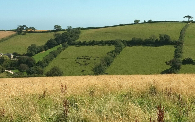
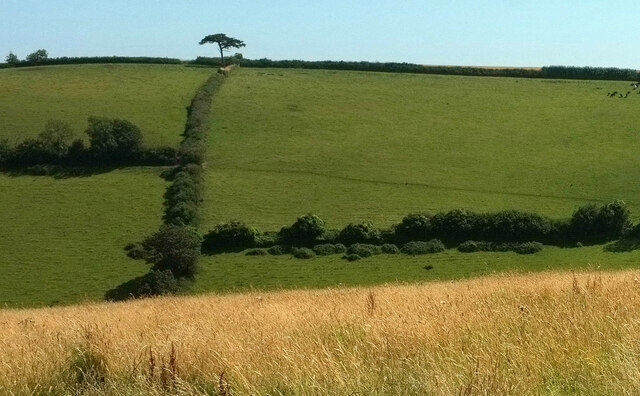
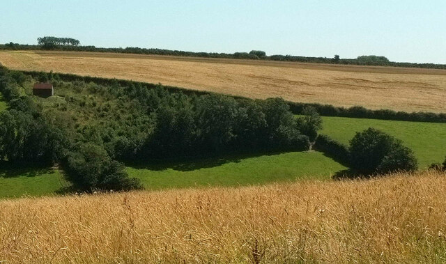
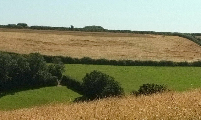
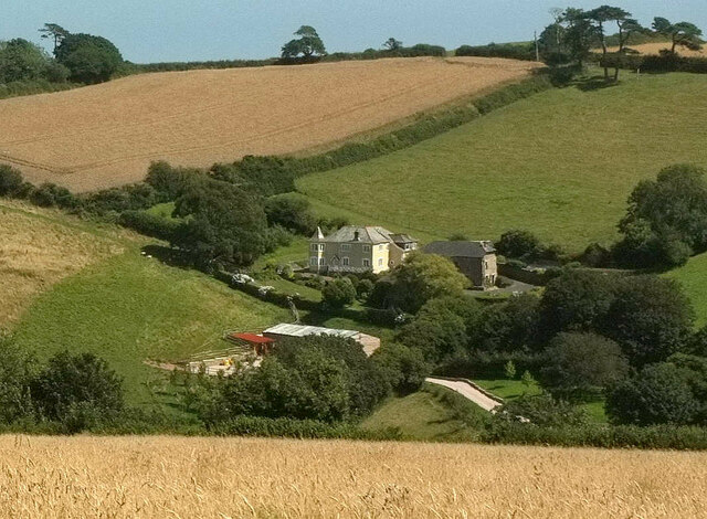
Warfleet Creek is a picturesque waterway located in Devon, a county in southwestern England. It is situated near the town of Dartmouth, flowing into the Dart Estuary. The creek is approximately 2 kilometers long and is known for its stunning natural beauty and tranquil surroundings.

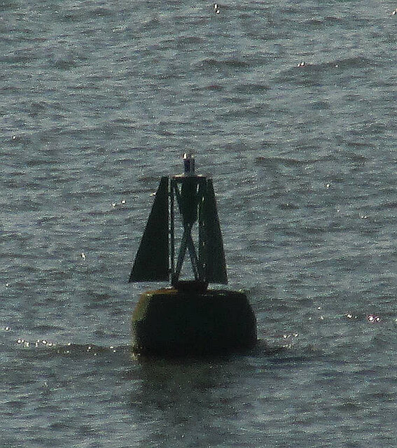
As a tidal creek, Warfleet Creek experiences regular fluctuations in water levels due to the ebb and flow of the tide. During high tide, the creek is filled with crystal-clear seawater, creating a peaceful and serene atmosphere. At low tide, the water recedes, revealing a muddy estuary floor. This tidal movement also affects the creek's speed and strength, with the currents varying throughout the day.

The creek is surrounded by lush greenery and rolling hills, making it an ideal spot for nature enthusiasts and hikers. The area is home to a diverse range of wildlife, including various species of birds, fish, and crustaceans, which thrive in the creek's rich ecosystem.

Warfleet Creek has historical significance as well. It was once a bustling port and shipbuilding center during the medieval period, with several shipyards and warehouses dotting its shores. Today, remnants of this maritime past can still be seen, adding an element of historical charm to the area.

Visitors to Warfleet Creek can enjoy activities such as boating, fishing, or simply taking a leisurely stroll along its banks. The creek's tranquil ambiance and stunning natural surroundings make it a popular destination for locals and tourists alike, providing a peaceful retreat amidst the beauty of Devon's coastal landscape.

If you have any feedback on the listing, please let us know in the comments section below.

Warfleet Creek Images

Images are sourced within 2km of 50.342933/-3.5730156 or Grid Reference SX8850. Thanks to Geograph Open Source API. All images are credited.

Charred tree stump above Newfoundland Cove Sixteen months after <a href="https://www.geograph.org.uk/photo/6553373">SX9049 : Charred tree stump above Newfoundland Cove</a>, there is plenty of new ground cover but the stump remains as a reminder.
Charred tree stump above Newfoundland Cove
Sixteen months after SX9049 : Charred tree stump above Newfoundland Cove, there is plenty of new ground cover but the stump remains as a reminder.
Bench overlooking The Warren Just off the coastal path as it goes towards Froward Point.
Bench overlooking The Warren
Just off the coastal path as it goes towards Froward Point.
Fields near Lower Weeke Looking right from <a href="https://www.geograph.org.uk/photo/6926864">SX8850 : Across the valley from Swannaton Road</a>.
Fields near Lower Weeke
Fields near Lower Weeke Looking right from <a href="https://www.geograph.org.uk/photo/6926887">SX8749 : Fields near Lower Weeke</a>, with overlap.
Fields near Lower Weeke
Looking right from SX8749 : Fields near Lower Weeke, with overlap.
Trees by young wood, Weeke Looking right from <a href="https://www.geograph.org.uk/photo/6926894">SX8749 : Fields near Lower Weeke</a>. The wood also appears in <a href="https://www.geograph.org.uk/photo/6608416">SX8749 : Valley, Week</a>.
Trees by young wood, Weeke
Looking right from SX8749 : Fields near Lower Weeke. The wood also appears in SX8749 : Valley, Week.
Farmland, Weeke Looking right from <a href="https://www.geograph.org.uk/photo/6927011">SX8749 : Trees by young wood, Weeke</a>, with overlap.
Farmland, Weeke
Looking right from SX8749 : Trees by young wood, Weeke, with overlap.
Lower Weeke Seen from the gateway in <a href="https://www.geograph.org.uk/photo/6927158">SX8750 : Gateway, Swannaton Road</a>.
Lower Weeke
Seen from the gateway in SX8750 : Gateway, Swannaton Road.
Valley, Weeke A view towards Weeke Cottage from Swannaton. Beyond it, Dartmouth footpath 6 climbs beside a hedge.
Valley, Weeke
A view towards Weeke Cottage from Swannaton. Beyond it, Dartmouth footpath 6 climbs beside a hedge.
Buoy off Newfoundland Cove Presumably a bell buoy, but an interesting shape, by the entrance to the River Dart.
Buoy off Newfoundland Cove
Presumably a bell buoy, but an interesting shape, by the entrance to the River Dart.
The South West Coast Path at The Warren
Foxglove on the coast path Digitalis purpurea above Newfoundland Cove. The blooms in South Devon only began to open the week before, and were currently at their best.
Foxglove on the coast path
Digitalis purpurea above Newfoundland Cove. The blooms in South Devon only began to open the week before, and were currently at their best.
South West Coast Path above Newfoundland Cove The path climbs through a mixture of vegetation towards the northwest corner of the square.
South West Coast Path above Newfoundland Cove
The path climbs through a mixture of vegetation towards the northwest corner of the square.
Slopes above Newfoundland Cove From the coast path, high above <a href="https://www.geograph.org.uk/photo/812076">SX8949 : Newfoundland Cove</a>, looking across the precipitous slopes to where the trees begin to close in.
Slopes above Newfoundland Cove
From the coast path, high above SX8949 : Newfoundland Cove, looking across the precipitous slopes to where the trees begin to close in.
South Hams : South West Coast Path Looking along the coast path.
South Hams : South West Coast Path
Looking along the coast path.
South Hams : Coastal Scenery The coastline from above Newfoundland Cove.
South Hams : Coastal Scenery
The coastline from above Newfoundland Cove.
South Hams : Coastal Scenery Looking across the coast from above Newfoundland Cove.
South Hams : Coastal Scenery
Looking across the coast from above Newfoundland Cove.
South Hams : Coastal Scenery Looking out across the South Hams coastline.
South Hams : Coastal Scenery
Looking out across the South Hams coastline.
South Hams : Coastal Scenery Trees hug the coastal cliffs off on the South Hams.
South Hams : Coastal Scenery
Trees hug the coastal cliffs off on the South Hams.
Show me another place!

Warfleet Creek is located at Grid Ref: SX8850 (Lat: 50.342933, Lng: -3.5730156)

Administrative County: Devon

District: South Hams

Police Authority: Devon and Cornwall

What 3 Words

///pheasants.tallest.debating. Near Dartmouth, Devon

Related Wikis

Warfleet Creek

Warfleet Creek is a small triangular tidal inlet in the west side of the River Dart estuary in England. It is near Dartmouth, Devon. It has steep rocky...

Dartmouth Castle

Dartmouth Castle is an artillery fort, built to protect Dartmouth harbour in Devon, England. The earliest parts of the castle date from the 1380s, when...

Dartmouth Friary

Dartmouth Friary was an Augustinian friary in Dartmouth, Devon, England. It was founded in 1331 and ceased to function as a friary in 1347. == Background... ==

Kingswear

Kingswear is a village and civil parish in the South Hams area of the English county of Devon. The village is located on the east bank of the tidal River...

Nearby Amenities

Located within 500m of 50.342933,-3.5730156
Source: PGS
Lat/Long: 50.347246/-3.5727926
Source: PGS
Lat/Long: 50.3470543/-3.5724331
Source: PGS
Lat/Long: 50.3468258/-3.5710957
Source: PGS
Lat/Long: 50.3467409/-3.5706261
Source: PGS
Lat/Long: 50.3466795/-3.5700835
Source: PGS
Lat/Long: 50.3466525/-3.5694754
Source: PGS
Lat/Long: 50.342928/-3.5677591
Source: PGS
Lat/Long: 50.3436039/-3.5692046
Source: PGS
Lat/Long: 50.3435072/-3.5693895
Source: PGS
Lat/Long: 50.3433124/-3.5702525
Source: PGS
Lat/Long: 50.3431158/-3.5710628
Source: PGS
Lat/Long: 50.3429207/-3.5717423
Source: PGS
Lat/Long: 50.3426622/-3.5725778
Source: PGS
Lat/Long: 50.3425178/-3.5735292
Source: PGS
Lat/Long: 50.342984/-3.5733163
Source: PGS
Lat/Long: 50.3434131/-3.5726748
Source: PGS
Lat/Long: 50.3437319/-3.5722513
Source: PGS
Lat/Long: 50.3438909/-3.5730138
Source: PGS
Lat/Long: 50.3441063/-3.5739179
Source: PGS
Lat/Long: 50.3448603/-3.5751816
Source: PGS
Lat/Long: 50.3453089/-3.5759079
Source: PGS
Lat/Long: 50.3455174/-3.5763248
Source: PGS
Lat/Long: 50.3458087/-3.5763212
Source: PGS
Lat/Long: 50.3463113/-3.5768229
One Gun Point
Natural: headland
Source: OS_OpenData_StreetView
Lat/Long: 50.3435312/-3.5687285
Ferry Terminal
Ferry: yes
Public Transport: station
Lat/Long: 50.34269/-3.56717
Toilets
Check Date: 2023-06-27
Fee: no
Lat/Long: 50.3418976/-3.5664863
Post Box
Brand: Royal Mail
Brand Wikidata: Q638098
Brand Wikipedia: en:Royal Mail
Check Date: 2022-03-26
Collection Times: Mo-Fr 09:00; Sa 07:00; Su off
Operator: Royal Mail
Operator Wikidata: Q638098
Post Box Design: type_b
Post Box Mounting: brick_pillar
Post Box Type: wall
Ref: TQ6 156D
Royal Cypher: EIIR
Royal Cypher Wikidata: Q33102113
Source: survey;streetlevel imagery;aerial imagery
Lat/Long: 50.343061/-3.573787
Post Box
Brand: Royal Mail
Brand Wikidata: Q638098
Brand Wikipedia: en:Royal Mail
Check Date: 2022-06-18
Collection Times: Mo-Fr 09:00; Sa 07:00; Su off
Mapillary: 350022693442429
Operator: Royal Mail
Operator Wikidata: Q638098
Post Box Mounting: brick_pillar
Post Box Type: wall
Ref: TQ6 162D
Royal Cypher: EIIR
Royal Cypher Wikidata: Q33102113
Source: survey;streetlevel imagery;aerial imagery
Survey Date: 2022-06-18
Lat/Long: 50.3454249/-3.577021
Seamark Beacon Lateral Category: port
Seamark Beacon Lateral Colour: red
Seamark Beacon Lateral Shape: pile
Seamark Beacon Lateral System: iala-a
Seamark Type: beacon_lateral
Lat/Long: 50.3439143/-3.5717904
Seamark Buoy Special Purpose Colour: yellow
Seamark Buoy Special Purpose Shape: spherical
Seamark Type: buoy_special_purpose
Lat/Long: 50.3440804/-3.5711626
Bench
Backrest: yes
Lat/Long: 50.3403815/-3.5672133
Kerb: no
Lat/Long: 50.3452475/-3.5772595
Waste Basket
Lat/Long: 50.3430349/-3.5738035
Bench
Backrest: yes
Mapillary: 3893638014047538
Survey Date: 2018-05-27
Lat/Long: 50.3430084/-3.5738263
Street Lamp
Lat/Long: 50.3426489/-3.5739912
Street Lamp
Lat/Long: 50.3419522/-3.5744378
Street Lamp
Lat/Long: 50.3433362/-3.573381
Street Lamp
Lat/Long: 50.3431505/-3.5737203
Street Lamp
Lat/Long: 50.3415952/-3.5746391
Street Lamp
Lat/Long: 50.3458883/-3.5778442
Street Lamp
Lat/Long: 50.3455862/-3.577513
Waste Basket
Waste: dog_excrement
Lat/Long: 50.3453877/-3.5774325
Street Lamp
Lat/Long: 50.3453615/-3.5769338
Street Lamp
Lat/Long: 50.345243/-3.5772206
Street Lamp
Lat/Long: 50.343833/-3.5741843
Bench
Backrest: yes
Mapillary: 1036416163560021
Survey Date: 2018-05-27
Lat/Long: 50.3437701/-3.5740529
Bench
Backrest: yes
Lat/Long: 50.3439113/-3.5744928
Bench
Backrest: yes
Mapillary: 390301645421247
Survey Date: 2018-05-27
Lat/Long: 50.3438591/-3.5743466
Note: gate for "Gramercy Boathouse" and "Ten Fathoms"
Lat/Long: 50.3441604/-3.574816
Street Lamp
Note: mounted on house wall
Lat/Long: 50.3463037/-3.5775587
Note: gate to 2 Beechcroft, Gallants Quay 32A
Lat/Long: 50.3457831/-3.5771629
Street Lamp
Lat/Long: 50.3456795/-3.5772045
Colour: green
Man Made: street_cabinet
Street Cabinet: telecom
Lat/Long: 50.3454532/-3.5770281
Colour: green
Communication: outdoor_dslam
Man Made: street_cabinet
Street Cabinet: telecom
Lat/Long: 50.3454425/-3.5770187
Street Lamp
Lat/Long: 50.3448754/-3.5762458
Bench
Backrest: yes
Lat/Long: 50.3411257/-3.5665748
Bench
Backrest: yes
Lat/Long: 50.3429231/-3.5702287
Bench
Backrest: yes
Lat/Long: 50.3406026/-3.5670398
Bench
Backrest: yes
Lat/Long: 50.3427554/-3.5708992
Telephone
Defibrillator
Booth: K6
Check Date: 2023-06-27
Covered: booth
Defibrillator Location: inside red phone box in front of the toilets by Dartmouth Castle
Emergency: defibrillator
Indoor: yes
Listed Status: Grade II
Man Made: telephone_box
Lat/Long: 50.3419377/-3.5664609
Generator Method: photovoltaic
Generator Output Electricity: yes
Generator Source: solar
Generator Type: solar_photovoltaic_panel
Location: roof
Power: generator
Lat/Long: 50.3460617/-3.577045
Generator Method: photovoltaic
Generator Output Electricity: yes
Generator Source: solar
Generator Type: solar_photovoltaic_panel
Location: roof
Power: generator
Lat/Long: 50.3417361/-3.5760311
Generator Method: photovoltaic
Generator Output Electricity: yes
Generator Source: solar
Generator Type: solar_photovoltaic_panel
Location: roof
Power: generator
Lat/Long: 50.3469118/-3.5700274
Generator Method: photovoltaic
Generator Output Electricity: yes
Generator Source: solar
Generator Type: solar_photovoltaic_panel
Location: roof
Power: generator
Lat/Long: 50.346905/-3.5698579
Power: pole
Lat/Long: 50.3433784/-3.5794388
Power: pole
Lat/Long: 50.3430846/-3.5787881
Power: pole
Lat/Long: 50.3427568/-3.5780904
Power: pole
Lat/Long: 50.342262/-3.577626
Power: pole
Lat/Long: 50.3416247/-3.5774643
Barrier: kissing_gate
Lat/Long: 50.3410613/-3.5711097
Addr City: Dartmouth
Addr Housename: The Old Coachouse
Addr Housenumber: 3
Addr Street: Weeke Hill
Lat/Long: 50.3411223/-3.5749426
Addr City: Dartmouth
Addr Housenumber: 4
Addr Street: Warfleet Creek Road
Lat/Long: 50.3421098/-3.5738801
Boat Storage
Warfleet Quay Boat Park
Access: permit
Operator: Dartmouth Town Council
Lat/Long: 50.3424138/-3.5733926
Addr City: Dartmouth
Addr Housename: Creek Cottage
Addr Street: Warfleet Creek Road
Lat/Long: 50.3423525/-3.573913
Addr City: Dartmouth
Addr Housename: The Old Coachouse
Addr Housenumber: 2
Addr Street: Weeke Hill
Lat/Long: 50.3412298/-3.5749463
Addr City: Dartmouth
Addr Housename: Creek View
Addr Street: Warfleet Creek Road
Lat/Long: 50.3421894/-3.5738068
Addr City: Dartmouth
Addr Housename: Foretop Cottage
Addr Street: Castle Road
Lat/Long: 50.3425452/-3.571217
Addr City: Dartmouth
Addr Housename: Gunfield
Addr Street: Castle Road
Lat/Long: 50.3432548/-3.5692206
Addr City: Dartmouth
Addr Housename: 4 Cottages
Addr Street: Warfleet Creek Road
Lat/Long: 50.3416939/-3.5741176
Addr Block Number: Appartments 2,3,4,5,6,7,8,9
Addr City: Dartmouth
Addr Street: Warfleet Creek Road
Lat/Long: 50.3419584/-3.5741143
Addr City: Dartmouth
Addr Housename: Warfleet Cottage
Addr Street: Warfleet Creek Road
Lat/Long: 50.3422357/-3.5738773
Addr City: Dartmouth
Addr Housename: Haven Lights
Addr Street: Castle Road
Lat/Long: 50.3429649/-3.568385
Addr City: Dartmouth
Addr Housename: 3 Cottages
Addr Street: Warfleet Creek Road
Lat/Long: 50.3416494/-3.5741763
Addr City: Dartmouth
Addr Housename: The Old Coachouse
Addr Housenumber: 1
Addr Street: Weeke Hill
Lat/Long: 50.3412876/-3.5748792
Addr Block Number: Appartment 1
Addr City: Dartmouth
Addr Street: Warfleet Creek Road
Tourism: apartment
Lat/Long: 50.3421052/-3.5741009
Addr City: Dartmouth
Addr Housename: Riverside
Lat/Long: 50.3433128/-3.5698756
Addr City: Dartmouth
Addr Housename: Rosebank
Addr Street: Castle Road
Lat/Long: 50.3429242/-3.5678939
Addr City: Dartmouth
Addr Housename: Pottery Cottage
Addr Housenumber: 1
Addr Street: Warfleet Creek Road
Lat/Long: 50.3415031/-3.5744549
Addr City: Dartmouth
Addr Housename: Slipway
Addr Street: Warfleet Creek Road
Lat/Long: 50.3423296/-3.5737446
Addr City: Dartmouth
Addr Housename: Galions Quay
Addr Street: Castle Road
Lat/Long: 50.3432228/-3.56967
Addr City: Dartmouth
Addr Housename: 5 Cottages
Addr Street: Warfleet Creek Road
Lat/Long: 50.3417341/-3.5740564
Addr City: Dartmouth
Addr Housename: 10 Cottages
Addr Street: Warfleet Creek Road
Lat/Long: 50.3419164/-3.5738257
Addr City: Dartmouth
Addr Housename: 9 Cottages
Addr Street: Warfleet Creek Road
Lat/Long: 50.3418813/-3.5738619
Addr City: Dartmouth
Addr Housename: 8 Cottages
Addr Street: Warfleet Creek Road
Lat/Long: 50.3418428/-3.5739088
Addr City: Dartmouth
Addr Housename: 7 Cottages
Addr Street: Warfleet Creek Road
Lat/Long: 50.3418034/-3.5739558
Addr City: Dartmouth
Addr Housename: 6 Cottages
Addr Street: Warfleet Creek Road
Lat/Long: 50.3417692/-3.5740161
Give Way
Direction: forward
Lat/Long: 50.3427246/-3.5739268
Bench
Survey Date: 2022-03-26
Lat/Long: 50.3418355/-3.5664344
Bench
Backrest: yes
Survey Date: 2022-03-26
Lat/Long: 50.3420521/-3.5665147
Bench
Backrest: yes
Survey Date: 2022-03-26
Lat/Long: 50.3420284/-3.5664381
Bench
Backrest: yes
Survey Date: 2022-03-26
Lat/Long: 50.3426041/-3.567443
Fire Hydrant
Emergency: fire_hydrant
Fire Hydrant Diameter Signed: no
Fire Hydrant Position: lane
Fire Hydrant Type: underground
Survey Date: 2022-03-26
Lat/Long: 50.3431703/-3.5690682
Life Ring
Emergency: life_ring
Survey Date: 2022-05-28
Lat/Long: 50.342439/-3.5736184
Information: guidepost
Survey Date: 2022-03-26
Tourism: information
Lat/Long: 50.3402434/-3.5682075
Bench
Backrest: yes
Survey Date: 2022-03-26
Lat/Long: 50.3426019/-3.5724313
Information: guidepost
Survey Date: 2022-03-26
Tourism: information
Lat/Long: 50.3400772/-3.5682272
Bench
Survey Date: 2022-03-26
Lat/Long: 50.34166/-3.566345
Waste Basket
Survey Date: 2022-03-26
Lat/Long: 50.3425672/-3.5724395
Fire Hydrant
Emergency: fire_hydrant
Fire Hydrant Type: underground
Survey Date: 2022-03-26
Lat/Long: 50.3400588/-3.5683001
Bench
Backrest: yes
Survey Date: 2022-03-26
Lat/Long: 50.3404417/-3.5679232
Waste Basket
Survey Date: 2022-03-26
Lat/Long: 50.3413664/-3.5665527
Bench
Survey Date: 2022-03-26
Lat/Long: 50.3417045/-3.5662695
Bench
Survey Date: 2022-03-26
Lat/Long: 50.34171/-3.5662927
Bench
Survey Date: 2022-03-26
Lat/Long: 50.3416833/-3.5662564
Waste Basket
Survey Date: 2022-03-26
Lat/Long: 50.3422424/-3.566547
Bench
Backrest: yes
Survey Date: 2022-03-26
Lat/Long: 50.3425794/-3.5674288
Waste Basket
Survey Date: 2022-03-26
Lat/Long: 50.3420396/-3.5665197
Bench
Survey Date: 2022-03-26
Lat/Long: 50.3418509/-3.5664384
Bench
Survey Date: 2022-03-26
Lat/Long: 50.3416744/-3.5663006
Life Ring
Emergency: life_ring
Survey Date: 2022-03-26
Lat/Long: 50.342628/-3.5672754
Defibrillator
Defibrillator Location: On wall next to Postbox on Warfleet Road
Emergency: defibrillator
Indoor: no
Mapillary: 1402375196829999
Survey Date: 2022-03-26
Lat/Long: 50.3430744/-3.5737802
Fire Hydrant
Emergency: fire_hydrant
Fire Hydrant Diameter: 4"
Fire Hydrant Position: lane
Fire Hydrant Type: underground
Survey Date: 2022-03-26
Lat/Long: 50.341502/-3.5747231
Leisure: slipway
Lat/Long: 50.3425663/-3.5733803
Fire Hydrant
Emergency: fire_hydrant
Fire Hydrant Type: underground
Survey Date: 2022-06-18
Lat/Long: 50.3424245/-3.5736808
Fire Hydrant
Emergency: fire_hydrant
Survey Date: 2022-06-18
Lat/Long: 50.3445574/-3.5758209
Fire Hydrant
Emergency: fire_hydrant
Survey Date: 2022-06-18
Lat/Long: 50.3436987/-3.5737389
Bench
Backrest: yes
Survey Date: 2022-06-18
Lat/Long: 50.3426456/-3.5724392
Fire Hydrant
Emergency: fire_hydrant
Fire Hydrant Type: underground
Survey Date: 2022-06-18
Lat/Long: 50.3428747/-3.5708563
Bench
Backrest: yes
Survey Date: 2022-06-18
Lat/Long: 50.3426428/-3.5724673
Bench
Backrest: yes
Survey Date: 2022-06-18
Lat/Long: 50.3426248/-3.5725509
Bench
Backrest: yes
Survey Date: 2022-06-18
Lat/Long: 50.3426215/-3.5726342
Fire Hydrant
Emergency: fire_hydrant
Fire Hydrant Type: underground
Survey Date: 2022-06-18
Lat/Long: 50.3442413/-3.5752384
Fire Hydrant
Emergency: fire_hydrant
Fire Hydrant Type: underground
Survey Date: 2022-06-18
Lat/Long: 50.3451259/-3.5770743
Bench
Backrest: yes
Lat/Long: 50.3453201/-3.5769336
Barrier: lift_gate
Lat/Long: 50.3460215/-3.5772785
Bench
Backrest: yes
Lat/Long: 50.3455888/-3.5782814
The data included in this document is from www.openstreetmap.org. The data is made available under ODbL.

Have you been to Warfleet Creek?

Leave your review of Warfleet Creek below (or comments, questions and feedback).