Castle Point

Coastal Feature, Headland, Point in Devon South Hams

England

Castle Point

Beetle on the military road A tiny shiny black beetle with red legs, a little larger than a ladybird, in defensive mode on the permissive path past the daymark.
Beetle on the military road Credit: Derek Harper

Castle Point is a prominent headland located along the coast of Devon, England. Situated in the southern part of the county, it forms part of the larger Jurassic Coastline, which is renowned for its geological significance and natural beauty.

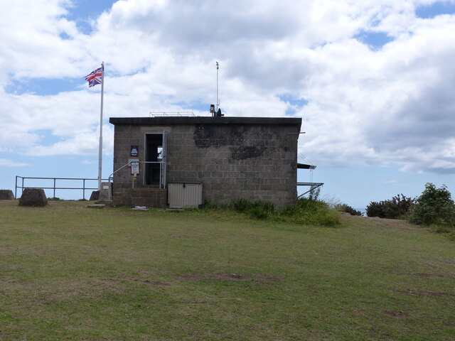
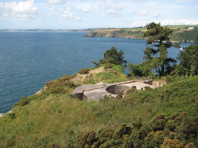
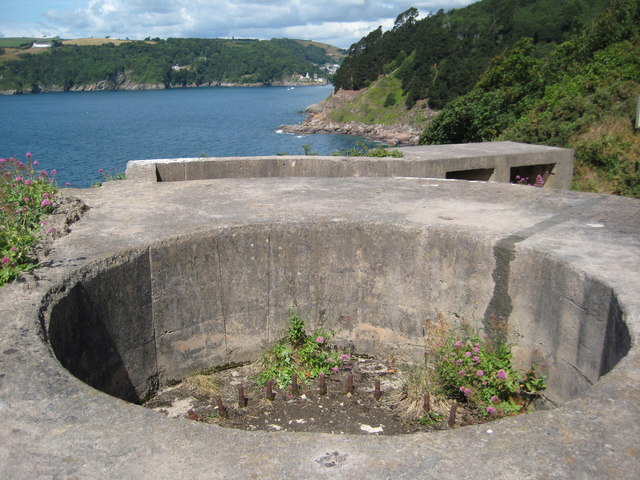
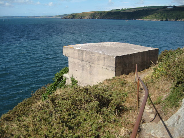
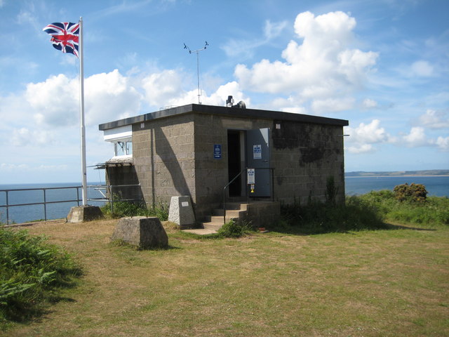
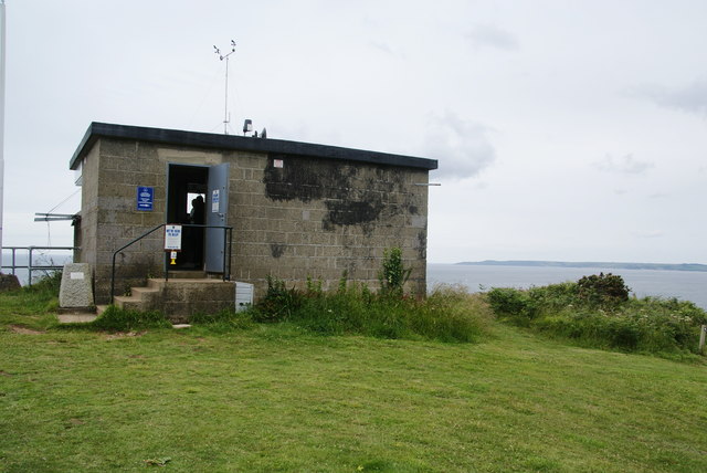
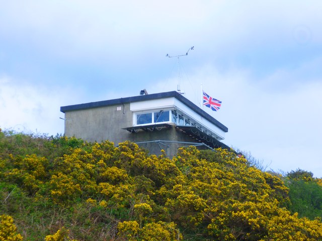
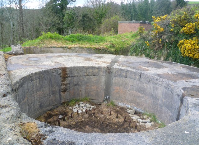
Rising sharply from the surrounding landscape, Castle Point stands as a formidable coastal feature, jutting out into the English Channel. Its name is derived from the remnants of an ancient fortification that once occupied the site, although only a few ruins remain today.

The headland is characterized by its rugged cliffs, which showcase layers of sedimentary rock dating back millions of years. These cliffs provide a glimpse into the region's geological past, with fossilized remains of prehistoric creatures often found within their layers.

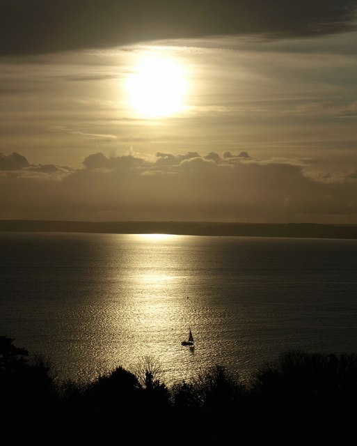
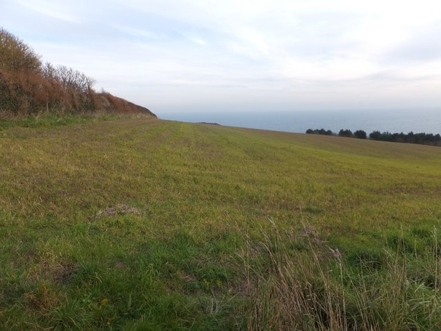
Castle Point offers breathtaking panoramic views of the surrounding coastline, making it a popular destination for visitors and locals alike. From its vantage point, one can admire the vast expanse of the sea, as well as the picturesque beaches and bays that dot the shoreline.

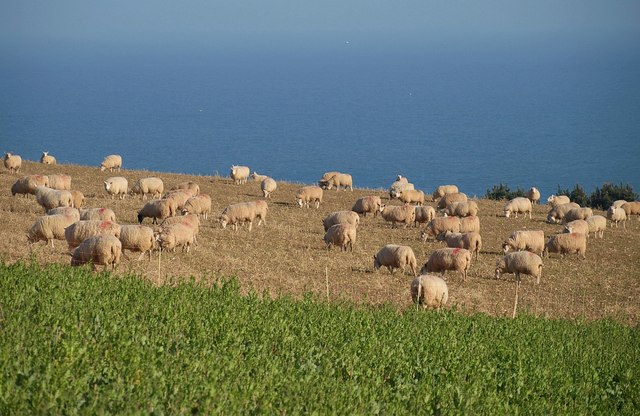
The headland also serves as an important habitat for various bird species, including seabirds such as gulls and cormorants. The surrounding waters are home to a rich marine ecosystem, with occasional sightings of dolphins and seals adding to the area's natural appeal.

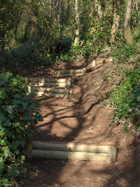
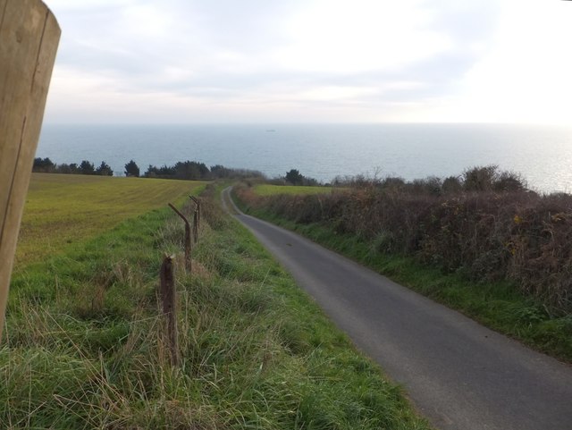
Castle Point is easily accessible via a network of footpaths and trails, allowing visitors to explore its rugged beauty on foot. Whether it's for its geological significance, stunning vistas, or abundant wildlife, Castle Point offers a captivating experience for those seeking to immerse themselves in Devon's coastal charm.

If you have any feedback on the listing, please let us know in the comments section below.
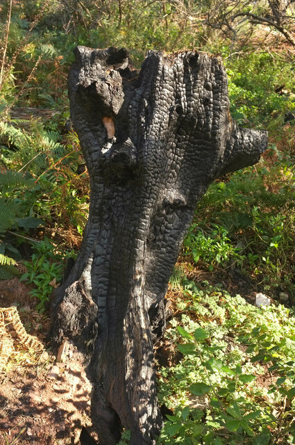
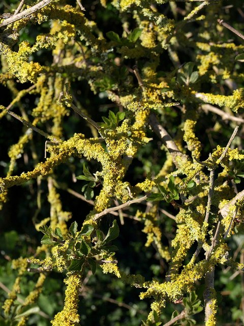
Castle Point Images

Images are sourced within 2km of 50.342505/-3.5660588 or Grid Reference SX8850. Thanks to Geograph Open Source API. All images are credited.

Beetle on the military road A tiny shiny black beetle with red legs, a little larger than a ladybird, in defensive mode on the permissive path past the daymark.
Beetle on the military road
A tiny shiny black beetle with red legs, a little larger than a ladybird, in defensive mode on the permissive path past the daymark.
Coastguard building
Coastguard building
Charred tree stump above Newfoundland Cove Sixteen months after <a href="https://www.geograph.org.uk/photo/6553373">SX9049 : Charred tree stump above Newfoundland Cove</a>, there is plenty of new ground cover but the stump remains as a reminder.
Charred tree stump above Newfoundland Cove
Sixteen months after SX9049 : Charred tree stump above Newfoundland Cove, there is plenty of new ground cover but the stump remains as a reminder.
Sheep above Inner Froward Point Some tempting spring greens await these sheep when the fence is shifted. Beyond is the English Channel; pretty sure the specks are gulls rather than boats.
Sheep above Inner Froward Point
Some tempting spring greens await these sheep when the fence is shifted. Beyond is the English Channel; pretty sure the specks are gulls rather than boats.
Lichen, Inner Froward Point Battery Yellow lichen on an elder bush by the South West Coast Path.
Lichen, Inner Froward Point Battery
Yellow lichen on an elder bush by the South West Coast Path.
New steps on the coast path These steps are a recent feature on a steep section of path approaching the battery on Inner Froward Point.
New steps on the coast path
These steps are a recent feature on a steep section of path approaching the battery on Inner Froward Point.
Brownstone Battery The remains of a World War II gun emplacement at Brownstone Battery above Inner Froward Point.
Brownstone Battery
The remains of a World War II gun emplacement at Brownstone Battery above Inner Froward Point.
Brownstone Battery The remains of a World War II gun emplacement at Brownstone Battery above Inner Froward Point.
Brownstone Battery
The remains of a World War II gun emplacement at Brownstone Battery above Inner Froward Point.
Former searchlight emplacement Former searchlight emplacement at Brownstone Battery.
Former searchlight emplacement
Former searchlight emplacement at Brownstone Battery.
Coast guard lookout, Inner Froward Point Coast guard lookout on the site of a former WWII battery above Inner Froward Point.
Coast guard lookout, Inner Froward Point
Coast guard lookout on the site of a former WWII battery above Inner Froward Point.
Bench overlooking The Warren Just off the coastal path as it goes towards Froward Point.
Bench overlooking The Warren
Just off the coastal path as it goes towards Froward Point.
Coastguard lookout station on Inner Froward Point This is now manned by volunteers, who are extremely enthusiastic and helpful.
Coastguard lookout station on Inner Froward Point
This is now manned by volunteers, who are extremely enthusiastic and helpful.
Boat off Inner Froward Point A small boat crosses Start Bay illuminated by the winter sun, seen from the Military road above the coastal battery.
Boat off Inner Froward Point
A small boat crosses Start Bay illuminated by the winter sun, seen from the Military road above the coastal battery.
National Coastwatch Institution Lookout Station The National Coastwatch Institution (NCI) is a voluntary organisation set up in 1994 to restore a visual watch along UK shores after many small Coastguard stations closed. NCI is a registered charity managed by a board of Trustees with a Constitution agreed by the Charities Commission.
National Coastwatch Institution Lookout Station
The National Coastwatch Institution (NCI) is a voluntary organisation set up in 1994 to restore a visual watch along UK shores after many small Coastguard stations closed. NCI is a registered charity managed by a board of Trustees with a Constitution agreed by the Charities Commission.
Gun Emplacement at Brownstone Battery Brownstone Battery is a World War II coastal defence position, situated on the eastern side of the mouth of the river Dart estuary at Froward Point (Grid Ref: 902946). This area has commanding views across Start Bay, which helped in its defence role. The site consists of two gun positions, two searchlight positions and a variety of other buildings, including an observation post, generator room, ammunition store, general store and mess rooms, which can still be seen.
Gun Emplacement at Brownstone Battery
Brownstone Battery is a World War II coastal defence position, situated on the eastern side of the mouth of the river Dart estuary at Froward Point (Grid Ref: 902946). This area has commanding views across Start Bay, which helped in its defence role. The site consists of two gun positions, two searchlight positions and a variety of other buildings, including an observation post, generator room, ammunition store, general store and mess rooms, which can still be seen.
Field and hedge on Froward Point
Coastguard access road to Froward Point
Inner Froward Point A view across Froward Cove from the coast path.
Inner Froward Point
A view across Froward Cove from the coast path.
Show me another place!

Castle Point is located at Grid Ref: SX8850 (Lat: 50.342505, Lng: -3.5660588)

Administrative County: Devon

District: South Hams

Police Authority: Devon and Cornwall

What 3 Words

///divided.decorated.resettle. Near Dartmouth, Devon

Related Wikis

Dartmouth Friary

Dartmouth Friary was an Augustinian friary in Dartmouth, Devon, England. It was founded in 1331 and ceased to function as a friary in 1347. == Background... ==

River Dart

The River Dart is a river in Devon, England, that rises high on Dartmoor and flows for 75 kilometres (47 mi) to the sea at Dartmouth. == Name == Most hydronyms...

Dartmouth Castle

Dartmouth Castle is an artillery fort, built to protect Dartmouth harbour in Devon, England. The earliest parts of the castle date from the 1380s, when...
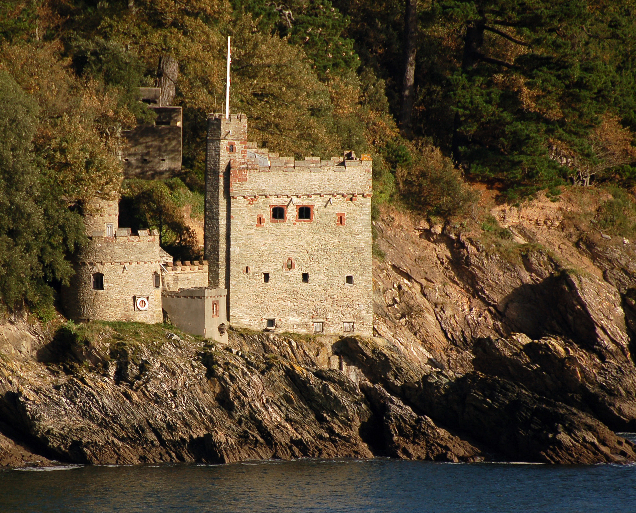
Kingswear Castle

Kingswear Castle is an artillery fort, built to protect Dartmouth harbour in Devon, England. It was constructed between 1491 and 1502 in response to the...

Warfleet Creek

Warfleet Creek is a small triangular tidal inlet in the west side of the River Dart estuary in England. It is near Dartmouth, Devon. It has steep rocky...

Kingswear

Kingswear is a village and civil parish in the South Hams area of the English county of Devon. The village is located on the east bank of the tidal River...

Church of St Thomas of Canterbury, Kingswear

The Church of St Thomas of Canterbury is situated in the village of Kingswear in the English county of Devon, it stands in a slightly elevated position...

Kingswear railway station

Kingswear railway station is the terminus of the Dartmouth Steam Railway, a heritage railway in Devon, England. It is situated in the centre of Kingswear...

Nearby Amenities

Located within 500m of 50.342505,-3.5660588
Source: PGS
Lat/Long: 50.3467995/-3.5673577
Source: PGS
Lat/Long: 50.3464349/-3.5663588
Source: PGS
Lat/Long: 50.3464821/-3.5661627
Source: PGS
Lat/Long: 50.3458129/-3.5649074
Source: PGS
Lat/Long: 50.3455496/-3.5647743
Source: PGS
Lat/Long: 50.3446771/-3.5639193
Source: PGS
Lat/Long: 50.344066/-3.5633938
Source: PGS
Lat/Long: 50.3433681/-3.5628248
Source: PGS
Lat/Long: 50.343036/-3.5628349
Source: PGS
Lat/Long: 50.3425508/-3.5621844
Source: PGS
Lat/Long: 50.3424482/-3.5616659
Source: PGS
Lat/Long: 50.3428989/-3.5605167
Source: PGS
Lat/Long: 50.3423044/-3.5604557
Source: PGS
Lat/Long: 50.3418654/-3.5597504
Source: PGS
Lat/Long: 50.3419429/-3.5596952
Source: PGS
Lat/Long: 50.3417775/-3.5595391
Source: PGS
Lat/Long: 50.3424155/-3.5658048
Source: PGS
Lat/Long: 50.342928/-3.5677591
Source: PGS
Lat/Long: 50.3436039/-3.5692046
Source: PGS
Lat/Long: 50.3435072/-3.5693895
Source: PGS
Lat/Long: 50.3433124/-3.5702525
Source: PGS
Lat/Long: 50.3431158/-3.5710628
Source: PGS
Lat/Long: 50.3429207/-3.5717423
Source: PGS
Lat/Long: 50.3426622/-3.5725778
Source: PGS
Lat/Long: 50.3434131/-3.5726748
Source: PGS
Lat/Long: 50.3437319/-3.5722513
Post Box
Brand: Royal Mail
Brand Wikidata: Q638098
Brand Wikipedia: en:Royal Mail
Collection Times: Mo-Fr 16:00; Sa 08:00; Su off
Operator: Royal Mail
Operator Wikidata: Q638098
Post Box Design: type_b
Post Box Mounting: building
Post Box Type: wall
Ref: TQ6 174
Royal Cypher: VR
Royal Cypher Wikidata: Q33102356
Source: https://www.mapillary.com/app/?lat=50.343538080389&lng=-3.560917703438141&z=17&pKey=_KZeAC4-HTx8eFuvbpfEfg&focus=photo;survey;aerial imagery
Survey Date: 2020-08-26
Lat/Long: 50.3435486/-3.5608624
Castle Cove
Natural: bay
Source: OS_OpenData_StreetView
Lat/Long: 50.3411865/-3.5656152
One Gun Point
Natural: headland
Source: OS_OpenData_StreetView
Lat/Long: 50.3435312/-3.5687285
Ferry Terminal
Ferry: yes
Public Transport: station
Lat/Long: 50.34269/-3.56717
Sugary Cove
Natural: bay
Source: OS_OpenData_StreetView
Lat/Long: 50.3397448/-3.5664611
Castle Point
Natural: headland
Source: OS_OpenData_StreetView
Lat/Long: 50.3423868/-3.5659654
Toilets
Check Date: 2023-06-27
Fee: no
Lat/Long: 50.3418976/-3.5664863
Seamark Light 1 Character: F
Seamark Light 1 Colour: white
Seamark Light 1 Height: 5
Seamark Light 1 Range: 9
Seamark Light 1 Sector End: 107
Seamark Light 1 Sector Start: 102
Seamark Light Reference: A 0237
Seamark Type: light_minor
Source: US NGA Pub. 114. 2011-05-26.
Lat/Long: 50.3441/-3.5634333
World War 2 Fixed Torpedo Battery (defunct)
Military: Torpedo Battery
Lat/Long: 50.3422789/-3.5604605
Checkstone
Seamark Buoy Lateral Category: port
Seamark Buoy Lateral Colour: red
Seamark Buoy Lateral Shape: can
Seamark Buoy Lateral System: iala-a
Seamark Type: buoy_lateral
Lat/Long: 50.3407619/-3.5633772
Seamark Beacon Lateral Category: port
Seamark Beacon Lateral Colour: red
Seamark Beacon Lateral Shape: pile
Seamark Beacon Lateral System: iala-a
Seamark Type: beacon_lateral
Lat/Long: 50.3439143/-3.5717904
Seamark Buoy Special Purpose Colour: yellow
Seamark Buoy Special Purpose Shape: spherical
Seamark Type: buoy_special_purpose
Lat/Long: 50.3440804/-3.5711626
Bench
Backrest: yes
Lat/Long: 50.3403815/-3.5672133
Bench
Backrest: yes
Lat/Long: 50.3408708/-3.5666286
Bench
Backrest: yes
Lat/Long: 50.3411257/-3.5665748
Bench
Backrest: yes
Lat/Long: 50.3429231/-3.5702287
Bench
Backrest: yes
Lat/Long: 50.3406749/-3.566706
Bench
Backrest: yes
Lat/Long: 50.3406026/-3.5670398
Bench
Backrest: yes
Lat/Long: 50.3427554/-3.5708992
Telephone
Defibrillator
Booth: K6
Check Date: 2023-06-27
Covered: booth
Defibrillator Location: inside red phone box in front of the toilets by Dartmouth Castle
Emergency: defibrillator
Indoor: yes
Listed Status: Grade II
Man Made: telephone_box
Lat/Long: 50.3419377/-3.5664609
Barrier: kissing_gate
Lat/Long: 50.3410613/-3.5711097
Addr City: Dartmouth
Addr Housename: Foretop Cottage
Addr Street: Castle Road
Lat/Long: 50.3425452/-3.571217
Addr City: Dartmouth
Addr Housename: Gunfield
Addr Street: Castle Road
Lat/Long: 50.3432548/-3.5692206
Addr City: Dartmouth
Addr Housename: Haven Lights
Addr Street: Castle Road
Lat/Long: 50.3429649/-3.568385
Addr City: Dartmouth
Addr Housename: Riverside
Lat/Long: 50.3433128/-3.5698756
Addr City: Dartmouth
Addr Housename: Rosebank
Addr Street: Castle Road
Lat/Long: 50.3429242/-3.5678939
Addr City: Dartmouth
Addr Housename: Galions Quay
Addr Street: Castle Road
Lat/Long: 50.3432228/-3.56967
Bench
Survey Date: 2022-03-26
Lat/Long: 50.3418355/-3.5664344
Bench
Survey Date: 2022-03-26
Lat/Long: 50.341723/-3.5661511
Bench
Survey Date: 2022-03-26
Lat/Long: 50.3417055/-3.5662025
Bench
Backrest: yes
Survey Date: 2022-03-26
Lat/Long: 50.3420521/-3.5665147
Bench
Backrest: yes
Survey Date: 2022-03-26
Lat/Long: 50.3420284/-3.5664381
Bench
Backrest: yes
Survey Date: 2022-03-26
Lat/Long: 50.3426041/-3.567443
Fire Hydrant
Emergency: fire_hydrant
Fire Hydrant Diameter Signed: no
Fire Hydrant Position: lane
Fire Hydrant Type: underground
Survey Date: 2022-03-26
Lat/Long: 50.3431703/-3.5690682
Information: guidepost
Survey Date: 2022-03-26
Tourism: information
Lat/Long: 50.3402434/-3.5682075
Bench
Backrest: yes
Survey Date: 2022-03-26
Lat/Long: 50.3426019/-3.5724313
Information: guidepost
Survey Date: 2022-03-26
Tourism: information
Lat/Long: 50.3400772/-3.5682272
Bench
Survey Date: 2022-03-26
Lat/Long: 50.34166/-3.566345
Waste Basket
Survey Date: 2022-03-26
Lat/Long: 50.3418094/-3.5660245
Waste Basket
Survey Date: 2022-03-26
Lat/Long: 50.3425672/-3.5724395
Fire Hydrant
Emergency: fire_hydrant
Fire Hydrant Type: underground
Survey Date: 2022-03-26
Lat/Long: 50.3400588/-3.5683001
Bench
Backrest: yes
Survey Date: 2022-03-26
Lat/Long: 50.3404417/-3.5679232
Life Ring
Emergency: life_ring
Survey Date: 2022-03-26
Lat/Long: 50.3402403/-3.5671284
Bench
Backrest: yes
Survey Date: 2022-03-26
Lat/Long: 50.3406275/-3.5668723
Bench
Backrest: yes
Survey Date: 2022-03-26
Lat/Long: 50.3407006/-3.5666617
Waste Basket
Survey Date: 2022-03-26
Lat/Long: 50.3413664/-3.5665527
Bench
Survey Date: 2022-03-26
Lat/Long: 50.3417045/-3.5662695
Bench
Survey Date: 2022-03-26
Lat/Long: 50.34171/-3.5662927
Bench
Survey Date: 2022-03-26
Lat/Long: 50.3416833/-3.5662564
Fire Hydrant
Emergency: fire_hydrant
Fire Hydrant Type: underground
Survey Date: 2022-03-26
Lat/Long: 50.3418388/-3.5659916
Waste Basket
Survey Date: 2022-03-26
Lat/Long: 50.3417886/-3.5660394
Waste Basket
Survey Date: 2022-03-26
Lat/Long: 50.3422424/-3.566547
Bench
Backrest: yes
Survey Date: 2022-03-26
Lat/Long: 50.3425794/-3.5674288
Bench
Backrest: yes
Survey Date: 2022-03-26
Lat/Long: 50.3407907/-3.5666329
Bench
Survey Date: 2022-03-26
Lat/Long: 50.3417499/-3.5661062
Waste Basket
Survey Date: 2022-03-26
Lat/Long: 50.3420396/-3.5665197
Bench
Backrest: yes
Survey Date: 2022-03-26
Lat/Long: 50.3419603/-3.5660849
Bench
Backrest: yes
Survey Date: 2022-03-26
Lat/Long: 50.340931/-3.5666089
Bench
Survey Date: 2022-03-26
Lat/Long: 50.3418509/-3.5664384
Bench
Survey Date: 2022-03-26
Lat/Long: 50.3416744/-3.5663006
Life Ring
Emergency: life_ring
Survey Date: 2022-03-26
Lat/Long: 50.3414954/-3.5663005
Life Ring
Emergency: life_ring
Survey Date: 2022-03-26
Lat/Long: 50.342628/-3.5672754
Addr Housename: Wavenden
Lat/Long: 50.3393785/-3.5676263
Fire Hydrant
Emergency: fire_hydrant
Fire Hydrant Type: underground
Survey Date: 2022-04-24
Lat/Long: 50.3435184/-3.5605199
Fire Hydrant
Emergency: fire_hydrant
Fire Hydrant Type: underground
Survey Date: 2022-04-24
Lat/Long: 50.3460771/-3.5634023
Bench
Backrest: yes
Survey Date: 2022-06-18
Lat/Long: 50.3426456/-3.5724392
Fire Hydrant
Emergency: fire_hydrant
Fire Hydrant Type: underground
Survey Date: 2022-06-18
Lat/Long: 50.3428747/-3.5708563
Bench
Backrest: yes
Survey Date: 2022-06-18
Lat/Long: 50.3426428/-3.5724673
Bench
Backrest: yes
Survey Date: 2022-06-18
Lat/Long: 50.3426248/-3.5725509
Bench
Backrest: yes
Survey Date: 2022-06-18
Lat/Long: 50.3426215/-3.5726342
Seamark Light 1 Character: F
Seamark Light 1 Colour: green
Seamark Light 1 Height: 5
Seamark Light 1 Range: 9
Seamark Light 1 Sector End: 62
Seamark Light 1 Sector Start: 50
Seamark Light 2 Character: F
Seamark Light 2 Colour: white
Seamark Light 2 Height: 5
Seamark Light 2 Range: 9
Seamark Light 2 Sector End: 67
Seamark Light 2 Sector Start: 62
Seamark Light 3 Character: F
Seamark Light 3 Colour: red
Seamark Light 3 Height: 5
Seamark Light 3 Range: 9
Seamark Light 3 Sector End: 75
Seamark Light 3 Sector Start: 67
Seamark Name: Kingswear
Seamark Type: light_minor
Lat/Long: 50.3433333/-3.5633333
The data included in this document is from www.openstreetmap.org. The data is made available under ODbL.

Have you been to Castle Point?

Leave your review of Castle Point below (or comments, questions and feedback).