Noss Creek
Sea, Estuary, Creek in Devon South Hams
England
Noss Creek

Noss Creek is a small estuary located in Devon, a county in the southwestern part of England. It is situated near the town of Dartmouth and flows into the English Channel. The creek is formed by the convergence of two smaller waterways, the Noss and the Stoke Fleming streams.
The creek is known for its stunning natural beauty, with picturesque views of rolling hills and lush greenery surrounding its banks. The area is rich in biodiversity, attracting a variety of bird species, such as herons, swans, and kingfishers, making it a popular spot for birdwatchers.
The tidal nature of Noss Creek means that its water levels fluctuate throughout the day, influenced by the tides from the English Channel. During high tide, the creek fills up with water, creating a serene and peaceful atmosphere. At low tide, the creek transforms into a vast mudflat, exposing the riverbed and offering a unique opportunity for exploration.
The creek also serves as a habitat for various marine creatures, including crabs, fish, and mollusks. It is a common spot for fishing enthusiasts, who try their luck in catching bass, flounder, and other local species.
Noss Creek is surrounded by several walking trails, providing visitors with the opportunity to explore the area's natural beauty on foot. The creek itself is not navigable by large boats due to its shallow depths, but kayaking and canoeing are popular activities for those seeking a more adventurous experience.
Overall, Noss Creek offers a tranquil escape from the hustle and bustle of city life, allowing visitors to immerse themselves in the beauty of Devon's natural landscapes.
If you have any feedback on the listing, please let us know in the comments section below.
Noss Creek Images
Images are sourced within 2km of 50.367885/-3.5754718 or Grid Reference SX8853. Thanks to Geograph Open Source API. All images are credited.


![Undercliff, Dartmouth Bringing <a href="https://www.geograph.org.uk/photo/827384">SX8751 : Undercliff, Dartmouth</a>] up to date.](https://s3.geograph.org.uk/geophotos/06/92/80/6928095_f103ea3b.jpg)


Noss Creek is located at Grid Ref: SX8853 (Lat: 50.367885, Lng: -3.5754718)
Administrative County: Devon
District: South Hams
Police Authority: Devon and Cornwall
What 3 Words
///twins.caravans.sloping. Near Dartmouth, Devon
Nearby Locations
Related Wikis
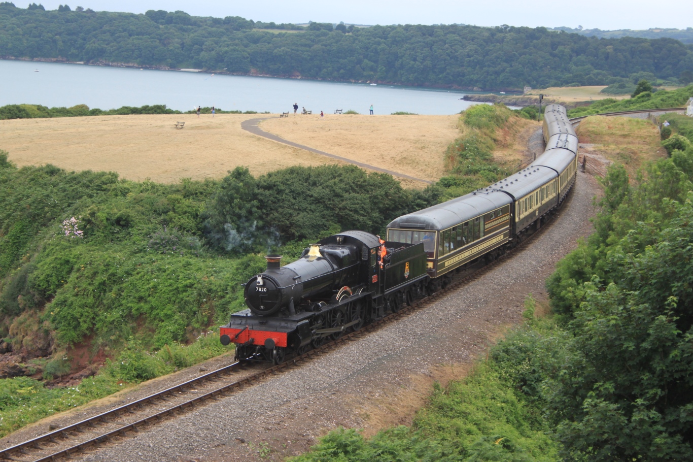
Dartmouth Steam Railway
The Dartmouth Steam Railway, formerly known as the Paignton and Dartmouth Steam Railway, is a 6.7-mile (10.8 km) heritage railway on the former Great Western...

Greenway Camp
Greenway Camp (also called Noss) is an Iron Age hill fort in the parish of Kingswear close to Dartmouth in Devon, England. The fort is situated on the...
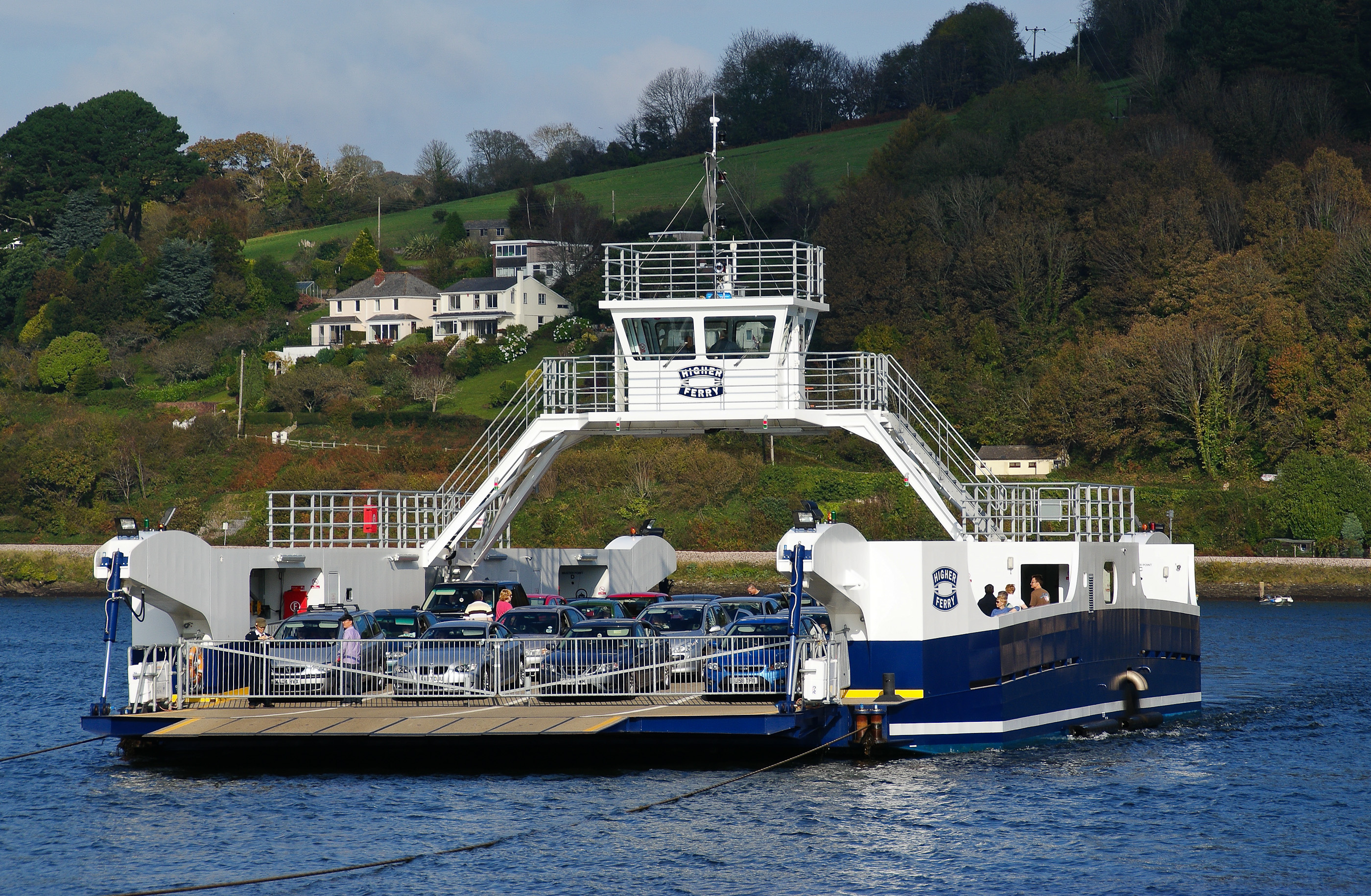
Dartmouth Higher Ferry
The Dartmouth Higher Ferry, also known as the Dartmouth–Kingswear Floating Bridge, is a vehicular and passenger cable ferry, which crosses the River Dart...

Britannia Royal Naval College
Britannia Royal Naval College (BRNC), commonly known as Dartmouth, is the naval academy of the United Kingdom and the initial officer training establishment...
Nearby Amenities
Located within 500m of 50.367885,-3.5754718Have you been to Noss Creek?
Leave your review of Noss Creek below (or comments, questions and feedback).