White Cove

Sea, Estuary, Creek in Kirkcudbrightshire

Scotland

White Cove

Natural arch at Brock's Holes Scale is deceptive. You can walk both over and under this arch - although, ideally, in calmer weather than this!
Natural arch at Brock's Holes Credit: Simon Brooke

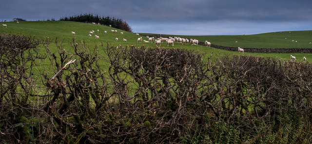
White Cove is a picturesque coastal area located in Kirkcudbrightshire, Scotland. Situated on the Solway Firth, it offers breathtaking views of the sea, estuary, and creek.

The main attraction of White Cove is its pristine white sandy beach, which stretches for approximately 1 kilometer. The beach is known for its soft sand and clear turquoise waters, making it a popular spot for sunbathing, swimming, and picnicking. The beach is also home to a variety of marine life, including seagulls, seals, and occasionally dolphins, providing a unique opportunity for wildlife enthusiasts.

Adjacent to the beach is an estuary, where a river meets the sea. This estuary is a haven for birdwatchers, as it attracts a wide variety of wading birds, such as oystercatchers, curlews, and herons. The estuary also serves as a feeding ground for migratory birds, making it a prime spot for bird migration enthusiasts.

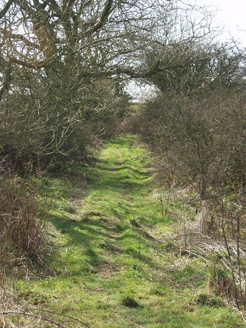
A creek flows into the estuary, adding to the natural beauty of White Cove. The creek is shallow and meandering, providing a tranquil setting for kayaking or paddleboarding. The calm waters of the creek are also ideal for fishing, attracting anglers in search of salmon and trout.

Overall, White Cove in Kirkcudbrightshire is a hidden gem for nature lovers and outdoor enthusiasts. With its stunning sea views, diverse wildlife, and recreational activities, it offers a peaceful and idyllic coastal experience.

If you have any feedback on the listing, please let us know in the comments section below.

White Cove Images

Images are sourced within 2km of 54.800029/-3.8883459 or Grid Reference NX7846. Thanks to Geograph Open Source API. All images are credited.

Natural arch at Brock's Holes Scale is deceptive. You can walk both over and under this arch - although, ideally, in calmer weather than this!
Natural arch at Brock's Holes
Scale is deceptive. You can walk both over and under this arch - although, ideally, in calmer weather than this!
Natural Arch on Rascarrel Shore
Natural Arch on Rascarrel Shore With Rascarrel Bay and Airds Hill in the distance
Natural Arch on Rascarrel Shore
With Rascarrel Bay and Airds Hill in the distance
Footbridge over Rascarrel Burn
View from abandoned beach hut Rapidly falling into disrepair this hut was quite substantial with cooking and sleeping quarters, all seemingly now abandoned.
View from abandoned beach hut
Rapidly falling into disrepair this hut was quite substantial with cooking and sleeping quarters, all seemingly now abandoned.
Rocky foreshore at Rascarrel Bay A small pebble beach about 300m south of Rascarrel Burn, accessible by a rough path.
Rocky foreshore at Rascarrel Bay
A small pebble beach about 300m south of Rascarrel Burn, accessible by a rough path.
Beached tree trunk at Rascarrel Bay On a small pebble beach a few hundred yards south of Rascarrel Burn.
Beached tree trunk at Rascarrel Bay
On a small pebble beach a few hundred yards south of Rascarrel Burn.
Chalets at Rascarrel Bay
High anxiety Worried sheep and a fine example of a hedge no longer cut but flailed into submission
High anxiety
Worried sheep and a fine example of a hedge no longer cut but flailed into submission
Rascarrel steading The steading at Rascarrel
Rascarrel steading
The steading at Rascarrel
Nether Hazelfield Cottage Cottage at the side of the track on Nether Hazelfield, looking south towards the Old Man.
Nether Hazelfield Cottage
Cottage at the side of the track on Nether Hazelfield, looking south towards the Old Man.
Abandoned Dons Knowe This track forms part of the old coast road from Balcary through to Rerrick. Prior to 1860 this would form part of the route the villagers from Auchencairn would follow to the parish church which was then at Rerrick. In my childhood it was still easily passable by motor vehicle, and is I believe still a vehicular right of way; but it's no longer passable by motor vehicle.
Abandoned Dons Knowe
This track forms part of the old coast road from Balcary through to Rerrick. Prior to 1860 this would form part of the route the villagers from Auchencairn would follow to the parish church which was then at Rerrick. In my childhood it was still easily passable by motor vehicle, and is I believe still a vehicular right of way; but it's no longer passable by motor vehicle.
Don's Knowe House
Don's Knowe House
Rascarrel Farm Farm track into Rascarrel farm.
Rascarrel Farm
Farm track into Rascarrel farm.
Nether Hazelfield Cottage Nether Hazelfield Cottage.
Nether Hazelfield Cottage
Nether Hazelfield Cottage.
Barlocco Farm Barlocco Farm.
Barlocco Farm
Barlocco Farm.
Track to Don's Knowe The start of the track to Don's Knowe.
Track to Don's Knowe
The start of the track to Don's Knowe.
Cave in Rascarrel Heugh
Show me another place!

White Cove is located at Grid Ref: NX7846 (Lat: 54.800029, Lng: -3.8883459)

Unitary Authority: Dumfries and Galloway

Police Authority: Dumfries and Galloway

What 3 Words

///birthdays.shipyards.tips. Near Kirkcudbright, Dumfries & Galloway

Related Wikis

Wickerman Festival

The Wickerman Festival was an annual music festival held near Auchencairn in Dumfries and Galloway, Scotland. Dubbed "Scotland's Alternative Music festival...

Dundrennan Abbey

Dundrennan Abbey, in Dundrennan, Scotland, near to Kirkcudbright, was a Cistercian monastery in the Romanesque architectural style, established in 1142...

Dundrennan

Dundrennan (Gaelic: Dun Droighnein) is a village Dumfries and Galloway, Scotland, about 5 miles (8 km) east of Kirkcudbright. Its population is around...

Auchencairn

Auchencairn ([ɔxən'kʰɛ:(r)n]) is a village in the historical county of Kirkcudbrightshire in the Dumfries and Galloway region of Scotland. It is located...

Nearby Amenities

Located within 500m of 54.800029,-3.8883459
Source: PGS
Lat/Long: 54.7984241/-3.8955704
Source: PGS
Lat/Long: 54.7984603/-3.8951135
Source: PGS
Lat/Long: 54.7985416/-3.8944999
Source: PGS
Lat/Long: 54.7988075/-3.8939361
Source: PGS
Lat/Long: 54.7988597/-3.8929219
Source: PGS
Lat/Long: 54.7987568/-3.8923278
Source: PGS
Lat/Long: 54.7989581/-3.8919685
Source: PGS
Lat/Long: 54.7991202/-3.8917087
Source: PGS
Lat/Long: 54.7992171/-3.8914887
Source: PGS
Lat/Long: 54.799315/-3.8910618
Source: PGS
Lat/Long: 54.7995494/-3.8912886
Source: PGS
Lat/Long: 54.7997049/-3.8908306
Source: PGS
Lat/Long: 54.7994911/-3.8902623
Source: PGS
Lat/Long: 54.7996502/-3.8898668
Source: PGS
Lat/Long: 54.7999053/-3.8897664
Source: PGS
Lat/Long: 54.8000984/-3.8887871
Source: PGS
Lat/Long: 54.8002861/-3.8881899
Source: PGS
Lat/Long: 54.7999504/-3.8876376
Source: PGS
Lat/Long: 54.8002406/-3.8876295
Source: PGS
Lat/Long: 54.8004338/-3.8870334
Source: PGS
Lat/Long: 54.800066/-3.8867597
Source: PGS
Lat/Long: 54.8006296/-3.8859277
Source: PGS
Lat/Long: 54.8010486/-3.88635
Source: PGS
Lat/Long: 54.8014748/-3.8857687
Source: PGS
Lat/Long: 54.8019456/-3.8853057
Source: PGS
Lat/Long: 54.8022427/-3.8840702
The data included in this document is from www.openstreetmap.org. The data is made available under ODbL.

Have you been to White Cove?

Leave your review of White Cove below (or comments, questions and feedback).