Horsepool Cove

Sea, Estuary, Creek in Devon South Hams

England

Horsepool Cove

Salcombe : Bay Scenery Looking out into the bay.
Salcombe : Bay Scenery Credit: Lewis Clarke

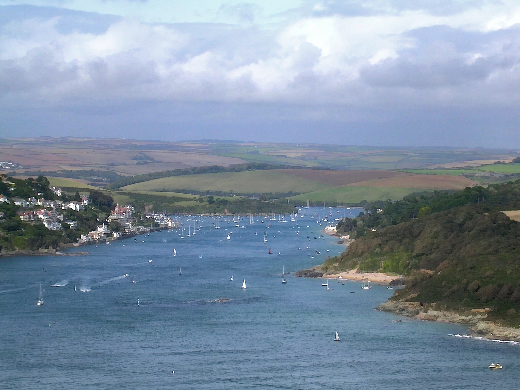
Horsepool Cove is a picturesque coastal area located in South Devon, England. Nestled between the towns of Salcombe and East Portlemouth, this hidden gem is renowned for its natural beauty and tranquil atmosphere.

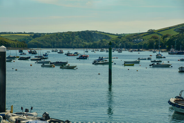
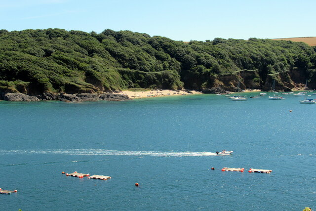
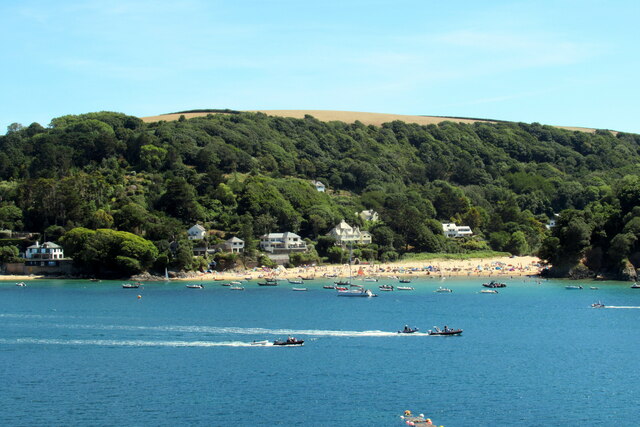
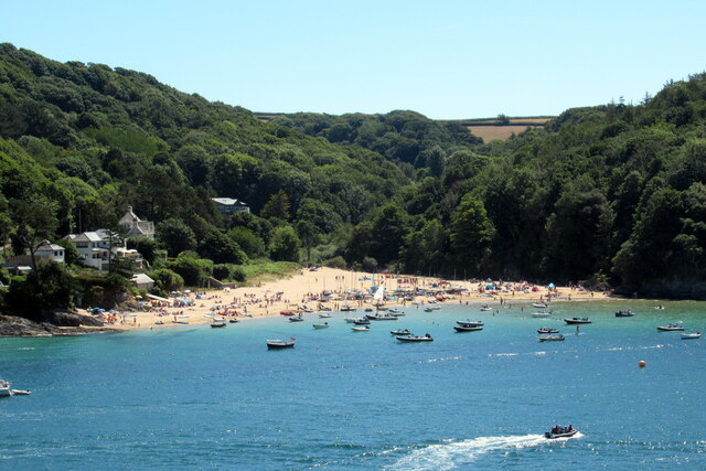
Situated on the mouth of the Kingsbridge Estuary, Horsepool Cove offers visitors a unique combination of sea, estuary, and creek. The cove is characterized by its pristine sandy beach, crystal-clear turquoise waters, and rugged cliffs that provide a stunning backdrop. The beach is relatively small, making it an ideal spot for those seeking peace and seclusion.

The cove is accessible by foot or by boat, with a scenic walking path leading down from the nearby village of East Portlemouth. The area is also popular among sailors and boaters who can moor their vessels in the calm waters of the cove.

Nature enthusiasts will appreciate the rich biodiversity found in Horsepool Cove. The surrounding cliffs are home to a variety of seabirds, including gulls and cormorants, providing a treat for birdwatchers. The clear waters of the estuary and creek are teeming with marine life, making it a popular spot for snorkeling and diving.

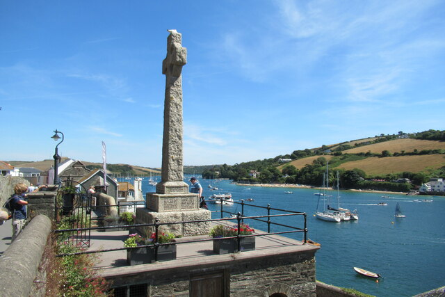
Visitors can also explore the nearby coastline and enjoy breathtaking views of the English Channel. The South West Coast Path, which passes through Horsepool Cove, offers scenic walks with panoramic vistas.

Overall, Horsepool Cove is a hidden coastal treasure in Devon, offering a unique blend of sea, estuary, and creek. Its natural beauty, tranquility, and diverse wildlife make it a must-visit destination for nature lovers and those seeking a peaceful seaside escape.

If you have any feedback on the listing, please let us know in the comments section below.

Horsepool Cove Images

Images are sourced within 2km of 50.237699/-3.750646 or Grid Reference SX7538. Thanks to Geograph Open Source API. All images are credited.

Salcombe : Bay Scenery Looking out into the bay.
Salcombe : Bay Scenery
Looking out into the bay.
East Portlemouth : Sunny Cove Looking towards a beach and cove.
East Portlemouth : Sunny Cove
Looking towards a beach and cove.
Salcombe : Beadon Road Beadon Road off Main Road.
Salcombe : Beadon Road
Beadon Road off Main Road.
Beadon Road Salcombe
The 164 bus to Salcombe leaving the Devon Road stop
Salcombe estuary looking towards Sunny Cove
Salcombe estuary looking towards Mill Bay
Footbridge over Cliff Road, Salcombe
Mill Bay Salcombe
Mill Bay Salcombe
Fork left for car and boat park, Salcombe
Salcombe war memorial
Steps down to the Ferry Inn and passenger ferry, Salcombe
Fore Street Salcombe
Salcombe slip-way
Salcombe slip-way
Salcombe Lifeboat station
Waterfront cottages Salcombe
Holy Trinity church Salcombe
Shadycombe Road Salcombe
Show me another place!

Horsepool Cove is located at Grid Ref: SX7538 (Lat: 50.237699, Lng: -3.750646)

Administrative County: Devon

District: South Hams

Police Authority: Devon and Cornwall

What 3 Words

///open.necklaces.rested. Near Salcombe, Devon

Nearby Locations

Horsepool Cove

Related Wikis

East Portlemouth

East Portlemouth is a village and civil parish in the South Hams district, in the county of Devon, England, situated at the southern end of the Kingsbridge...

Hallowe'en (clipper)

Hallowe’en was a 920-ton iron clipper ship. She was built in 1870 by Maudslay, Son & Field at Greenwich, England, for Jock Willis & Sons (commissioned...

Salcombe Lifeboat Station

Salcombe Lifeboat Station is the base for Royal National Lifeboat Institution (RNLI) search and rescue operations at Salcombe, Devon in England. The first...

Kingsbridge Estuary

The Kingsbridge Estuary (also, erroneously, known as the 'Salcombe Estuary') in the South Hams area of Devon, England runs from Kingsbridge in the north...

Nearby Amenities

Located within 500m of 50.237699,-3.750646
Source: PGS
Lat/Long: 50.2401102/-3.7551005
Source: PGS
Lat/Long: 50.2398689/-3.7540461
Source: PGS
Lat/Long: 50.2398/-3.7530328
Source: PGS
Lat/Long: 50.2398065/-3.7522044
Source: PGS
Lat/Long: 50.2398827/-3.7518482
Source: PGS
Lat/Long: 50.2399787/-3.7511793
Source: PGS
Lat/Long: 50.240181/-3.750397
Source: PGS
Lat/Long: 50.2402956/-3.7489196
Source: PGS
Lat/Long: 50.2403524/-3.7480448
Source: PGS
Lat/Long: 50.2406931/-3.7471117
Source: PGS
Lat/Long: 50.2407843/-3.7463932
Source: PGS
Lat/Long: 50.2367906/-3.7570416
Source: PGS
Lat/Long: 50.2364631/-3.7573413
Southpool Creek
Place: locality
Lat/Long: 50.239402/-3.748213
Horsepool Cove
Place: locality
Lat/Long: 50.2375512/-3.7501846
Source: PGS
Lat/Long: 50.2387103/-3.7440479
Source: PGS
Lat/Long: 50.238453/-3.744699
Source: PGS
Lat/Long: 50.2373948/-3.7451468
Source: PGS
Lat/Long: 50.2373351/-3.7453564
Source: PGS
Lat/Long: 50.2374521/-3.7454197
Source: PGS
Lat/Long: 50.2381476/-3.7463511
Source: PGS
Lat/Long: 50.2380729/-3.7468884
Source: PGS
Lat/Long: 50.2379545/-3.7476994
Source: PGS
Lat/Long: 50.2378637/-3.7482347
Source: PGS
Lat/Long: 50.237771/-3.7488229
Source: PGS
Lat/Long: 50.2372841/-3.7492982
Source: PGS
Lat/Long: 50.2368201/-3.7492245
Source: PGS
Lat/Long: 50.2369747/-3.7503018
Source: PGS
Lat/Long: 50.2370961/-3.7507148
Source: PGS
Lat/Long: 50.2372144/-3.7509421
Source: PGS
Lat/Long: 50.2375652/-3.7516348
Source: PGS
Lat/Long: 50.2375671/-3.7536449
Source: PGS
Lat/Long: 50.2376284/-3.7552257
Source: PGS
Lat/Long: 50.237498/-3.75594
Source: PGS
Lat/Long: 50.2372926/-3.7565925
Source: PGS
Lat/Long: 50.2371115/-3.756851
Yalton
Place: hamlet
Lat/Long: 50.2383675/-3.7440792
Fire Hydrant
Emergency: fire_hydrant
Fire Hydrant Type: underground
Survey Date: 2022-03-19
Lat/Long: 50.236525/-3.7493231
Fire Hydrant
Emergency: fire_hydrant
Fire Hydrant Type: underground
Survey Date: 2022-03-19
Lat/Long: 50.2367432/-3.7490094
Fire Hydrant
Emergency: fire_hydrant
Fire Hydrant Type: underground
Survey Date: 2022-03-19
Lat/Long: 50.2370835/-3.7545534
Fire Hydrant
Emergency: fire_hydrant
Fire Hydrant Type: underground
Survey Date: 2022-03-19
Lat/Long: 50.2363335/-3.7572391
The data included in this document is from www.openstreetmap.org. The data is made available under ODbL.

Have you been to Horsepool Cove?

Leave your review of Horsepool Cove below (or comments, questions and feedback).