Porth Daniel

Sea, Estuary, Creek in Anglesey

Wales

Porth Daniel

Sluice valve marker on Siliwen Road, Bangor
Sluice valve marker on Siliwen Road, Bangor Credit: Meirion

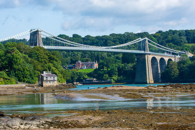
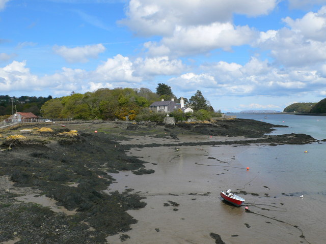
Porth Daniel is a picturesque coastal area located on the island of Anglesey in Wales. It is a small village situated on the eastern coast of the island, adjacent to the Menai Strait. Porth Daniel is known for its stunning sea views, estuary, and creek, making it a popular destination for nature lovers and water enthusiasts.

The area is characterized by its rocky shoreline, which is dotted with small sandy coves and pebble beaches. The crystal-clear waters of the sea provide a perfect spot for swimming, snorkeling, and other water activities. The estuary and creek in Porth Daniel are home to a diverse range of marine life, including various species of fish, crabs, and mollusks.

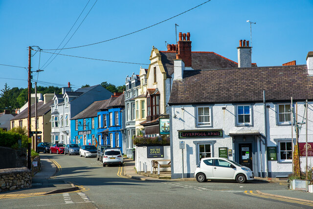
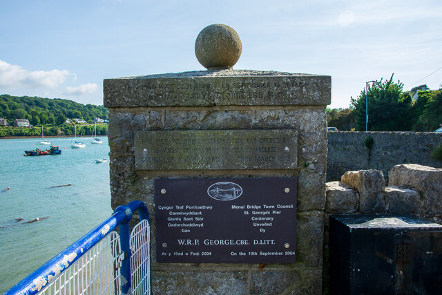
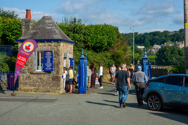
The village itself is a quaint and charming settlement, with traditional Welsh cottages and buildings lining the narrow streets. There are a few small shops and cafes in the area, catering to both locals and tourists. Porth Daniel is also known for its vibrant sailing and boating community, with several yacht clubs and marinas in the vicinity.

For those who enjoy walking and hiking, Porth Daniel offers breathtaking coastal trails that provide panoramic views of the Menai Strait and the surrounding countryside. The area is also a haven for birdwatchers, as numerous species of seabirds can be spotted throughout the year.

Overall, Porth Daniel is a hidden gem on Anglesey, offering a tranquil and idyllic coastal experience for visitors seeking natural beauty and a peaceful retreat.

If you have any feedback on the listing, please let us know in the comments section below.
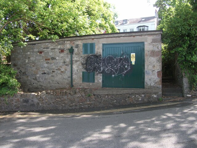
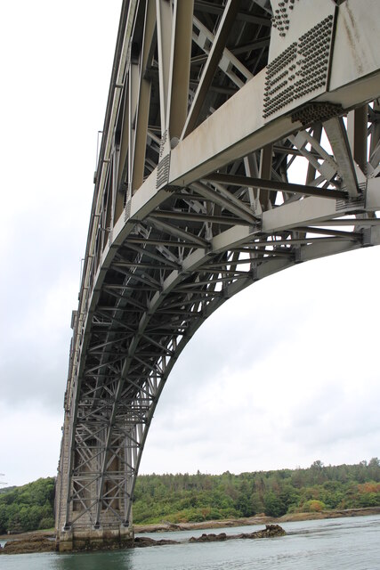
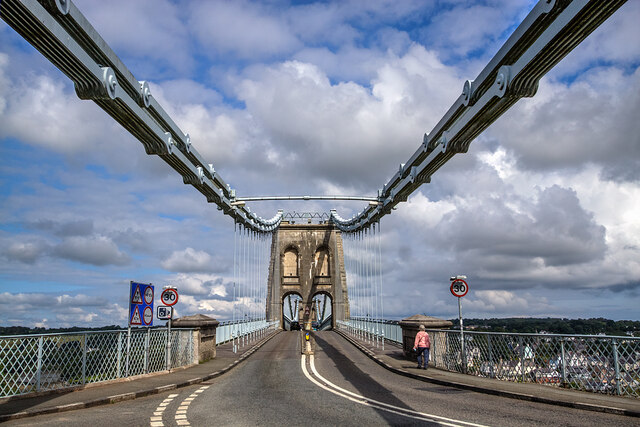
Porth Daniel Images

Images are sourced within 2km of 53.225123/-4.1602463 or Grid Reference SH5571. Thanks to Geograph Open Source API. All images are credited.

Sluice valve marker on Siliwen Road, Bangor
Hydrant sign on Siliwen Road, Bangor
Hydrant marker on Siliwen Road, Bangor
Bryn y Mor substation on Siliwen Road, Bangor See also: <a href="https://www.geograph.org.uk/photo/6925871">SH5772 : Signs at Bryn y Mor substation on Siliwen Road, Bangor</a>
Bryn y Mor substation on Siliwen Road, Bangor
Signs at Bryn y Mor substation on Siliwen Road, Bangor See also: <a href="https://www.geograph.org.uk/photo/6925870">SH5772 : Bryn y Mor substation on Siliwen Road, Bangor</a>
Signs at Bryn y Mor substation on Siliwen Road, Bangor
Hydrant sign on Glanrafon Hill, Bangor
Hydrant sticker on Glanrafon Hill, Bangor
Under the Bridge Photo of the underside of Britannia Bridge, taken from the mainland side. The Britannia Bridge takes road and rail traffic and connects Anglesey to the mainland, crossing the Menai Strait.
Under the Bridge
Photo of the underside of Britannia Bridge, taken from the mainland side. The Britannia Bridge takes road and rail traffic and connects Anglesey to the mainland, crossing the Menai Strait.
Hydrant marker on Hill Street, Bangor
Menai Suspension Bridge The world's first major suspension bridge, it was designed by Thomas Telford and completed in 1826. A Grade I structure, it spans the Menai Strait between Anglesey and the Welsh mainland. Viewed from the Welsh mainland side of the Menai Strait.
Menai Suspension Bridge
The world's first major suspension bridge, it was designed by Thomas Telford and completed in 1826. A Grade I structure, it spans the Menai Strait between Anglesey and the Welsh mainland. Viewed from the Welsh mainland side of the Menai Strait.
Menai Suspension Bridge Viewed at low tide, from Church Island.
Menai Suspension Bridge
Viewed at low tide, from Church Island.
Water Street and St George's Road, Menai Bridge St George's Road and the Promenade are located further to the right, past the Liverpool Arms.
Water Street and St George's Road, Menai Bridge
St George's Road and the Promenade are located further to the right, past the Liverpool Arms.
Commemoration plaques at St George's Pier, Menai Bridge Top to bottom: Original opening in 1904; opening following reconstruction in 1979; centenary in 2004. On the opposite stone pier are two further plaques: opening following an earlier reconstruction in 1969, and a Welsh translation of the 1979 plaque.
Commemoration plaques at St George's Pier, Menai Bridge
Top to bottom: Original opening in 1904; opening following reconstruction in 1979; centenary in 2004. On the opposite stone pier are two further plaques: opening following an earlier reconstruction in 1969, and a Welsh translation of the 1979 plaque.
Entrance to the Promenade, Menai Bridge The building and gates probably formed a toll complex for the St George's Pier of 1904. The building is now an ice cream kiosk.
Entrance to the Promenade, Menai Bridge
The building and gates probably formed a toll complex for the St George's Pier of 1904. The building is now an ice cream kiosk.
Hydrant sign on College Road, Bangor
Hydrant sign on Menai Avenue, Bangor
Hydrant sticker on Victoria Park, Bangor
Show me another place!

Porth Daniel is located at Grid Ref: SH5571 (Lat: 53.225123, Lng: -4.1602463)

Unitary Authority: Isle of Anglesey

Police Authority: North Wales

What 3 Words

///brownish.singers.grinning. Near Menai Bridge, Isle of Anglesey

Related Wikis

Victoria Hotel, Menai Bridge

The Victoria Hotel is a Grade II listed building in Menai Bridge, Anglesey. == References ==

Hawthorn House, Menai Bridge

Hawthorn House is a Grade II listed building located on the main street in the town of Menai Bridge, on the Isle of Anglesey. == References ==

Ynys Faelog

Ynys Faelog is a small tidal island in the Menai Strait between Gwynedd and the Isle of Anglesey, Wales, near the town of Menai Bridge. On average it measures...

Glannau Porthaethwy

Glannau Porthaethwy is a designated Site of Special Scientific Interest (SSSI) along the northern shore of the Menai Strait in North Wales. It is a linear...

Nearby Amenities

Located within 500m of 53.225123,-4.1602463
Source: PGS
Lat/Long: 53.2276155/-4.1573292
Source: PGS
Lat/Long: 53.2247022/-4.1530825
Source: PGS
Lat/Long: 53.2242143/-4.1538405
Source: PGS
Lat/Long: 53.2240026/-4.1543864
Source: PGS
Lat/Long: 53.2239227/-4.154682
Source: PGS
Lat/Long: 53.2232445/-4.1555792
Source: PGS
Lat/Long: 53.2228869/-4.1559882
Source: PGS
Lat/Long: 53.2224761/-4.1564104
Source: PGS
Lat/Long: 53.2222949/-4.1566142
Source: PGS
Lat/Long: 53.2218811/-4.1571953
Source: PGS
Lat/Long: 53.2216029/-4.1576814
Source: PGS
Lat/Long: 53.2211446/-4.1581253
Source: PGS
Lat/Long: 53.2209765/-4.1584487
Source: PGS
Lat/Long: 53.2245362/-4.1609003
Source: PGS
Lat/Long: 53.2251548/-4.1607635
Source: PGS
Lat/Long: 53.2256013/-4.1605996
Source: PGS
Lat/Long: 53.2272724/-4.1598406
Uxbridge Square
Name Cy: Y Sgwar
Name En: Uxbridge Square
Lat/Long: 53.2259658/-4.1629077
Milestone
Historic: milepost
Lat/Long: 53.2233292/-4.1660787
Porthaethwy / Menai Bridge
Name Cy: Porthaethwy
Name En: Menai Bridge
Place: town
Wikidata: Q2655856
Lat/Long: 53.2259347/-4.1631064
Post Box
Collection Times: Mo-Fr 11:30; Sa 10:00
Operator: Royal Mail
Operator Wikidata: Q638098
Post Box Type: lamp
Ref: LL59 45
Royal Cypher: EIIR
Royal Cypher Wikidata: Q33102113
Lat/Long: 53.2292008/-4.1599776
Bus Stop
Ffordd Cadnant
Bus: yes
Departures Board: no
Network: Arriva
Network Wikidata: Q680991
Network Wikipedia: en:Arriva
Operator: Arriva
Public Transport: platform
Shelter: no
Lat/Long: 53.2286045/-4.1609661
Bus Stop
Oriel Tegfryn
Bench: no
Bus: yes
Departures Board: no
Network: Arriva
Network Wikidata: Q680991
Network Wikipedia: en:Arriva
Operator: Arriva
Public Transport: platform
Shelter: no
Lat/Long: 53.228045/-4.1615447
Barrier: kissing_gate
Foot: yes
Lat/Long: 53.2250375/-4.164716
Crossing
Crossing Island: yes
Lat/Long: 53.2243299/-4.1661254
Post Office
Menai Bridge Post Office
Addr Postcode: LL59 5EE
Branch: Menai Bridge
Brand: Post Office
Brand Wikidata: Q1783168
Check Date: 2020-02-20
Contact Website: https://www.postoffice.co.uk/branch-finder/2606046/menai-bridge
Name Cy: Swyddfa'r Post Porthaethwy
Ref Pol Id: 10338
Lat/Long: 53.226274/-4.1628808
Post Box
Note: Inside post office
Ref: LL59 43
Lat/Long: 53.2263232/-4.1628623
Pub
Auckland Arms
Internet Access: wlan
Wikidata: Q80857889
Lat/Long: 53.2255014/-4.1621969
Crossing
Crossing: traffic_signals
Lat/Long: 53.226236/-4.1627974
Barrier: bollard
Lat/Long: 53.2273568/-4.1628413
Barrier: bollard
Lat/Long: 53.2272975/-4.1628774
Bus Stop
Ffordd y Ffair
Bus: yes
Departures Board: realtime
Public Transport: platform
Lat/Long: 53.225363/-4.1642219
Bus Stop
Ffordd y Ffair
Bus: yes
Departures Board: realtime
Naptan AtcoCode: 5410AWD70026
Naptan NaptanCode: ynydajm
Public Transport: platform
Lat/Long: 53.2254332/-4.1641364
Give Way
Direction: backward
Lat/Long: 53.2229425/-4.1660237
Princes Pier
Leisure: garden
Lat/Long: 53.2239472/-4.1613678
Link
Atm: yes
Operator: Link
Lat/Long: 53.2260005/-4.1631401
Crossing
Crossing: unmarked
Crossing Island: no
Crossing Markings: no
Lat/Long: 53.2224245/-4.1652582
Post Box
Collection Times: Mo-Fr 11:00; Sa 10:30
Operator: Royal Mail
Operator Wikidata: Q638098
Post Box Type: wall
Ref: LL59 8
Royal Cypher: EIIR
Royal Cypher Wikidata: Q33102113
Lat/Long: 53.2223381/-4.165139
Post Box
Collection Times: Mo-Fr 11:00; Sa 10:30
Operator: Royal Mail
Operator Wikidata: Q638098
Post Box Type: lamp
Ref: LL59 111
Royal Cypher: EIIR
Royal Cypher Wikidata: Q33102113
Lat/Long: 53.2228158/-4.1622105
Bus Stop
Menai Bridge Fair only
Bus: yes
Public Transport: platform
Lat/Long: 53.2250122/-4.1667902
Post Box
Collection Times: Mo-Fr 09:00; Sa 07:00
Operator: Royal Mail
Operator Wikidata: Q638098
Post Box Type: wall
Ref: LL59 112D
Royal Cypher: EIIR
Royal Cypher Wikidata: Q33102113
Lat/Long: 53.2273743/-4.1665131
Access: no
Lat/Long: 53.2238573/-4.1543877
School of Sport, Health & Exercise Sciences
Name Cy: Ysgol Gwyddorau Chwaraeon, Iechydac Ymarfer
Operator: Bangor University
Phone: +44 1248 388256
Website: https://www.bangor.ac.uk/sport/
Lat/Long: 53.2232367/-4.1550207
IMSCaR (Institute of Medical & Social Care Research)
Name Cy: Sefydliad Ymchwil Gofal Meddygol a Chymdeithasol
Operator: Bangor University
Phone: +44 1248 388771
Website: https://www.bangor.ac.uk/imscar/index.php.en
Lat/Long: 53.2233919/-4.1534328
NWORTH Trials Unit
Name Cy: Uned Treialon NWORTH
Operator: Bangor University
Phone: +44 1248 388095
Lat/Long: 53.2234519/-4.1533733
Awen Menai
Addr Housenumber: 17
Addr Postcode: LL59 5EE
Addr Street: High Street
Shop: books
Source: Survey
Website: www.awenmenai.co.uk
Lat/Long: 53.226598/-4.1628003
Academic Development Unit
Name Cy: Yr Uned Datblygu Academaidd
Operator: Bangor University
Phone: +44 1248 383195
Website: https://www.bangor.ac.uk/adu/
Lat/Long: 53.2231607/-4.1551701
Bus Stop
Telford Road
Bench: no
Bin: no
Bus: yes
Public Transport: platform
Shelter: no
Lat/Long: 53.2240162/-4.1639707
Seamark Light Character: Fl
Seamark Light Colour: green
Seamark Light Period: 10
Seamark Light Reference: A 5155
Seamark Light Sequence: 1+(9)
Seamark Type: light_minor
Source: US NGA Pub. 114. 2011-05-26.
Lat/Long: 53.2253748/-4.1592158
Bicycle Parking
Bicycle Parking: stands
Capacity: 8
Lat/Long: 53.2253855/-4.1643832
Entrance: yes
Lat/Long: 53.2257573/-4.1649
Waste Basket
Check Date: 2023-03-05
Lat/Long: 53.2238433/-4.1641075
Vacuum Cleaner
Lat/Long: 53.2255115/-4.1669115
Fast Food
Menai Deli
Addr Housenumber: 20
Addr Postcode: LL59 5EE
Addr Street: High Street
Cuisine: sandwich
Fhrs Id: 208924
Opening Hours: Mo-Sa 07:00-15:00; Su 08:30-13:30
Source Addr: FHRS Open Data
Takeaway: yes
Lat/Long: 53.2265864/-4.1625428
Entrance: main
Lat/Long: 53.2267682/-4.1612124
Bicycle Parking
Bicycle Parking: stands
Capacity: 12
Covered: no
Lat/Long: 53.2268317/-4.1611418
Crossing
Crossing Island: yes
Lat/Long: 53.2231877/-4.166041
Noexit: yes
Lat/Long: 53.2211793/-4.1571456
Fixme: position very approximate
Lat/Long: 53.2269328/-4.1579768
Bicycle Parking
Bicycle Parking: stands
Capacity: 6
Covered: no
Lat/Long: 53.2231163/-4.1668045
Board Type: history
Information: board
Tourism: information
Lat/Long: 53.2214545/-4.163572
Recycling
Recycling Clothes: yes
Recycling Type: container
Lat/Long: 53.2278337/-4.162582
Elsa
Addr City: Menai Bridge
Addr Street: 1 Nant Terrace, Cadnant Road
Shop: clothes
Wheelchair: yes
Lat/Long: 53.227801/-4.1619311
Bryn Aethwy
Addr Postcode: LL59 5HS
Addr Street: Pentraeth Road
Fhrs Id: 133422
Source Addr: FHRS Open Data
Tourism: guest_house
Lat/Long: 53.2265144/-4.1672933
Noexit: yes
Lat/Long: 53.2216575/-4.1566634
Man Made: surveillance
Surveillance: public
Surveillance Zone: town
Lat/Long: 53.2259839/-4.1628048
Bus Stop
Bus: yes
Public Transport: platform
Lat/Long: 53.2221958/-4.1650708
Bench
Lat/Long: 53.2250183/-4.1609559
Meirionfa
Building: yes
Note: middle bdg in terrace of three.
Lat/Long: 53.2253013/-4.1619061
Defibrillator
Defibrillator Location: Indoors, at Reception.
Defibrillator Type: AED_Plus
Emergency: defibrillator
Indoor: yes
Lat/Long: 53.2226165/-4.1660702
Barrier: kissing_gate
Foot: yes
Lat/Long: 53.2243875/-4.1659816
Bowling Green
Tourism: viewpoint
Lat/Long: 53.2235212/-4.1611803
Cambria
Board Type: history
Information: board
Tourism: information
Lat/Long: 53.2221386/-4.1629279
Power: substation
Lat/Long: 53.222444/-4.163855
Power: substation
Lat/Long: 53.226168/-4.160567
Power: substation
Lat/Long: 53.226759/-4.161834
Power: substation
Lat/Long: 53.224895/-4.164539
Cafe
Plus39
Addr Postcode: LL59 5DG
Addr Street: Y Sgwar
Fhrs Id: 1051099
Old Amenity: bank
Old Name: HSBC
Source Addr: FHRS Open Data
Lat/Long: 53.2260086/-4.1630916
Lifestyle Express
Addr City: Menai Bridge
Addr Country: GB
Addr Postcode: LL59 5DN
Addr Street: Bridge Street
Brand: Lifestyle Express
Brand Wikidata: Q61994869
Check Date: 2024-03-03
Fhrs Id: 554624
Old Name: Menai Bridge Post Office
Shop: convenience
Lat/Long: 53.2256608/-4.1628472
Post Box
Collection Times: Mo-Fr 17:30; Sa 12:15
Post Box Apertures: 2
Post Box Design: type_c
Post Box Type: pillar
Ref: LL59 42;LL59 942
Royal Cypher: EIIR
Royal Cypher Wikidata: Q33102113
Lat/Long: 53.2257041/-4.162815
Direction: 80
Generator Method: photovoltaic
Generator Output Electricity: yes
Generator Solar Modules: 16
Generator Source: solar
Generator Type: solar_photovoltaic_panel
Location: roof
Power: generator
Lat/Long: 53.2263193/-4.1602611
Direction: SSE
Generator Method: photovoltaic
Generator Output Electricity: yes
Generator Solar Modules: 11
Generator Source: solar
Generator Type: solar_photovoltaic_panel
Location: roof
Power: generator
Lat/Long: 53.2265456/-4.1659668
Direction: 125
Generator Method: photovoltaic
Generator Output Electricity: yes
Generator Solar Modules: 10
Generator Source: solar
Generator Type: solar_photovoltaic_panel
Location: roof
Power: generator
Lat/Long: 53.2285708/-4.1640306
Bench
Lat/Long: 53.2253934/-4.1642281
Waste Basket
Lat/Long: 53.2253993/-4.1642394
Direction: 260
Historic: milestone
Lat/Long: 53.2231847/-4.1659325
Charging Station
Wood Street Car Park
Access: yes
Capacity: 2
Fee: yes
Operator: Swarco e-Connect
Payment Contactless: yes
Socket Chademo: 1
Socket Type2: 1
Socket Type2 Combo Output: 1
Lat/Long: 53.2252365/-4.1644673
Entrance: yes
Lat/Long: 53.2246858/-4.1629902
Waste Basket
Waste: trash
Lat/Long: 53.2222963/-4.1651883
Give Way
Direction: backward
Lat/Long: 53.2227202/-4.1659749
Tactile Paving: yes
Lat/Long: 53.2227427/-4.1659836
Crossing
Bicycle: yes
Crossing: unmarked
Crossing Island: no
Crossing Markings: no
Segregated: no
Tactile Paving: yes
Lat/Long: 53.2227876/-4.1659951
Give Way
Direction: backward
Lat/Long: 53.2227898/-4.1659675
Give Way
Direction: forward
Lat/Long: 53.2227823/-4.1660595
Tactile Paving: yes
Lat/Long: 53.2221388/-4.1650121
Traffic Sign Backward: GB:956
Traffic Sign Forward: GB:951
Lat/Long: 53.2219704/-4.1648863
Traffic Sign Backward: GB:951
Traffic Sign Forward: GB:956
Lat/Long: 53.2220376/-4.1651083
Bus: yes
Public Transport: stop_position
Lat/Long: 53.2221345/-4.1651394
Crossing
Bicycle: yes
Crossing: unmarked
Crossing Island: no
Crossing Markings: no
Lat/Long: 53.2220741/-4.1650732
Tactile Paving: yes
Lat/Long: 53.2220278/-4.1650991
Give Way
Direction: forward
Lat/Long: 53.2219733/-4.1649094
Tactile Paving: yes
Lat/Long: 53.2219477/-4.1648633
Traffic Sign Backward: GB:951
Traffic Sign Forward: GB:956
Lat/Long: 53.2221478/-4.165018
Tactile Paving: yes
Lat/Long: 53.2223823/-4.1652626
Noexit: yes
Lat/Long: 53.2220116/-4.1560802
Noexit: yes
Lat/Long: 53.2214584/-4.1567534
Traffic Signals
Traffic Signals: pedestrian_crossing
Traffic Signals Direction: backward
Lat/Long: 53.2262088/-4.1628084
Traffic Signals
Traffic Signals: pedestrian_crossing
Traffic Signals Direction: forward
Lat/Long: 53.226265/-4.1627857
Restaurant
SteakFritesMoules @ Prohibition
Cuisine: american;french
Smoking: no
Takeaway: no
Lat/Long: 53.2260061/-4.1634858
The data included in this document is from www.openstreetmap.org. The data is made available under ODbL.

Have you been to Porth Daniel?

Leave your review of Porth Daniel below (or comments, questions and feedback).