Eden's Cove
Sea, Estuary, Creek in Devon
England
Eden's Cove
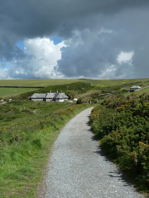
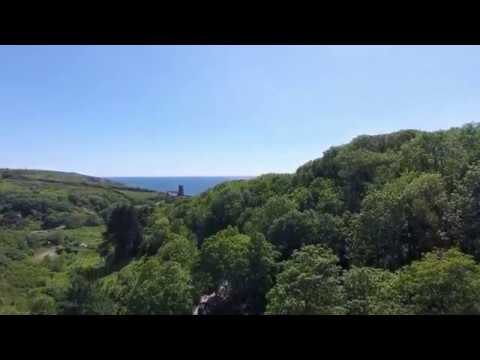
Eden's Cove is a picturesque coastal area located in Devon, England. Nestled between rolling hills and the vast expanse of the English Channel, this idyllic destination is known for its stunning sea views, charming estuary, and serene creek.
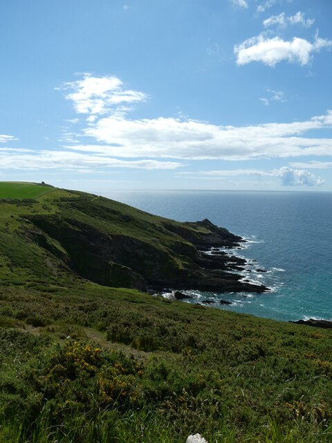
The sea at Eden's Cove is a sight to behold, with its crystal-clear turquoise waters and gently crashing waves. It is a popular spot for water activities such as swimming, paddleboarding, and kayaking. The beach is adorned with golden sand, perfect for sunbathing or building sandcastles.
Adjacent to the beach is the estuary, a tranquil body of water where the river meets the sea. This estuary is home to a diverse array of marine life, including fish, crabs, and seabirds. Visitors can enjoy leisurely walks along the estuary, taking in the breathtaking views and observing the local flora and fauna.
A short distance away from the estuary is the creek, a narrow and winding waterway that meanders through the surrounding countryside. Lined with lush greenery and dotted with charming cottages, the creek offers a peaceful setting for boating or simply enjoying the serenity of nature.
Eden's Cove is not only a haven for nature lovers but also a paradise for photographers and artists, who are drawn to its natural beauty and picturesque landscapes. Whether it's capturing the vibrant hues of the sea, the serenity of the estuary, or the charm of the creek, this stunning location offers endless opportunities for capturing the essence of Devon's coastal beauty.
In conclusion, Eden's Cove is a hidden gem in Devon, with its stunning sea, estuary, and creek. It is a place where visitors can immerse themselves in nature, unwind, and experience the tranquility of coastal living.
If you have any feedback on the listing, please let us know in the comments section below.
Eden's Cove Images
Images are sourced within 2km of 50.302277/-4.0686253 or Grid Reference SX5246. Thanks to Geograph Open Source API. All images are credited.


Eden's Cove is located at Grid Ref: SX5246 (Lat: 50.302277, Lng: -4.0686253)
Administrative County: Devon
Police Authority: Devon and Cornwall
What 3 Words
///blushed.beginning.holds. Near Wembury, Devon
Nearby Locations
Related Wikis


Related Videos
Churchwood Valley Holiday Park
Spring 2020.

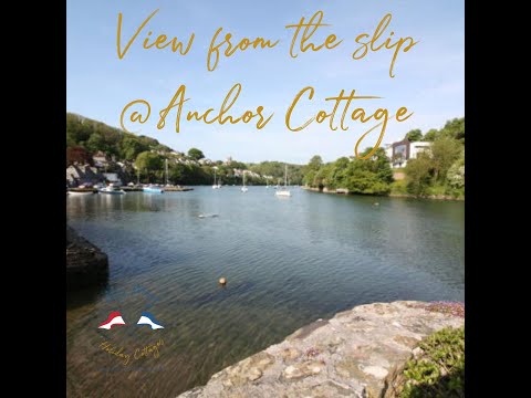
Holiday Cottages Noss Mayo
Kayaking to the pub from Anchor Cottage - Holiday Cottages Noss Mayo. There are two kayaks at Anchor Cottage and at high tide ...
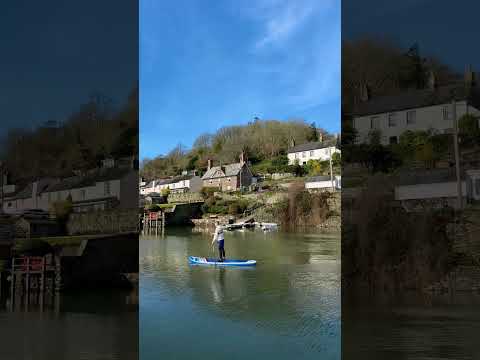
Such a lovely weekend on my board in the bay of Noss Mayo this weekend #holiday #sup #devon
Such a lovely calm bay at Noss Mayo to take my board out for an hour each morning while the tide was in Definitely check it out if ...
Holiday Cottages Noss Mayo
Our first video of our beautiful Anchor Cottage in Noss Mayo, Devon, England. Noss Mayo is Devon's best kept secret! It's an easy ...
Nearby Amenities
Located within 500m of 50.302277,-4.0686253Have you been to Eden's Cove?
Leave your review of Eden's Cove below (or comments, questions and feedback).