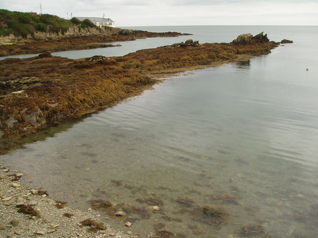
Ffos y Defaid

Sea, Estuary, Creek in Anglesey

Wales

Ffos y Defaid
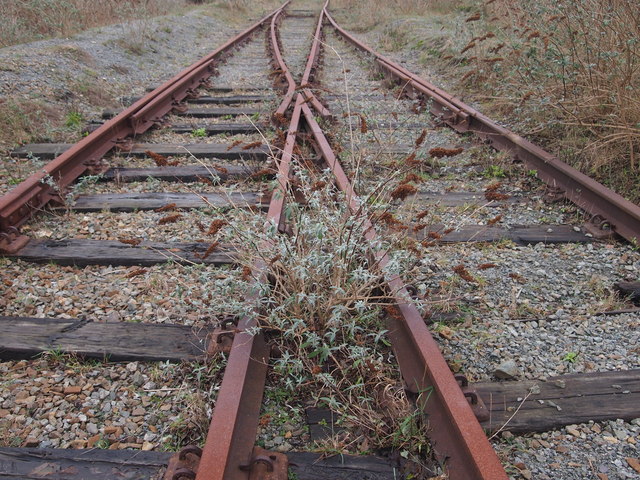
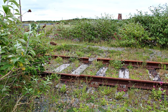
Disused Railway, Amlwch This line led to the Associated Octel/Great Lakes Chemicals bromine production plant.
Disused Railway, Amlwch Credit: Chris Andrews

The requested URL returned error: 429 Too Many Requests

If you have any feedback on the listing, please let us know in the comments section below.

Ffos y Defaid Images

Images are sourced within 2km of 53.420743/-4.3653441 or Grid Reference SH4294. Thanks to Geograph Open Source API. All images are credited.
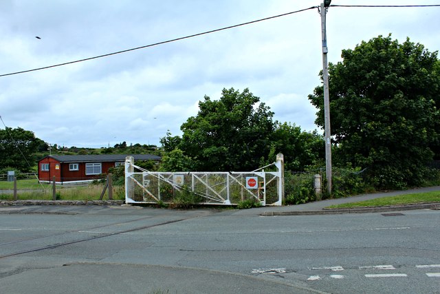
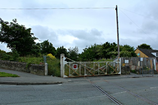
Disused Railway, Amlwch This line led to the Associated Octel/Great Lakes Chemicals bromine production plant.
Disused Railway, Amlwch
This line led to the Associated Octel/Great Lakes Chemicals bromine production plant.
Level crossing gates closed The redundant and disused line which led to the Associated Octel/Great Lakes Chemicals bromine production plant.
<a href="https://www.geograph.org.uk/photo/5024465">SH4493 : Level crossing gates closed (2)</a>
Level crossing gates closed
The redundant and disused line which led to the Associated Octel/Great Lakes Chemicals bromine production plant. SH4493 : Level crossing gates closed (2)
Level crossing gates closed (2) The redundant and disused line which led from the Associated Octel/Great Lakes Chemicals bromine production plant. 
<a href="https://www.geograph.org.uk/photo/5024460">SH4493 : Level crossing gates closed</a>
Level crossing gates closed (2)
The redundant and disused line which led from the Associated Octel/Great Lakes Chemicals bromine production plant. SH4493 : Level crossing gates closed
Disused and broken railway track This line led to the Associated Octel/Great Lakes Chemicals bromine production plant.
Disused and broken railway track
This line led to the Associated Octel/Great Lakes Chemicals bromine production plant.
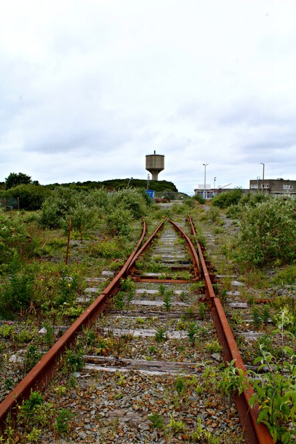
Disused railway track at Amlwch This line led to the Associated Octel/Great Lakes Chemicals bromine production plant.
Disused railway track at Amlwch
This line led to the Associated Octel/Great Lakes Chemicals bromine production plant.
Coastline above Bull Bay
Disused railway track at Amlwch (2) Talk of leaves on the line.
This line led to the Associated Octel/Great Lakes Chemicals bromine production plant.
Disused railway track at Amlwch (2)
Talk of leaves on the line. This line led to the Associated Octel/Great Lakes Chemicals bromine production plant.
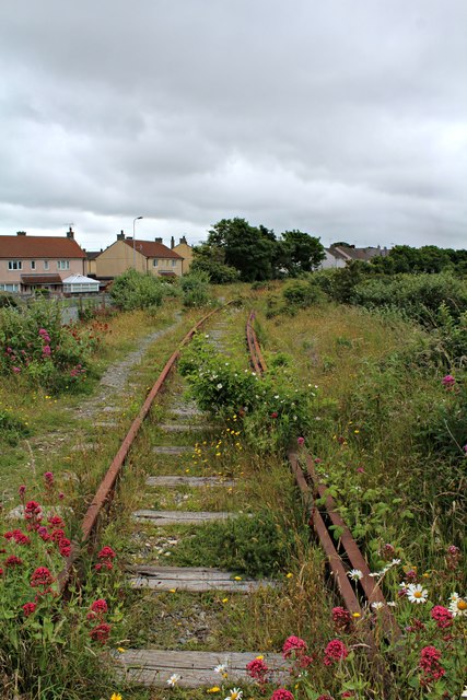
Disused railway track at Amlwch (3) This line leads from the Associated Octel/Great Lakes Chemicals bromine production plant.
Disused railway track at Amlwch (3)
This line leads from the Associated Octel/Great Lakes Chemicals bromine production plant.
"The King's Head", Amwlch
View To Bull Bay
View To Bull Bay
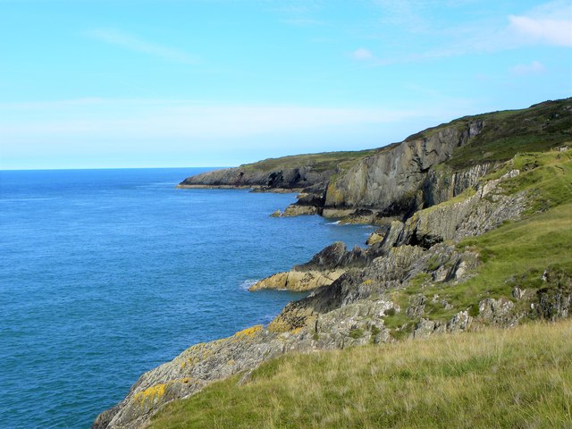
Coastline east of Porth Wen Walking the coast path eastwards from Cemaes is fairly challenging, with many steep ups and downs, but east of Porth Wen the gradients ease and the path is easy to Bull Bay.
Coastline east of Porth Wen
Walking the coast path eastwards from Cemaes is fairly challenging, with many steep ups and downs, but east of Porth Wen the gradients ease and the path is easy to Bull Bay.
Penybonc Road in Amlwch Looking south-eastward.
Penybonc Road in Amlwch
Looking south-eastward.
Mona Street (B5111) in Amlwch approaching the A5025 Looking eastward.
Mona Street (B5111) in Amlwch approaching the A5025
Looking eastward.
The junction of Mona Street and Bathesda Street (B5111) in Amlwch Looking south-westward.
The junction of Mona Street and Bathesda Street (B5111) in Amlwch
Looking south-westward.
Ordnance Survey Flush Bracket S7550 This can be found on the wall of a Council/Police Office building in Amlwch. The benchmark height is ecorded as being 26.257 metres above sea level. For more detail see : <span class="nowrap"><a title="http://www.bench-marks.org.uk/bm16373" rel="nofollow ugc noopener" href="http://www.bench-marks.org.uk/bm16373">Link</a><img style="margin-left:2px;" alt="External link" title="External link - shift click to open in new window" src="https://s1.geograph.org.uk/img/external.png" width="10" height="10"/></span>
Ordnance Survey Flush Bracket S7550
This can be found on the wall of a Council/Police Office building in Amlwch. The benchmark height is ecorded as being 26.257 metres above sea level. For more detail see : LinkExternal link
Ordnance Survey Flush Bracket S7551 This can be found on the wall of a school in Amlwch. The benchmark height is recorded as being 37.908 metres above sea level. For more detail see : <span class="nowrap"><a title="http://www.bench-marks.org.uk/bm16372" rel="nofollow ugc noopener" href="http://www.bench-marks.org.uk/bm16372">Link</a><img style="margin-left:2px;" alt="External link" title="External link - shift click to open in new window" src="https://s1.geograph.org.uk/img/external.png" width="10" height="10"/></span>
Ordnance Survey Flush Bracket S7551
This can be found on the wall of a school in Amlwch. The benchmark height is recorded as being 37.908 metres above sea level. For more detail see : LinkExternal link
Coastline at Bull Bay
Porth-llechog, Bull Bay
Show me another place!

Ffos y Defaid is located at Grid Ref: SH4294 (Lat: 53.420743, Lng: -4.3653441)

Unitary Authority: Isle of Anglesey

Police Authority: North Wales

What 3 Words

///articulated.unhappily.ports. Near Amlwch, Isle of Anglesey

Related Wikis

Bull Bay, Anglesey

Bull Bay (Welsh: Porth Llechog) is a village and bay on the northern coast of Anglesey, Wales, close to Amlwch. Its Welsh name, Porth Llechog, means "sheltered...

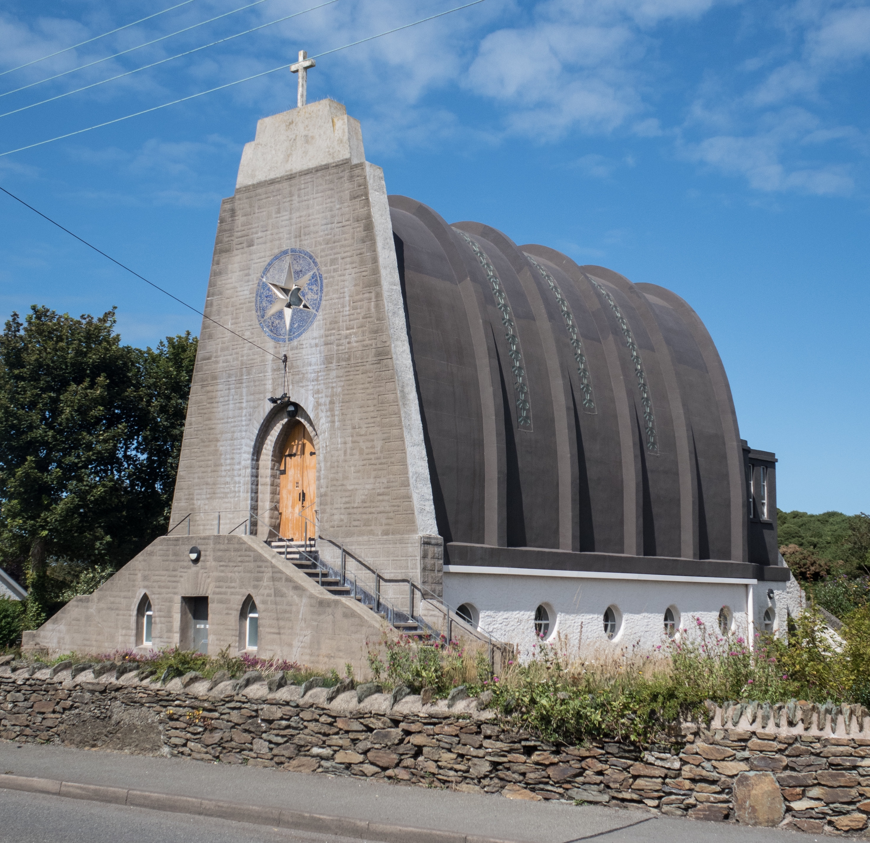
Our Lady Star of the Sea and St Winefride, Amlwch

Our Lady Star of the Sea and St Winefride (Welsh: Mair, Seren Y Mor a Santes Wenfrewi) is a Roman Catholic church in Amlwch, a town on the island of Anglesey...

Burwen

Burwen is a village in Anglesey, Wales, in the community of Amlwch. Located on the A5025, it is 1 kilometre southwest of the larger village of Bull Bay...

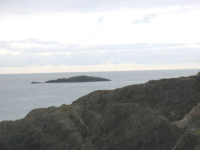
East Mouse

East Mouse (Welsh: Ynys Amlwch) is an islet found off the north coast of Anglesey, Wales. It is found just a few hundred metres away from the town of Amlwch...

Nearby Amenities

Located within 500m of 53.420743,-4.3653441
Source: PGS
Lat/Long: 53.4231057/-4.3674128
Source: PGS
Lat/Long: 53.4234428/-4.3674627
Source: PGS
Lat/Long: 53.4235859/-4.3675032
Source: PGS
Lat/Long: 53.4238838/-4.3676771
Source: PGS
Lat/Long: 53.4240772/-4.3682975
Porthllechog
Name Cy: Porthllechog
Name En: Bull Bay
Place: village
Source: NPE
Source Name: local_knowledge
Wikidata: Q4996547
Wikipedia: en:Bull Bay, Anglesey
Lat/Long: 53.4218266/-4.3717094
Barrier: stile
Lat/Long: 53.4230465/-4.3684923
Barrier: kissing_gate
Lat/Long: 53.4229535/-4.369303
Bench
Lat/Long: 53.4228578/-4.3692908
Bench
Lat/Long: 53.4222966/-4.3719876
Bench
Lat/Long: 53.421984/-4.370116
Bull Bay Baths
Historic: yes
Lat/Long: 53.4233111/-4.3680853
Power: substation
Lat/Long: 53.422136/-4.37073
Power: substation
Lat/Long: 53.420084/-4.37207
Give Way
Direction: backward
Lat/Long: 53.4223532/-4.3705314
Porthllechog
Name Cy: Porthllechog
Name En: Bull Bay
Natural: bay
Lat/Long: 53.4221268/-4.3674716
Direction: 145
Generator Method: photovoltaic
Generator Output Electricity: yes
Generator Solar Modules: 17
Generator Source: solar
Generator Type: solar_photovoltaic_panel
Location: roof
Power: generator
Lat/Long: 53.4177162/-4.366589
Direction: 215
Generator Method: photovoltaic
Generator Output Electricity: yes
Generator Solar Modules: 20
Generator Source: solar
Generator Type: solar_photovoltaic_panel
Location: roof
Power: generator
Lat/Long: 53.4205786/-4.368268
Direction: WSW
Generator Method: photovoltaic
Generator Output Electricity: yes
Generator Solar Modules: 10
Generator Source: solar
Generator Type: solar_photovoltaic_panel
Location: roof
Power: generator
Lat/Long: 53.4219598/-4.3705972
Ffos y Defaid
Natural: bay
Lat/Long: 53.4208013/-4.366074
Direction: 235
Generator Method: photovoltaic
Generator Output Electricity: yes
Generator Solar Modules: 4
Generator Source: solar
Generator Type: solar_photovoltaic_panel
Location: roof
Power: generator
Lat/Long: 53.4193664/-4.3724439
Direction: WSW
Generator Method: photovoltaic
Generator Output Electricity: yes
Generator Solar Modules: 6
Generator Source: solar
Generator Type: solar_photovoltaic_panel
Location: roof
Power: generator
Lat/Long: 53.421953/-4.3706274
Direction: WSW
Generator Method: photovoltaic
Generator Output Electricity: yes
Generator Solar Modules: 16
Generator Source: solar
Generator Type: solar_photovoltaic_panel
Location: roof
Power: generator
Lat/Long: 53.4198112/-4.3682671
Direction: 235
Generator Method: photovoltaic
Generator Output Electricity: yes
Generator Solar Modules: 12
Generator Source: solar
Generator Type: solar_photovoltaic_panel
Location: roof
Power: generator
Lat/Long: 53.4194243/-4.3724996
Direction: 255
Generator Method: photovoltaic
Generator Output Electricity: yes
Generator Solar Modules: 16
Generator Source: solar
Generator Type: solar_photovoltaic_panel
Location: roof
Power: generator
Lat/Long: 53.4195922/-4.370968
Direction: 165
Generator Method: photovoltaic
Generator Output Electricity: yes
Generator Solar Modules: 4
Generator Source: solar
Generator Type: solar_photovoltaic_panel
Location: roof
Power: generator
Lat/Long: 53.4201396/-4.3704987
Direction: 165
Generator Method: photovoltaic
Generator Output Electricity: yes
Generator Solar Modules: 6
Generator Source: solar
Generator Type: solar_photovoltaic_panel
Location: roof
Power: generator
Lat/Long: 53.4201476/-4.3704115
The data included in this document is from www.openstreetmap.org. The data is made available under ODbL.

Have you been to Ffos y Defaid?

Leave your review of Ffos y Defaid below (or comments, questions and feedback).