Port an Dòbhrain

Sea, Estuary, Creek in Argyllshire

Scotland

Port an Dòbhrain

Loch Etive Looking up the loch to Beinn Trilleachan from the track to Inverliver.
Loch Etive Credit: Jim Barton

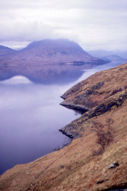
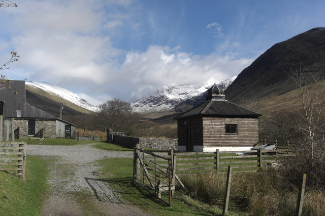
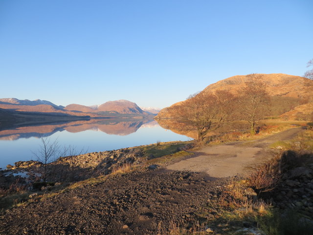
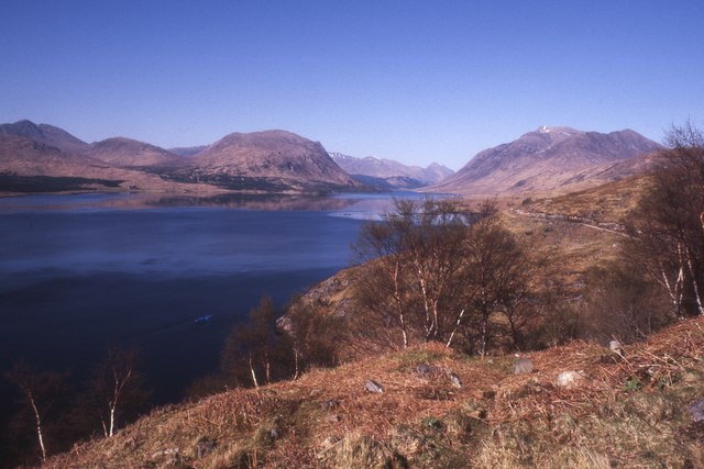
Port an Dòbhrain is a picturesque coastal village located in Argyllshire, Scotland. Nestled on the western shore of Loch Linnhe, it boasts stunning views of the sea, estuary, and nearby creek. The name "Port an Dòbhrain" translates to "Harbour of the Otter" in Gaelic, paying homage to the abundant wildlife found in the area.

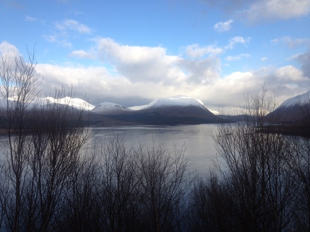
The village is known for its idyllic setting, with rugged cliffs framing the deep blue waters of the sea. The sea itself offers a range of activities, such as fishing, boating, and wildlife spotting. Visitors can often catch a glimpse of seals swimming in the crystal-clear waters or seabirds soaring above. The coastline is also dotted with small, sandy beaches, perfect for leisurely strolls and picnics.

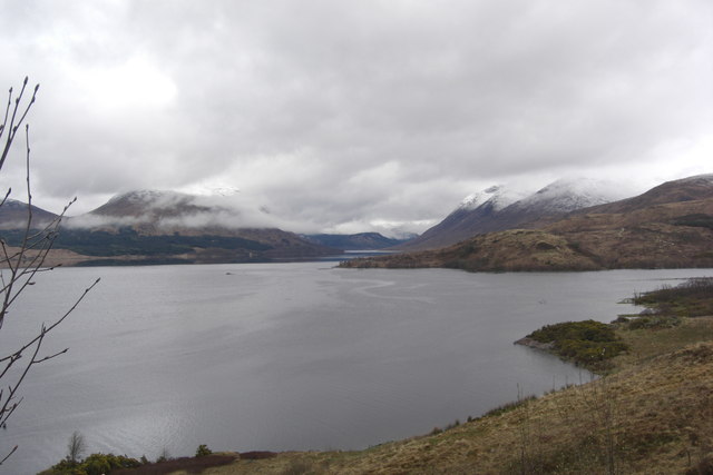
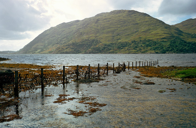
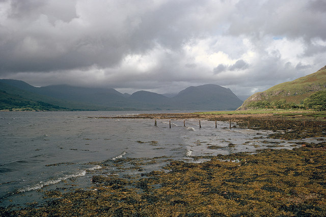
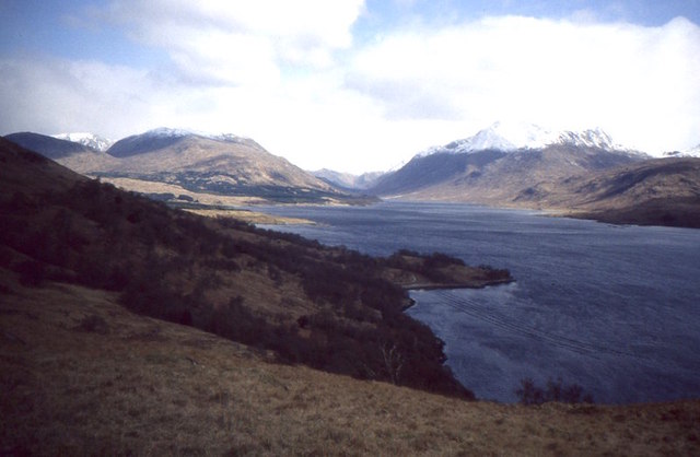
The estuary adjacent to Port an Dòbhrain is a haven for birdwatchers and nature enthusiasts. The diverse ecosystem supports a wide array of bird species, making it an ideal spot for bird spotting and photography. From wading birds to migrating ducks, the estuary provides a rich habitat for both resident and visiting avian species.

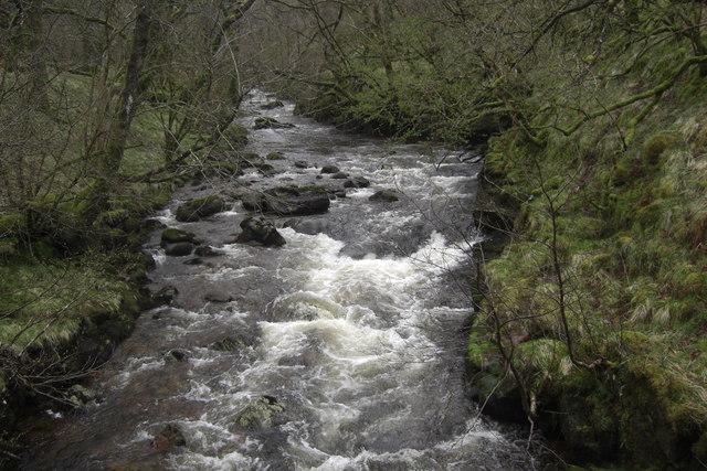
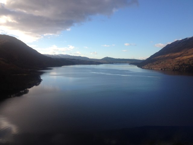
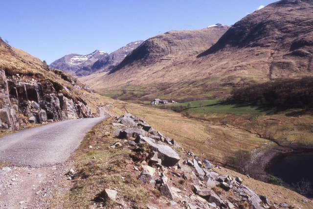
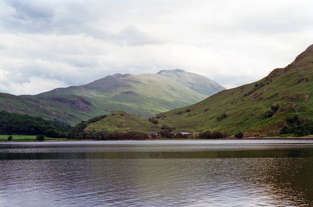
A short distance from the village lies a tranquil creek, which is a popular spot for kayaking and paddleboarding. Surrounded by lush greenery and rolling hills, the creek offers a peaceful retreat for those seeking a closer connection with nature. Exploring the creek by boat allows visitors to discover hidden coves and secluded spots, immersing themselves in the beauty of the surrounding landscape.

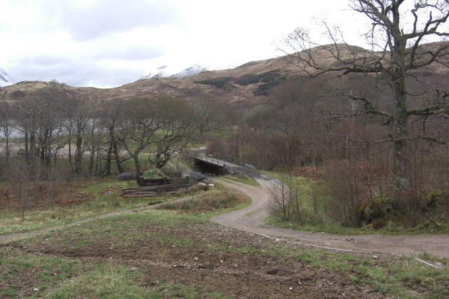
Overall, Port an Dòbhrain's sea, estuary, and creek provide a captivating blend of natural beauty and recreational opportunities, making it a must-visit destination for nature lovers and outdoor enthusiasts alike.

If you have any feedback on the listing, please let us know in the comments section below.

Port an Dòbhrain Images

Images are sourced within 2km of 56.463135/-5.1646824 or Grid Reference NN0534. Thanks to Geograph Open Source API. All images are credited.

Loch Etive Looking up the loch to Beinn Trilleachan from the track to Inverliver.
Loch Etive
Looking up the loch to Beinn Trilleachan from the track to Inverliver.
River Noe River Noe looking upstream from Glen Noe bridge.
River Noe
River Noe looking upstream from Glen Noe bridge.
Loch Etive shoreline Foreground is shoreline of Loch Etive SE of Inverliver.
Loch Etive shoreline
Foreground is shoreline of Loch Etive SE of Inverliver.
Bridge at Inverliver Bridge over River Liver at Inverliver. The bridge has a lower level which presumably acts as a ford when the river water level is high. There is also an alternative higher level bridge.
Bridge at Inverliver
Bridge over River Liver at Inverliver. The bridge has a lower level which presumably acts as a ford when the river water level is high. There is also an alternative higher level bridge.
Onion-domed outbuilding Onion-domed outbuilding at Glen Noe close to track leading to Inverliver and Ardmaddy.
Onion-domed outbuilding
Onion-domed outbuilding at Glen Noe close to track leading to Inverliver and Ardmaddy.
Loch Etive From the track up the eastern shore.
Loch Etive
From the track up the eastern shore.
Loch Etive
Loch Etive
Snow filled burn course on the lower slopes of Meall Copagach
Estate track on the South East shore of Loch Etive
Shore of Loch Etive Looking across to Beinn Duirinnis from the eastern shore of Loch Etive.  This image taken 40 years ago has been positioned from studying the detail in <a href="https://www.geograph.org.uk/photo/1342550">NN0433 : On the southeast shore of Loch Etive</a> that gives the same apparent viewpoint.  That said, its exact position within this grid square must be doubtful.
Shore of Loch Etive
Looking across to Beinn Duirinnis from the eastern shore of Loch Etive. This image taken 40 years ago has been positioned from studying the detail in NN0433 : On the southeast shore of Loch Etive that gives the same apparent viewpoint. That said, its exact position within this grid square must be doubtful.
Shore of Loch Etive near Glen Noe The distant hill is Beinn Trilleachan and the row of fence posts is the same feature in <a href="https://www.geograph.org.uk/photo/3611999">NN0433 : Shore of Loch Etive</a>
Shore of Loch Etive near Glen Noe
The distant hill is Beinn Trilleachan and the row of fence posts is the same feature in NN0433 : Shore of Loch Etive
Track to Glennoe
Track to Glennoe
Loch Etive Between Glennoe and Inverliver.
Loch Etive
Between Glennoe and Inverliver.
Ridge on Beinn Duirinnis View up Loch Etive.
Ridge on Beinn Duirinnis
View up Loch Etive.
Eastward up Glen Noe from Loch Etive Viewed from a pleasure-launch up Loch Etive from Taynuilt and back. Directly ahead is Beinn a' Chochuill (3,215 ft.). (Cf. <a href="https://www.geograph.org.uk/photo/2040723">NN0434 : Glen Noe from Loch Etive</a>).
Eastward up Glen Noe from Loch Etive
Viewed from a pleasure-launch up Loch Etive from Taynuilt and back. Directly ahead is Beinn a' Chochuill (3,215 ft.). (Cf. NN0434 : Glen Noe from Loch Etive).
Road, Inverliver The road crosses Glen Liver with an annoying climb only to return to the loch before the much meatier climb around to Glen Noe.
Road, Inverliver
The road crosses Glen Liver with an annoying climb only to return to the loch before the much meatier climb around to Glen Noe.
Bridge, Glen Liver Crossing the Liver. If you are here, you are going to be going steeply uphill soon.
Bridge, Glen Liver
Crossing the Liver. If you are here, you are going to be going steeply uphill soon.
Ruins, Glen Liver Beside the road as it climbs southwards to cross over to Glen Noe.
Ruins, Glen Liver
Beside the road as it climbs southwards to cross over to Glen Noe.
Show me another place!

Port an Dòbhrain is located at Grid Ref: NN0534 (Lat: 56.463135, Lng: -5.1646824)

Unitary Authority: Argyll and Bute

Police Authority: Argyll and West Dunbartonshire

What 3 Words

///ignites.sunflower.pumps. Near Oban, Argyll & Bute

Related Wikis

Loch Etive

Loch Etive (Scottish Gaelic, Loch Eite) is a 30 km sea loch in Argyll and Bute, Scotland. It reaches the sea at Connel, 5 km north of Oban. It measures...

River Awe

The River Awe (Scottish Gaelic: Uisge Abha) is a short river in the Southwest Highlands of Scotland by which the freshwater Loch Awe empties into Loch...

Bonawe

Bonawe (Scots pronunciation: [boˈnɔː]; Scottish Gaelic: Bun Abha [puˈna.ə]) is a village in Ardchattan Parish Argyll and Bute, Scotland opposite Taynuilt...

Ben Cruachan

Ben Cruachan (Scottish Gaelic: Cruachan Beann) is a mountain that rises to 1,126 metres (3,694 ft), the highest in Argyll and Bute, Scotland. It gives...

Nearby Amenities

Located within 500m of 56.463135,-5.1646824
Glen Noe
Place: locality
Lat/Long: 56.4586744/-5.1640044
MacIntyre Cairn
Historic: monument
Lat/Long: 56.461316/-5.1668451
Power: pole
Lat/Long: 56.461403/-5.1575645
Power: pole
Lat/Long: 56.4616657/-5.1580377
Power: pole
Lat/Long: 56.4620899/-5.1588199
Power: pole
Lat/Long: 56.4625954/-5.1597325
Power: pole
Lat/Long: 56.4630116/-5.160464
Power: pole
Lat/Long: 56.463345/-5.1610845
Power: pole
Lat/Long: 56.4638946/-5.1620985
Power: pole
Lat/Long: 56.4646722/-5.1619126
Power: pole
Lat/Long: 56.4650389/-5.1618257
Power: pole
Lat/Long: 56.4654644/-5.1617315
Power: pole
Lat/Long: 56.4658378/-5.1613139
Power: pole
Lat/Long: 56.4665074/-5.1605437
The data included in this document is from www.openstreetmap.org. The data is made available under ODbL.

Have you been to Port an Dòbhrain?

Leave your review of Port an Dòbhrain below (or comments, questions and feedback).