Iron Cove

Sea, Estuary, Creek in Cornwall

England

Iron Cove

Grazing cattle near Gunver Head
Grazing cattle near Gunver Head Credit: Roger Cornfoot

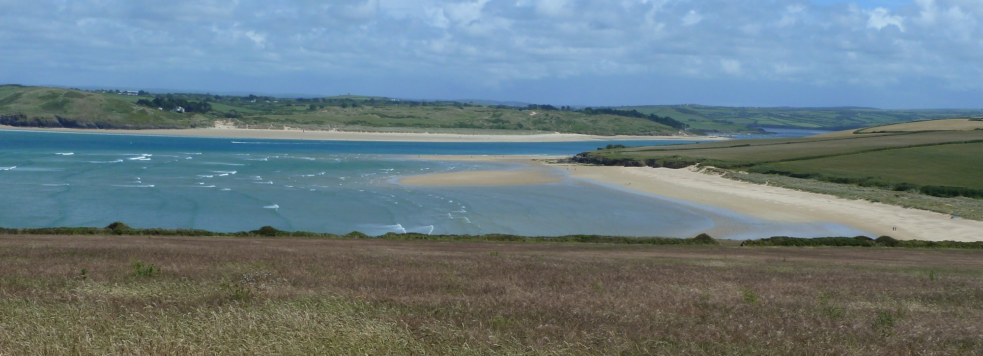
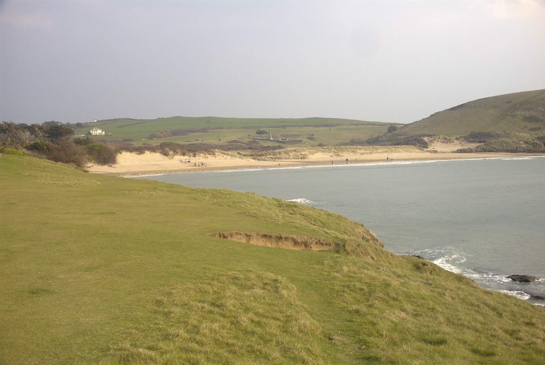
Iron Cove is a picturesque coastal area located in Cornwall, England. Nestled along the southwestern coast of the country, it is known for its stunning sea views, estuary, and creek. The cove is a popular destination for nature lovers and outdoor enthusiasts, offering a diverse range of natural attractions.

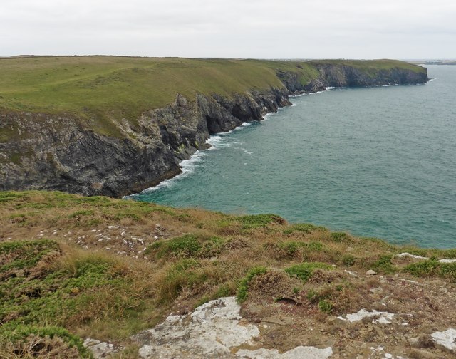
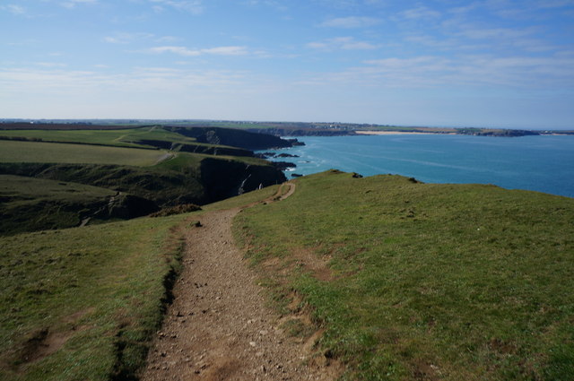
The sea at Iron Cove is a prominent feature, with its crystal-clear waters and rugged coastline. Visitors can enjoy a variety of water activities such as swimming, snorkeling, and fishing. The sea is also home to a diverse marine ecosystem, making it a haven for wildlife enthusiasts and birdwatchers.

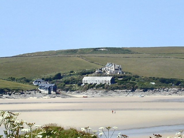
The estuary at Iron Cove is a unique feature that adds to its charm. The estuary is formed where the river meets the sea, creating a tranquil and sheltered environment. It provides a habitat for various species of fish and birds, making it an ideal spot for birdwatching and angling.

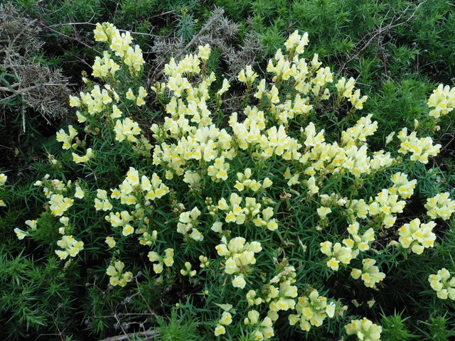
A small creek runs through Iron Cove, adding to its natural beauty. The creek is surrounded by lush vegetation and offers a peaceful setting for picnics and leisurely walks. Visitors can explore its banks, spotting wildlife and enjoying the serenity of the area.

Iron Cove is also known for its coastal trails and walking routes, allowing visitors to explore the stunning scenery at their own pace. The area is rich in history, with remnants of ancient settlements and landmarks scattered throughout.

Overall, Iron Cove offers a unique blend of natural beauty, wildlife, and historical significance. Whether visitors are seeking adventure, relaxation, or cultural exploration, this coastal gem in Cornwall has something to offer to everyone.

If you have any feedback on the listing, please let us know in the comments section below.

Iron Cove Images

Images are sourced within 2km of 50.561338/-4.9475832 or Grid Reference SW9177. Thanks to Geograph Open Source API. All images are credited.

Grazing cattle near Gunver Head
Middle Merope Island
Wild Snapdragon, on Gunver Head
Gunver Head
Gunver Head
The coast at Gunver Head The rock below the cliff edge is Middle Merope Island.
The coast at Gunver Head
The rock below the cliff edge is Middle Merope Island.
Higher Merope Island A glimpse of the distinctive stack also shown in <a href="https://www.geograph.org.uk/photo/1299196">SW8977 : Merope Rocks stack (1)</a> and <a href="https://www.geograph.org.uk/photo/1299197">SW8977 : Merope Rocks stack (2)</a>, down a cleft in the cliffs at Gunver Head.
Higher Merope Island
A glimpse of the distinctive stack also shown in SW8977 : Merope Rocks stack (1) and SW8977 : Merope Rocks stack (2), down a cleft in the cliffs at Gunver Head.
Middle and Higher Merope Islands Stacks or islands? Two of the dramatic rock features at Gunver Head.
Middle and Higher Merope Islands
Stacks or islands? Two of the dramatic rock features at Gunver Head.
Sea pinks by the signpost A posy of thrift (Armeria maritima) clinging to the base of a footpath sign above the Merope islands.
Sea pinks by the signpost
A posy of thrift (Armeria maritima) clinging to the base of a footpath sign above the Merope islands.
Fox Hole Spectacular coastal scenery looking northeast from Gunver Head across the chasm of Fox Hole, with purplish rocks and cliffs (and other colours).
Fox Hole
Spectacular coastal scenery looking northeast from Gunver Head across the chasm of Fox Hole, with purplish rocks and cliffs (and other colours).
Gunver Head Thrift occupies the top of the cliff, following the line of the dipping rocks, which plummet vertically on the right into Fox Hole (on the right - see <a href="https://www.geograph.org.uk/photo/2441361">SW8977 : Fox Hole</a>).
Gunver Head
Thrift occupies the top of the cliff, following the line of the dipping rocks, which plummet vertically on the right into Fox Hole (on the right - see SW8977 : Fox Hole).
Merope Islands A cow grazes within a few feet of a 50 metre vertical cliff. On the right are higher, Middle and Lower Merope Islands. View from Gunver Head.
Merope Islands
A cow grazes within a few feet of a 50 metre vertical cliff. On the right are higher, Middle and Lower Merope Islands. View from Gunver Head.
Higher Merope Island Another view of the stack shown in <a href="https://www.geograph.org.uk/photo/2392273">SW8977 : Higher Merope Island</a>.
Higher Merope Island
Another view of the stack shown in SW8977 : Higher Merope Island.
South West coast path at Gunver Head
South West coast path near Middle Merope Island
Show me another place!

Iron Cove is located at Grid Ref: SW9177 (Lat: 50.561338, Lng: -4.9475832)

Unitary Authority: Cornwall

Police Authority: Devon and Cornwall

What 3 Words

///paid.seatbelt.crest. Near Polzeath, Cornwall

Related Wikis

Hawker's Cove, Cornwall

Hawker's Cove is a small coastal settlement in north Cornwall, England, United Kingdom. It is situated one-and-a-half miles (2 kilometres) north of Padstow...

Doom Bar

The Doom Bar (previously known as Dunbar sands, Dune-bar, and similar names) is a sandbar at the mouth of the estuary of the River Camel, where it meets...
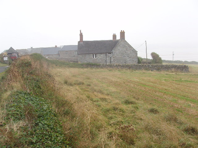
Lellizzick

Lellizzick (Cornish: Lan Wolesyk, meaning Woledic's church enclosure) is a farmstead settlement in north Cornwall, England. It is situated approximately...
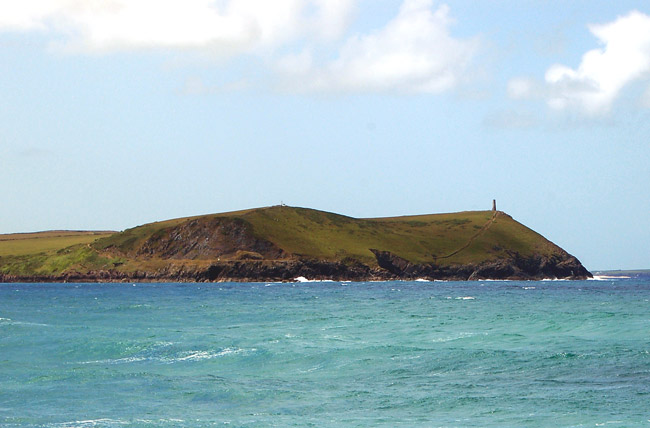
Stepper Point

Stepper Point (Cornish: Penn Stuppert) is a headland on the Atlantic coast in north Cornwall, England, United Kingdom. It is at grid reference SW911781...

Tregirls

Tregirls (Cornish: Tregryllas, meaning farmstead of the ruins of an ancient dwelling) is a farmstead in Cornwall, United Kingdom. It is situated approximately...
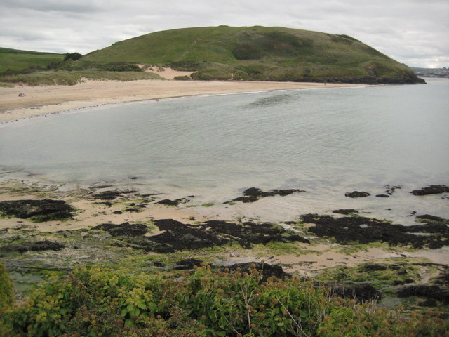
Brea Hill

Brea Hill (Cornish: Bre, meaning hill), pronounced "Bray Hill" is a round hill beside the River Camel estuary in north Cornwall, England, United Kingdom...

Daymer Bay

Daymer Bay is a bay and a beach on the east side of the River Camel estuary in north Cornwall, England, United Kingdom. It is situated approximately six...

Crugmeer

Crugmeer (Cornish: Krugmeur, great barrow) is a hamlet in north Cornwall, England, United Kingdom. It is situated one-and-a-half miles (2 kilometres) from...

Nearby Amenities

Located within 500m of 50.561338,-4.9475832
Source: PGS
Lat/Long: 50.5586526/-4.9486713
Source: PGS
Lat/Long: 50.56039/-4.9490843
Source: PGS
Lat/Long: 50.5606323/-4.9476929
Source: PGS
Lat/Long: 50.5607531/-4.9475372
Source: PGS
Lat/Long: 50.5611457/-4.9473098
Source: PGS
Lat/Long: 50.5613457/-4.9478802
Source: PGS
Lat/Long: 50.5616236/-4.9474893
Source: PGS
Lat/Long: 50.5616977/-4.9473809
Source: PGS
Lat/Long: 50.562549/-4.947174
Cafe
Rest A While Tea Garden
Addr City: Padstow
Addr Country: GB
Addr Housenumber: 7
Addr Place: Hawkers Cove
Addr Postcode: PL28 8HW
Addr Street: Coastguard Houses
Fhrs Id: 581647
Source Addr: FHRS Open Data
Lat/Long: 50.5613525/-4.9489156
Barrier: kissing_gate
Lat/Long: 50.5611484/-4.9481853
Barrier: stile
Material: wood
Stile: stepover
Lat/Long: 50.5615043/-4.9491913
Barrier: stile
Lat/Long: 50.5633693/-4.9527371
WW2 RAF 44 Air Sea Rescue Unit Mooring Posts
Seamark Type: mooring
Lat/Long: 50.5592104/-4.9484919
Abandoned Military: bunker
Building: bunker
Bunker Type: hut
Description: WW2 RAF 44 Air Sea Rescure Unit Base (site of)
Lat/Long: 50.5604979/-4.9500033
The data included in this document is from www.openstreetmap.org. The data is made available under ODbL.

Have you been to Iron Cove?

Leave your review of Iron Cove below (or comments, questions and feedback).