Port na Mairt

Sea, Estuary, Creek in Argyllshire

Scotland

Port na Mairt

Maiden Island The northern end seen from the Lismore ferry.
Maiden Island Credit: Richard Webb

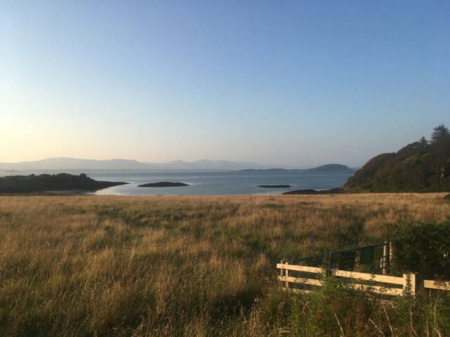
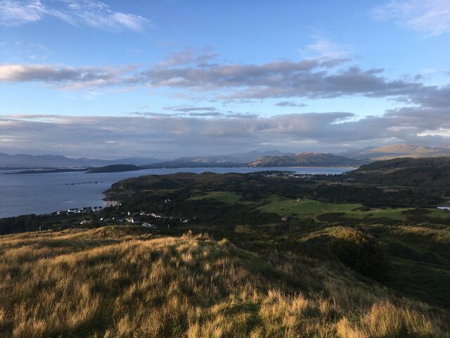
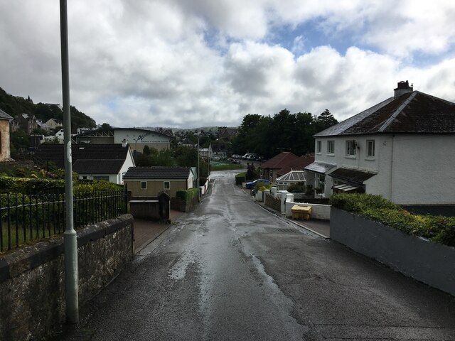
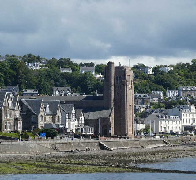
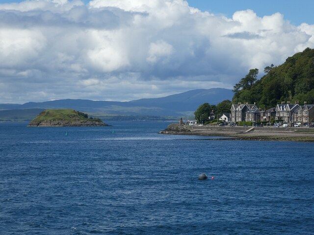
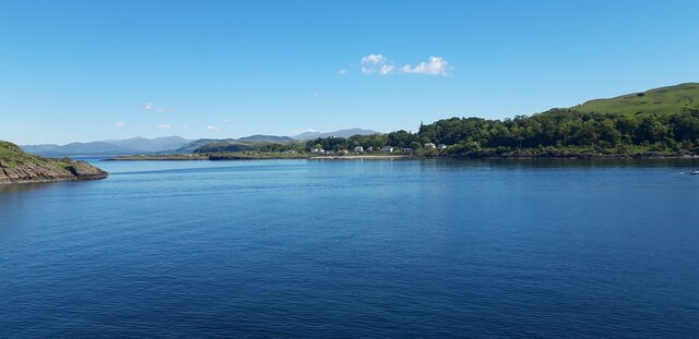
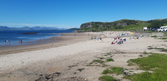
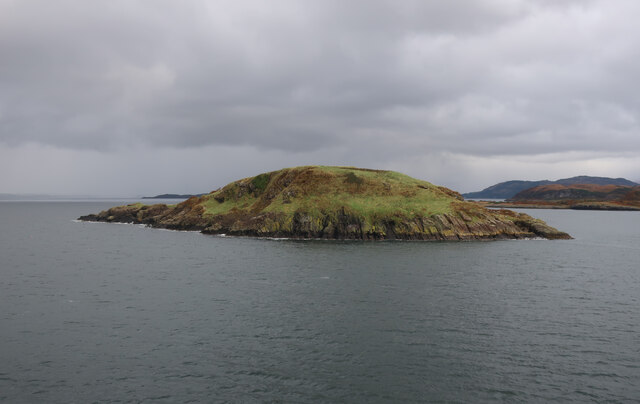
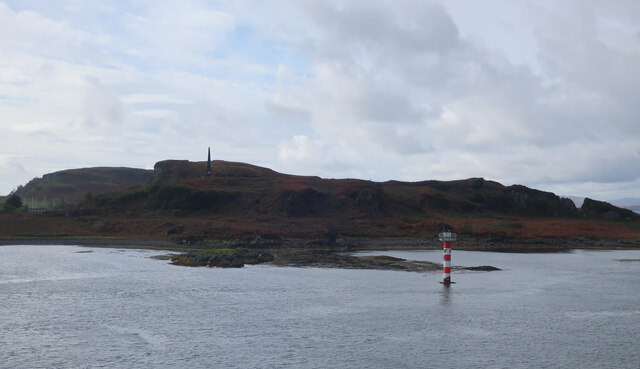
Port na Mairt is a picturesque coastal inlet located in Argyllshire, Scotland. It is situated along the rugged coastline and is approximately 1 mile in length. The area is characterized by its stunning natural beauty, with rocky cliffs and lush greenery surrounding the tranquil waters of the inlet.

The waters of Port na Mairt are a mix of saltwater from the sea and freshwater from nearby streams and rivers, creating a unique estuarine environment. This blend of salt and freshwater creates a rich ecosystem that supports a diverse range of marine life, including fish, crustaceans, and seabirds.

The inlet is a popular spot for recreational activities such as fishing, boating, and birdwatching. Visitors can often be seen exploring the rocky shoreline, soaking in the natural beauty of the area, or enjoying a peaceful picnic by the water's edge.

Overall, Port na Mairt is a hidden gem in Argyllshire, offering visitors a chance to experience the beauty and tranquility of Scotland's coastal landscape.

If you have any feedback on the listing, please let us know in the comments section below.

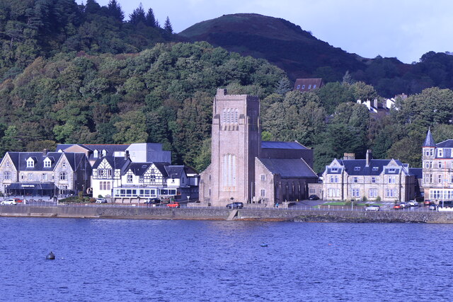
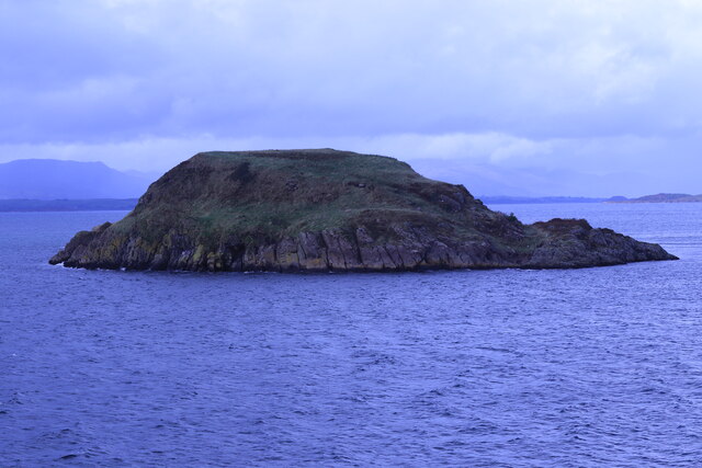
Port na Mairt Images

Images are sourced within 2km of 56.435913/-5.4752752 or Grid Reference NM8532. Thanks to Geograph Open Source API. All images are credited.

Maiden Island The northern end seen from the Lismore ferry.
Maiden Island
The northern end seen from the Lismore ferry.
St Columba's Cathedral, Oban Category A listed. Listing number LB38820. Architect Sir Giles Gilbert Scott, 1935-52.
St Columba's Cathedral, Oban
Category A listed. Listing number LB38820. Architect Sir Giles Gilbert Scott, 1935-52.
Maiden Island From the MV Isle of Mull.
Maiden Island
From the MV Isle of Mull.
Alexandra Hotel, Oban On Corran Esplanade.
Alexandra Hotel, Oban
On Corran Esplanade.
Field near Ganavan
Field near Ganavan
Cnoc Carnach
Cnoc Carnach
Croft Road, Oban
Croft Road, Oban
Oban Youth Hostel, 1983
Oban - Corran Esplanade from the sea Taken from a CalMac ferry approaching Oban with the houses along Corran Esplanade lining the coast. The large building in the distance is <a href="https://www.geograph.org.uk/photo/7256430">NM8530 : Oban - St Columba's Cathedral</a>
Oban - Corran Esplanade from the sea
Taken from a CalMac ferry approaching Oban with the houses along Corran Esplanade lining the coast. The large building in the distance is NM8530 : Oban - St Columba's Cathedral
Oban - St Columba's Cathedral - from incoming ferry St Columba's Cathedral was designed in the Neo-Gothic style by the architect Sir Giles Gilbert Scott and built between 1935 and 1952.
See HES Category 'A' listing here: <span class="nowrap"><a title="http://portal.historicenvironment.scot/designation/LB38820" rel="nofollow ugc noopener" href="http://portal.historicenvironment.scot/designation/LB38820">Link</a><img style="margin-left:2px;" alt="External link" title="External link - shift click to open in new window" src="https://s1.geograph.org.uk/img/external.png" width="10" height="10"/></span>
See also <a href="https://www.geograph.org.uk/photo/7256430">NM8530 : Oban - St Columba's Cathedral</a>
Oban - St Columba's Cathedral - from incoming ferry
St Columba's Cathedral was designed in the Neo-Gothic style by the architect Sir Giles Gilbert Scott and built between 1935 and 1952. See HES Category 'A' listing here: LinkExternal link See also NM8530 : Oban - St Columba's Cathedral
Oban - St Columba's Cathedral St Columba's Cathedral was designed in the Neo-Gothic style by the architect Sir Giles Gilbert Scott and built between 1935 and 1952.
See HES Category 'A' listing here: <span class="nowrap"><a title="http://portal.historicenvironment.scot/designation/LB38820" rel="nofollow ugc noopener" href="http://portal.historicenvironment.scot/designation/LB38820">Link</a><img style="margin-left:2px;" alt="External link" title="External link - shift click to open in new window" src="https://s1.geograph.org.uk/img/external.png" width="10" height="10"/></span>
See also <a href="https://www.geograph.org.uk/photo/7256423">NM8530 : Oban - St Columba's Cathedral - from incoming ferry</a>
Oban - St Columba's Cathedral
St Columba's Cathedral was designed in the Neo-Gothic style by the architect Sir Giles Gilbert Scott and built between 1935 and 1952. See HES Category 'A' listing here: LinkExternal link See also NM8530 : Oban - St Columba's Cathedral - from incoming ferry
Oban - View northwards out of the bay On the right can be seen the northernmost houses of Corran Esplanade while the little island on the left is Maiden Island (c.3ha (7 acres) with highest elevation 28m (92'))
Two of the green North Channel starboard buoys can be seen, probably numbers 1 & 3.
Oban - View northwards out of the bay
On the right can be seen the northernmost houses of Corran Esplanade while the little island on the left is Maiden Island (c.3ha (7 acres) with highest elevation 28m (92')) Two of the green North Channel starboard buoys can be seen, probably numbers 1 & 3.
Ganavan Sands
Ganavan Sands
Maiden Island View from Barra to Oban Ferry.
Maiden Island
View from Barra to Oban Ferry.
Camas Bàn View from the Barra to Oban Ferry.
Camas Bàn
View from the Barra to Oban Ferry.
Ganavan Sands
Ganavan Sands
Maiden Island From the ferry into Oban.
Maiden Island
From the ferry into Oban.
Beacon off Kerrera From the ferry into Oban.
Beacon off Kerrera
From the ferry into Oban.
Show me another place!

Port na Mairt is located at Grid Ref: NM8532 (Lat: 56.435913, Lng: -5.4752752)

Unitary Authority: Argyll and Bute

Police Authority: Argyll and West Dunbartonshire

What 3 Words

///sentences.wager.declining. Near Oban, Argyll & Bute

Related Wikis

Ganavan

Ganavan (Scottish Gaelic: A' Ghaineamh Bhàn) is a small settlement on Ganavan Bay on the west coast of Scotland, around 1.5 miles (2.4 km) north of the...

Pennyfuir Cemetery

Pennyfuir Cemetery is a cemetery in Oban, Argyll and Bute, Scotland. It was established in the 19th century.The cemetery contains 23 graves from the First...

Dunollie Castle

Dunollie Castle (Scottish Gaelic: Caisteal Dhùn Ollaigh) is a small ruined castle located on a hill north of the town of Oban, on the west coast of Scotland...

Maiden Island

Maiden Island is a small uninhabited island at the mouth of Oban Bay on the west coast of Scotland. == Geography == Maiden Island lies just off the coast...

Nearby Amenities

Located within 500m of 56.435913,-5.4752752
Source: PGS
Lat/Long: 56.4368131/-5.4731018
Source: PGS
Lat/Long: 56.4352471/-5.4789043
Source: PGS
Lat/Long: 56.4350981/-5.4792962
Addr Housename: Ganavan Cottage
Building: house
Source: OS Opendata StreetView
Source Name: OS Opendata StreetView
Lat/Long: 56.432912/-5.4790336
Ganavan Slip
Leisure: slipway
Lat/Long: 56.4377668/-5.4696223
Ganavan Bay
Natural: bay
Lat/Long: 56.4377063/-5.4752697
Bus Stop
Ganavan at Ganavan Sands
Bench: yes
Bus: yes
Departures Board: yes
Lit: no
Public Transport: platform
Shelter: yes
Tactile Paving: no
Lat/Long: 56.4374025/-5.4698073
Bicycle Parking
Bicycle Parking: stands
Capacity: 10
Covered: no
Lat/Long: 56.4374961/-5.4689167
Defibrillator
Defibrillator Location: On outside of public toilets. Available 24/7.
Emergency: defibrillator
Indoor: no
Opening Hours: 24/7
Ref GB The Circuit: 1794F01F-C085-4D9C-AB42-1265A6C7F7F2
Lat/Long: 56.4375752/-5.468933
Traffic Calming: hump
Lat/Long: 56.4370368/-5.4699814
Traffic Calming: hump
Lat/Long: 56.4366192/-5.4703158
Traffic Calming: hump
Lat/Long: 56.4362634/-5.4705628
Life Ring
Emergency: life_ring
Lat/Long: 56.4377599/-5.4694834
Life Ring
Emergency: life_ring
Lat/Long: 56.4381032/-5.4690784
Life Ring
Emergency: life_ring
Lat/Long: 56.4373944/-5.4698797
Maxspeed: 30 mph
Traffic Sign: maxspeed
Lat/Long: 56.4358292/-5.4706555
Man Made: street_cabinet
Lat/Long: 56.435927/-5.4706202
Ganavan
Alt Name Gd: Gaineamhan
Name Gd: A' Ghaineamh Bhàn
Place: suburb
Lat/Long: 56.4346606/-5.4733949
Power: pole
Lat/Long: 56.4321542/-5.4721613
Rubha na h-Earba
Natural: cape
Lat/Long: 56.4369642/-5.4823503
The Story of the Appin Murder
Board Type: history
Information: board
Tourism: information
Lat/Long: 56.4377044/-5.4689658
Board Type: history
Direction: 330
Information: board
Tourism: information
Lat/Long: 56.4372647/-5.47187
Bench
Backrest: yes
Direction: 345
Material: wood
Lat/Long: 56.4372892/-5.4717848
Direction: 100
Historic: memorial
Material: stone
Memorial: war_memorial
Lat/Long: 56.4372456/-5.4720317
Direction: 30;210
Information: map
Tourism: information
Lat/Long: 56.4376558/-5.4695714
Waste Basket
Colour: gray
Material: metal
Lat/Long: 56.4377588/-5.4694279
Waste Basket
Colour: gray
Material: metal
Lat/Long: 56.4376788/-5.4695191
Leisure: slipway
Lat/Long: 56.4376489/-5.4711991
Life Ring
Emergency: life_ring
Lat/Long: 56.4374514/-5.4710641
Bus Stop
Bus: yes
Public Transport: platform
Shelter: no
Lat/Long: 56.4346205/-5.4722532
Post Box
Operator: Royal Mail
Operator Wikidata: Q638098
Post Box Type: lamp
Lat/Long: 56.4344812/-5.472634
Bus Stop
Bus: yes
Public Transport: platform
Shelter: no
Lat/Long: 56.4343447/-5.4735058
The data included in this document is from www.openstreetmap.org. The data is made available under ODbL.

Have you been to Port na Mairt?

Leave your review of Port na Mairt below (or comments, questions and feedback).