Pill Creek

Sea, Estuary, Creek in Cornwall

England

Pill Creek

St Feock's Church
St Feock's Church Credit: Paul Barnett

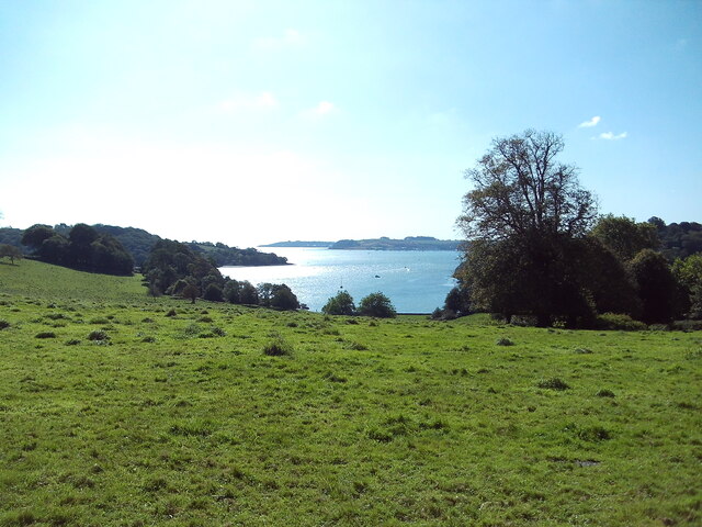
Pill Creek is a picturesque waterway located in Cornwall, England. It is situated on the eastern side of the Roseland Peninsula, near the village of St Mawes. This tranquil creek is formed by the confluence of two smaller streams, which meander through the surrounding countryside before merging to create the estuary.

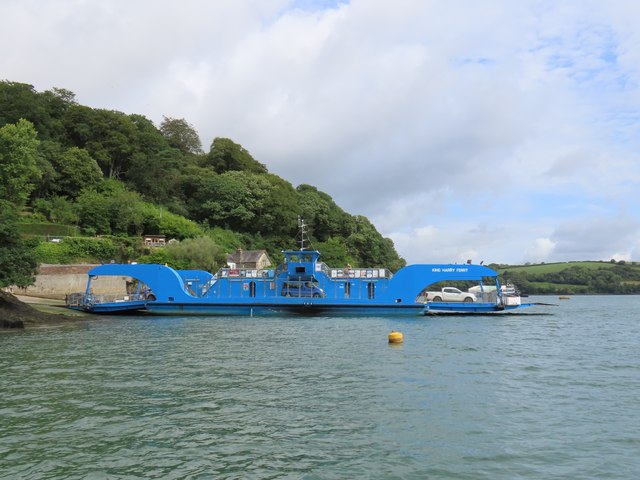
The creek is a popular destination for boating enthusiasts, as its calm waters provide an ideal environment for sailing, kayaking, and paddleboarding. Its sheltered position makes it particularly appealing for novice sailors or those seeking a relaxing day on the water. The creek is also home to a small marina, offering moorings and facilities for visiting boats.

The area surrounding Pill Creek is rich in wildlife, making it a haven for nature lovers. The estuary provides a diverse ecosystem, supporting a variety of bird species, including herons, oystercatchers, and kingfishers. The surrounding marshes are also home to numerous species of plants and wildflowers, attracting butterflies and bees.

Pill Creek is not only a natural beauty, but it also holds historical significance. In the past, it served as an important trading route, with boats transporting goods to and from the nearby villages. The remains of old quays and jetties can still be seen along the creek, serving as a reminder of its maritime heritage.

For those seeking tranquility and natural beauty, Pill Creek is a hidden gem in the Cornish landscape. Whether exploring its serene waters, observing its abundant wildlife, or simply enjoying the peaceful surroundings, a visit to Pill Creek offers a delightful escape from the hustle and bustle of everyday life.

If you have any feedback on the listing, please let us know in the comments section below.
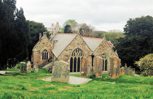
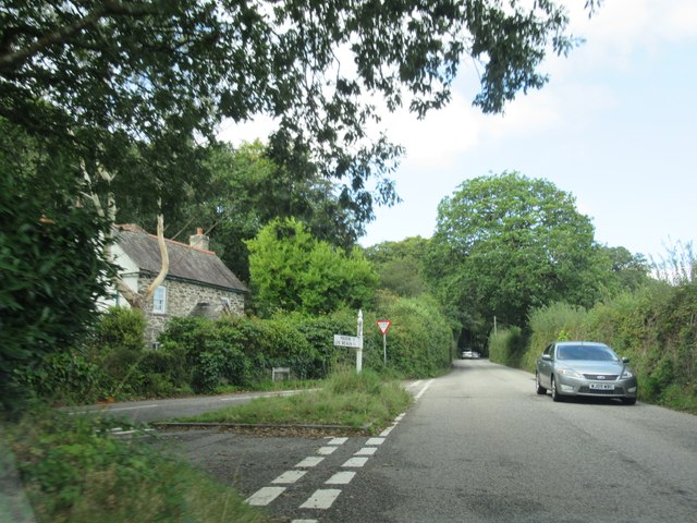
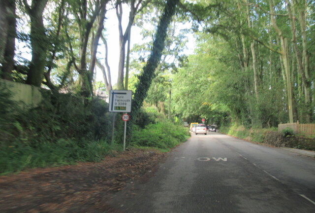
Pill Creek Images

Images are sourced within 2km of 50.205704/-5.0455116 or Grid Reference SW8238. Thanks to Geograph Open Source API. All images are credited.

St Feock's Church
St Feock's Church
Tower at Trelissick Gardens The tower in the grounds of the gardens at Trelissick.
Tower at Trelissick Gardens
The tower in the grounds of the gardens at Trelissick.
Peegee hydrangea at Trelissick Gardens A lovely flowering Peegee hydrangea at Trelissick Gardens in front of the house.
Peegee hydrangea at Trelissick Gardens
A lovely flowering Peegee hydrangea at Trelissick Gardens in front of the house.
Slope down to Channals Creek The grassy slope down to Channals Creek from Trelissick.
Slope down to Channals Creek
The grassy slope down to Channals Creek from Trelissick.
Tower at Trelissick Gardens The tower in the grounds of the gardens at Trelissick.
Tower at Trelissick Gardens
The tower in the grounds of the gardens at Trelissick.
King Harry Ferry
King Harry Ferry
Trelissick House
Trelissick House
Leaving the King Harry ferry
Footbridge over the B3289 at Trelissick
Junction for Feock on the B3289
Approaching crossroads on the B3289
Track into grounds of Trelissick House
Terrace in front of Trelissick House With my wife enjoying the view.
Terrace in front of Trelissick House
With my wife enjoying the view.
Channals Creek from Trelissick Garden Part of the estuary of the River Fal, seen from the Tennis Lawn viewpoint.
Channals Creek from Trelissick Garden
Part of the estuary of the River Fal, seen from the Tennis Lawn viewpoint.
Father Christmas on the King Harry Ferry There was another Father Christmas sitting on the west bank looking out over the ferry and estuary.
Father Christmas on the King Harry Ferry
There was another Father Christmas sitting on the west bank looking out over the ferry and estuary.
New footbridge over the stream at the head of Lamouth Creek The bridge <a href="https://www.geograph.org.uk/photo/855170">SW8340 : Footbridge over the stream at the head of Lamouth Creek</a> has recently been rebuilt to a very attractive design. Also, a lot of thinning has been carried out to open up this area.
New footbridge over the stream at the head of Lamouth Creek
The bridge SW8340 : Footbridge over the stream at the head of Lamouth Creek has recently been rebuilt to a very attractive design. Also, a lot of thinning has been carried out to open up this area.
Show me another place!

Pill Creek is located at Grid Ref: SW8238 (Lat: 50.205704, Lng: -5.0455116)

Unitary Authority: Cornwall

Police Authority: Devon and Cornwall

What 3 Words

///shorthand.anthems.bleaching. Near Mylor Bridge, Cornwall

Related Wikis

Creek Vean

Creek Vean is the Grade II* listed residential property in the village of Feock in Cornwall, England. It was the first building designed by Team 4, being...

Feock, Cornwall

Feock ( FEE-ok; Cornish: Lannfyek) is a coastal civil parish and village in Cornwall, England, United Kingdom. It is about 5 miles (8.0 km) south of Truro...

Porthgwidden

Porthgwidden (Cornish: Porth Gwydn, meaning white cove) is a small hamlet in Cornwall, England, United Kingdom. It is located in the civil parish of Feock...

Goon Piper

Goon Piper is a hamlet in the parish of Feock, Cornwall, England. == References ==

Nearby Amenities

Located within 500m of 50.205704,-5.0455116
Source: PGS
Lat/Long: 50.2023943/-5.0500967
Source: PGS
Lat/Long: 50.2026074/-5.0496251
Source: PGS
Lat/Long: 50.2030336/-5.0442623
Source: PGS
Lat/Long: 50.2033872/-5.0438089
Source: PGS
Lat/Long: 50.2034817/-5.0437905
Source: PGS
Lat/Long: 50.2037497/-5.0442588
Source: PGS
Lat/Long: 50.2040343/-5.0447094
Source: PGS
Lat/Long: 50.2049939/-5.0453946
Source: PGS
Lat/Long: 50.2055295/-5.0464024
Source: PGS
Lat/Long: 50.2060676/-5.0472354
Source: PGS
Lat/Long: 50.2063472/-5.0476868
Source: PGS
Lat/Long: 50.2065119/-5.0477338
Source: PGS
Lat/Long: 50.2071448/-5.0479302
Source: PGS
Lat/Long: 50.2090665/-5.047907
Source: PGS
Lat/Long: 50.2089482/-5.047635
Source: PGS
Lat/Long: 50.2072893/-5.0462745
Source: PGS
Lat/Long: 50.2058145/-5.0451341
Source: PGS
Lat/Long: 50.205265/-5.0443425
Source: PGS
Lat/Long: 50.2052934/-5.0441798
Source: PGS
Lat/Long: 50.204306/-5.0429249
Source: PGS
Lat/Long: 50.2044027/-5.0424028
Source: PGS
Lat/Long: 50.2045149/-5.0419973
Source: PGS
Lat/Long: 50.2046674/-5.0404178
Source: PGS
Lat/Long: 50.2049472/-5.040216
Source: PGS
Lat/Long: 50.2056012/-5.0394523
Bus Stop
St Feock's Church
Bus: yes
Naptan AtcoCode: 0800COC30076
Naptan Bearing: N
Naptan CommonName: St Feock's Church
Naptan Indicator: Opp
Naptan NaptanCode: corawmtm
Naptan Street: Unclassified
Naptan Verified: no
Public Transport: platform
Source: naptan_import
Lat/Long: 50.2059751/-5.0502236
Place: farm
Lat/Long: 50.2087067/-5.0420039
Parking
Supervised: no
Lat/Long: 50.2064442/-5.048794
Direction: W
Generator Method: photovoltaic
Generator Output Electricity: small_installation
Generator Source: solar
Generator Type: solar_photovoltaic_panel
Location: roof
Power: generator
Source: bing;survey
Survey Date: 2020-07-25
Lat/Long: 50.2033869/-5.0462276
Direction: SE
Generator Method: photovoltaic
Generator Output Electricity: small_installation
Generator Source: solar
Generator Type: solar_photovoltaic_panel
Location: roof
Power: generator
Source: bing;survey
Survey Date: 2020-07-25
Lat/Long: 50.2065534/-5.0500698
Generator Method: photovoltaic
Generator Output Electricity: small_installation
Generator Source: solar
Generator Type: solar_photovoltaic_panel
Location: roof
Power: generator
Source: bing;survey
Survey Date: 2020-07-25
Lat/Long: 50.2081121/-5.0489125
Historic: memorial
Lat/Long: 50.2056385/-5.0501711
Post Box
Brand: Royal Mail
Brand Wikidata: Q638098
Collection Times: Mo-Fr 17:15; Sa 11:45; Su off
Drive Through: no
Operator: Royal Mail
Operator Wikidata: Q638098
Post Box Mounting: pier
Post Box Type: lamp
Ref: TR3 22
Royal Cypher: EIIR
Royal Cypher Wikidata: Q33102113
Source: survey;streetlevel imagery;aerial imagery
Lat/Long: 50.2055507/-5.0502184
Public Bookcase
Book Swap Box
Booth: K6
Disused Amenity: telephone
Man Made: telephone_box
Public Bookcase Type: phone_box
Lat/Long: 50.2055327/-5.0502855
The data included in this document is from www.openstreetmap.org. The data is made available under ODbL.

Have you been to Pill Creek?

Leave your review of Pill Creek below (or comments, questions and feedback).