Leggan Cove

Sea, Estuary, Creek in Cornwall

England

Leggan Cove

Footpath to Lowland Point The path was re-routed a few years ago to accommodate expansion of the Dean Gabbro Quarry to the north.
Virtually all the land within this square and indeed the hectad SW81 can be seen in this shot.
Footpath to Lowland Point Credit: Jonathan Billinger

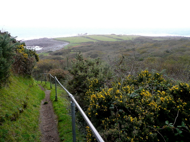
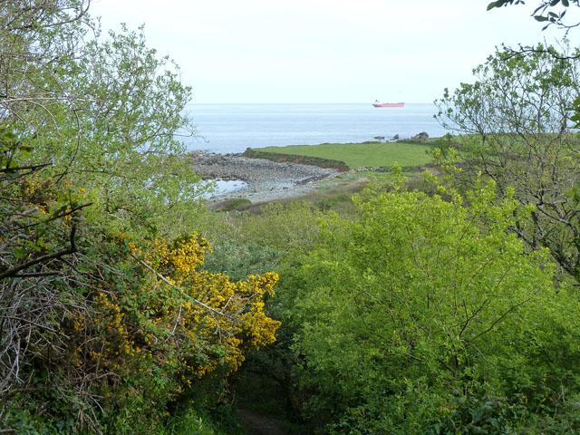
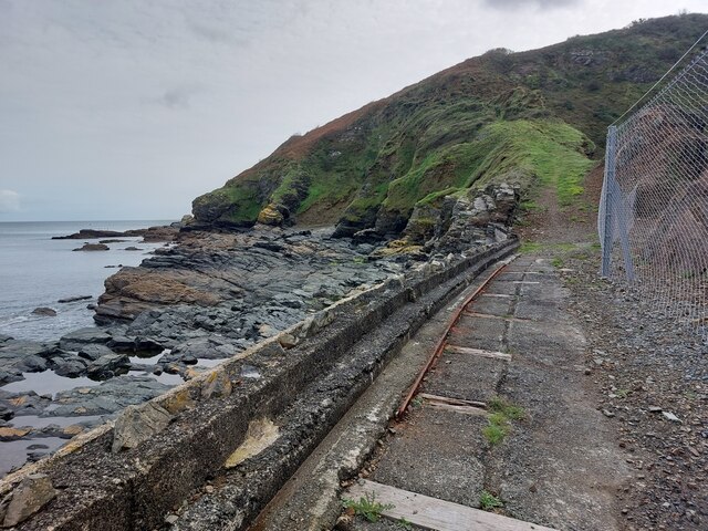
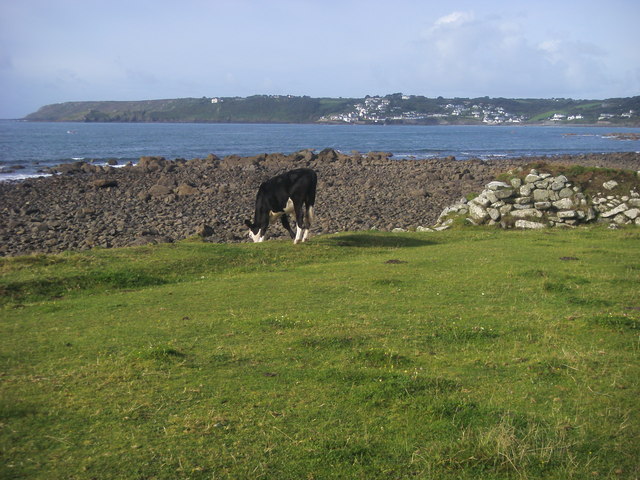
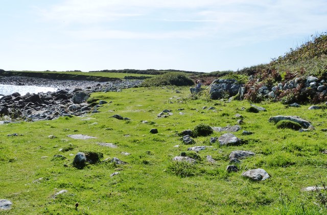
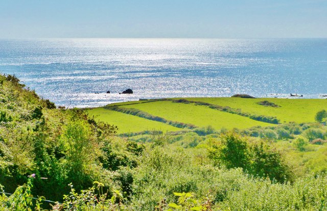
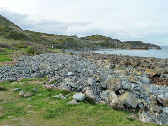
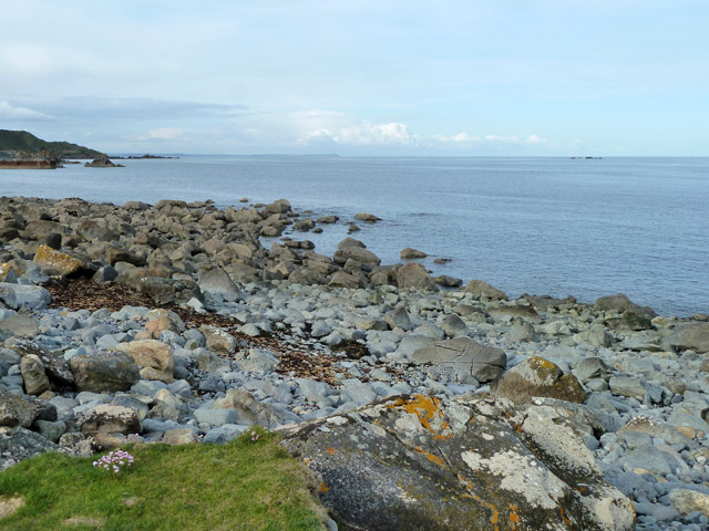
Leggan Cove is a picturesque coastal area located in Cornwall, England. Nestled between towering cliffs and lush greenery, it offers breathtaking views of the sea, estuary, and creek. With its natural beauty and tranquility, Leggan Cove attracts both locals and tourists alike.

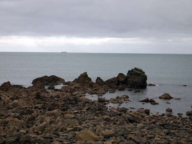
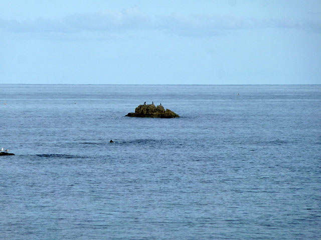
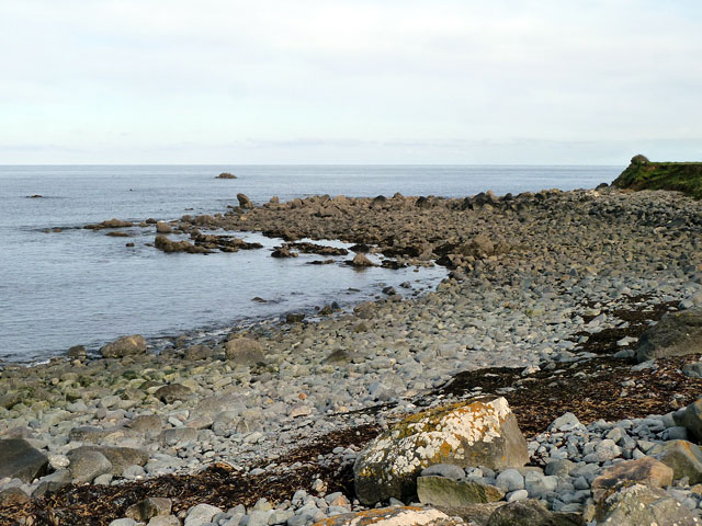
The cove is renowned for its pristine sandy beaches, which are perfect for sunbathing, swimming, and picnicking. The crystal-clear waters of the sea provide a refreshing escape from the summer heat, while the gentle waves make it an ideal spot for water sports enthusiasts.

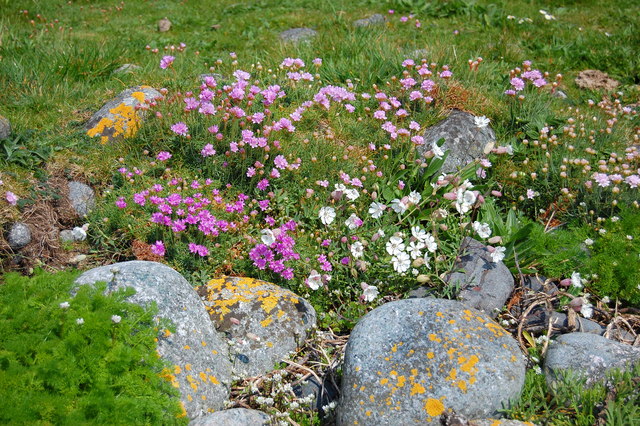
The estuary, formed where a river meets the sea, adds to the charm of Leggan Cove. It is a haven for wildlife, providing a habitat for various bird species, fish, and marine creatures. Birdwatchers can catch glimpses of seagulls, herons, and even the occasional osprey. The estuary is also home to a diverse range of flora and fauna, including colorful wildflowers and rare plants.

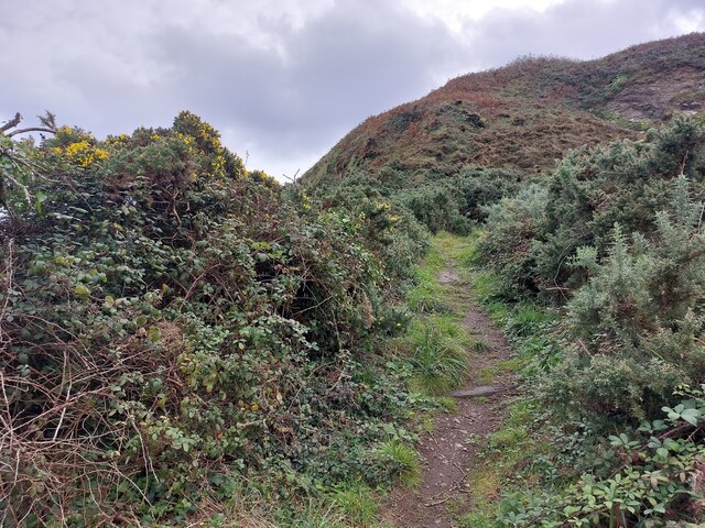
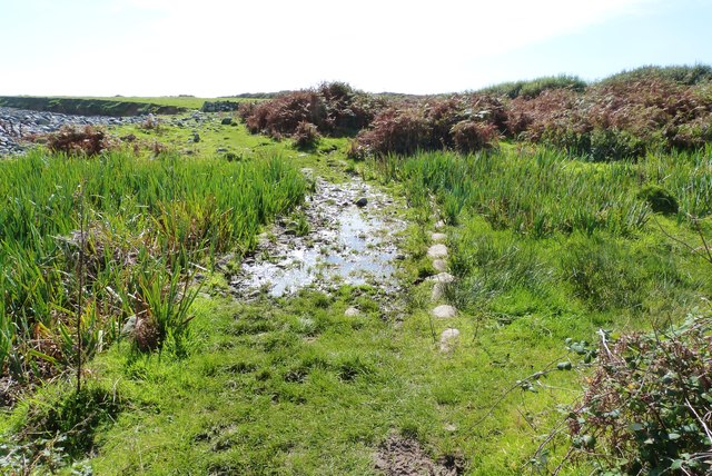
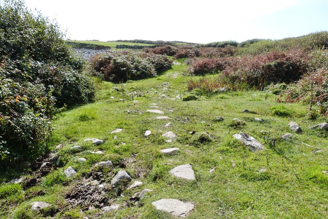
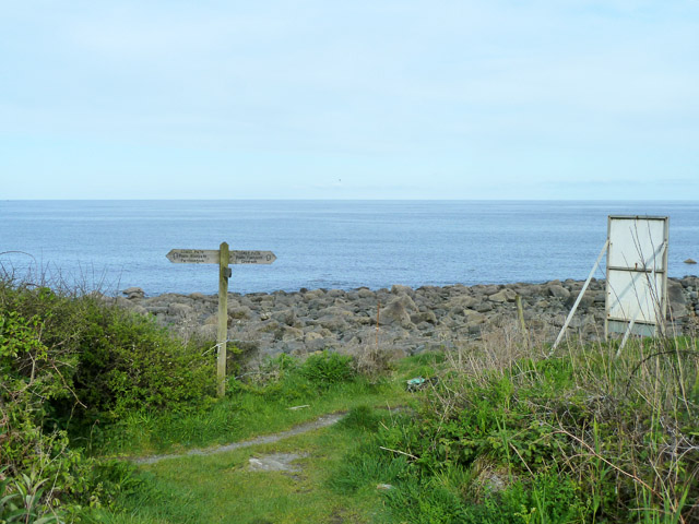
A meandering creek flows through the cove, offering a peaceful and picturesque spot for nature lovers. Visitors can enjoy a leisurely stroll along its banks, taking in the sights and sounds of the surrounding landscape. The creek is also popular among kayakers and canoeists, providing a scenic route to explore the area.

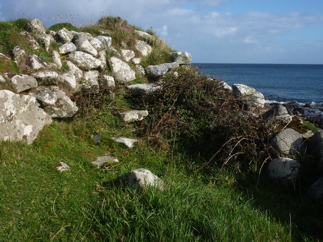
Leggan Cove is not only a natural wonder but also rich in history. The nearby cliffs are dotted with remnants of old mining buildings, a testament to Cornwall's mining heritage. Exploring these remnants provides insight into the region's industrial past.

In conclusion, Leggan Cove is a captivating destination that offers a blend of natural beauty, recreational activities, and historical significance. Whether you seek relaxation or adventure, this coastal gem in Cornwall is sure to leave a lasting impression.

If you have any feedback on the listing, please let us know in the comments section below.

Leggan Cove Images

Images are sourced within 2km of 50.050194/-5.063577 or Grid Reference SW8021. Thanks to Geograph Open Source API. All images are credited.

Footpath to Lowland Point The path was re-routed a few years ago to accommodate expansion of the Dean Gabbro Quarry to the north.
Virtually all the land within this square and indeed the hectad SW81 can be seen in this shot.
Footpath to Lowland Point
The path was re-routed a few years ago to accommodate expansion of the Dean Gabbro Quarry to the north. Virtually all the land within this square and indeed the hectad SW81 can be seen in this shot.
Flowers and boulders at Lowland Point On a glorious spring day.
Flowers and boulders at Lowland Point
On a glorious spring day.
Great Wrea Rocks off Lowland Point.
Great Wrea
Rocks off Lowland Point.
Lowland Point A descriptive name for a very low coastal area, unusual for Cornwall. Viewed from the steeply descending path along the western boundary of the old Dean Quarry.
Lowland Point
A descriptive name for a very low coastal area, unusual for Cornwall. Viewed from the steeply descending path along the western boundary of the old Dean Quarry.
Little Wrea Current population three (cormorants).
Little Wrea
Current population three (cormorants).
Lowland Point The isolated rock some way out is Little Wrea. Great Wrea is hidden round the corner of the point and is much closer in, no longer an island at low tide.
Lowland Point
The isolated rock some way out is Little Wrea. Great Wrea is hidden round the corner of the point and is much closer in, no longer an island at low tide.
Stairway to Heaven A stile at the receding cliff near Lowland Point.
Stairway to Heaven
A stile at the receding cliff near Lowland Point.
On the new SW coast path from Porthkerris to Porthoustock The path is much wider now.
On the new SW coast path from Porthkerris to Porthoustock
The path is much wider now.
On the new SW coast path from Porthkerris to Porthoustock Many fences are being built along the path.
On the new SW coast path from Porthkerris to Porthoustock
Many fences are being built along the path.
Lowland Point Grazing on Lowland Point looking in the distance to Coverack
Lowland Point
Grazing on Lowland Point looking in the distance to Coverack
A very wet section of the SW Coast Path at Lowland Point, Cprnwall
Stepping stones across some of the boggier part of the SW Coast Path at Lowland Point, Cornwall This section passes through National Trust land.
Stepping stones across some of the boggier part of the SW Coast Path at Lowland Point, Cornwall
This section passes through National Trust land.
Entering National Trust land at Lowland Point, Cornwall Part of the SW coast path.
Entering National Trust land at Lowland Point, Cornwall
Part of the SW coast path.
The SW coast path skirts the far end of this cultivated field Taken from an inland path linking the coast path with the nearest road near to St. Keverne.
The SW coast path skirts the far end of this cultivated field
Taken from an inland path linking the coast path with the nearest road near to St. Keverne.
Junction on the coastal path The diverted route via Treglohan reaches the bottom of the hill and the coastal path. The sign on the right warns users of the coastal path of the hazards of blasting in the quarries off to the left.
Junction on the coastal path
The diverted route via Treglohan reaches the bottom of the hill and the coastal path. The sign on the right warns users of the coastal path of the hazards of blasting in the quarries off to the left.
Stone stile and warning sign, coastal path The sign warns of the possibility of blasting in Dean Quarry ahead. The pole to the left is one of the warning flagpoles. At the time the quarry seemed disused. The large upright stone of the stile is presumably the 'Stone' marked on larger scale maps. It has a large 'W' crudely carved on it. There are no administrative boundaries around here, so a property boundary marker?
Stone stile and warning sign, coastal path
The sign warns of the possibility of blasting in Dean Quarry ahead. The pole to the left is one of the warning flagpoles. At the time the quarry seemed disused. The large upright stone of the stile is presumably the 'Stone' marked on larger scale maps. It has a large 'W' crudely carved on it. There are no administrative boundaries around here, so a property boundary marker?
Shore near Lowland Point The area is mapped as 'Polcries', there in no significant near feature other than the beach of large stones, so perhaps that is what it is called.
Shore near Lowland Point
The area is mapped as 'Polcries', there in no significant near feature other than the beach of large stones, so perhaps that is what it is called.
Show me another place!

Leggan Cove is located at Grid Ref: SW8021 (Lat: 50.050194, Lng: -5.063577)

Unitary Authority: Cornwall

Police Authority: Devon and Cornwall

What 3 Words

///swooned.outdoor.submit. Near Falmouth, Cornwall

Related Wikis

Porthoustock

Porthoustock (Cornish: Porthewstek) is a hamlet near St Keverne in Cornwall, England, United Kingdom, on the east coast of Lizard Peninsula. Aggregates...

Rosenithon

Rosenithon (Cornish: Ros an Eythin) is a hamlet east of St Keverne in west Cornwall, England. The name Rosenithon comes from the Cornish language Ros an...

SS Mohegan

The SS Mohegan was a steamer which sank off the coast of the Lizard Peninsula, Cornwall, on her second voyage. She hit The Manacles on 14 October 1898...

The Manacles

The Manacles (Cornish: Meyn Eglos, meaning church stones) (grid reference SW820205) are a set of treacherous rocks off The Lizard peninsula in Cornwall...

Nearby Amenities

Located within 500m of 50.050194,-5.063577
Manacle Point
Is In Country Code: GB
Is In County: Cornwall
Place: locality
Source: npe
Lat/Long: 50.0521172/-5.0573571
Barrier: kissing_gate
Lat/Long: 50.048086/-5.0681741
Godrevy Cove
Is In: Cornwall, England, UK
Place: locality
Lat/Long: 50.0473182/-5.0657394
Barrier: stile
Material: stone
Stile: stepover
Lat/Long: 50.0522259/-5.0693092
Giant's Quoits
Archaeological Site: megalith
Historic: archaeological_site
Moved: yes
Natural: stone
Lat/Long: 50.052613/-5.0679374
Barrier: stile
Stile: stepover
Lat/Long: 50.0527717/-5.0689522
Barrier: kissing_gate
Lat/Long: 50.0480171/-5.0679275
Barrier: kissing_gate
Lat/Long: 50.0509787/-5.0648188
Barrier: kissing_gate
Lat/Long: 50.0529692/-5.0660021
The data included in this document is from www.openstreetmap.org. The data is made available under ODbL.

Have you been to Leggan Cove?

Leave your review of Leggan Cove below (or comments, questions and feedback).