Batty's Point

Coastal Feature, Headland, Point in Cornwall

England

Batty's Point

St Keverne : Porthallow - Coastal Scenery Looking across the rocky coastline near Porthallow.
St Keverne : Porthallow - Coastal Scenery Credit: Lewis Clarke

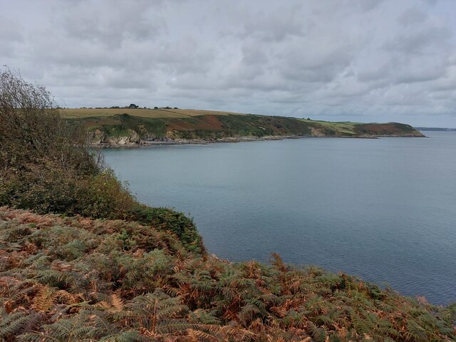
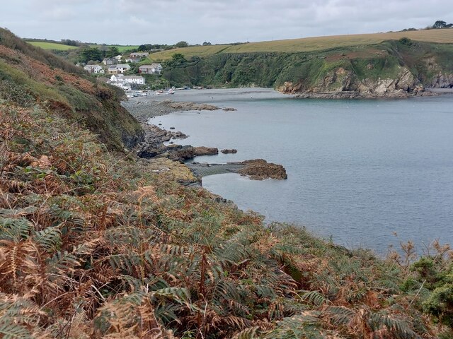
Batty's Point is a prominent headland located on the southern coast of Cornwall, England. Situated near the picturesque village of Polperro, it offers breathtaking panoramic views of the surrounding coastline and the English Channel. The point is named after the Batty family, who were prominent local fishermen and played a significant role in the village's history.

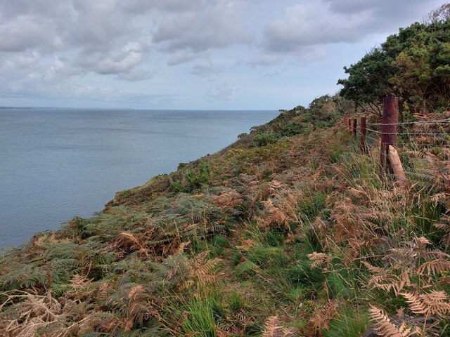
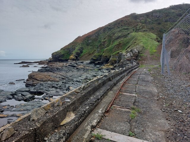
The rugged cliffs of Batty's Point are composed of weathered slate and granite, creating a dramatic backdrop against the azure waters below. The headland is known for its towering cliffs, which reach heights of up to 100 meters in some areas. These cliffs provide nesting sites for various seabird species, including gulls, cormorants, and puffins during the breeding season.

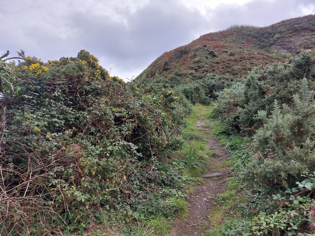
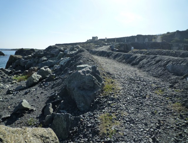
Visitors to Batty's Point can enjoy a scenic coastal walk along the South West Coast Path, which passes through the headland and offers stunning views of the surrounding landscape. The area is also popular for fishing, with anglers often casting their lines from the cliff edges into the deep waters below.

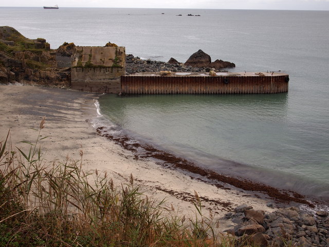
In addition to its natural beauty, Batty's Point is steeped in history. The headland was once a lookout point during World War II, providing strategic views of the English Channel against potential enemy invasions. The remnants of these wartime structures can still be seen today, adding an element of historical interest to the area.

Overall, Batty's Point is a remarkable coastal feature that combines stunning natural beauty, rich wildlife, and historical significance. It attracts visitors from near and far who come to appreciate the unique charms of this rugged headland in Cornwall.

If you have any feedback on the listing, please let us know in the comments section below.

Batty's Point Images

Images are sourced within 2km of 50.056929/-5.0633356 or Grid Reference SW8021. Thanks to Geograph Open Source API. All images are credited.

St Keverne : Porthallow - Coastal Scenery Looking across the rocky coastline near Porthallow.
St Keverne : Porthallow - Coastal Scenery
Looking across the rocky coastline near Porthallow.
St Keverne : Porthallow - Coastal Scenery Looking across the rocky coastline near Porthallow.
St Keverne : Porthallow - Coastal Scenery
Looking across the rocky coastline near Porthallow.
On the new SW coast path from Porthallow to Porthkerris The path is now easier to follow as in the years before and a long fence has been built.
On the new SW coast path from Porthallow to Porthkerris
The path is now easier to follow as in the years before and a long fence has been built.
View from the new SW coast path section While the SW coast path between Porthallow and Porthoustock follows inland routes, there has always been an unofficial path along the coast. This narrow and at times overgrown path is now being converted to become an official section of the coast path: It is already wider, steps have been built, rocks have been secured and some posts have been installed.
View from the new SW coast path section
While the SW coast path between Porthallow and Porthoustock follows inland routes, there has always been an unofficial path along the coast. This narrow and at times overgrown path is now being converted to become an official section of the coast path: It is already wider, steps have been built, rocks have been secured and some posts have been installed.
Porthallow seen from the new SW coast path section While the SW coast path between Porthallow and Porthoustock follows inland routes, there has always been an unofficial path along the coast. This narrow and at times overgrown path is now being converted to become an official section of the coast path: It is already wider, steps have been built, rocks have been secured and some posts have been installed.
Porthallow seen from the new SW coast path section
While the SW coast path between Porthallow and Porthoustock follows inland routes, there has always been an unofficial path along the coast. This narrow and at times overgrown path is now being converted to become an official section of the coast path: It is already wider, steps have been built, rocks have been secured and some posts have been installed.
On the new SW coast path from Porthkerris to Porthoustock The path is much wider now.
On the new SW coast path from Porthkerris to Porthoustock
The path is much wider now.
On the new SW coast path from Porthkerris to Porthoustock Many fences are being built along the path.
On the new SW coast path from Porthkerris to Porthoustock
Many fences are being built along the path.
Porthoustock
Porthoustock
Rosenithon
Rosenithon
Route of the South West Coast Path through quarry An information board tells that the rock mined here, known as "gabbro", was loaded at high tide onto ships at the nearby jetty until 2005.
Route of the South West Coast Path through quarry
An information board tells that the rock mined here, known as "gabbro", was loaded at high tide onto ships at the nearby jetty until 2005.
Coverack gig, Porthoustock
Works vehicle, Porthoustock, Cornwall Porthoustock is perhaps not the prettiest of Cornish coves as this picture shows, but it is unusual in that the view inland is much better than that towards the sea, with nicely set cottages on the hillside. See <a href="https://www.geograph.org.uk/photo/2397034">SW8021 : Cottages, Porthoustock</a>
Works vehicle, Porthoustock, Cornwall
Porthoustock is perhaps not the prettiest of Cornish coves as this picture shows, but it is unusual in that the view inland is much better than that towards the sea, with nicely set cottages on the hillside. See SW8021 : Cottages, Porthoustock
Cottages, Porthoustock
The Manacles These rocks appear at low tide but when the tide is in they have caught out many a mariner. They are very popular with divers.
The Manacles
These rocks appear at low tide but when the tide is in they have caught out many a mariner. They are very popular with divers.
Porthoustock Beach
Porthoustock Beach
Porthoustock Beach
Porthoustock Beach
Coverack gig, Porthoustock
Jetty, Dean Quarry
Jetty, Dean Quarry
Show me another place!

Batty's Point is located at Grid Ref: SW8021 (Lat: 50.056929, Lng: -5.0633356)

Unitary Authority: Cornwall

Police Authority: Devon and Cornwall

What 3 Words

///hothouse.zeal.hears. Near Falmouth, Cornwall

Related Wikis

Porthoustock

Porthoustock (Cornish: Porthewstek) is a hamlet near St Keverne in Cornwall, England, United Kingdom, on the east coast of Lizard Peninsula. Aggregates...

Rosenithon

Rosenithon (Cornish: Ros an Eythin) is a hamlet east of St Keverne in west Cornwall, England.The name Rosenithon comes from the Cornish language Ros an...

SS Mohegan

The SS Mohegan was a steamer which sank off the coast of the Lizard Peninsula, Cornwall, on her second voyage. She hit The Manacles on 14 October 1898...

The Manacles

The Manacles (Cornish: Meyn Eglos, meaning church stones) (grid reference SW820205) are a set of treacherous rocks off The Lizard peninsula in Cornwall...

Nearby Amenities

Located within 500m of 50.056929,-5.0633356
Porthoustock
Is In: Cornwall, England, UK
Is In Country: England
Is In Country Code: GB
Is In County: Cornwall
Name Br: Porthewstek
Name Kw: Porthewstek
Place: village
Source: npe
Source Name Br: proper translation
Wikidata: Q7231793
Wikipedia: en:Porthoustock
Lat/Long: 50.0562982/-5.0661298
Barrier: kissing_gate
Lat/Long: 50.0563378/-5.0681646
Barrier: stile
Material: stone
Stile: stepover
Lat/Long: 50.0541604/-5.0679654
WW2 Pillbox
Building: bunker
Bunker Type: pillbox
Military: bunker
Lat/Long: 50.0551304/-5.0636457
Post Box
Brand: Royal Mail
Brand Wikidata: Q638098
Collection Times: Mo-Fr 09:00; Sa 07:00; Su off
Drive Through: no
Operator: Royal Mail
Operator Wikidata: Q638098
Post Box Mounting: telegraph_pole
Post Box Type: lamp
Ref: TR12 28D
Royal Cypher: EIIR
Source: survey;streetlevel imagery;aerial imagery
Lat/Long: 50.0561933/-5.0664544
Fire Hydrant
Emergency: fire_hydrant
Survey Date: 2023-08-12
Lat/Long: 50.0562507/-5.0675878
Telephone
Booth: K6
Survey Date: 2023-08-12
Lat/Long: 50.0560706/-5.0665087
Defibrillator
Defibrillator Location: Next to public toilets at Old Lifeboar House
Emergency: defibrillator
Ref GB The Circuit: 7D4741C2-5D2B-4901-BCA8-AE610103BF69
Survey Date: 2023-08-12
Lat/Long: 50.0559556/-5.0670031
Fire Hydrant
Emergency: fire_hydrant
Fire Hydrant Type: underground
Survey Date: 2023-08-12
Lat/Long: 50.0556412/-5.0666217
Grit Bin
Survey Date: 2023-08-12
Lat/Long: 50.0547649/-5.0681683
Fire Hydrant
Emergency: fire_hydrant
Survey Date: 2023-08-12
Lat/Long: 50.0548412/-5.0681573
Waste Basket
Survey Date: 2023-08-12
Lat/Long: 50.0560075/-5.0664666
Waste Basket
Survey Date: 2023-08-12
Waste: dog_excrement
Lat/Long: 50.0559539/-5.0662708
Leisure: picnic_table
Survey Date: 2023-08-12
Waste: dog_excrement
Lat/Long: 50.0556251/-5.0652238
Leisure: picnic_table
Survey Date: 2023-08-12
Lat/Long: 50.0556428/-5.0653589
Leisure: picnic_table
Survey Date: 2023-08-12
Lat/Long: 50.0556686/-5.0654593
Leisure: picnic_table
Survey Date: 2023-08-12
Lat/Long: 50.055578/-5.0650565
Life Ring
Emergency: life_ring
Survey Date: 2023-08-12
Lat/Long: 50.0560384/-5.0645336
Bench
Backrest: yes
Survey Date: 2023-08-12
Lat/Long: 50.0560538/-5.0645571
Bench
Backrest: yes
Survey Date: 2023-08-12
Lat/Long: 50.0561067/-5.0646178
Bench
Backrest: yes
Survey Date: 2023-08-12
Lat/Long: 50.0561394/-5.0645481
Bench
Backrest: yes
Survey Date: 2023-08-12
Lat/Long: 50.0554965/-5.0646155
Leisure: playground
Lat/Long: 50.0558415/-5.0659301
Barrier: kissing_gate
Lat/Long: 50.0529692/-5.0660021
The data included in this document is from www.openstreetmap.org. The data is made available under ODbL.

Have you been to Batty's Point?

Leave your review of Batty's Point below (or comments, questions and feedback).