Perran Porth

Sea, Estuary, Creek in Cornwall

England

Perran Porth

Perranporth beach, 1 Overall view from the south side of the bay.
Perranporth beach, 1 Credit: Jonathan Billinger

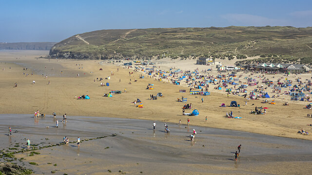
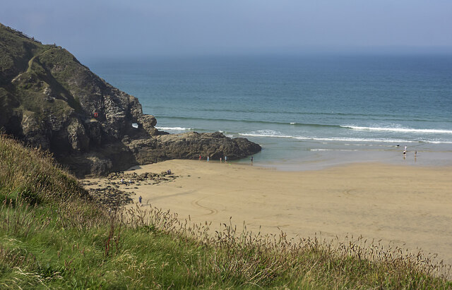
Perran Porth is a picturesque coastal village located on the north coast of Cornwall, England. The village is known for its stunning sandy beach, which stretches for over a mile and is popular with surfers and sunbathers alike. The beach is backed by towering cliffs and sand dunes, providing a dramatic backdrop to the crystal-clear waters of the Atlantic Ocean.

In addition to the beach, Perran Porth is also home to a small estuary and creek, which meander through the village and provide a habitat for a variety of bird and marine life. The estuary is a popular spot for birdwatching and wildlife enthusiasts, with a number of rare and endangered species making their home in the area.

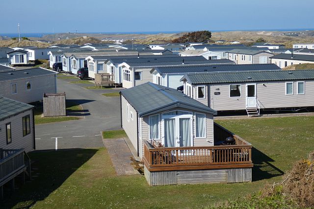
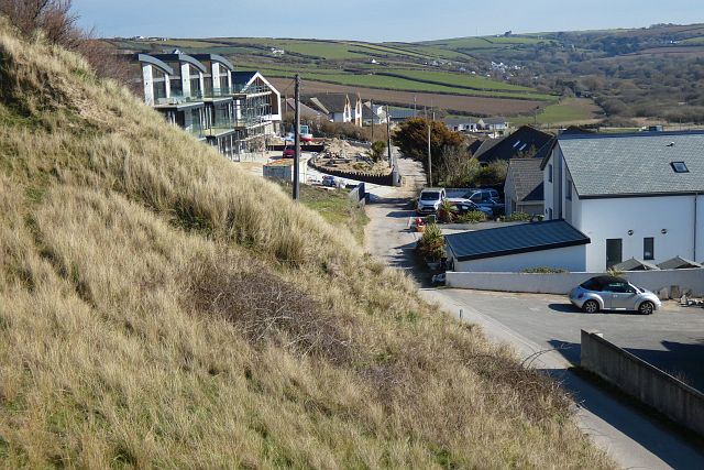
Perran Porth is a popular destination for holidaymakers looking to enjoy the beauty of the Cornish coast, with a range of accommodation options available in the village and surrounding area. Whether you're looking to relax on the beach, explore the estuary, or simply soak up the stunning scenery, Perran Porth has something to offer everyone.

If you have any feedback on the listing, please let us know in the comments section below.
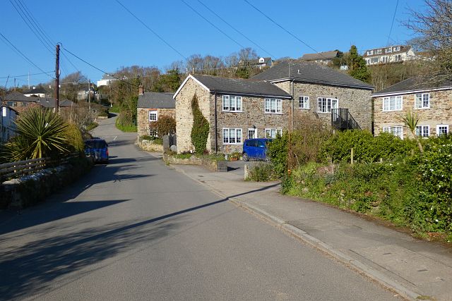
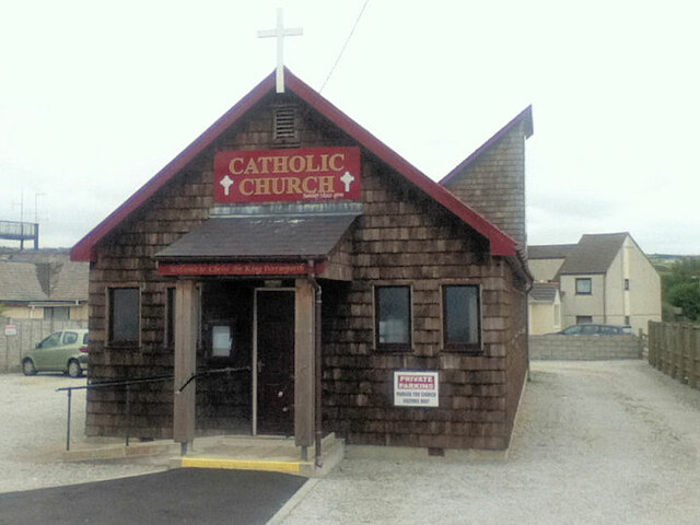
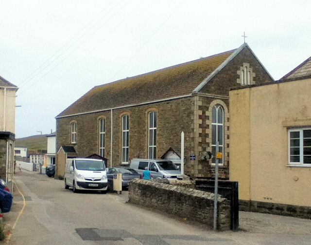
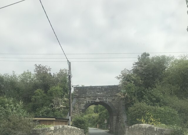
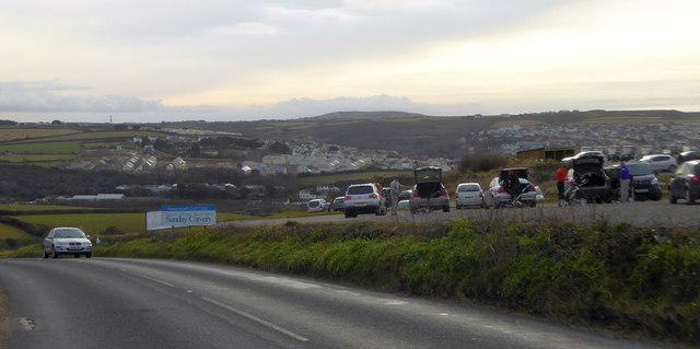
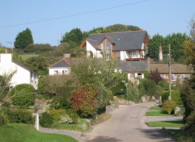
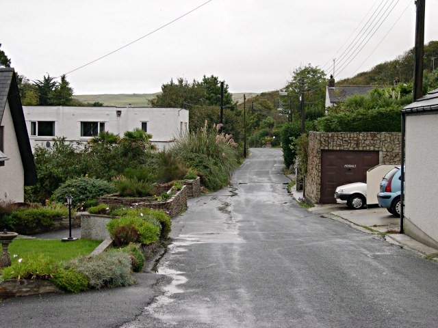
Perran Porth Images

Images are sourced within 2km of 50.347916/-5.1570796 or Grid Reference SW7554. Thanks to Geograph Open Source API. All images are credited.

Perranporth beach, 1 Overall view from the south side of the bay.
Perranporth beach, 1
Overall view from the south side of the bay.
Clifftop path above Perranporth beach A fine morning in early September.
Clifftop path above Perranporth beach
A fine morning in early September.
Droskyn Point Viewed from the clifftop above Perranporth.
Droskyn Point
Viewed from the clifftop above Perranporth.
Perranporth beach, 2 Chapel Rock takes centre stage with Droskyn Point beyond.
Perranporth beach, 2
Chapel Rock takes centre stage with Droskyn Point beyond.
Perranporth beach, 3 A surfing lesson in progress along with onlookers.
Perranporth beach, 3
A surfing lesson in progress along with onlookers.
Holiday chalets, Perranzabuloe The southern edge of Perran Sands Holiday Centre.
Holiday chalets, Perranzabuloe
The southern edge of Perran Sands Holiday Centre.
Ramoth Way, Perranporth, Perranzabuloe This private road has seen a lot of recent development and redevelopment including the replacement of a single house with three 3-storey ones seen on the left.
Ramoth Way, Perranporth, Perranzabuloe
This private road has seen a lot of recent development and redevelopment including the replacement of a single house with three 3-storey ones seen on the left.
Mill Road, Bolingey, Perranzabuloe Bolingey is close to, but retains a serparate identity from, the neighbouring Perranporth.
Mill Road, Bolingey, Perranzabuloe
Bolingey is close to, but retains a serparate identity from, the neighbouring Perranporth.
Christ the King Catholic Church
Perranporth Methodist Church
Chapel Rock
Chapel Rock
Coastal path, Perranzabuloe Gull Rocks and Penhale Point are seen from the path passing above Shag Rock.
Coastal path, Perranzabuloe
Gull Rocks and Penhale Point are seen from the path passing above Shag Rock.
Farmland and houses, Perranzabuloe Cramped modern houses on the southern edge of Perranporth reflect a style of architecture currently popular in the area. They are seen across a valley from Coombe View.
Farmland and houses, Perranzabuloe
Cramped modern houses on the southern edge of Perranporth reflect a style of architecture currently popular in the area. They are seen across a valley from Coombe View.
Two bridges on Mill Road Over a stream and under a former railway.
Two bridges on Mill Road
Over a stream and under a former railway.
Hill down to Perranporth
B3284 towards Perranporth
Bend in B3285 at Gear Sands The white house is marked as Tollgate Cottage or Tollgate Farm; a road leads past it towards Mount
Bend in B3285 at Gear Sands
The white house is marked as Tollgate Cottage or Tollgate Farm; a road leads past it towards Mount
Perranporth from Budnic Hill On the right, the car park and an advert for Perranporth Golf Club
Perranporth from Budnic Hill
On the right, the car park and an advert for Perranporth Golf Club
Show me another place!

Perran Porth is located at Grid Ref: SW7554 (Lat: 50.347916, Lng: -5.1570796)

Unitary Authority: Cornwall

Police Authority: Devon and Cornwall

What 3 Words

///thrusters.yours.silk. Near Perranporth, Cornwall

Related Wikis

Perranporth

Perranporth (Standard Written Form: Porthperan) is a seaside resort town on the north coast of Cornwall, England, United Kingdom. It is 2.1 miles east...

Reen Manor

Reen Manor is a hamlet east of Perranporth in Cornwall, England. == References ==

Bolingey

Bolingey (Cornish: Melinji) is a village on the north coast of Cornwall, England, United Kingdom. It is half-a-mile south of the small seaside resort of...

Perrancoombe

Perrancoombe (Cornish: Kommperan) is a hamlet near Perranzabuloe in Cornwall, England. The name Perrancoombe comes from the Cornish language words Peran...

Nearby Amenities

Located within 500m of 50.347916,-5.1570796
Source: PGS
Lat/Long: 50.3513192/-5.1538841
Source: PGS
Lat/Long: 50.3502965/-5.1545289
Source: PGS
Lat/Long: 50.34949/-5.1549087
Source: PGS
Lat/Long: 50.3484679/-5.1553196
Source: PGS
Lat/Long: 50.347993/-5.15551
Source: PGS
Lat/Long: 50.3475539/-5.1556721
Source: PGS
Lat/Long: 50.3471564/-5.1555921
Source: PGS
Lat/Long: 50.3472225/-5.15428
Source: PGS
Lat/Long: 50.3462031/-5.153848
Source: PGS
Lat/Long: 50.3464129/-5.1555699
Source: PGS
Lat/Long: 50.3468102/-5.1560781
Source: PGS
Lat/Long: 50.3470435/-5.1565175
Source: PGS
Lat/Long: 50.3472287/-5.1582599
Source: PGS
Lat/Long: 50.3471499/-5.1588784
Source: PGS
Lat/Long: 50.3469921/-5.1592271
Source: PGS
Lat/Long: 50.3467765/-5.1597641
Source: PGS
Lat/Long: 50.3465711/-5.1600972
Source: PGS
Lat/Long: 50.34657/-5.1621131
Source: PGS
Lat/Long: 50.3462845/-5.1623669
Source: PGS
Lat/Long: 50.3459586/-5.162546
Source: PGS
Lat/Long: 50.34555/-5.16281
Mini Roundabout
Direction: clockwise
Lat/Long: 50.3458804/-5.1511238
Post Box
Collection Times: Mo-Fr 16:45; Sa 11:30; Su off
Operator: Royal Mail
Operator Wikidata: Q638098
Post Box Apertures: 2
Post Box Design: type_c
Post Box Type: pillar
Ref: TR6 135;TR6 1350
Royal Cypher: EIIR
Royal Cypher Wikidata: Q33102113
Source: survey;aerial imagery
Lat/Long: 50.3446816/-5.1542726
Bus Stop
Tywarnhayle
Bus: yes
Naptan AtcoCode: 0800COC04308
Naptan Bearing: N
Naptan CommonName: Tywarnhayle
Naptan Crossing: St Georges Road
Naptan NaptanCode: corgatam
Naptan Street: St Pirans Road
Naptan Verified: no
Public Transport: platform
Source: naptan_import
Lat/Long: 50.3442646/-5.1545189
Bus Stop
Tregonning Court
Bench: no
Bin: no
Bus: yes
Naptan AtcoCode: 0800COC04336
Naptan Bearing: E
Naptan CommonName: Tregonning Court
Naptan Crossing: Station Road
Naptan NaptanCode: corgatgw
Naptan Street: St Pirans Road
Naptan Verified: no
Public Transport: platform
Shelter: no
Source: naptan_import
Lat/Long: 50.3458121/-5.1515287
Bus Stop
Opp Tregonning Court
Bench: no
Bus: yes
Naptan AtcoCode: 0800COC04337
Naptan Bearing: W
Naptan CommonName: Opp Tregonning Court
Naptan Crossing: Station Road
Naptan NaptanCode: corgatdm
Naptan Street: St Pirans Road
Naptan Verified: no
Public Transport: platform
Shelter: no
Source: naptan_import
Lat/Long: 50.3457309/-5.1515374
Bus Stop
Perranporth Beach Road
Bench: yes
Bin: yes
Bus: yes
Lit: no
Naptan AtcoCode: 0800FWW38453
Naptan Bearing: N
Naptan CommonName: Beach Road
Naptan Crossing: St Pirans Road
Naptan Indicator: N
Naptan NaptanCode: corapmgw
Naptan Street: Beach Road
Naptan Verified: no
Public Transport: platform
Shelter: yes
Source: naptan;bing
Tactile Paving: no
Lat/Long: 50.345462/-5.1547322
Post Box
Collection Times: Mo-Fr 09:00; Sa 07:00; Su off
Operator: Royal Mail
Operator Wikidata: Q638098
Post Box Design: type_b
Post Box Type: pillar
Ref: TR6 65D
Royal Cypher: EIIR
Source: survey;aerial imagery
Lat/Long: 50.3459797/-5.1511747
Post Office
Perranporth Post Office
Addr Country: GB
Addr Postcode: TR6 0LG
Brand: Post Office
Brand Wikidata: Q1783168
Contact Website: https://www.postoffice.co.uk/branch-finder/1715550/perranporth
Ref Pol Id: 4597
Lat/Long: 50.3447124/-5.1539103
Perranporth
Is In Country: England
Is In Country Code: GB
Is In County: Cornwall
Name Kw: Porthperan
Place: village
Source: OS_OpenData_StreetView
Wikidata: Q390260
Wikipedia: en:Perranporth
Lat/Long: 50.3444208/-5.153844
Barrier: kissing_gate
Lat/Long: 50.3458271/-5.1607598
Pharmacy
Boots
Brand: Boots
Brand Wikidata: Q6123139
Brand Wikipedia: en:Boots UK
Healthcare: pharmacy
Lat/Long: 50.3451699/-5.1547017
Shop: alcohol
Lat/Long: 50.3444716/-5.1540768
Premier
Brand: Premier
Brand Wikidata: Q7240340
Brand Wikipedia: en:Premier Stores
Shop: convenience
Lat/Long: 50.344362/-5.1548278
Co-op Food
Addr Country: GB
Addr Postcode: TR6 0EW
Addr Street: Boscawen Road
Addr Village: Perranporth
Brand: Co-op Food
Brand Wikidata: Q3277439
Brand Wikipedia: en:Co-op Food
Contact Phone: +44 1872 573086
Fhrs Id: 798024
Old Name: Costcutter
Opening Hours: Mo-Su 07:00-22:00
Operator: The Co-operative Group
Operator Wikidata: Q117202
Shop: convenience
Source Addr: FHRS Open Data
Website: https://www.coop.co.uk/store-finder/TR6-0EW/1-boscawen-road
Lat/Long: 50.3445793/-5.154031
Droskyn Point
Place: locality
Source: OD Streetview
Lat/Long: 50.3470423/-5.162591
Bench
Backrest: yes
Lat/Long: 50.3454272/-5.1614685
Barrier: bollard
Fixme: barrier type?
Lat/Long: 50.3452349/-5.1522306
Bench
Backrest: yes
Lat/Long: 50.3466253/-5.1536811
Restaurant
Willow Bistro
Addr City: Perranporth
Addr Housename: The Willow Bistro
Addr Housenumber: 4
Addr Postcode: TR6 0JL
Addr Street: Beach Road
Fhrs Id: 586963
Source Addr: FHRS Open Data
Lat/Long: 50.345558/-5.1552634
Chapel Rock
Place: island
Lat/Long: 50.3485818/-5.1571964
Toilets
Lat/Long: 50.3458029/-5.1540347
Pub
The Seiners Arms
Addr City: Perranporth
Addr Housename: The Seiners Armsl
Addr Postcode: TR6 0DP
Addr Street: Beach Road
Check Date: 2023-12-26
Fhrs Id: 456221
Source Addr: FHRS Open Data
Lat/Long: 50.3462033/-5.1556228
Post Box
Brand: Royal Mail
Brand Wikidata: Q638098
Collection Times: Mo-Fr 09:00; Sa 07:00; Su off
Drive Through: no
Operator: Royal Mail
Operator Wikidata: Q638098
Post Box Design: type_b
Post Box Mounting: brick_pillar
Post Box Type: wall
Ref: TR6 42D
Royal Cypher: GR
Royal Cypher Wikidata: Q33102273
Source: survey;aerial imagery
Lat/Long: 50.3459707/-5.1572351
Barrier: bollard
Bollard: fixed
Fixme: barrier type?
Lat/Long: 50.3454257/-5.152417
Bench
Lat/Long: 50.3441892/-5.1546792
Bench
Lat/Long: 50.345475/-5.1620614
Bench
Lat/Long: 50.3461673/-5.1614968
Clock
Display: sundial
Lat/Long: 50.347203/-5.1575224
Bus Stop
Car Park
Bench: yes
Bin: yes
Bus: yes
Naptan AtcoCode: 0800COC31657
Naptan Bearing: S
Naptan BusStopType: CUS
Naptan CommonName: Car Park
Naptan Crossing: St Pirans Road
Naptan Indicator: S-bound
Naptan NaptanCode: corapmjg
Naptan Street: Beach Road
Naptan Verified: no
Public Transport: platform
Shelter: no
Source: naptan;bing
Lat/Long: 50.3453132/-5.154505
Cafe
The Waterfront
Lat/Long: 50.3453096/-5.1537872
Pub
The Green Parrot
Addr City: Perranporth
Addr County: Cornwall
Addr Postcode: TR6 0JP
Addr Street: St George’s Hill
Brand: Wetherspoon
Brand Wikidata: Q6109362
Brand Wikipedia: en:Wetherspoons
Contact Phone: 01872 574990
Contact Website: https://www.jdwetherspoon.com/pubs/all-pubs/england/cornwall/the-green-parrot-perranporth
Diet Vegan: yes
Diet Vegetarian: yes
Food: yes
Note: Has room hire
Has TV screens
Has meeting facilites
Outdoor Seating: yes
Payment Cash: yes
Payment Credit Cards: yes
Payment Debit Cards: yes
Payment Mastercard: yes
Payment Visa: yes
Real Ale: yes
Toilets: yes
Toilets Access: customers
Wheelchair: yes
Lat/Long: 50.3444929/-5.1560446
The data included in this document is from www.openstreetmap.org. The data is made available under ODbL.

Have you been to Perran Porth?

Leave your review of Perran Porth below (or comments, questions and feedback).