Hanover Cove

Sea, Estuary, Creek in Cornwall

England

Hanover Cove

Droskyn Point Viewed from the clifftop above Perranporth.
Droskyn Point Credit: Jonathan Billinger

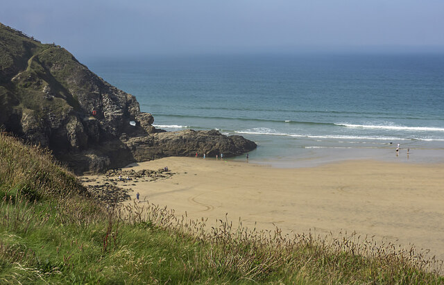
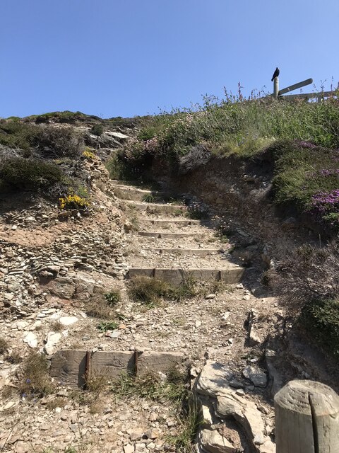
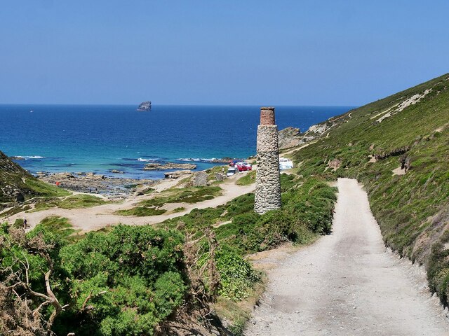
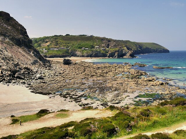
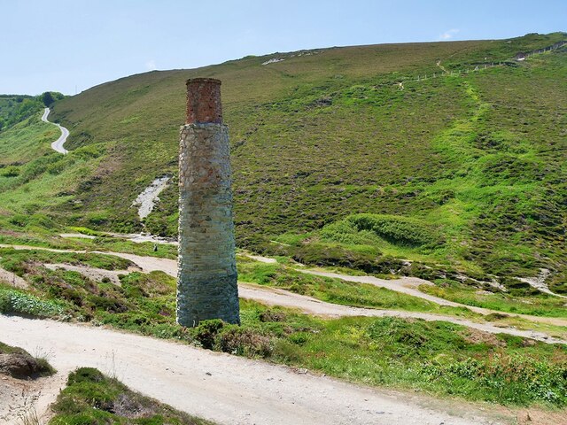
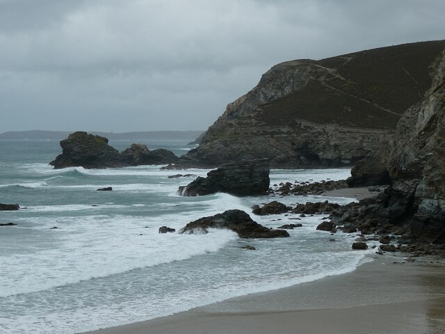
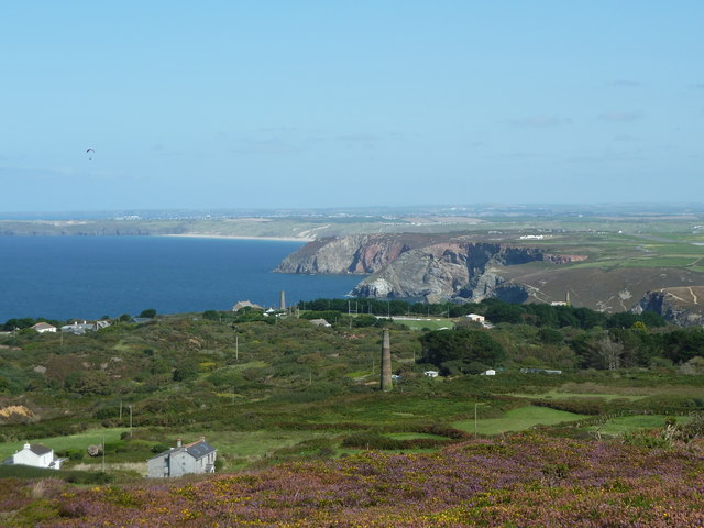
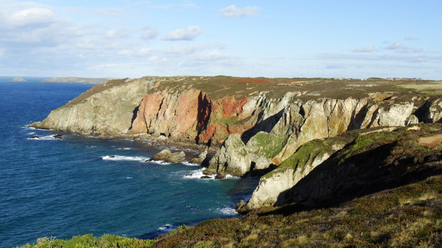
Hanover Cove is a picturesque coastal area located in Cornwall, England. Situated along the southwestern coast of the county, Hanover Cove offers breathtaking views of the sea, estuary, and creek, making it a popular destination for nature enthusiasts and beachgoers alike.

The cove is characterized by its pristine sandy beaches and crystal-clear turquoise waters. Its location on the Atlantic Ocean provides visitors with ample opportunities for swimming, sunbathing, and various water activities such as surfing and sailing. The gentle waves and calm currents make it an ideal spot for families and beginner water sports enthusiasts.

Adjacent to the cove is an estuary, where the river meets the sea. This unique ecosystem is home to a diverse array of plant and animal species. Nature lovers can explore the estuary's salt marshes, sand dunes, and mudflats, which provide habitats for a wide range of bird species, including herons, gulls, and terns. The estuary also supports a thriving population of fish, making it a popular spot for fishing enthusiasts.

Towards the eastern end of Hanover Cove is a picturesque creek that meanders through the surrounding hills and valleys. The creek is an important waterway for local fishermen and boaters, providing access to the open ocean. Visitors can take leisurely walks along the creek's banks, enjoying the tranquil atmosphere and observing the abundant wildlife.

In summary, Hanover Cove in Cornwall offers a stunning coastal experience with its beautiful sandy beaches, clear waters, estuary, and creek. Whether you're seeking relaxation, water activities, or a chance to immerse yourself in nature, this scenic location has something to offer everyone.

If you have any feedback on the listing, please let us know in the comments section below.
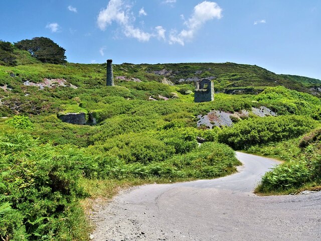
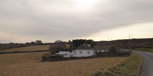
Hanover Cove Images

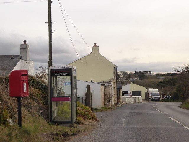
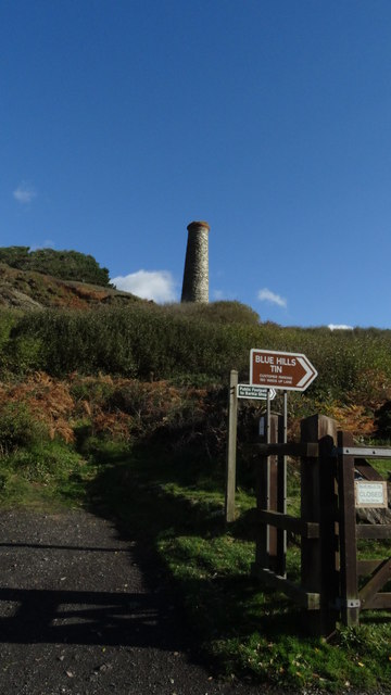
Images are sourced within 2km of 50.334714/-5.1810243 or Grid Reference SW7353. Thanks to Geograph Open Source API. All images are credited.

Droskyn Point Viewed from the clifftop above Perranporth.
Droskyn Point
Viewed from the clifftop above Perranporth.
Farmland, Perranzabuloe Arable land above Penwartha with the B3284 Ellestan Farm to the left.
Farmland, Perranzabuloe
Arable land above Penwartha with the B3284 Ellestan Farm to the left.
Farmland, St Agnes A crop of daffodils beside the footpath approaching Trevellas from Mithian.
Farmland, St Agnes
A crop of daffodils beside the footpath approaching Trevellas from Mithian.
Coastal path, Perranzabuloe Gull Rocks and Penhale Point are seen from the path passing above Shag Rock.
Coastal path, Perranzabuloe
Gull Rocks and Penhale Point are seen from the path passing above Shag Rock.
Cliff Path between Trevillas Coombe and Trevaunance Cove The Coastal footpath from Perranporth to St Agnes.
Cliff Path between Trevillas Coombe and Trevaunance Cove
The Coastal footpath from Perranporth to St Agnes.
Cliff Path above Trevillas Coombe The coastal path towards Perranporth.
Cliff Path above Trevillas Coombe
The coastal path towards Perranporth.
Trevellas Coombe Trevallas Valley was a mining area for hundreds of years there are still the remains of tall engine house chimneys which act as a reminder of the area's tin mining heritage. The early/mid-nineteenth-century detached chimney here was associated with the nearby Blue Hills Mine. It is a Grade II listed building (List Entry Number:1141490 <span class="nowrap"><a title="https://historicengland.org.uk/listing/the-list/list-entry/1141490?section=official-list-entry" rel="nofollow ugc noopener" href="https://historicengland.org.uk/listing/the-list/list-entry/1141490?section=official-list-entry">Link</a><img style="margin-left:2px;" alt="External link" title="External link - shift click to open in new window" src="https://s1.geograph.org.uk/img/external.png" width="10" height="10"/></span> Historic England).
Trevellas Coombe
Trevallas Valley was a mining area for hundreds of years there are still the remains of tall engine house chimneys which act as a reminder of the area's tin mining heritage. The early/mid-nineteenth-century detached chimney here was associated with the nearby Blue Hills Mine. It is a Grade II listed building (List Entry Number:1141490 LinkExternal link Historic England).
Trevellas Cove, St Agnes Bay Just to the east of <a href="https://www.geograph.org.uk/photo/7507558">SW7251 : Trevaunance Cove, St Agnes</a>.
Trevellas Cove, St Agnes Bay
South West Coast Path above Trevellas Cove The South West Coast Path National Trail - 630 miles of superb coastal walking. From Minehead on the edge of the Exmoor National Park to the shores of Poole Harbour in Dorset. It is the longest of all Britain's National Trails.
Website: <span class="nowrap"><a title="http://www.southwestcoastpath.com/" rel="nofollow ugc noopener" href="http://www.southwestcoastpath.com/">Link</a><img style="margin-left:2px;" alt="External link" title="External link - shift click to open in new window" src="https://s1.geograph.org.uk/img/external.png" width="10" height="10"/></span>
South West Coast Path above Trevellas Cove
The South West Coast Path National Trail - 630 miles of superb coastal walking. From Minehead on the edge of the Exmoor National Park to the shores of Poole Harbour in Dorset. It is the longest of all Britain's National Trails. Website: LinkExternal link
Former Mine Chimney. Trevellas Coombe Trevallas Valley was a mining area for hundreds of years there are still the remains of tall engine house chimneys which act as a reminder of the area's tin mining heritage. The early/mid-nineteenth-century detached chimney here was associated with the nearby Blue Hills Mine. It is a Grade II listed building (List Entry Number:1141490 <span class="nowrap"><a title="https://historicengland.org.uk/listing/the-list/list-entry/1141490?section=official-list-entry" rel="nofollow ugc noopener" href="https://historicengland.org.uk/listing/the-list/list-entry/1141490?section=official-list-entry">Link</a><img style="margin-left:2px;" alt="External link" title="External link - shift click to open in new window" src="https://s1.geograph.org.uk/img/external.png" width="10" height="10"/></span> Historic England).
Former Mine Chimney. Trevellas Coombe
Trevallas Valley was a mining area for hundreds of years there are still the remains of tall engine house chimneys which act as a reminder of the area's tin mining heritage. The early/mid-nineteenth-century detached chimney here was associated with the nearby Blue Hills Mine. It is a Grade II listed building (List Entry Number:1141490 LinkExternal link Historic England).
Blue Hills The area between St Agnes and Trevellas Cove was dominated by the Blue Hills Mine.  Remains of an engine house and chimney can be seen in this photograph. Both are Grade II listed buildings  (List Entry Numbers: 1328687 and 1137979 <span class="nowrap"><a title="https://historicengland.org.uk/listing/the-list/list-entry/1328687" rel="nofollow ugc noopener" href="https://historicengland.org.uk/listing/the-list/list-entry/1328687">Link</a><img style="margin-left:2px;" alt="External link" title="External link - shift click to open in new window" src="https://s1.geograph.org.uk/img/external.png" width="10" height="10"/></span> and <span class="nowrap"><a title="https://historicengland.org.uk/listing/the-list/list-entry/1137979" rel="nofollow ugc noopener" href="https://historicengland.org.uk/listing/the-list/list-entry/1137979">Link</a><img style="margin-left:2px;" alt="External link" title="External link - shift click to open in new window" src="https://s1.geograph.org.uk/img/external.png" width="10" height="10"/></span> Historic England).
Blue Hills
The area between St Agnes and Trevellas Cove was dominated by the Blue Hills Mine. Remains of an engine house and chimney can be seen in this photograph. Both are Grade II listed buildings (List Entry Numbers: 1328687 and 1137979 LinkExternal link and LinkExternal link Historic England).
Trevellas Porth The rocky coastline of Trevellas Porth is at the northeastern end of Trevaunance Cove.
For a wider view see <a href="https://www.geograph.org.uk/photo/7613305">SW7251 : Trevaunance Cove - Sandy beach and rocky coastline</a>
Trevellas Porth
The rocky coastline of Trevellas Porth is at the northeastern end of Trevaunance Cove. For a wider view see SW7251 : Trevaunance Cove - Sandy beach and rocky coastline
Looking along the Coast from St Agnes Beacon
St George's Hill, Perranporth Two bungalows on the hill south of the village, surrounded by farmland
St George's Hill, Perranporth
Two bungalows on the hill south of the village, surrounded by farmland
Communications from Trevellas Postbox and telephone box by the B3285 at the north of the village
Communications from Trevellas
Postbox and telephone box by the B3285 at the north of the village
Supplies for the holidaymaker, Trevellas A business which sells camping and caravanning accessories
Supplies for the holidaymaker, Trevellas
A business which sells camping and caravanning accessories
Path leading to Blue Hills Tin Mine above Trevellas Porth
Cliff scenery S of Cligga Head near Perranporth
Show me another place!

Hanover Cove is located at Grid Ref: SW7353 (Lat: 50.334714, Lng: -5.1810243)

Unitary Authority: Cornwall

Police Authority: Devon and Cornwall

What 3 Words

///clinking.stray.river. Near Perranporth, Cornwall

Nearby Locations

Hanover Cove Cligga Head

Related Wikis

Hanover (ship)

Hanover was a two-masted brigantine packet ship owned and operated by the Falmouth Post Office Packet Service, which operated between 1688 and 1852.On...

Perranporth Airfield

Perranporth Airfield (ICAO: EGTP) airfield is located 1.5 NM (2.8 km; 1.7 mi) southwest of Perranporth and 6 NM (11 km; 6.9 mi) southwest of Newquay, in...

RAF Perranporth

Royal Air Force Perranporth or more simply RAF Perranporth is a former Royal Air Force satellite station situated near Perranporth, Cornwall, in the United...

Cornish Parachute Centre

The Cornish Parachute Centre is a BPA affiliated parachuting centre and skydiving drop zone at St Agnes, Cornwall. The centre opened in 2006 operating...

Nearby Amenities

Located within 500m of 50.334714,-5.1810243
Source: PGS
Lat/Long: 50.3391894/-5.1815729
Source: PGS
Lat/Long: 50.3389175/-5.1814286
Source: PGS
Lat/Long: 50.3387758/-5.1812532
Source: PGS
Lat/Long: 50.3386713/-5.1809962
Source: PGS
Lat/Long: 50.3382386/-5.1805446
Source: PGS
Lat/Long: 50.3378869/-5.1805135
Source: PGS
Lat/Long: 50.336765/-5.180235
Source: PGS
Lat/Long: 50.3365605/-5.1802769
Source: PGS
Lat/Long: 50.3363684/-5.1801133
Source: PGS
Lat/Long: 50.3361681/-5.1800843
Source: PGS
Lat/Long: 50.3359921/-5.1801589
Source: PGS
Lat/Long: 50.3357244/-5.1800875
Source: PGS
Lat/Long: 50.3355631/-5.1808514
Source: PGS
Lat/Long: 50.3353867/-5.1808482
Source: PGS
Lat/Long: 50.3351693/-5.1807731
Source: PGS
Lat/Long: 50.3351539/-5.1806535
Source: PGS
Lat/Long: 50.3350118/-5.1805843
Source: PGS
Lat/Long: 50.3348656/-5.1802538
Source: PGS
Lat/Long: 50.334305/-5.181524
Source: PGS
Lat/Long: 50.3339623/-5.1821292
Source: PGS
Lat/Long: 50.333738/-5.1816716
Source: PGS
Lat/Long: 50.3334685/-5.1823304
Source: PGS
Lat/Long: 50.3332939/-5.1826303
Source: PGS
Lat/Long: 50.3329594/-5.1839832
Source: PGS
Lat/Long: 50.3327536/-5.1844112
Source: PGS
Lat/Long: 50.3326217/-5.1855244
Source: PGS
Lat/Long: 50.3325652/-5.1859782
Source: PGS
Lat/Long: 50.3325163/-5.1857513
Source: PGS
Lat/Long: 50.3326957/-5.1872785
Perranporth Airfield
Aerodrome: public
Aeroway: aerodrome
Ele: 101
Icao: EGTP
Is In: Perranporth
Operator: Perranporth Airfield Ltd
Source: wikipedia
Wikidata: Q3912942
Wikipedia: en:Perranporth Airfield
Lat/Long: 50.3312581/-5.1783579
Leisure: picnic_table
Lat/Long: 50.3321988/-5.1830077
Bench
Lat/Long: 50.3322514/-5.1846242
Bench
Lat/Long: 50.3349953/-5.1791596
Bench
Lat/Long: 50.336301/-5.1785231
The data included in this document is from www.openstreetmap.org. The data is made available under ODbL.

Have you been to Hanover Cove?

Leave your review of Hanover Cove below (or comments, questions and feedback).