Port an Laoigh

Sea, Estuary, Creek in Argyllshire

Scotland

Port an Laoigh

The house at Carse This is the old road bridge, now by-passed.
The house at Carse Credit: Gordon Brown

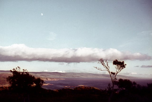
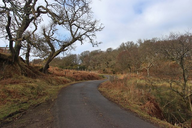
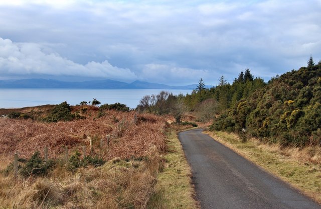
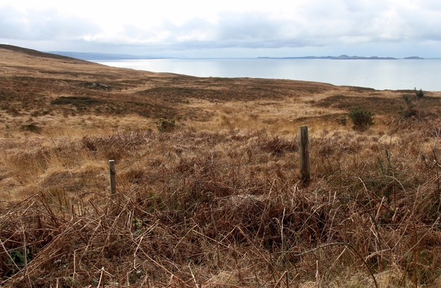
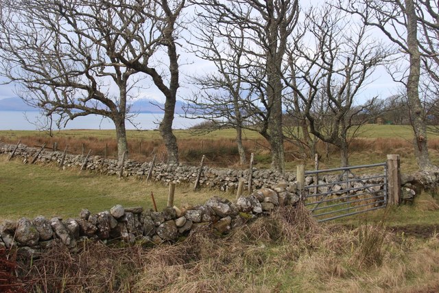
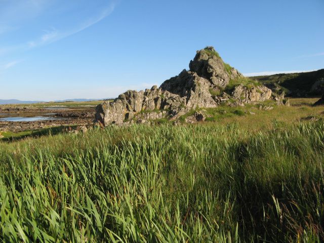
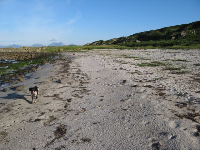
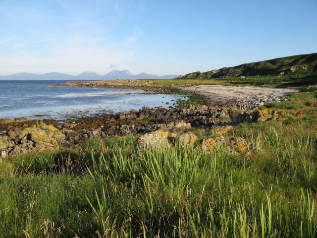
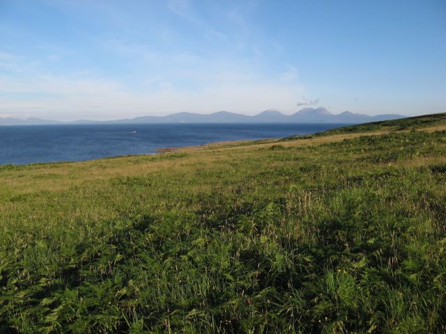
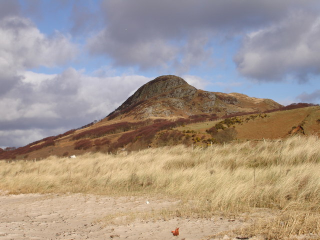
Port an Laoigh is a picturesque coastal village located in Argyllshire, Scotland. Situated on the shores of the Atlantic Ocean, it is well-known for its stunning sea views, estuary, and creek. The village is nestled amidst rolling hills and rugged cliffs, providing a breathtaking backdrop to its natural beauty.

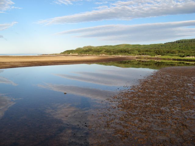
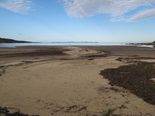
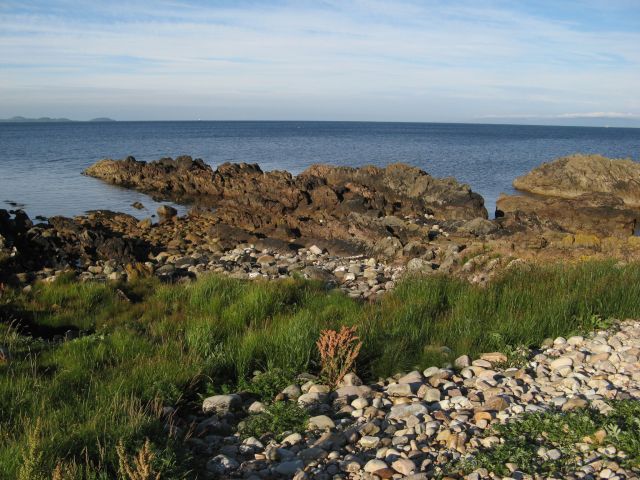
The sea at Port an Laoigh is known for its crystal-clear turquoise waters, making it a popular spot for swimming, snorkeling, and diving. The calm tides and gentle waves create a tranquil environment, perfect for water sports enthusiasts and beachgoers alike.

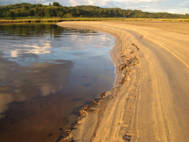
The estuary at Port an Laoigh is formed by the convergence of a river and the ocean, creating a unique ecosystem. This estuarine environment supports a diverse range of marine life, including various fish species, crabs, and shellfish. It also serves as a crucial habitat for migratory birds, making it a haven for birdwatchers and nature lovers.

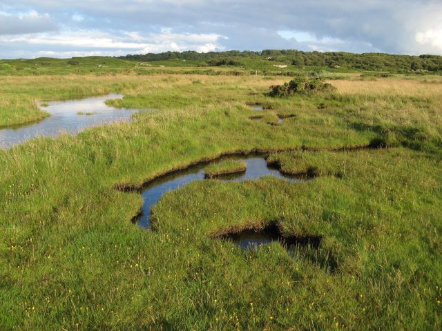
The creek at Port an Laoigh is a small, narrow waterway that meanders through the village, providing a peaceful setting for boating and fishing. The creek is flanked by lush vegetation and offers a serene escape from the hustle and bustle of everyday life.

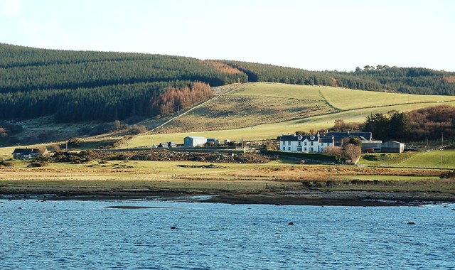
In addition to its natural attractions, Port an Laoigh boasts a rich history and a close-knit community. The village features charming cottages, a quaint harbor, and a few local shops and restaurants, providing a glimpse into traditional Scottish coastal life.

Overall, Port an Laoigh is a hidden gem in Argyllshire, offering visitors a chance to immerse themselves in the beauty of the sea, estuary, and creek while enjoying the tranquility of a coastal village.

If you have any feedback on the listing, please let us know in the comments section below.

Port an Laoigh Images

Images are sourced within 2km of 55.788077/-5.6286941 or Grid Reference NR7260. Thanks to Geograph Open Source API. All images are credited.

The house at Carse This is the old road bridge, now by-passed.
The house at Carse
This is the old road bridge, now by-passed.
Coastal scene by the B8024 Looking south past West Loch Tarbert (the inlet on the left) to the southern part of Kintyre.
Coastal scene by the B8024
Looking south past West Loch Tarbert (the inlet on the left) to the southern part of Kintyre.
Kintyre Peninsula The evening sun on the west coast of the Kintyre peninsula.  Taken from the B8024 near Creag Stars.
Kintyre Peninsula
The evening sun on the west coast of the Kintyre peninsula. Taken from the B8024 near Creag Stars.
Bridge and church at Carse
The road to Kilberry climbs Bruach nan Clach-muillin
Islay comes into view from the B8024
Moorland above Rubha Cruitiridh
Stone dykes at Tiretigan Snow-capped Paps of Jura through the trees.
Stone dykes at Tiretigan
Snow-capped Paps of Jura through the trees.
Morning reflections Reflections in the estuary at the head of Loch Stornoway.
Morning reflections
Reflections in the estuary at the head of Loch Stornoway.
Patterns in sand Accumulations of seaweed accentuate the contours of sand at the high-tide mark. The island of Gigha occupies the horizon.
Patterns in sand
Accumulations of seaweed accentuate the contours of sand at the high-tide mark. The island of Gigha occupies the horizon.
Sand patterns Striations in the sandy bank of the estuary at the head of Loch Stornoway, highlighted in evening sunshine.
Sand patterns
Striations in the sandy bank of the estuary at the head of Loch Stornoway, highlighted in evening sunshine.
Promontory of schist Resistant beds of Dalradian schist finger out into the sea. There is a pronounced storm beach above the normal tide line, which makes walking difficult when weeds have grown over and hidden the surface. Gigha and Islay creep into the horizon, the latter with a surprising layer of cloud over its hills.
Promontory of schist
Resistant beds of Dalradian schist finger out into the sea. There is a pronounced storm beach above the normal tide line, which makes walking difficult when weeds have grown over and hidden the surface. Gigha and Islay creep into the horizon, the latter with a surprising layer of cloud over its hills.
Relict sea-stack At one time this prominent rock would have been a small rocky island lying some distance from a shore with rocky cliffs, but relative lowering of sea level has left it stranded. It is one of several such features on this stretch of the Main Rock Platform, a 'fossilised' landscape feature well known in the Hebrides (see also <a href="https://www.geograph.org.uk/photo/5097312">NR7062 : Erosion platform with Jura</a>). In the background can be seen both the extending platform and the relict cliff line. The sodden ground here supports a thick growth of Flag Iris and it is not easy walking.
Relict sea-stack
At one time this prominent rock would have been a small rocky island lying some distance from a shore with rocky cliffs, but relative lowering of sea level has left it stranded. It is one of several such features on this stretch of the Main Rock Platform, a 'fossilised' landscape feature well known in the Hebrides (see also NR7062 : Erosion platform with Jura). In the background can be seen both the extending platform and the relict cliff line. The sodden ground here supports a thick growth of Flag Iris and it is not easy walking.
Sandy shore, Port Mòr A fine little bay below the relict cliff line which lies in shadow at this early-morning hour. Such is the importance of access to such locations that a small track makes its way down the cliffs from the road.
Sandy shore, Port Mòr
A fine little bay below the relict cliff line which lies in shadow at this early-morning hour. Such is the importance of access to such locations that a small track makes its way down the cliffs from the road.
Port Mòr A beautiful bay with a horizon filled by the distant island of Jura. There is another sandy bay without a name to the south-west of this little headland. The bay is developed in the Main rock Platform (see <a href="https://www.geograph.org.uk/photo/5097312">NR7062 : Erosion platform with Jura</a>), whose relict cliffs are well displayed here.
Port Mòr
A beautiful bay with a horizon filled by the distant island of Jura. There is another sandy bay without a name to the south-west of this little headland. The bay is developed in the Main rock Platform (see NR7062 : Erosion platform with Jura), whose relict cliffs are well displayed here.
Improved grazing A wide meadow spreads out below the road, but above the steep and high relict cliff line. Jura looks magnificent on the morning horizon.
Improved grazing
A wide meadow spreads out below the road, but above the steep and high relict cliff line. Jura looks magnificent on the morning horizon.
Carse Farm and bridge A view along the old loop of road past the farm house and bridge over the burn.
Carse Farm and bridge
A view along the old loop of road past the farm house and bridge over the burn.
Flooded marsh The salt-marsh below Gorten is inundated by an unusually high tide.
Flooded marsh
The salt-marsh below Gorten is inundated by an unusually high tide.
Show me another place!

Port an Laoigh is located at Grid Ref: NR7260 (Lat: 55.788077, Lng: -5.6286941)

Unitary Authority: Argyll and Bute

Police Authority: Argyll and West Dunbartonshire

What 3 Words

///falters.beards.customers. Near Tarbert, Argyll & Bute

Related Wikis

Kilcalmonell

The parish of Kilcalmonell is situated in Argyll and Bute, Scotland. It extends from Clachan, in Kintyre to Kilberry, in Knapdale. == References == W....

Ardpatrick, Argyll

Ardpatrick (Scottish Gaelic: Àird Phàdraig) is a village at the southwestern extremity of the Knapdale, Argyll, Scotland. The village is built along the...

Ardpatrick House

Ardpatrick House is a category-B-listed 18th-century country house in Ardpatrick, South Knapdale, Argyll and Bute, Scotland. == History == A fortified...

Kilberry Castle

Kilberry Castle is a Category B listed country house near Kilberry in South Knapdale in the county of Argyll, in western Scotland on the shores of the...

Kilberry

Kilberry (Scottish Gaelic: Cill Bheiridh) is a village in Argyll and Bute, Scotland. It is close to the western coast of the district of Knapdale. Kilberry...

Dun Skeig

Dun Skeig is an oval Iron Age dun (fort) complex which is perched atop a rocky outcropping about 40 metres (130 ft) above sea level overlooking West Loch...

Loup House

Loup House is a manor house north of Clachan on the Kintyre peninsula of Argyll, Scotland. The estate was once home to the chiefs of Clan MacAlister, and...

Clachan, Kintyre

Clachan is a small village in North Kintyre, Argyll & Bute, Scotland. Clachan is the site of an old church, which was the principal church for the North...

Have you been to Port an Laoigh?

Leave your review of Port an Laoigh below (or comments, questions and feedback).