Port an Dùine Mhairbh

Sea, Estuary, Creek in Argyllshire

Scotland

Port an Dùine Mhairbh

Descending Creag Bhàn The descent of Creag Bhàn offers a fine view over the south and west of the Isle of Gigha, and a distant Islay.  In this view, Ardailly can be noted, with the covered Gigha service reservoir below.  Mill Loch and High Loch can be noted to the left in the near and far distance, respectively.

This photograph was taken during the Coronavirus (COVID-19) pandemic of 2020/21.
Descending Creag Bhàn Credit: James T M Towill

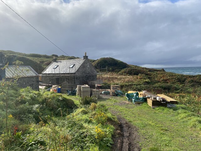
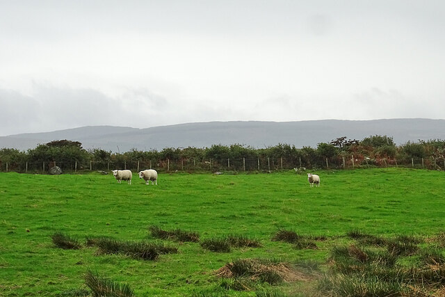
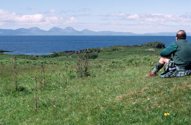
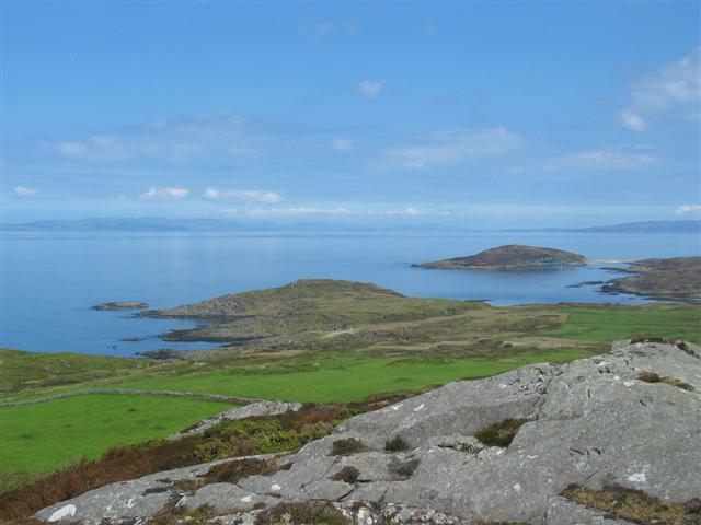
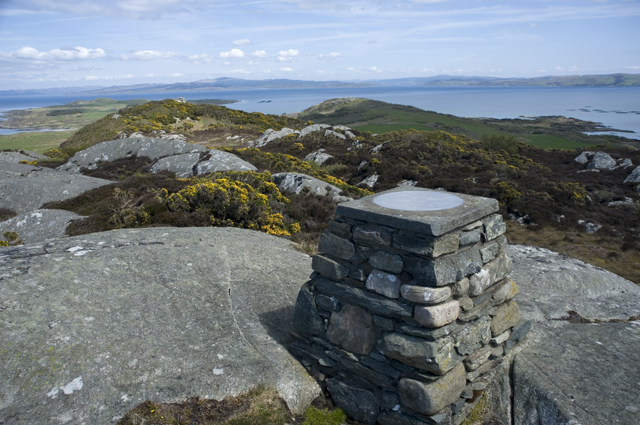
Port an Dùine Mhairbh, also known as the Port of the Dead Man, is a picturesque coastal area located in Argyllshire, Scotland. Nestled along the western coast, this sea, estuary, and creek combination offers stunning natural beauty and a rich historical significance.

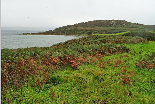
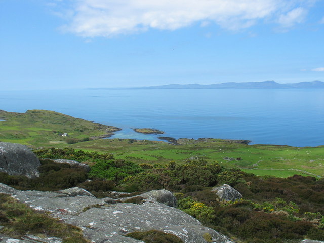
The area is characterized by its rugged cliffs, rocky shores, and crystal-clear waters. The sea in Port an Dùine Mhairbh is home to a diverse range of marine life, including seals, dolphins, and various species of fish. The estuary provides a habitat for numerous bird species, making it a popular spot for birdwatching enthusiasts.

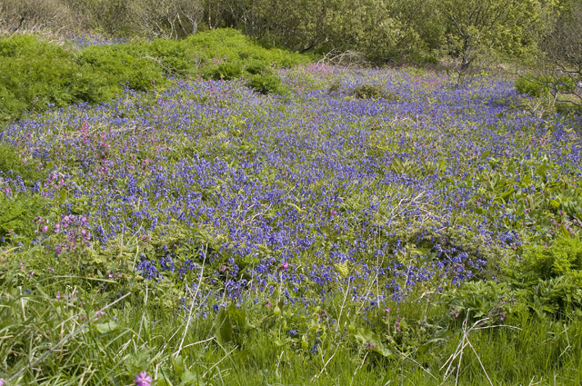
The creek in Port an Dùine Mhairbh is a small, narrow waterway that winds its way inland, surrounded by lush greenery and vibrant wildflowers. It serves as a natural harbor for small boats and fishing vessels, with local fishermen often launching from here to explore the surrounding waters.

The area holds a fascinating historical significance as well. Legend has it that Port an Dùine Mhairbh got its name from a tragic incident involving a shipwreck, where the bodies of the deceased washed ashore. The eerie name and the haunting beauty of the place have captured the imagination of many visitors.

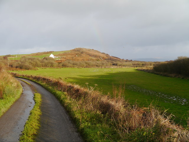
Today, Port an Dùine Mhairbh attracts nature lovers, photographers, and history enthusiasts alike. Its remote and unspoiled charm offers a peaceful escape from the hustle and bustle of everyday life, allowing visitors to immerse themselves in the stunning coastal landscape and soak up the area's rich cultural heritage.

If you have any feedback on the listing, please let us know in the comments section below.

Port an Dùine Mhairbh Images

Images are sourced within 2km of 55.6962/-5.7530107 or Grid Reference NR6451. Thanks to Geograph Open Source API. All images are credited.

Descending Creag Bhàn The descent of Creag Bhàn offers a fine view over the south and west of the Isle of Gigha, and a distant Islay.  In this view, Ardailly can be noted, with the covered Gigha service reservoir below.  Mill Loch and High Loch can be noted to the left in the near and far distance, respectively.

This photograph was taken during the Coronavirus (COVID-19) pandemic of 2020/21.
Descending Creag Bhàn
The descent of Creag Bhàn offers a fine view over the south and west of the Isle of Gigha, and a distant Islay. In this view, Ardailly can be noted, with the covered Gigha service reservoir below. Mill Loch and High Loch can be noted to the left in the near and far distance, respectively. This photograph was taken during the Coronavirus (COVID-19) pandemic of 2020/21.
Ardailly Mill and miller's cottage At the far end of a long and winding track on the Isle of Gigha stands Ardailly  Mill. It's in an idyllic spot on Gigha's remote west shore, looking out to the neighbouring islands of Islay and Jura. In this photograph it is seen with building works under way, transforming the old millers cottage into someone's dream house.....
Ardailly Mill and miller's cottage
At the far end of a long and winding track on the Isle of Gigha stands Ardailly Mill. It's in an idyllic spot on Gigha's remote west shore, looking out to the neighbouring islands of Islay and Jura. In this photograph it is seen with building works under way, transforming the old millers cottage into someone's dream house.....
Carragh an Tarbert A distinctive standing stone beside the road at Tarbert on the Isle of Gigha. It is also known as the Druids' Stone, and A Thom, author of 'The standing stones in Argyllshire' and 'Megalithic lunar observatories', considers it to be a lunar obervatory dating from the 1st millennium BC.
Carragh an Tarbert
A distinctive standing stone beside the road at Tarbert on the Isle of Gigha. It is also known as the Druids' Stone, and A Thom, author of 'The standing stones in Argyllshire' and 'Megalithic lunar observatories', considers it to be a lunar obervatory dating from the 1st millennium BC.
Looking over Tràigh Bhàn If the tide were not so high, the white sand that gives the beach its name would be visible here. The hummock is Cnoc Largie, in the next square.
Looking over Tràigh Bhàn
If the tide were not so high, the white sand that gives the beach its name would be visible here. The hummock is Cnoc Largie, in the next square.
Tarbert Farm The farm houses and steading are set back a little from the road.
Tarbert Farm
The farm houses and steading are set back a little from the road.
Druimyeon More Farm The name of this farm by the roadside is curious. The spelling is not Gaelic; perhaps it's a mangled version of Druim an Eoin Mòr 'The ridge of the big bird'?
Druimyeon More Farm
The name of this farm by the roadside is curious. The spelling is not Gaelic; perhaps it's a mangled version of Druim an Eoin Mòr 'The ridge of the big bird'?
Bedraggled Sheep Even the sheep look a bit dispirited on this horrible wet day.
Bedraggled Sheep
Even the sheep look a bit dispirited on this horrible wet day.
Grassland near Ardailly Looking towards the west coast of Gigha and beyond to the Paps of Jura. Just visible (towards the left) are the gables of the ruined old water mill at Port An Duin, which dates from the 18th century.
Grassland near Ardailly
Looking towards the west coast of Gigha and beyond to the Paps of Jura. Just visible (towards the left) are the gables of the ruined old water mill at Port An Duin, which dates from the 18th century.
Looking towards the Paps of Jura From near Ardailly on the west coast of Gigha.
Looking towards the Paps of Jura
From near Ardailly on the west coast of Gigha.
Approaching Rain at Creag Bhan, Gigha
Gigha trig point at Creag Bhan
North east view from Gigha trig point
East view from Gigha trig point
North view from Gigha trig point
West view from Gigha trig point
Summit of Creag Bhan The toposcope or topograph on the summit of Creag Bhan the highest point on Gigha
Summit of Creag Bhan
The toposcope or topograph on the summit of Creag Bhan the highest point on Gigha
Small flower meadow A small field full of wild flowers mainly Bluebell and Campion near Druimyeon Farm.
Small flower meadow
A small field full of wild flowers mainly Bluebell and Campion near Druimyeon Farm.
Pasture At Druimyeon More A small pasture which also featured a flock of nearly 100 Greylag Geese.
Pasture At Druimyeon More
A small pasture which also featured a flock of nearly 100 Greylag Geese.
Show me another place!

Port an Dùine Mhairbh is located at Grid Ref: NR6451 (Lat: 55.6962, Lng: -5.7530107)

Unitary Authority: Argyll and Bute

Police Authority: Argyll and West Dunbartonshire

What 3 Words

///desktop.overdone.overhear. Near Craighouse, Argyll & Bute

Related Wikis

Gigha

Gigha (; Scottish Gaelic: Giogha; Scots: Gigha) or the Isle of Gigha (and formerly Gigha Island) is an island off the west coast of Kintyre in Scotland...

Kilchattan Chapel

Kilchattan Chapel (St Cathan's Chapel) is a ruined medieval chapel near Ardminish, Isle of Gigha, Argyll and Bute, Scotland. Built in the 13th century...

Achamore House

Achamore House is a mansion on the Isle of Gigha, Scotland. It was built in 1884 for Lt-Col William James Scarlett, and the extensive gardens were laid...

Sound of Gigha

The Sound of Gigha is a sound between the Inner Hebridean Isle of Gigha and Kintyre. It forms part of the Atlantic Ocean. == External links ==

Nearby Amenities

Located within 500m of 55.6962,-5.7530107
Created By: dmgroom_coastlines
Lat/Long: 55.69261/-5.755027
Created By: dmgroom_coastlines
Lat/Long: 55.692876/-5.754592
Created By: dmgroom_coastlines
Lat/Long: 55.694928/-5.754509
Created By: dmgroom_coastlines
Lat/Long: 55.695065/-5.754065
Created By: dmgroom_coastlines
Lat/Long: 55.695731/-5.752979
Created By: dmgroom_coastlines
Lat/Long: 55.697152/-5.752397
Gigha Mill
Man Made: watermill
Survey: visual
Lat/Long: 55.6919332/-5.7544534
Man Made: mast
Lat/Long: 55.6918107/-5.7518933
Power: pole
Lat/Long: 55.6921752/-5.7515559
Power: pole
Lat/Long: 55.6922704/-5.7504417
Power: pole
Lat/Long: 55.6919678/-5.7539793
Ardailly
Place: hamlet
Lat/Long: 55.6920286/-5.7523547
Dun an Trinnse Dun
Heritage Operator: Historic Environment Scotland
Heritage Website: https://portal.historicenvironment.scot/designation/SM3229
Historic: archaeological_site
Ref GB Hs: SM3229
Ref Canmore: 38627
Wikidata: Q56667998
Lat/Long: 55.6945177/-5.7538372
The data included in this document is from www.openstreetmap.org. The data is made available under ODbL.

Have you been to Port an Dùine Mhairbh?

Leave your review of Port an Dùine Mhairbh below (or comments, questions and feedback).