Basset's Cove

Sea, Estuary, Creek in Cornwall

England

Basset's Cove

Gull Rock From the beach at Portreath.
Gull Rock Credit: David P Howard

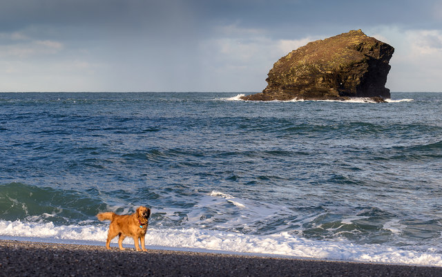
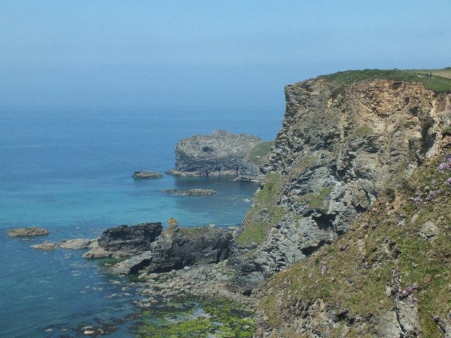
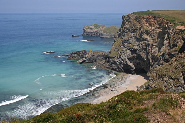
Basset's Cove is a stunning coastal area located in Cornwall, England. Situated between St Ives and Hayle, this picturesque cove is renowned for its natural beauty and tranquil surroundings. Basset's Cove is surrounded by rugged cliffs, golden sandy beaches, and crystal-clear turquoise waters, making it a popular destination for locals and tourists alike.

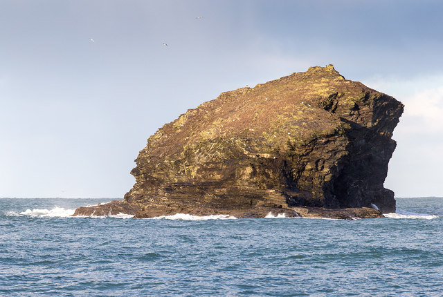
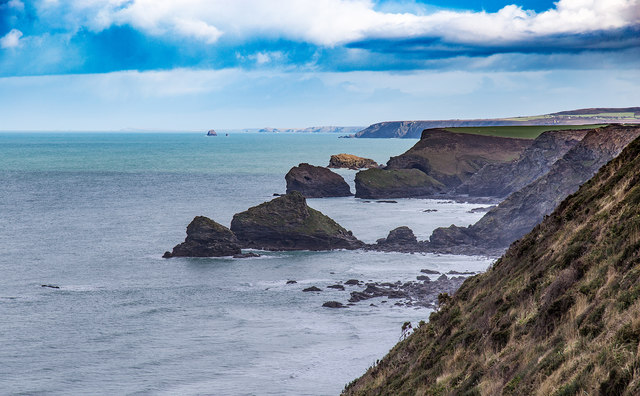
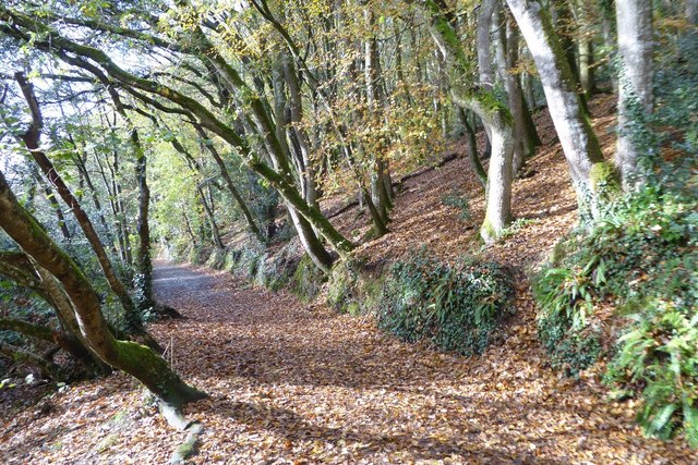
The cove is primarily known for its stunning sea views, with panoramic vistas stretching out towards the Atlantic Ocean. The coastline features dramatic cliffs that offer breathtaking views and provide the perfect backdrop for coastal walks and hikes. Visitors can enjoy exploring the rocky shores, discovering hidden caves, and observing the diverse marine life that calls these waters home.

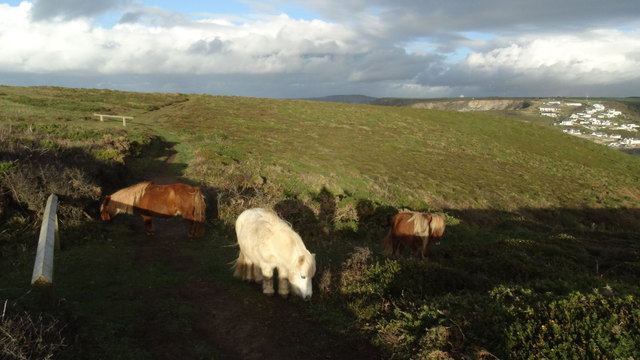
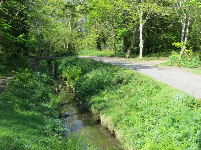
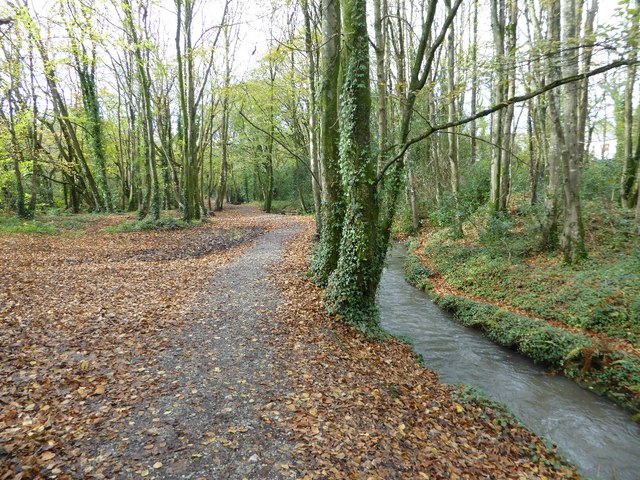
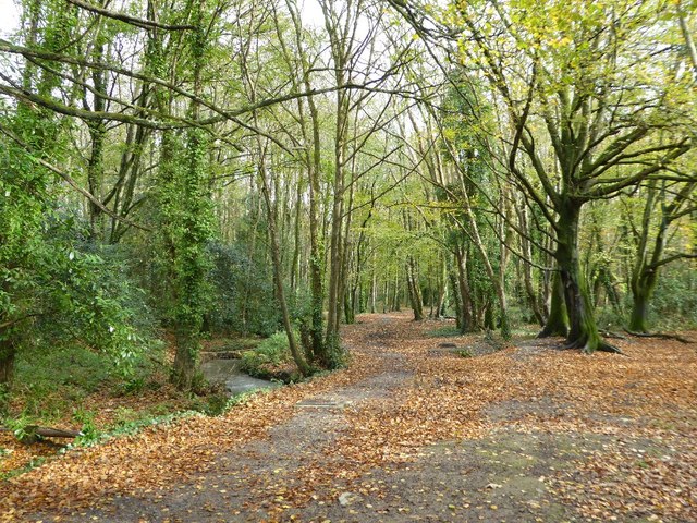
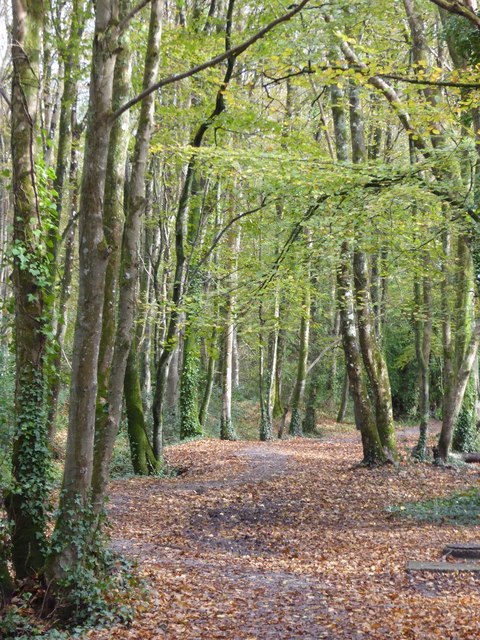
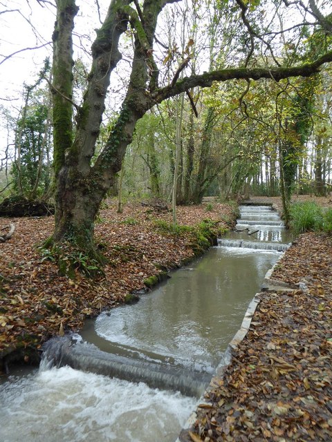
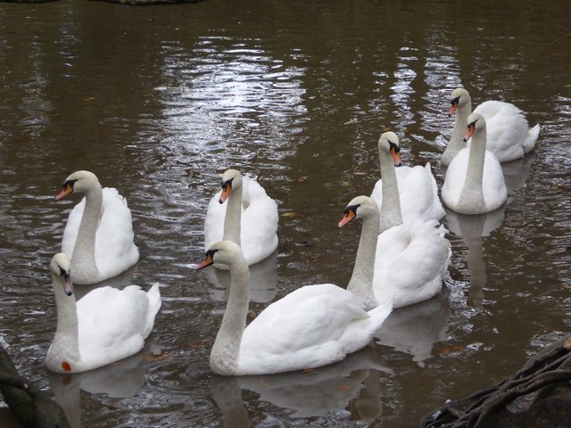
Basset's Cove is also home to a beautiful estuary and creek, creating a diverse landscape that attracts a variety of wildlife. The estuary is formed by the convergence of several streams and rivers, which flow into the cove, creating a unique habitat for a range of bird species, including herons and egrets. The creek offers opportunities for kayaking, paddleboarding, and boating, allowing visitors to explore the picturesque waterways at their leisure.

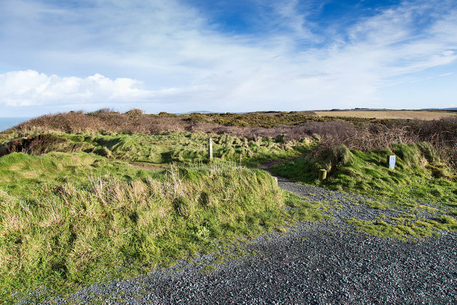
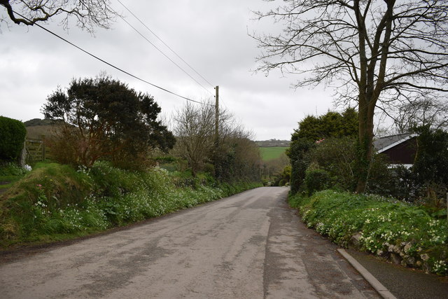
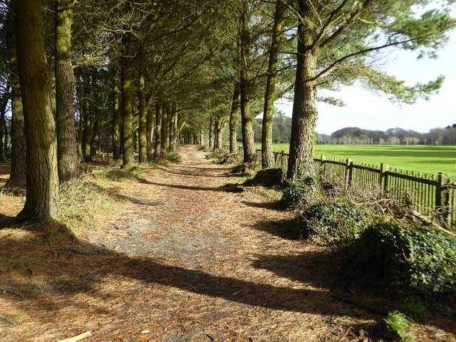
The cove is easily accessible, with a small car park located nearby, providing convenient access for visitors. Basset's Cove offers a peaceful and secluded atmosphere, making it an ideal spot for relaxation, picnicking, and enjoying the natural beauty of Cornwall's coastline. Whether you are seeking a peaceful retreat or an adventurous day out, Basset's Cove has something to offer for everyone.

If you have any feedback on the listing, please let us know in the comments section below.

Basset's Cove Images

Images are sourced within 2km of 50.250347/-5.3161759 or Grid Reference SW6344. Thanks to Geograph Open Source API. All images are credited.

Gull Rock From the beach at Portreath.
Gull Rock
From the beach at Portreath.
Gull Rock From the beach at Portreath
Gull Rock
From the beach at Portreath
View east from the car park at North Cliffs Looking out east over Reskajeage Downs.
View east from the car park at North Cliffs
Looking out east over Reskajeage Downs.
View north east from North Cliffs The view extends past the cliffs and rocks in the foreground, past the Crane Islands in the middle distance, past Gull Rock off Portreath, to St. Agnes' Head in the far distance.
View north east from North Cliffs
The view extends past the cliffs and rocks in the foreground, past the Crane Islands in the middle distance, past Gull Rock off Portreath, to St. Agnes' Head in the far distance.
Coastline near Basset's Cove, near Portreath, Cornwall
Shetland ponies above Western Cove, Portreath
Lane in Coombe Taken outside Coombe Cottage looking east.
Lane in Coombe
Taken outside Coombe Cottage looking east.
South Drive at Tehidy Country Park Looking north-westward.
South Drive at Tehidy Country Park
Looking north-westward.
Woodland path through Tehidy Country Park Looking westward.
Woodland path through Tehidy Country Park
Looking westward.
Pine Walk, Tehidy Park Pine Walk, is also a bridleway, and leads to East Lodge.
Pine Walk, Tehidy Park
Pine Walk, is also a bridleway, and leads to East Lodge.
Autumn on the West Drive, Tehidy Park Sunlight highlighting trees and autumn leaves on the West Drive in Tehidy Park.
Autumn on the West Drive, Tehidy Park
Sunlight highlighting trees and autumn leaves on the West Drive in Tehidy Park.
Path in Tehidy Park Path beside Red River in woodland in Tehidy Country Park.
Path in Tehidy Park
Path beside Red River in woodland in Tehidy Country Park.
Path in Tehidy Country Park Path passing through woodland in Tehidy Country Park.
Path in Tehidy Country Park
Path passing through woodland in Tehidy Country Park.
Trees in Tehidy Country Park
Stream in Tehidy Country Park
Mute swans Eight mute swans on the lake in Tehidy Country Park.
Mute swans
Eight mute swans on the lake in Tehidy Country Park.
Bracket fungi Bracket fungi on a tree in Tehidy Country Park.
Bracket fungi
Bracket fungi on a tree in Tehidy Country Park.
Trees in Tehidy Country Park Trees beside a path in Tehidy Country Park.
Trees in Tehidy Country Park
Trees beside a path in Tehidy Country Park.
Show me another place!

Basset's Cove is located at Grid Ref: SW6344 (Lat: 50.250347, Lng: -5.3161759)

Unitary Authority: Cornwall

Police Authority: Devon and Cornwall

What 3 Words

///lingering.driven.instant. Near Camborne, Cornwall

Related Wikis

Godrevy Head to St Agnes

Godrevy Head to St Agnes is a coastal Site of Special Scientific Interest (SSSI) in north Cornwall, England], noted for both its biological and geological...

Tehidy Country Park

Tehidy Country Park is a country park in Illogan in Cornwall, England which incorporates 250 acres (1.0 km2) of the parkland and estate around Tehidy House...

Coombe, Camborne

Coombe (Cornish: Komm) is a hamlet in west Cornwall, England, United Kingdom. It is situated two miles (3 km) north of the town of Camborne in the valley...

Porteath

Porteath is a hamlet in the parish of St Minver, Cornwall, England. == References ==

Nearby Amenities

Located within 500m of 50.250347,-5.3161759
Source: PGS
Lat/Long: 50.2540204/-5.3121878
Source: PGS
Lat/Long: 50.2534966/-5.3122374
Source: PGS
Lat/Long: 50.2527809/-5.3124161
Source: PGS
Lat/Long: 50.2523497/-5.3130553
Source: PGS
Lat/Long: 50.25208/-5.3135793
Source: PGS
Lat/Long: 50.2519964/-5.3138179
Source: PGS
Lat/Long: 50.251606/-5.3142218
Source: PGS
Lat/Long: 50.250768/-5.3138007
Source: PGS
Lat/Long: 50.2506982/-5.3137995
Source: PGS
Lat/Long: 50.2504421/-5.3141735
Source: PGS
Lat/Long: 50.2497656/-5.3147873
Source: PGS
Lat/Long: 50.24941/-5.3152456
Source: PGS
Lat/Long: 50.2495391/-5.3161173
Source: PGS
Lat/Long: 50.2493376/-5.3167543
Source: PGS
Lat/Long: 50.2490815/-5.3174889
Source: PGS
Lat/Long: 50.2491168/-5.3179364
Source: PGS
Lat/Long: 50.2491395/-5.3185813
Source: PGS
Lat/Long: 50.2489664/-5.3196633
Source: PGS
Lat/Long: 50.249136/-5.3198577
Source: PGS
Lat/Long: 50.2489602/-5.3202524
Source: PGS
Lat/Long: 50.248773/-5.3200048
Source: PGS
Lat/Long: 50.2479106/-5.3198945
Source: PGS
Lat/Long: 50.2476375/-5.319926
Source: PGS
Lat/Long: 50.2473364/-5.3203448
Basset's Cove
Natural: bay
Lat/Long: 50.2507686/-5.316339
Barrier: stile
Material: wood
Stile: stepover
Lat/Long: 50.2502987/-5.3135703
Crane Castle
Access: yes
Castle Type: defensive
Description: Cliff castles are coastal promontories adapted as enclosures and fortified on the landward side by the construction of one or more ramparts accompanied by ditches. On the seaward side the precipitous cliffs of the promontory provided a natural defence, on
Historic: castle
Historic Civilization: iron-age
Website: https://historicengland.org.uk/listing/the-list/list-entry/1004390
Lat/Long: 50.2485639/-5.3189313
The data included in this document is from www.openstreetmap.org. The data is made available under ODbL.

Have you been to Basset's Cove?

Leave your review of Basset's Cove below (or comments, questions and feedback).