Greenbank Cove

Sea, Estuary, Creek in Cornwall

England

Greenbank Cove

View east from the car park at North Cliffs Looking out east over Reskajeage Downs.
View east from the car park at North Cliffs Credit: David P Howard

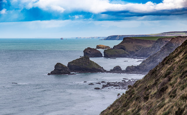
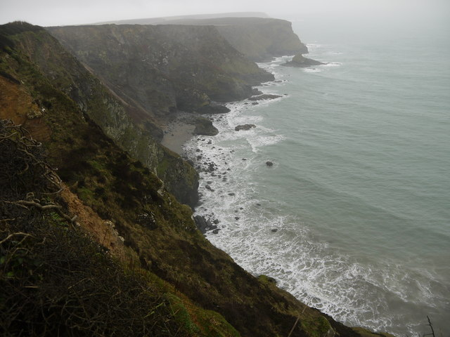
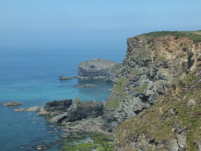
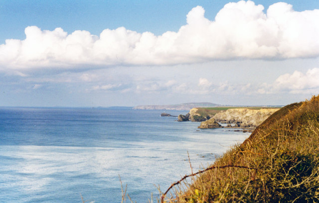
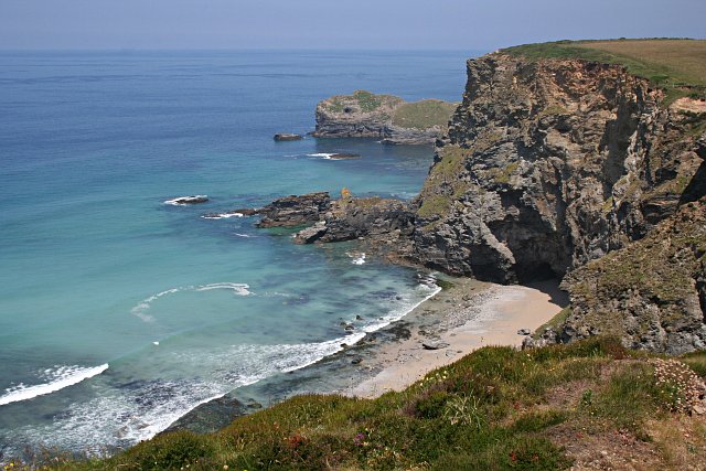
Greenbank Cove is a picturesque coastal area located in Cornwall, England. Nestled between lush green hills and overlooking the Atlantic Ocean, it offers a stunning natural landscape that attracts locals and tourists alike. The cove is known for its pristine sandy beach, clear turquoise waters, and breathtaking sea views.

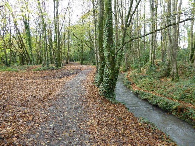
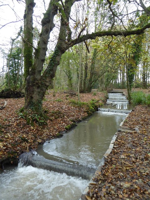
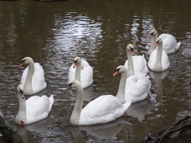
One of the main features of Greenbank Cove is its estuary, which is formed by the convergence of a small creek and the open sea. This estuary provides a unique ecosystem that supports a diverse range of marine and bird life. Visitors can witness an array of seabirds, such as gulls and cormorants, diving into the water to catch fish.

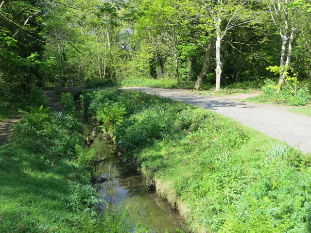
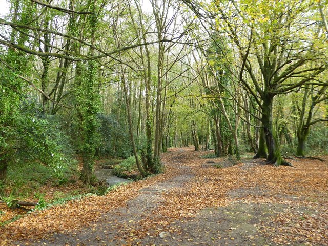
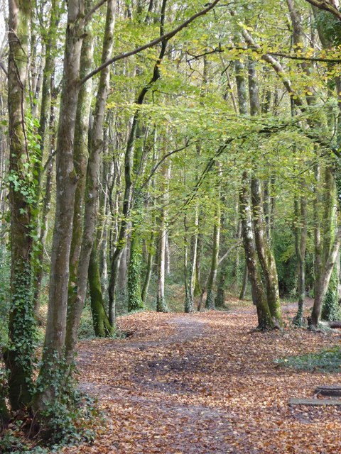
The creek that flows into the estuary is a tranquil and serene spot that adds to the charm of Greenbank Cove. It is a popular spot for kayaking and paddleboarding, allowing visitors to explore the cove from a different perspective. The creek is surrounded by lush vegetation and offers a peaceful escape from the bustling beach.

Greenbank Cove is also a haven for wildlife enthusiasts, as it is home to various species of marine life. Dolphins and seals are often spotted swimming in the waters, delighting onlookers. During low tide, explorers can discover a wide range of marine creatures in the rock pools along the shore.

Whether visitors are seeking a relaxing beach day, an adventurous water activity, or a chance to connect with nature, Greenbank Cove offers it all. With its breathtaking scenery, diverse wildlife, and tranquil atmosphere, it is a must-visit destination for anyone exploring the beauty of Cornwall.

If you have any feedback on the listing, please let us know in the comments section below.

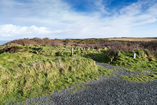
Greenbank Cove Images

Images are sourced within 2km of 50.24461/-5.3251765 or Grid Reference SW6343. Thanks to Geograph Open Source API. All images are credited.

View east from the car park at North Cliffs Looking out east over Reskajeage Downs.
View east from the car park at North Cliffs
Looking out east over Reskajeage Downs.
View north east from North Cliffs The view extends past the cliffs and rocks in the foreground, past the Crane Islands in the middle distance, past Gull Rock off Portreath, to St. Agnes' Head in the far distance.
View north east from North Cliffs
The view extends past the cliffs and rocks in the foreground, past the Crane Islands in the middle distance, past Gull Rock off Portreath, to St. Agnes' Head in the far distance.
A Misty Winters Day at Derrick's Cove View along the steep cliffs of north Cornwall on and cold wet and misty winters afternoon
A Misty Winters Day at Derrick's Cove
View along the steep cliffs of north Cornwall on and cold wet and misty winters afternoon
A Misty Day on the North Coast of Cornwall Looking North up the coast from the cliff top near the parking area just off the B3301 between Hayle and Portreath.
A Misty Day on the North Coast of Cornwall
Looking North up the coast from the cliff top near the parking area just off the B3301 between Hayle and Portreath.
Derrick Cove  View west along the Cornish Coast on a damp miserable misty day from the top of the cliffs next to the B3301 between Hayle and Portreath.
Derrick Cove
View west along the Cornish Coast on a damp miserable misty day from the top of the cliffs next to the B3301 between Hayle and Portreath.
Coastline near Basset's Cove, near Portreath, Cornwall
North Cornwall Coast, west of Portreath, 1995 Eastward on B3301 near Deadman's Cove to North Cliffs, Crane Islands; on horizon Mount Hawke and, dimly, St Agnes Head.
North Cornwall Coast, west of Portreath, 1995
Eastward on B3301 near Deadman's Cove to North Cliffs, Crane Islands; on horizon Mount Hawke and, dimly, St Agnes Head.
Lane in Coombe Taken outside Coombe Cottage looking east.
Lane in Coombe
Taken outside Coombe Cottage looking east.
Woodland path through Tehidy Country Park Looking westward.
Woodland path through Tehidy Country Park
Looking westward.
Autumn on the West Drive, Tehidy Park Sunlight highlighting trees and autumn leaves on the West Drive in Tehidy Park.
Autumn on the West Drive, Tehidy Park
Sunlight highlighting trees and autumn leaves on the West Drive in Tehidy Park.
Path in Tehidy Park Path beside Red River in woodland in Tehidy Country Park.
Path in Tehidy Park
Path beside Red River in woodland in Tehidy Country Park.
Path in Tehidy Country Park Path passing through woodland in Tehidy Country Park.
Path in Tehidy Country Park
Path passing through woodland in Tehidy Country Park.
Trees in Tehidy Country Park
Stream in Tehidy Country Park
Mute swans Eight mute swans on the lake in Tehidy Country Park.
Mute swans
Eight mute swans on the lake in Tehidy Country Park.
Bracket fungi Bracket fungi on a tree in Tehidy Country Park.
Bracket fungi
Bracket fungi on a tree in Tehidy Country Park.
Trees in Tehidy Country Park Trees beside a path in Tehidy Country Park.
Trees in Tehidy Country Park
Trees beside a path in Tehidy Country Park.
Waterfall at Porth-cadjack Cove  
Just south of Portreath the South West Coast Path rises to cross Carvannel Downs, which are carved in two by this steep sided combe. There is a right of way marked on OS maps that show a route around the combe, but this is not immediately obvious on the ground and so most people walk the zig-zag path down and then zig-zag up via the combe bottom.

To see a photograph of the zig-zag path climbing the southern side of the combe, click here:- <a href="https://www.geograph.org.uk/photo/5672168">SW6444 : Combe in the  Carvannel Downs</a>.

The stream falling over the waterfall into <a href="https://www.geograph.org.uk/photo/5672222">SW6444 : Porth-cadjack Cove</a> is quite short (some 770m), starting near Carvannel Farm just beyond the head of the combe and draining the surrounding downs.

See also these photographs of Porth-cadjack Cove by:-
Brian:- <a href="https://www.geograph.org.uk/photo/407132">SW6444 : Porth-cadjack Cove and Cliff at Low Tide</a>,
Rod Allday:- <a href="https://www.geograph.org.uk/photo/809135">SW6444 : Porth-cadjack Cove at low tide</a>,
Maurice D Budden:- <a href="https://www.geograph.org.uk/photo/2537213">SW6444 : Porth-cadjack Cove</a> and
Philip Halling:- <a href="https://www.geograph.org.uk/photo/1850301">SW6444 : Coomb in the Carvannel Downs</a>.
Waterfall at Porth-cadjack Cove
  Just south of Portreath the South West Coast Path rises to cross Carvannel Downs, which are carved in two by this steep sided combe. There is a right of way marked on OS maps that show a route around the combe, but this is not immediately obvious on the ground and so most people walk the zig-zag path down and then zig-zag up via the combe bottom. To see a photograph of the zig-zag path climbing the southern side of the combe, click here:- SW6444 : Combe in the Carvannel Downs. The stream falling over the waterfall into SW6444 : Porth-cadjack Cove is quite short (some 770m), starting near Carvannel Farm just beyond the head of the combe and draining the surrounding downs. See also these photographs of Porth-cadjack Cove by:- Brian:- SW6444 : Porth-cadjack Cove and Cliff at Low Tide, Rod Allday:- SW6444 : Porth-cadjack Cove at low tide, Maurice D Budden:- SW6444 : Porth-cadjack Cove and Philip Halling:- SW6444 : Coomb in the Carvannel Downs.
Show me another place!

Greenbank Cove is located at Grid Ref: SW6343 (Lat: 50.24461, Lng: -5.3251765)

Unitary Authority: Cornwall

Police Authority: Devon and Cornwall

What 3 Words

///respects.doll.absorb. Near Camborne, Cornwall

Related Wikis

Godrevy Head to St Agnes

Godrevy Head to St Agnes is a coastal Site of Special Scientific Interest (SSSI) in north Cornwall, England], noted for both its biological and geological...

Coombe, Camborne

Coombe (Cornish: Komm) is a hamlet in west Cornwall, England, United Kingdom. It is situated two miles (3 km) north of the town of Camborne in the valley...

Tehidy Country Park

Tehidy Country Park is a country park in Illogan in Cornwall, England which incorporates 250 acres (1.0 km2) of the parkland and estate around Tehidy House...

Ashill, Cornwall

Ashill is a small hamlet in west Cornwall, England, United Kingdom in the valley of the Red River about 2 miles north west of Camborne. The Red River Nature...

Nearby Amenities

Located within 500m of 50.24461,-5.3251765
Source: PGS
Lat/Long: 50.2473364/-5.3203448
Source: PGS
Lat/Long: 50.2470607/-5.3213122
Source: PGS
Lat/Long: 50.2468261/-5.3220008
Source: PGS
Lat/Long: 50.2465894/-5.3228715
Source: PGS
Lat/Long: 50.2463587/-5.3229632
Source: PGS
Lat/Long: 50.2461365/-5.3229958
Source: PGS
Lat/Long: 50.2460842/-5.3229668
Source: PGS
Lat/Long: 50.2459284/-5.3229602
Source: PGS
Lat/Long: 50.24526/-5.3237113
Source: PGS
Lat/Long: 50.2450323/-5.3237208
Source: PGS
Lat/Long: 50.2447234/-5.3243453
Source: PGS
Lat/Long: 50.2442047/-5.3250788
Source: PGS
Lat/Long: 50.2441091/-5.3256741
Source: PGS
Lat/Long: 50.2439254/-5.3264093
Source: PGS
Lat/Long: 50.2438535/-5.3277036
Source: PGS
Lat/Long: 50.2431338/-5.3278269
Source: PGS
Lat/Long: 50.242488/-5.3282697
Bench
Backrest: no
Lat/Long: 50.2458336/-5.3212103
Greenbank Cove
Natural: bay
Lat/Long: 50.2436732/-5.3261783
The data included in this document is from www.openstreetmap.org. The data is made available under ODbL.

Have you been to Greenbank Cove?

Leave your review of Greenbank Cove below (or comments, questions and feedback).