Acairseid Mhòr

Sea, Estuary, Creek in Inverness-shire

Scotland

Acairseid Mhòr

Acairseid Mhor from Meall Acairseid South Top, Rona A view on the west side of the Isle of Rona (north of Raasay), with the Trotternish hills beyond the Sound of Raasay, on Skye. Just in case you are wondering, Acairsaid means Harbour. Sheltering the entrance to the harbour is Eilean Garbh.
Acairseid Mhor from Meall Acairseid South Top, Rona Credit: Michael Earnshaw

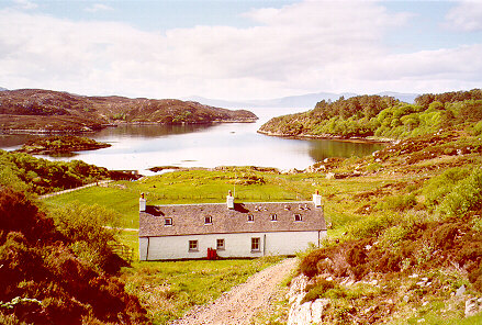
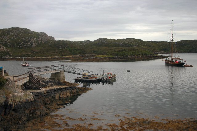
Acairseid Mhòr is a scenic coastal area located in Inverness-shire, Scotland. Nestled between the cities of Inverness and Nairn, it is situated on the east coast of the country, overlooking the Moray Firth.

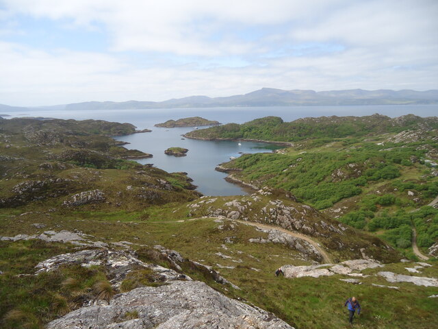
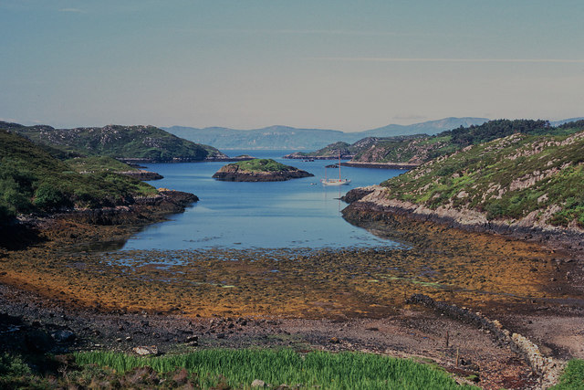
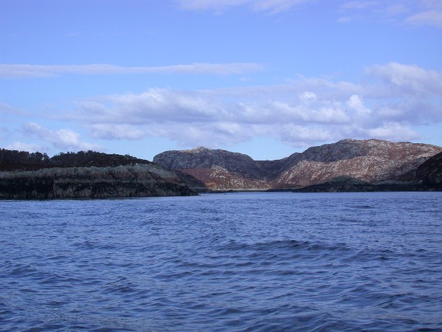
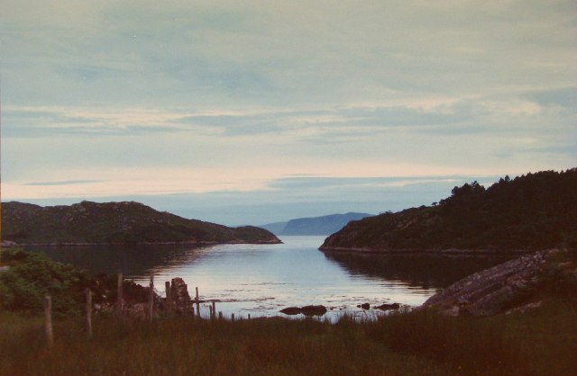
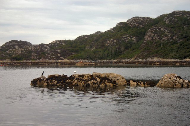
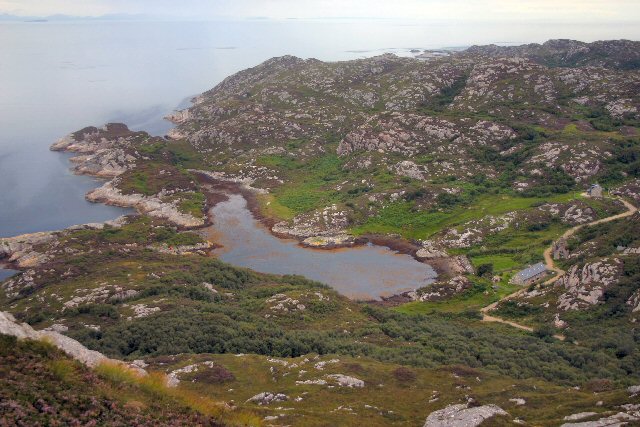
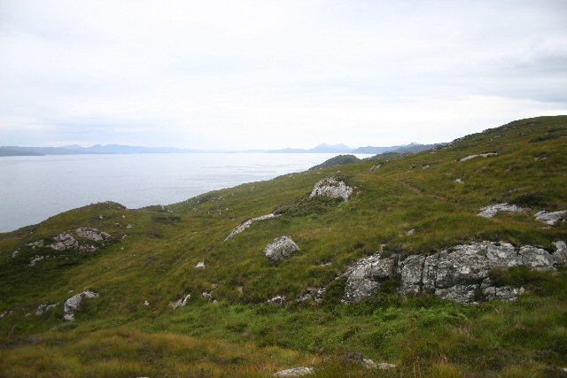
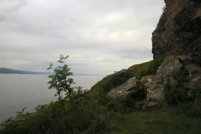
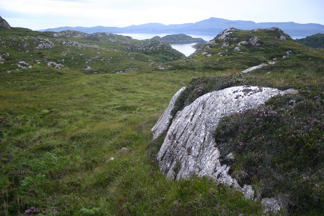
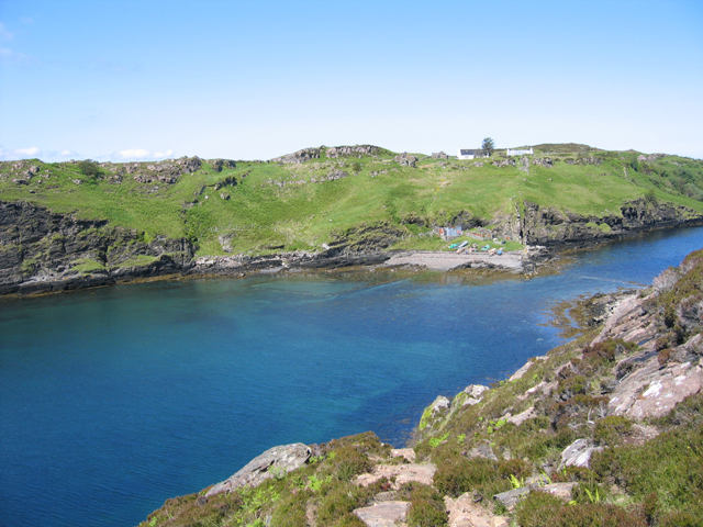
This stunning landscape is characterized by its diverse natural features, including a sea, estuary, and creek. The sea, with its vast expanse of water, offers breathtaking views and is a popular spot for various water activities such as sailing, kayaking, and fishing. The estuary, formed by the River Nairn flowing into the Moray Firth, provides a rich habitat for various species of fish, birds, and other wildlife. It is a haven for birdwatchers and nature enthusiasts, who can often spot species like herons, oystercatchers, and seals.

The creek is a smaller waterway that meanders through the area, adding to its charm. It provides a tranquil setting for leisurely walks along its banks, with its calm waters reflecting the surrounding hills and forests. The creek is also home to a variety of aquatic life, including salmon and trout, making it a popular spot for fishing enthusiasts.

Acairseid Mhòr is not only a paradise for nature lovers but also a place of historical significance. Nearby, the ruins of Fort George, a former military stronghold, stand as a reminder of Scotland's past. Visitors can explore the fort's well-preserved ramparts and barracks, gaining insight into its role in defending the area.

Overall, Acairseid Mhòr offers a blend of natural beauty, recreational opportunities, and historical intrigue. Whether one seeks adventure on the water, peaceful walks along the creek, or a glimpse into Scotland's past, this coastal area has something for everyone.

If you have any feedback on the listing, please let us know in the comments section below.

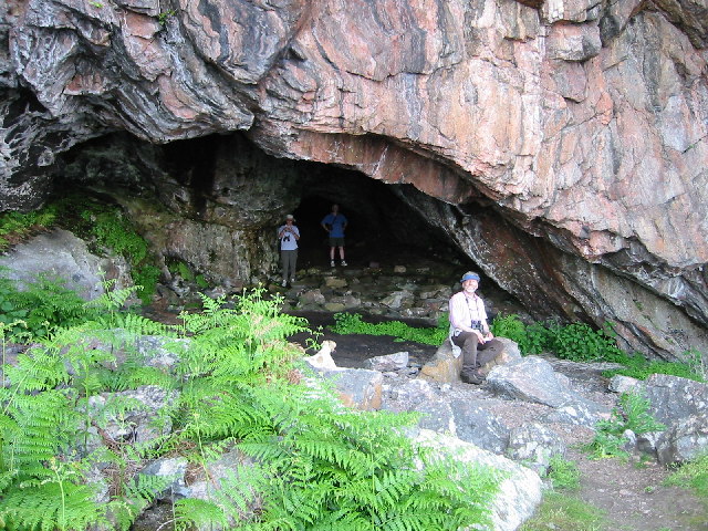
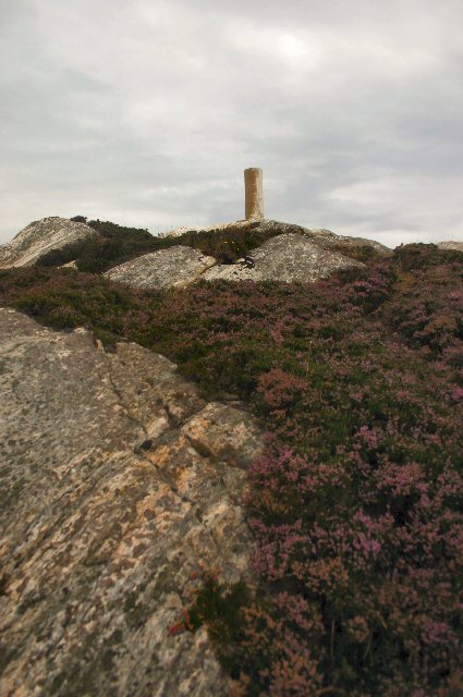
Acairseid Mhòr Images

Images are sourced within 2km of 57.535626/-5.9895112 or Grid Reference NG6156. Thanks to Geograph Open Source API. All images are credited.

Acairseid Mhor from Meall Acairseid South Top, Rona A view on the west side of the Isle of Rona (north of Raasay), with the Trotternish hills beyond the Sound of Raasay, on Skye. Just in case you are wondering, Acairsaid means Harbour. Sheltering the entrance to the harbour is Eilean Garbh.
Acairseid Mhor from Meall Acairseid South Top, Rona
A view on the west side of the Isle of Rona (north of Raasay), with the Trotternish hills beyond the Sound of Raasay, on Skye. Just in case you are wondering, Acairsaid means Harbour. Sheltering the entrance to the harbour is Eilean Garbh.
Arcairseid Mhòr, Rona An idyllic day to arrive on a 14-m yacht on the Great Anchorage of Rona. The yacht is Ismana built in 1951.  See <span class="nowrap"><a title="http://www.sandemanyachtcompany.co.uk/yacht/272/laurent-giles-47-ft-yawl-1951" rel="nofollow ugc noopener" href="http://www.sandemanyachtcompany.co.uk/yacht/272/laurent-giles-47-ft-yawl-1951">Link</a><img style="margin-left:2px;" alt="External link" title="External link - shift click to open in new window" src="https://s1.geograph.org.uk/img/external.png" width="10" height="10"/></span>
Arcairseid Mhòr, Rona
An idyllic day to arrive on a 14-m yacht on the Great Anchorage of Rona. The yacht is Ismana built in 1951. See LinkExternal link
Meall Acairseid, Rona A tale of 2 trigs perhaps.  First island of the day on a RIB from Portree on day after Marhofn 2011 annual meeting in Portree organised by Alan Holmes.
Name: Meall Acairseid
Hill number: 4790
Height: 125m / 410ft
Area: 17A: North Skye and Raasay
Class: Hu
Grid ref: NG 62275 57580
Summit feature: trig point
Drop: 125m
Col: Sea
Meall Acairseid, Rona
A tale of 2 trigs perhaps. First island of the day on a RIB from Portree on day after Marhofn 2011 annual meeting in Portree organised by Alan Holmes. Name: Meall Acairseid Hill number: 4790 Height: 125m / 410ft Area: 17A: North Skye and Raasay Class: Hu Grid ref: NG 62275 57580 Summit feature: trig point Drop: 125m Col: Sea
Rona RIB Pick Up Point First island of the day on a RIB from Portree on day after Marhofn 2011 annual meeting in Portree organised by Alan Holmes.  Our pick up point after walking down part of Rona.
Rona RIB Pick Up Point
First island of the day on a RIB from Portree on day after Marhofn 2011 annual meeting in Portree organised by Alan Holmes. Our pick up point after walking down part of Rona.
Distant view of Rona From the coast of Skye. Much less accessible than adjacent Raasay to the south but boat trips can be arranged from the pier in Portree harbour.
Distant view of Rona
From the coast of Skye. Much less accessible than adjacent Raasay to the south but boat trips can be arranged from the pier in Portree harbour.
Entrance to Acairseid Mhor on Rona Entering Acairseid Mhor on Rona by Kayak
Entrance to Acairseid Mhor on Rona
Entering Acairseid Mhor on Rona by Kayak
Church Cave, Rona This cave which looks out to the E from Rona has a long history as a place of worship- there are stone pews and an altar. It is not easy to find!
Church Cave, Rona
This cave which looks out to the E from Rona has a long history as a place of worship- there are stone pews and an altar. It is not easy to find!
Rona Lodge, Isle of South Rona Built in 1866 as a hunting lodge for the Raasay estate, the lodge is now home to Bill Cowie, Island Manager for the current owner of South Rona.
Rona Lodge, Isle of South Rona
Built in 1866 as a hunting lodge for the Raasay estate, the lodge is now home to Bill Cowie, Island Manager for the current owner of South Rona.
Acairseid Mhor, South Rhona From the shore below Rona Lodge <a href="https://www.geograph.org.uk/photo/94021">NG6157 : Rona Lodge, Isle of South Rona</a> (which in 1986 was an empty shell) having sailed from Portree
Acairseid Mhor, South Rhona
From the shore below Rona Lodge NG6157 : Rona Lodge, Isle of South Rona (which in 1986 was an empty shell) having sailed from Portree
Meall Acairseid, Rona The highest point on Rona, at 125 metres.
Meall Acairseid, Rona
The highest point on Rona, at 125 metres.
Rona letter box The Royal Mail doesn't collect from Rona, hence "Collection Wednesdays and Saturdays, April to September.  Mail will be franked with the Rona date stamp and must have a Rona stamp (available at The Lodge) in addition to a Royal Mail stamp." The mail is taken to Portree by private boat.
Rona letter box
The Royal Mail doesn't collect from Rona, hence "Collection Wednesdays and Saturdays, April to September. Mail will be franked with the Rona date stamp and must have a Rona stamp (available at The Lodge) in addition to a Royal Mail stamp." The mail is taken to Portree by private boat.
Acairseid Mhor, Rona The pontoon is a relatively recent addition, effectively replacing the jetty which is covered at spring high tides.
Acairseid Mhor, Rona
The pontoon is a relatively recent addition, effectively replacing the jetty which is covered at spring high tides.
Entrance to Acairseid Mhor, Rona This rock, and the white marker, are covered at high water springs, making the entrance extremely hazardous.
Entrance to Acairseid Mhor, Rona
This rock, and the white marker, are covered at high water springs, making the entrance extremely hazardous.
Dry Harbour, Rona Viewed from Meall Acairseid (out of square).
Dry Harbour, Rona
Viewed from Meall Acairseid (out of square).
Footpath to Church Cave The path leads downhill from the main track at Meall Acairseid.
Footpath to Church Cave
The path leads downhill from the main track at Meall Acairseid.
By Church Cave, Rona Outside the entrance to Church Cave.
By Church Cave, Rona
Outside the entrance to Church Cave.
Inside Church Cave, Rona The cave was once used as a church by local people. The square stone in the centre was the altar and other stones were set inside the cave to act as pews.  A wooden box containing a bible still remains in the heart of the cave.
Inside Church Cave, Rona
The cave was once used as a church by local people. The square stone in the centre was the altar and other stones were set inside the cave to act as pews. A wooden box containing a bible still remains in the heart of the cave.
Gneiss outcrop, Rona The island of Rona consists of ancient Lewissian gneiss, among the oldest rocks in Europe.
Gneiss outcrop, Rona
The island of Rona consists of ancient Lewissian gneiss, among the oldest rocks in Europe.
Show me another place!

Acairseid Mhòr is located at Grid Ref: NG6156 (Lat: 57.535626, Lng: -5.9895112)

Unitary Authority: Highland

Police Authority: Highlands and Islands

What 3 Words

///tomato.indirect.fancied. Near Portree, Highland

Nearby Locations

Acairseid Mhòr

Related Wikis

South Rona

Rona (Scottish Gaelic: Rònaigh), sometimes called South Rona to distinguish it from North Rona (a small uninhabited island to the northwest of Cape Wrath...

Eilean Tigh

Eilean Tigh (Scottish Gaelic: Eilean Taighe) is a tidal island in the Sound of Raasay of Scotland, that lies between Rona and Raasay. Approximately 54...

Eilean Fladday

Eilean Fladday (also Fladda; Scottish Gaelic: Eilean Fladaigh) is a previously populated tidal island off Raasay, near the Isle of Skye, Scotland. ��2...

Sound of Raasay

The Sound of Raasay (Scottish Gaelic: Linne Ratharsair) is the sound between the islands of Raasay and Skye. == See also == Inner Sound, Scotland Isle...

Nearby Amenities

Located within 500m of 57.535626,-5.9895112
Seamark Name: Acarseid Mhor
Seamark Type: anchorage
Lat/Long: 57.5383112/-5.9880746
Seamark Name: Acarseid Mhor
Seamark Type: anchorage
Lat/Long: 57.5383601/-5.9846306
Seamark Mooring Category: buoy
Seamark Mooring Colour: white
Seamark Mooring Shape: spherical
Seamark Name: VisitorsMooring
Seamark Type: mooring
Lat/Long: 57.5384263/-5.9856928
An Acarsaid Mhòr
Alt Name: An Acairseid Mhòr
Natural: bay
Lat/Long: 57.5358892/-5.9894086
The data included in this document is from www.openstreetmap.org. The data is made available under ODbL.

Have you been to Acairseid Mhòr?

Leave your review of Acairseid Mhòr below (or comments, questions and feedback).