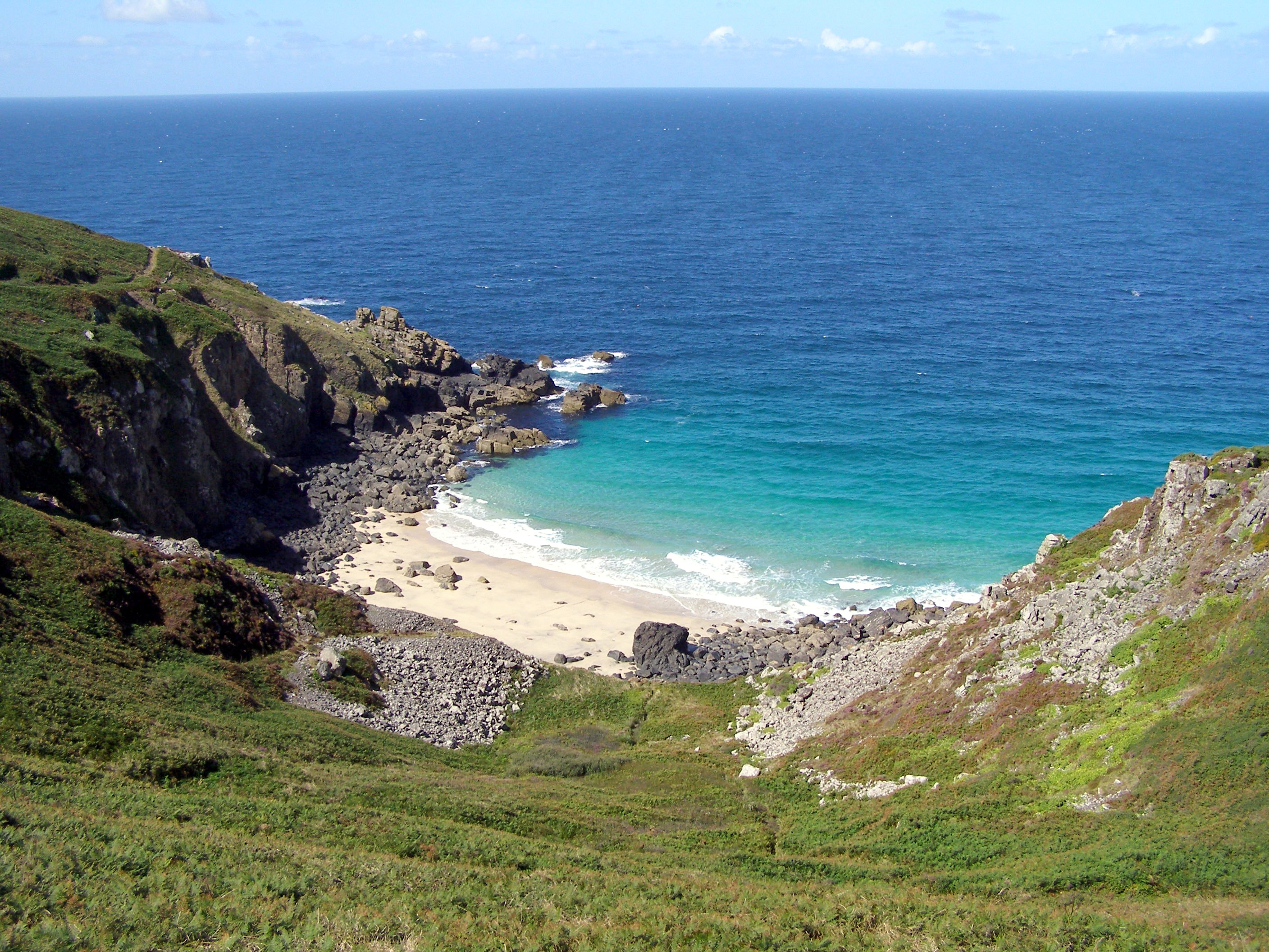
Porthzennor Cove

Sea, Estuary, Creek in Cornwall

England

Porthzennor Cove

Coast east of Mussel Point Viewed from the coastal footpath, Mussel Point is the point in the mid-distance. Far beyond, two further headlands show - these must be Zennor Head and furthest, Gurnard's Head.
Coast east of Mussel Point Credit: Robin Webster

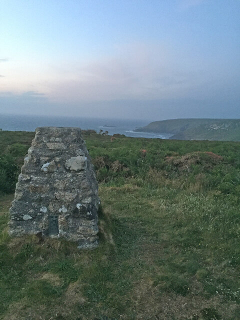
Porthzennor Cove is a picturesque coastal area located in Cornwall, England. Situated on the southern coast, it is known for its stunning views of the sea, estuary, and creek, making it a popular destination for both locals and tourists alike.

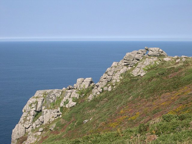
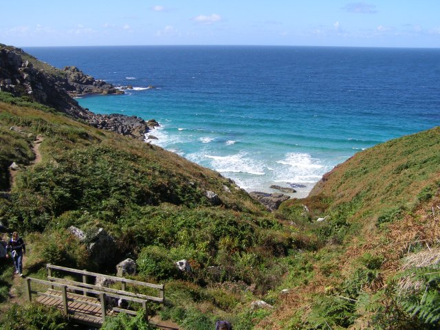
The cove is characterized by its pristine sandy beach, which stretches along the coastline and is framed by towering cliffs on either side. The crystal-clear waters of the sea provide a refreshing and inviting atmosphere, attracting swimmers, snorkelers, and water sport enthusiasts.

One of the notable features of Porthzennor Cove is the estuary that flows into the sea. This estuary is formed by the convergence of a river and the ocean, creating a unique ecosystem that is home to a diverse array of marine life. It is a popular spot for birdwatching, as numerous species of birds can be found nesting or feeding in the area.

Additionally, a small creek can be found within the cove, meandering through the landscape and offering a tranquil spot for visitors to relax. The creek is often used by kayakers and canoeists, who enjoy exploring its gentle currents and hidden nooks.

Surrounded by lush greenery and breathtaking coastal cliffs, Porthzennor Cove offers a serene and idyllic setting for nature lovers. Whether one is seeking a day of relaxation on the beach, an adventurous water sports experience, or a peaceful stroll along the estuary, this coastal gem in Cornwall has something to offer for everyone.

If you have any feedback on the listing, please let us know in the comments section below.

Porthzennor Cove Images

Images are sourced within 2km of 50.199159/-5.570524 or Grid Reference SW4539. Thanks to Geograph Open Source API. All images are credited.

Coast east of Mussel Point Viewed from the coastal footpath, Mussel Point is the point in the mid-distance. Far beyond, two further headlands show - these must be Zennor Head and furthest, Gurnard's Head.
Coast east of Mussel Point
Viewed from the coastal footpath, Mussel Point is the point in the mid-distance. Far beyond, two further headlands show - these must be Zennor Head and furthest, Gurnard's Head.
Stile by the Wicca Pool A local design of stile formed from granite blocks.
Stile by the Wicca Pool
A local design of stile formed from granite blocks.
Posted missing? The plate on the post gives the ref as SW465401, placing it to the north of the Wicca Pool gully. The stile beside which the post is located is in the wall to the south of the gully <a href="https://www.geograph.org.uk/photo/4079575">SW4640 : Stile by the Wicca Pool</a>. Even allowing for degrees of accuracy in the three figure ref, I couldn't get it to be where it should be.
Posted missing?
The plate on the post gives the ref as SW465401, placing it to the north of the Wicca Pool gully. The stile beside which the post is located is in the wall to the south of the gully SW4640 : Stile by the Wicca Pool. Even allowing for degrees of accuracy in the three figure ref, I couldn't get it to be where it should be.
Coast path above Mussel Point View to the south-west along the coast from the South West Coast Path above Mussel Point.
Coast path above Mussel Point
View to the south-west along the coast from the South West Coast Path above Mussel Point.
Coast path above Treveal Cliff The South West Coast Path passing above Treveal Cliff.
Coast path above Treveal Cliff
The South West Coast Path passing above Treveal Cliff.
Old wall above Cornelias Zawn Old wall above Cornelias Zawn with the Cornish coast beyond.
Old wall above Cornelias Zawn
Old wall above Cornelias Zawn with the Cornish coast beyond.
Mussel Point
Mussel Point
Economy Cove from the SWC path
Economy Cove and Mussel Point Zennor Head and Gurnard's Head can be seen in the distance.
Economy Cove and Mussel Point
Zennor Head and Gurnard's Head can be seen in the distance.
Economy Cove
Economy Cove
Wicca Pool seen from Mussel Point The prominent rock is Trilley Rock, in the adjacent square.
Wicca Pool seen from Mussel Point
The prominent rock is Trilley Rock, in the adjacent square.
Zawn on Wicca Cliff Next to Cornelias Zawn.
Zawn on Wicca Cliff
Next to Cornelias Zawn.
Green path near Treveal
Cliffs on Mussel Point Looking across Economy Cove.
Cliffs on Mussel Point
Looking across Economy Cove.
Coastal views near Zennor in the fading light
Footpath to Zennor Head
Zennor Cliff Trig Point Flush Bracket S8143
Stone Stile SW4438a One of several stiles on a footpath across fields in a westerly direction to Poniou. 
A simple coffen-type stile of granite slabs.
Public footpath 120/6/1 gold Trewey to Poniou.
Stone Stile SW4438a
One of several stiles on a footpath across fields in a westerly direction to Poniou. A simple coffen-type stile of granite slabs. Public footpath 120/6/1 gold Trewey to Poniou.
Show me another place!

Porthzennor Cove is located at Grid Ref: SW4539 (Lat: 50.199159, Lng: -5.570524)

Unitary Authority: Cornwall

Police Authority: Devon and Cornwall

What 3 Words

///deflated.snooty.exclusive. Near St Ives, Cornwall

Related Wikis

Zennor Head

Zennor Head is a 750-metre (2,460 ft) long promontory on the Cornish coast of England, between Pendour Cove and Porthzennor Cove. Facing the Atlantic...

Pendour Cove

Pendour Cove (grid reference SW447389) is a beach in west Cornwall, England, UK. It is about 1 mile northwest of the village of Zennor, and immediately...
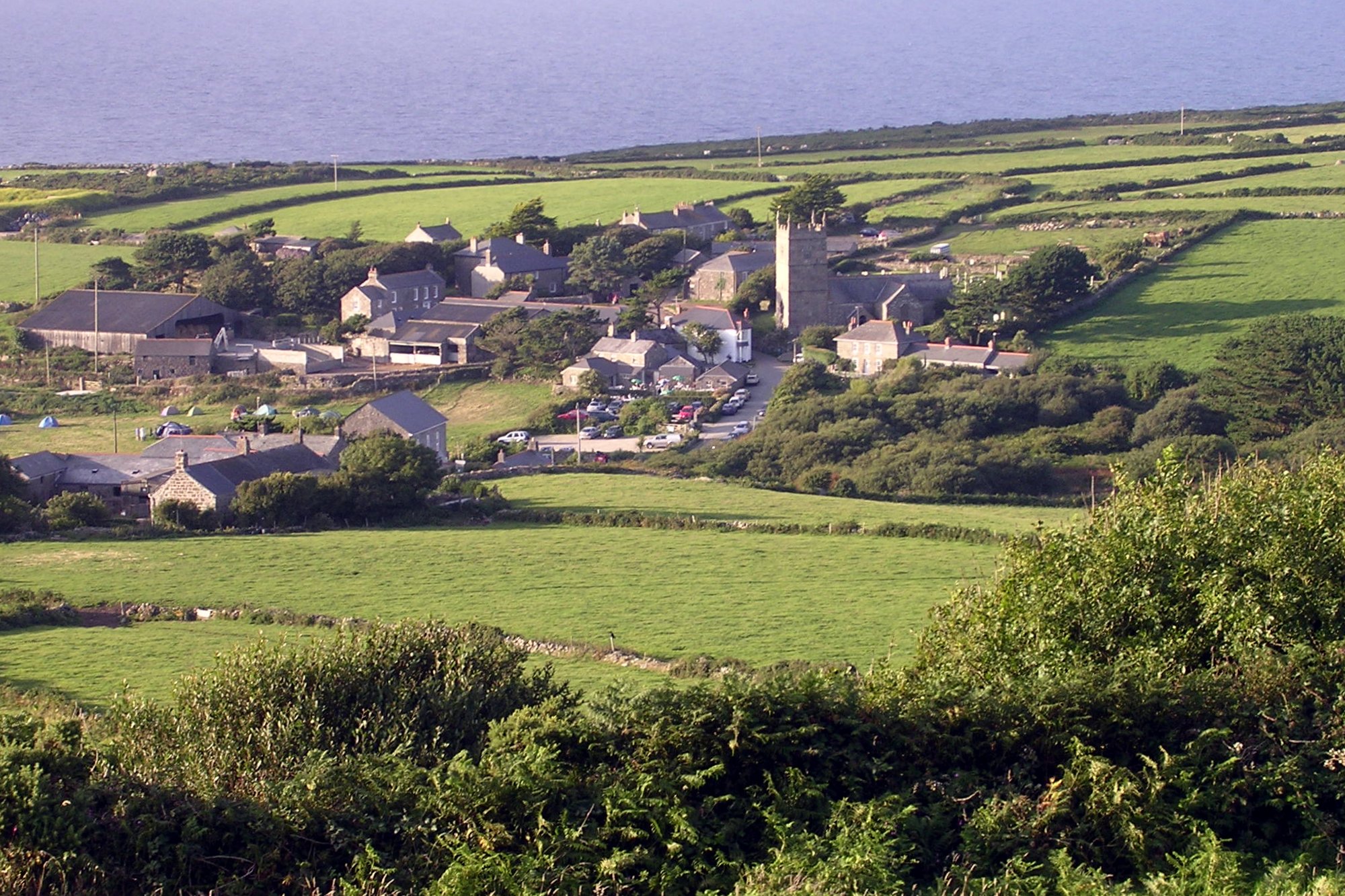
Zennor

Zennor is a village and civil parish in Cornwall, England, United Kingdom. The parish includes the villages of Zennor, Boswednack and Porthmeor and the...

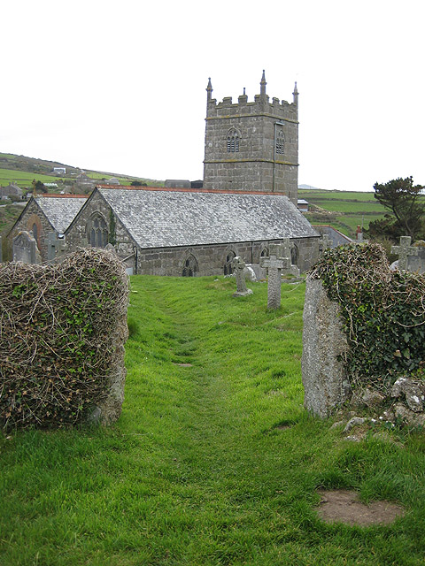
St Senara's Church, Zennor

St Senara's Church, in Zennor Churchtown, Cornwall, England, UK, is the parish church of the parish of Zennor. It is in the Deanery of Penwith, Archdeaconry...

Tinner's Arms

The Tinner's Arms is a Grade II-listed traditional Cornish pub in Zennor, Cornwall. The name is derived from the Tinners, with records of tin extraction...

Wayside Folk Museum

The Wayside Folk Museum was a small private museum situated in the village of Zennor in west Cornwall, United Kingdom. It was the oldest private museum...

Veor Cove

Veor Cove (grid reference SW444388) is a beach in Cornwall, UK. It is about 1 mile northwest of the village of Zennor, and immediately to the west of Pendour...

Poniou

Poniou or Ponjou is a hamlet west of Zennor in west Cornwall, England. The name is from Cornish "ponjow" meaning "bridges". == References ==

Nearby Amenities

Located within 500m of 50.199159,-5.570524
Source: Bing
Lat/Long: 50.1985173/-5.5701562
Source: Bing
Lat/Long: 50.1987658/-5.5697491
Entrance: yes
Lat/Long: 50.1955251/-5.5697465
Entrance: yes
Lat/Long: 50.1949894/-5.5687755
Entrance: yes
Lat/Long: 50.1951044/-5.5720934
Entrance: yes
Lat/Long: 50.1954663/-5.5720733
Entrance: yes
Lat/Long: 50.1959956/-5.5712968
Entrance: yes
Lat/Long: 50.1959097/-5.5710192
Entrance: yes
Lat/Long: 50.1952993/-5.5710286
Entrance: yes
Lat/Long: 50.1956384/-5.5717266
Entrance: yes
Lat/Long: 50.1947902/-5.5703098
Entrance: yes
Lat/Long: 50.1957157/-5.5715999
Entrance: yes
Lat/Long: 50.1954341/-5.5684269
Zennor Cliff
Description: OS trig pillar
Ele: 95.707
Man Made: survey_point
Note: Accurate location import for imagery offset calibration
Ref: S8143
Source: Ordnance Survey (OGL)
Survey Point: pillar
Lat/Long: 50.1975167/-5.5748278
The data included in this document is from www.openstreetmap.org. The data is made available under ODbL.

Have you been to Porthzennor Cove?

Leave your review of Porthzennor Cove below (or comments, questions and feedback).