Abhainn a' Chùirn

Sea, Estuary, Creek in Argyllshire

Scotland

Abhainn a' Chùirn

The summit of Beinn Oronsay A substantial and well-built cairn for a hill only 93m high.  But Oronsay is a popular island to visit. It is tidal, and can be easily walked to from Colonsay except near low tide. There are the ruins of an Augustinian priory nearby. And the hill is low, and an easy walk!

Just left of the cairn is Beinn Eibhne on the mainland of Colonsay.
The summit of Beinn Oronsay Credit: Michael Earnshaw

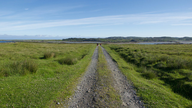
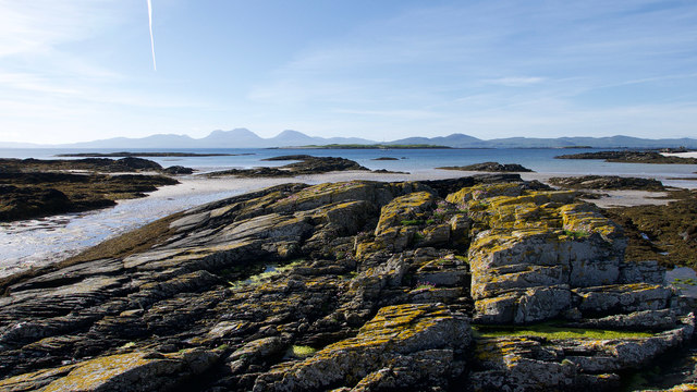
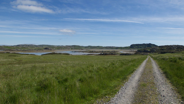
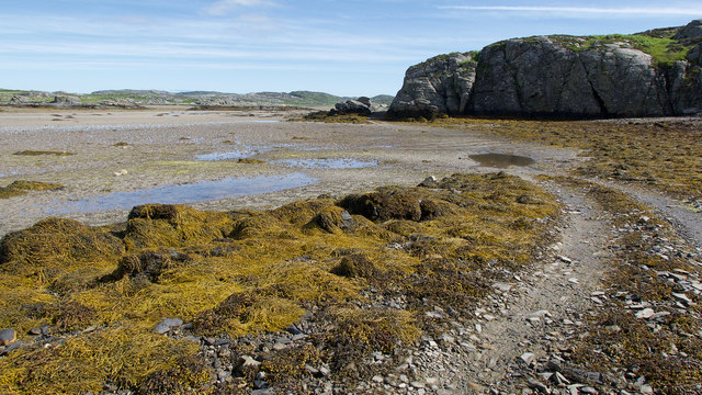
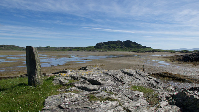
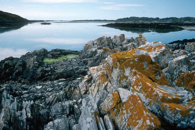
Abhainn a' Chùirn, also known as the Curran River, is a picturesque water body located in Argyllshire, Scotland. It is a combination of a sea, estuary, and creek, making it a unique and diverse natural feature.

The river begins its journey in the remote hills of Argyllshire, cascading down the rugged terrain before merging with the sea. As it flows, it carves out a beautiful valley, characterized by steep cliffs and lush greenery. The river's estuary is particularly noteworthy, as it provides a habitat for a wide variety of marine species. The estuary is home to various bird species, including oystercatchers, herons, and gulls, making it a popular spot for birdwatchers.

Abhainn a' Chùirn's creek meanders through the countryside, creating a serene and tranquil atmosphere. Its crystal-clear waters and rocky bed make it a perfect habitat for small fish and invertebrates.

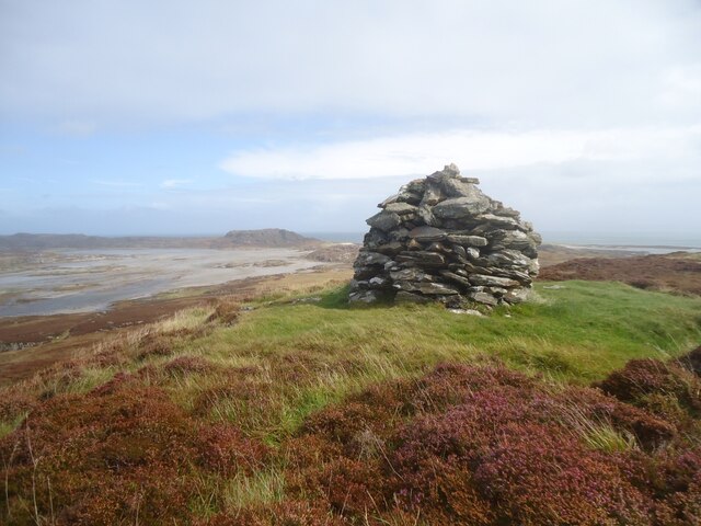
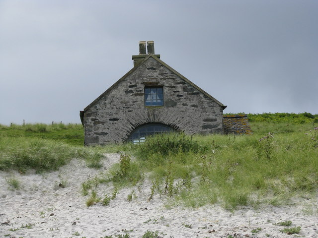
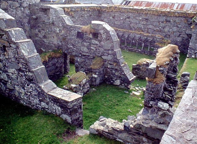
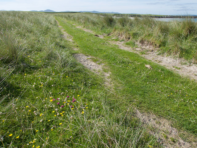
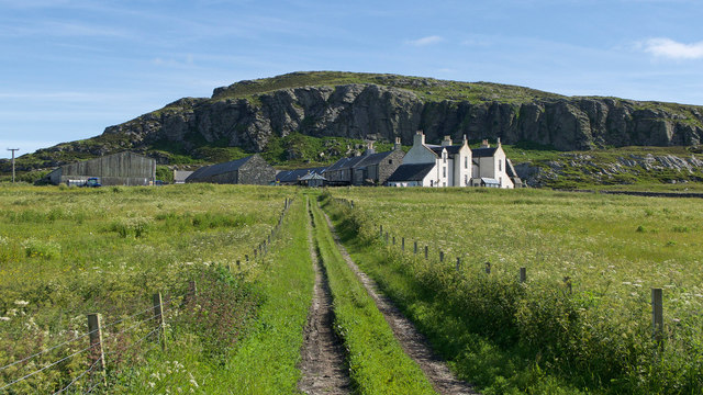
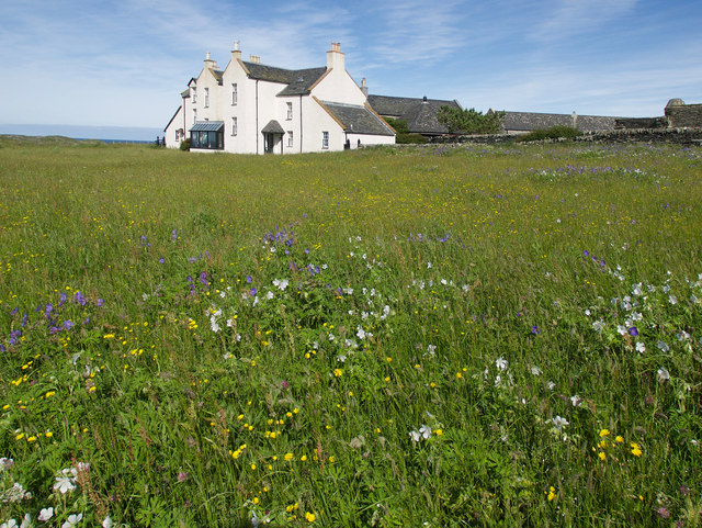
The surrounding landscape of Abhainn a' Chùirn is stunning, with rolling hills and towering mountains. The river's valley is dotted with ancient ruins and historic sites, adding to its charm and sense of history. The area is also popular for outdoor activities such as hiking, fishing, and boating.

Abhainn a' Chùirn is not only a natural beauty but also holds cultural significance. It has inspired local poets and artists throughout history, and its beauty continues to captivate visitors. Whether you are a nature enthusiast or a history buff, a visit to Abhainn a' Chùirn is sure to leave you in awe of its natural splendor and rich heritage.

If you have any feedback on the listing, please let us know in the comments section below.

Abhainn a' Chùirn Images

Images are sourced within 2km of 56.027467/-6.2485494 or Grid Reference NR3589. Thanks to Geograph Open Source API. All images are credited.

The summit of Beinn Oronsay A substantial and well-built cairn for a hill only 93m high.  But Oronsay is a popular island to visit. It is tidal, and can be easily walked to from Colonsay except near low tide. There are the ruins of an Augustinian priory nearby. And the hill is low, and an easy walk!

Just left of the cairn is Beinn Eibhne on the mainland of Colonsay.
The summit of Beinn Oronsay
A substantial and well-built cairn for a hill only 93m high. But Oronsay is a popular island to visit. It is tidal, and can be easily walked to from Colonsay except near low tide. There are the ruins of an Augustinian priory nearby. And the hill is low, and an easy walk! Just left of the cairn is Beinn Eibhne on the mainland of Colonsay.
An Taigh Cearc (The Hen House) This small dwelling is of a type common in the eighteenth century
An Taigh Cearc (The Hen House)
This small dwelling is of a type common in the eighteenth century
Seal Cottage A remote holiday cottage
Seal Cottage
A remote holiday cottage
Oronsay scarecrow Oronsay is an RSPB reserve which is farmed to encourage an increase in the population of corncrakes
Oronsay scarecrow
Oronsay is an RSPB reserve which is farmed to encourage an increase in the population of corncrakes
Stabilised walls in Oronsay Priory
Track to Oronsay Priory An excellent track connects the farmland of Oronsay with the tidal route across the Strand.
Track to Oronsay Priory
An excellent track connects the farmland of Oronsay with the tidal route across the Strand.
Rocks of Oronsay's east coast A delightful bay of rock and sand close to Seal Cottage. The Paps of Jura form a fitting backcloth.
Rocks of Oronsay's east coast
A delightful bay of rock and sand close to Seal Cottage. The Paps of Jura form a fitting backcloth.
Descent to the Strand A straight evenly falling path back to sea level.
Descent to the Strand
A straight evenly falling path back to sea level.
Land Rover track by the Strand, Oronsay Having crossed the Strand, the track hugs the coast before heading inland.
Land Rover track by the Strand, Oronsay
Having crossed the Strand, the track hugs the coast before heading inland.
Landfall markers for the Strand crossing, Oronsay An older standing stone on a prominent hillock and a newer marker at sea level show where the best route for crossing the Strand makes landfall.
Landfall markers for the Strand crossing, Oronsay
An older standing stone on a prominent hillock and a newer marker at sea level show where the best route for crossing the Strand makes landfall.
Mesolithic shell mound, Oronsay Cows grazing on an area of shell mounds.
Mesolithic shell mound, Oronsay
Cows grazing on an area of shell mounds.
On the west coast of Oronsay All the important elements.  A bay, machair, the home farm and Priory, Benn Oronsay and ---surprise, surprise --- a small building marked only on the most detailed maps.
On the west coast of Oronsay
All the important elements. A bay, machair, the home farm and Priory, Benn Oronsay and ---surprise, surprise --- a small building marked only on the most detailed maps.
Track through the machair These tracks are used daily by the RSPB staff who run around the island in their vehicles checking the welfare of the animals and birds.
Track through the machair
These tracks are used daily by the RSPB staff who run around the island in their vehicles checking the welfare of the animals and birds.
Track to Oronsay Farm and House From this angle Oronsay Priory is hidden behind the buildings.  The field adjacent to the track is full of wildflowers for the corncrakes who were rather noisy!
Track to Oronsay Farm and House
From this angle Oronsay Priory is hidden behind the buildings. The field adjacent to the track is full of wildflowers for the corncrakes who were rather noisy!
Wildflower meadow, Oronsay Located in front of the rather fine Oronsay House. The meadows are designed to provide habitat for the corncrakes that are attracted to the area.
Wildflower meadow, Oronsay
Located in front of the rather fine Oronsay House. The meadows are designed to provide habitat for the corncrakes that are attracted to the area.
Tombstones at Oronsay Priory Eighteen years on since <a href="https://www.geograph.org.uk/photo/3096272">NR3488 : Tombstones at Oronsay Priory</a>.  Spot the difference!

One of the roofed buildings of Oronsay Priory contains an array of tombstones. Of the two raised off the floor one is reputed to be that of Sir Alexander Macdonald of Lochalsh, who died about 1498.
Tombstones at Oronsay Priory
Eighteen years on since NR3488 : Tombstones at Oronsay Priory. Spot the difference! One of the roofed buildings of Oronsay Priory contains an array of tombstones. Of the two raised off the floor one is reputed to be that of Sir Alexander Macdonald of Lochalsh, who died about 1498.
The Strand between Colonsay and Oronsay After low tide the Strand fills with water and the oysters are happy while those on Oronsay must await the next low water to cross back to the shop or their ferry.  Yellow lichens are a feature of Colonsay.
The Strand between Colonsay and Oronsay
After low tide the Strand fills with water and the oysters are happy while those on Oronsay must await the next low water to cross back to the shop or their ferry. Yellow lichens are a feature of Colonsay.
Oronsay Priory and Farm The priory is a Scheduled Monument (see <span class="nowrap"><a title="http://portal.historicenvironment.scot/designation/SM287" rel="nofollow ugc noopener" href="http://portal.historicenvironment.scot/designation/SM287">Link</a><img style="margin-left:2px;" alt="External link" title="External link - shift click to open in new window" src="https://s1.geograph.org.uk/img/external.png" width="10" height="10"/></span> ).
Comparison with <a href="https://www.geograph.org.uk/photo/4403124">NR3488 : Oronsay Priory</a> shows that many of the farm buildings have been renovated since 1974.
Islay is on the horizon on the left.
Oronsay Priory and Farm
The priory is a Scheduled Monument (see LinkExternal link ). Comparison with NR3488 : Oronsay Priory shows that many of the farm buildings have been renovated since 1974. Islay is on the horizon on the left.
Show me another place!

Abhainn a' Chùirn is located at Grid Ref: NR3589 (Lat: 56.027467, Lng: -6.2485494)

Unitary Authority: Argyll and Bute

Police Authority: Argyll and West Dunbartonshire

What 3 Words

///assess.crown.committed. Near Scalasaig, Argyll & Bute

Related Wikis

Oronsay, Colonsay

Oronsay (Scottish Gaelic: Orasaigh), also sometimes spelt and pronounced Oransay by the local community, is a small tidal island south of Colonsay in the...
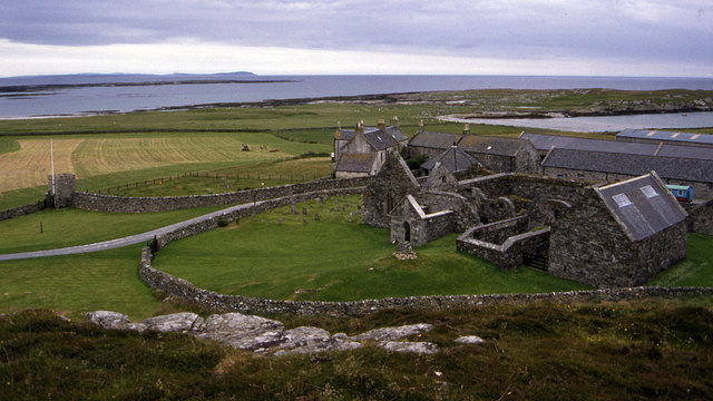
Oronsay Priory

Oronsay Priory was a monastery of canons regular on the island of Oronsay, Inner Hebrides, Argyll, off the coast of Scotland. It was in existence by 1353...

Ardskenish

Ardskenish is a hamlet on the island of Colonsay, in the civil parish of Colonsay and Oronsay, in the council area of Argyll and Bute, Scotland. ��2�...

Dùn Cholla

Dùn Cholla is a hill fort located on the Inner Hebridean island of Colonsay, Scotland. The site is located at grid reference NR37759150.According to tradition...

Nearby Amenities

Located within 500m of 56.027467,-6.2485494
Abhainn a' Chuirn
Natural: bay
Source Name: OS_OpenData_StreetView
Lat/Long: 56.0274841/-6.2451333
Caolas na Brathan
Natural: bay
Source Name: OS_OpenData_StreetView
Lat/Long: 56.0310122/-6.2513609
The data included in this document is from www.openstreetmap.org. The data is made available under ODbL.

Have you been to Abhainn a' Chùirn?

Leave your review of Abhainn a' Chùirn below (or comments, questions and feedback).