Beinn Oronsay

Hill, Mountain in Argyllshire

Scotland

Beinn Oronsay

The summit of Beinn Oronsay A substantial and well-built cairn for a hill only 93m high.  But Oronsay is a popular island to visit. It is tidal, and can be easily walked to from Colonsay except near low tide. There are the ruins of an Augustinian priory nearby. And the hill is low, and an easy walk!

Just left of the cairn is Beinn Eibhne on the mainland of Colonsay.
The summit of Beinn Oronsay Credit: Michael Earnshaw

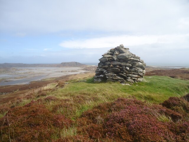
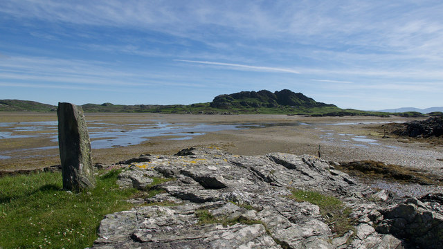
Beinn Oronsay is a prominent hill located in Argyllshire, Scotland. With an elevation of 413 meters (1,355 feet), it stands as an impressive landmark in the region. Situated near the village of Port Askaig on the Isle of Islay, Beinn Oronsay offers breathtaking views of the surrounding landscapes, including the nearby Sound of Islay and the Paps of Jura.

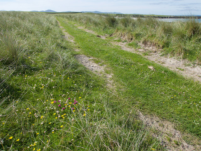
The hill is known for its diverse flora and fauna, making it a popular destination for nature enthusiasts and hikers. The lower slopes are covered in heather and grasses, while the higher regions feature rocky outcrops and scattered boulders. The hill is also home to a variety of bird species, including golden eagles and peregrine falcons, which can often be spotted soaring above its peaks.

Hiking to the summit of Beinn Oronsay is a rewarding experience, with several well-marked trails available for visitors. The ascent is moderate in difficulty, providing a suitable challenge for both seasoned hikers and beginners. From the top, hikers are treated to panoramic vistas of the surrounding landscapes, including the sparkling waters of the Sound of Islay and the picturesque hills of Argyllshire.

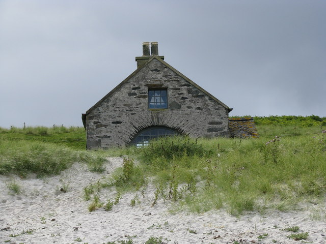
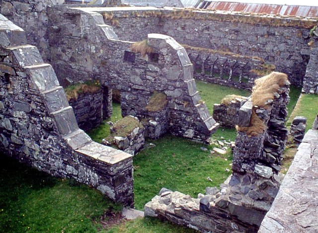
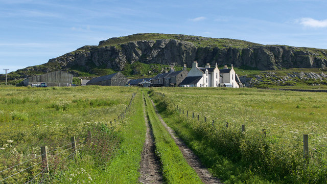
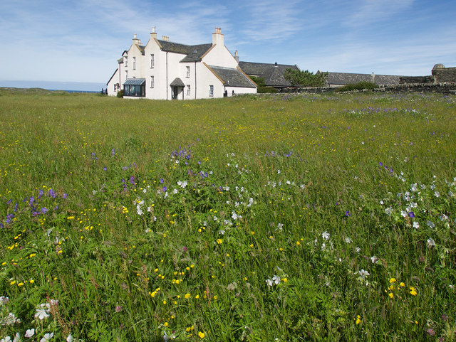
Beinn Oronsay is not only a natural wonder but also holds historical significance. At the base of the hill lies the remains of a chapel, dating back to the 14th century. The chapel is believed to have been a pilgrimage site and is now a popular spot for visitors to explore and learn about the region's history.

Overall, Beinn Oronsay is a captivating hill in Argyllshire that offers stunning views, diverse wildlife, and a glimpse into the area's rich history.

If you have any feedback on the listing, please let us know in the comments section below.

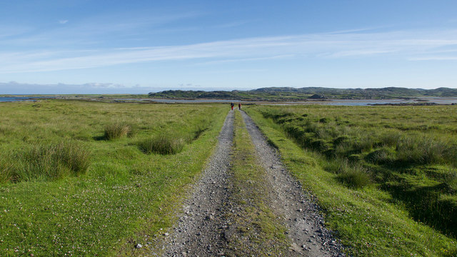
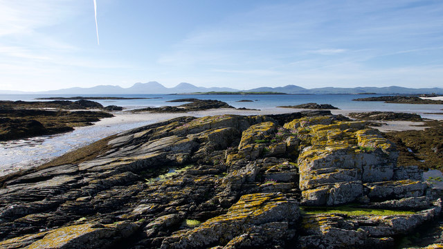
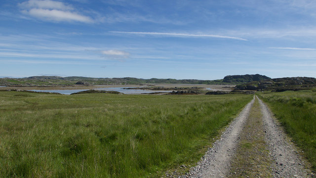
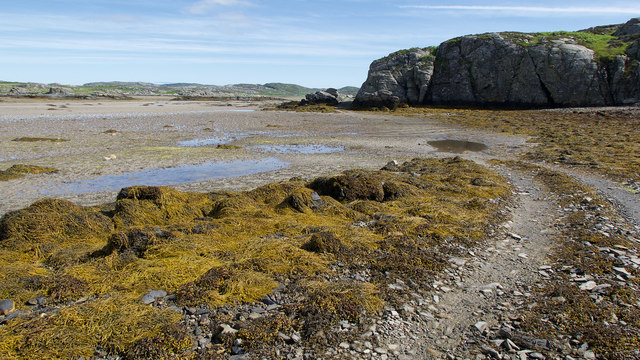
Beinn Oronsay Images

Images are sourced within 2km of 56.022317/-6.2528969 or Grid Reference NR3589. Thanks to Geograph Open Source API. All images are credited.

The summit of Beinn Oronsay A substantial and well-built cairn for a hill only 93m high.  But Oronsay is a popular island to visit. It is tidal, and can be easily walked to from Colonsay except near low tide. There are the ruins of an Augustinian priory nearby. And the hill is low, and an easy walk!

Just left of the cairn is Beinn Eibhne on the mainland of Colonsay.
The summit of Beinn Oronsay
A substantial and well-built cairn for a hill only 93m high. But Oronsay is a popular island to visit. It is tidal, and can be easily walked to from Colonsay except near low tide. There are the ruins of an Augustinian priory nearby. And the hill is low, and an easy walk! Just left of the cairn is Beinn Eibhne on the mainland of Colonsay.
An Taigh Cearc (The Hen House) This small dwelling is of a type common in the eighteenth century
An Taigh Cearc (The Hen House)
This small dwelling is of a type common in the eighteenth century
Seal Cottage A remote holiday cottage
Seal Cottage
A remote holiday cottage
Traigh Uamha Seilbhe A rarely visited beach in the south-west of Oronsay
Traigh Uamha Seilbhe
A rarely visited beach in the south-west of Oronsay
Oronsay scarecrow Oronsay is an RSPB reserve which is farmed to encourage an increase in the population of corncrakes
Oronsay scarecrow
Oronsay is an RSPB reserve which is farmed to encourage an increase in the population of corncrakes
Stabilised walls in Oronsay Priory
Track to Oronsay Priory An excellent track connects the farmland of Oronsay with the tidal route across the Strand.
Track to Oronsay Priory
An excellent track connects the farmland of Oronsay with the tidal route across the Strand.
Rocks of Oronsay's east coast A delightful bay of rock and sand close to Seal Cottage. The Paps of Jura form a fitting backcloth.
Rocks of Oronsay's east coast
A delightful bay of rock and sand close to Seal Cottage. The Paps of Jura form a fitting backcloth.
Descent to the Strand A straight evenly falling path back to sea level.
Descent to the Strand
A straight evenly falling path back to sea level.
Land Rover track by the Strand, Oronsay Having crossed the Strand, the track hugs the coast before heading inland.
Land Rover track by the Strand, Oronsay
Having crossed the Strand, the track hugs the coast before heading inland.
Landfall markers for the Strand crossing, Oronsay An older standing stone on a prominent hillock and a newer marker at sea level show where the best route for crossing the Strand makes landfall.
Landfall markers for the Strand crossing, Oronsay
An older standing stone on a prominent hillock and a newer marker at sea level show where the best route for crossing the Strand makes landfall.
Traigh Uamha Seilbhe, Oronsay A fine place to be in fine weather and at low tide.  Because the access to Oronsay is tidal, most view the coastline of Oronsay at the most favourable time for enjoying the beaches.
Traigh Uamha Seilbhe, Oronsay
A fine place to be in fine weather and at low tide. Because the access to Oronsay is tidal, most view the coastline of Oronsay at the most favourable time for enjoying the beaches.
Mesolithic shell mound, Oronsay Cows grazing on an area of shell mounds.
Mesolithic shell mound, Oronsay
Cows grazing on an area of shell mounds.
Bay on the west coast of Oronsay Low tide on a simple beach line.
Bay on the west coast of Oronsay
Low tide on a simple beach line.
On the west coast of Oronsay All the important elements.  A bay, machair, the home farm and Priory, Benn Oronsay and ---surprise, surprise --- a small building marked only on the most detailed maps.
On the west coast of Oronsay
All the important elements. A bay, machair, the home farm and Priory, Benn Oronsay and ---surprise, surprise --- a small building marked only on the most detailed maps.
Track through the machair These tracks are used daily by the RSPB staff who run around the island in their vehicles checking the welfare of the animals and birds.
Track through the machair
These tracks are used daily by the RSPB staff who run around the island in their vehicles checking the welfare of the animals and birds.
Track to Oronsay Farm and House From this angle Oronsay Priory is hidden behind the buildings.  The field adjacent to the track is full of wildflowers for the corncrakes who were rather noisy!
Track to Oronsay Farm and House
From this angle Oronsay Priory is hidden behind the buildings. The field adjacent to the track is full of wildflowers for the corncrakes who were rather noisy!
Wildflower meadow, Oronsay Located in front of the rather fine Oronsay House. The meadows are designed to provide habitat for the corncrakes that are attracted to the area.
Wildflower meadow, Oronsay
Located in front of the rather fine Oronsay House. The meadows are designed to provide habitat for the corncrakes that are attracted to the area.
Show me another place!

Beinn Oronsay is located at Grid Ref: NR3589 (Lat: 56.022317, Lng: -6.2528969)

Unitary Authority: Argyll and Bute

Police Authority: Argyll and West Dunbartonshire

What 3 Words

///beaks.potential.luxury. Near Scalasaig, Argyll & Bute

Related Wikis

Oronsay, Colonsay

Oronsay (Scottish Gaelic: Orasaigh), also sometimes spelt and pronounced Oransay by the local community, is a small tidal island south of Colonsay in the...

Oronsay Priory

Oronsay Priory was a monastery of canons regular on the island of Oronsay, Inner Hebrides, Argyll, off the coast of Scotland. It was in existence by 1353...

Ardskenish

Ardskenish is a hamlet on the island of Colonsay, in the civil parish of Colonsay and Oronsay, in the council area of Argyll and Bute, Scotland. ��2�...

Dùn Cholla

Dùn Cholla is a hill fort located on the Inner Hebridean island of Colonsay, Scotland. The site is located at grid reference NR37759150.According to tradition...

Nearby Amenities

Located within 500m of 56.022317,-6.2528969
Barrier: cattle_grid
Source: survey
Lat/Long: 56.0193842/-6.253457
Beinn Oronsay
Ele: 93
Name Gd: Beinn Orasaigh
Natural: peak
Lat/Long: 56.0221612/-6.2527778
Oronsay High Cross
Historic: wayside_cross
Lat/Long: 56.0198743/-6.254249
Oronsay Farm
Place: hamlet
Lat/Long: 56.019567/-6.2544877
Power: pole
Lat/Long: 56.0194809/-6.2502476
Power: pole
Lat/Long: 56.0194567/-6.2492063
Power: pole
Lat/Long: 56.0195099/-6.2470972
Power: pole
Lat/Long: 56.0194854/-6.2480659
The data included in this document is from www.openstreetmap.org. The data is made available under ODbL.

Have you been to Beinn Oronsay?

Leave your review of Beinn Oronsay below (or comments, questions and feedback).