Alt na Crìche

Sea, Estuary, Creek in Argyllshire

Scotland

Alt na Crìche

Small reef west from Rubha nan Leacan This small reef is the only land in NR3039 and lies below the cliffs from Beinn Mhor in the background to Rhubha nan Leacan which is behind the kayakers. On the map it looks like it might be the most southerly point in the Hebrides but my GPS track suggests it might be the tip of Rubha nan Leacan 0.25 miles to the east.
Small reef west from Rubha nan Leacan Credit: Douglas Wilcox

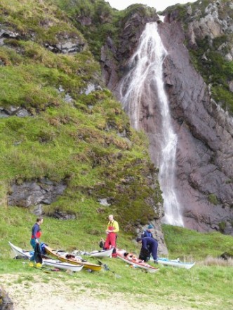
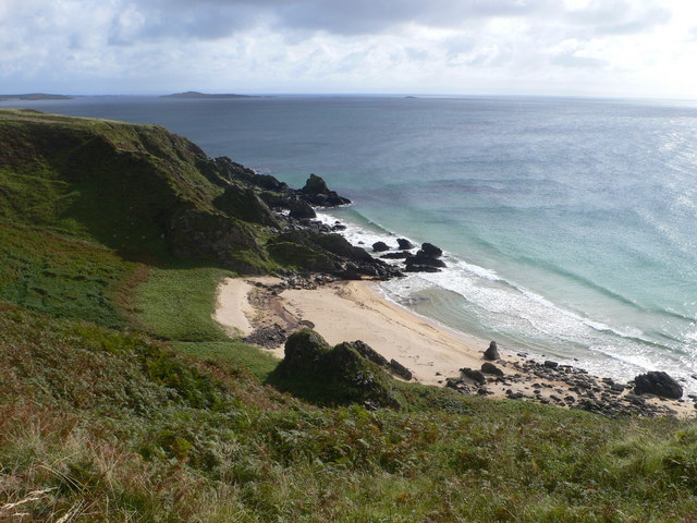
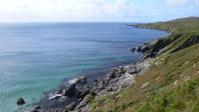
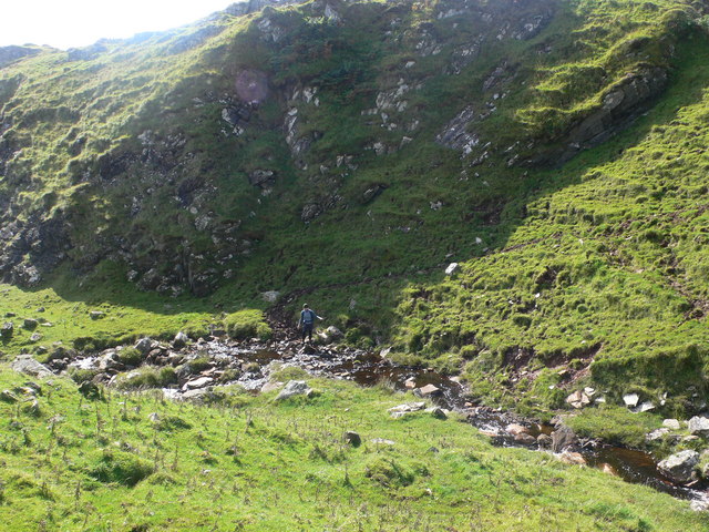
Alt na Crìche is a prominent geographical feature located in Argyllshire, Scotland. It is a picturesque sea estuary that stretches along the coastline, offering scenic beauty and a thriving ecosystem. The name "Alt na Crìche" translates to "the creek at the boundary" in Gaelic, hinting at its historical significance as a natural boundary between different regions.

The estuary is characterized by its wide expanse of water, which is influenced by the tidal movements of the nearby sea. The ebb and flow of the tides create a dynamic environment, supporting a diverse range of marine life. This includes various species of fish, shellfish, and crustaceans, which thrive in the nutrient-rich waters.

Alt na Crìche serves as an important habitat for numerous bird species, attracting both resident and migratory birds. The marshlands and mudflats that surround the estuary provide ideal feeding grounds for wading birds, such as herons, oystercatchers, and curlews. The area also supports a healthy population of seals, which can often be spotted basking on the rocky outcrops or swimming in the estuary.

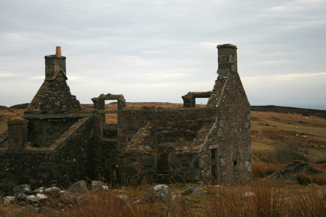
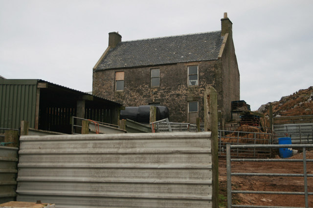
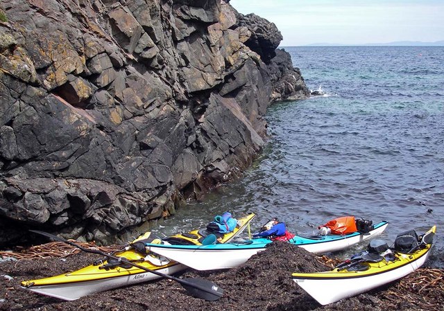
The estuary is surrounded by stunning natural landscapes, with rolling hills and rocky cliffs providing a picturesque backdrop. The shoreline is dotted with small settlements, offering charming views of traditional fishing boats and colorful houses. The area is also popular with outdoor enthusiasts, who can enjoy a range of activities including birdwatching, hiking, and kayaking.

Alt na Crìche is not only a beautiful natural feature but also an important ecological and cultural resource, contributing to the rich tapestry of Argyllshire's landscape.

If you have any feedback on the listing, please let us know in the comments section below.

Alt na Crìche Images

Images are sourced within 2km of 55.590224/-6.2531001 or Grid Reference NR3241. Thanks to Geograph Open Source API. All images are credited.

Small reef west from Rubha nan Leacan This small reef is the only land in NR3039 and lies below the cliffs from Beinn Mhor in the background to Rhubha nan Leacan which is behind the kayakers. On the map it looks like it might be the most southerly point in the Hebrides but my GPS track suggests it might be the tip of Rubha nan Leacan 0.25 miles to the east.
Small reef west from Rubha nan Leacan
This small reef is the only land in NR3039 and lies below the cliffs from Beinn Mhor in the background to Rhubha nan Leacan which is behind the kayakers. On the map it looks like it might be the most southerly point in the Hebrides but my GPS track suggests it might be the tip of Rubha nan Leacan 0.25 miles to the east.
Rhubha nan Leacan This reef at the end of Rhubha nan Leacan is the most southerly point in the Hebrides. Although it looks like this honour belongs to a small offshore reef 0.25 miles to the west, my GPS track suggests this is the most southerly point. Beyond the reef you can see the Mull of Oa tide race.
Rhubha nan Leacan
This reef at the end of Rhubha nan Leacan is the most southerly point in the Hebrides. Although it looks like this honour belongs to a small offshore reef 0.25 miles to the west, my GPS track suggests this is the most southerly point. Beyond the reef you can see the Mull of Oa tide race.
Rhubha nan Leacan The rock on the left, just off Rubha nan Leacan is probably the most southerly point in the Hebrides.
Rhubha nan Leacan
The rock on the left, just off Rubha nan Leacan is probably the most southerly point in the Hebrides.
Port na Luinge A fine camp site
Port na Luinge
A fine camp site
Old boat looking over Loch Ard Achadh
Going fishing on Loch Ard Achadh
Waypointer to the Lochs - Islay Signpost to Loch Kinnabus and Loch Nan Gillean as you leave Loch Ard Achadh - Islay
Waypointer to the Lochs - Islay
Signpost to Loch Kinnabus and Loch Nan Gillean as you leave Loch Ard Achadh - Islay
Loch Ard Achadh - Isle of Islay The School Loch
Loch Ard Achadh - Isle of Islay
The School Loch
Looking on to the bay at Port an Eas
Coastline south-west of Rubha Dubh Alt a' Mhadaidh
Burn at Carraig Bun Aibhne
Climbing towards Beinn Mhor
Inveraval, Islay This ruined cottage is situated on the south-east corner of the Oa peninsula. See <a href="https://www.geograph.org.uk/photo/2570071">NR3242 : Inveraval, Islay</a> for photo of the renovated property.
Inveraval, Islay
This ruined cottage is situated on the south-east corner of the Oa peninsula. See NR3242 : Inveraval, Islay for photo of the renovated property.
Ballychatrigan Farm, Islay A derelict farm on the Oa Peninsula.
Ballychatrigan Farm, Islay
A derelict farm on the Oa Peninsula.
Rubha na h-Uamha Rocky gully near Rubha na h-Uamha, access only from the sea.
Rubha na h-Uamha
Rocky gully near Rubha na h-Uamha, access only from the sea.
Loch Ard Achadh Loch Ard Achadh on Islay - Oa peninsula
Loch Ard Achadh
Loch Ard Achadh on Islay - Oa peninsula
School Loch  - Loch Ard Achadh The School Loch on Oa Peninsula Islay from Maol Beag
School Loch - Loch Ard Achadh
The School Loch on Oa Peninsula Islay from Maol Beag
Moorland near Stremnishmore, Islay With the deserted and ruined Stremnishmore farm in the distance.
Moorland near Stremnishmore, Islay
With the deserted and ruined Stremnishmore farm in the distance.
Show me another place!

Alt na Crìche is located at Grid Ref: NR3241 (Lat: 55.590224, Lng: -6.2531001)

Unitary Authority: Argyll and Bute

Police Authority: Argyll and West Dunbartonshire

What 3 Words

///sunbeam.copper.expert. Near Port Ellen, Argyll & Bute

Related Wikis

The Oa

The Oa ( OH) (Scottish Gaelic: An Obha) is a rocky peninsula in the southwest of the island of Islay, in Argyll, Scotland. It is an RSPB nature reserve...

Eas Mòr, upper

Eas Mor is a waterfall is a waterfall on the Abhainn Ghil on the island of Islay in Scotland. It lies on The Oa peninsula south of Giol and west of Lenavore...

Eas Mòr, lower

Eas Mor (lower) is a waterfall on the Abhainn Ghil on the island of Islay, in Scotland. It lies on the west coast of The Oa peninsula north of Lower Killeyan...

Port Ellen distillery

Port Ellen distillery is located in Port Ellen on the isle of Islay, Scotland. It initially operated between 1825 and 1983 when production shut down....

St John's Church, Port Ellen

St John's Church, Port Ellen is a Category B listed building in Port Ellen, Islay, Argyll and Bute, Scotland. == History == The memorial stone for the...

Port Ellen

Port Ellen (Scottish Gaelic: Port Ìlein) is a small town on the island of Islay, in Argyll, Scotland. The town is named after the wife of its founder,...

Texa

Texa (Scottish Gaelic: Teacsa) is a small island 700 metres (3⁄8 mile) directly south of Islay, in the Inner Hebrides, Scotland. It reaches a height of...

Laphroaig distillery

Laphroaig distillery ( lə-FROYG) is an Islay single malt Scotch whisky distillery. It is named after the area of land at the head of Loch Laphroaig on...

Have you been to Alt na Crìche?

Leave your review of Alt na Crìche below (or comments, questions and feedback).