Alt Aithlis

Sea, Estuary, Creek in Argyllshire

Scotland

Alt Aithlis

Three white rocks on heather The rocks are on heather moorland north-west of Beinn Mhòr which is the distant hill.
Three white rocks on heather Credit: Trevor Littlewood

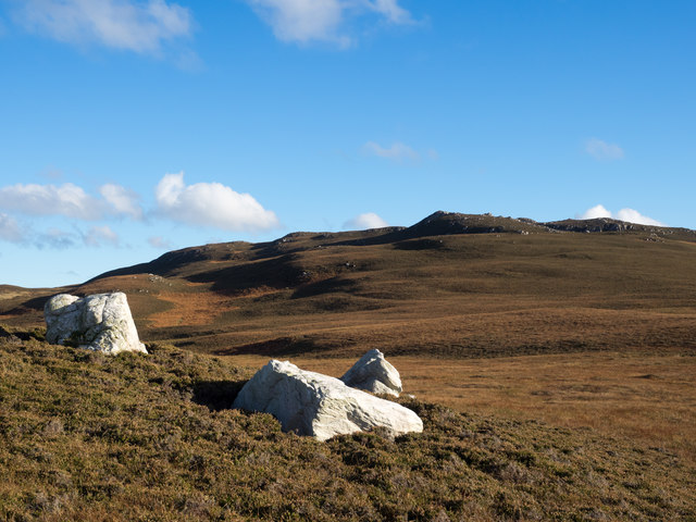
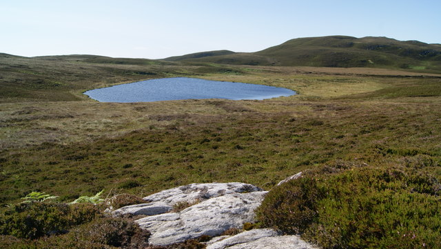
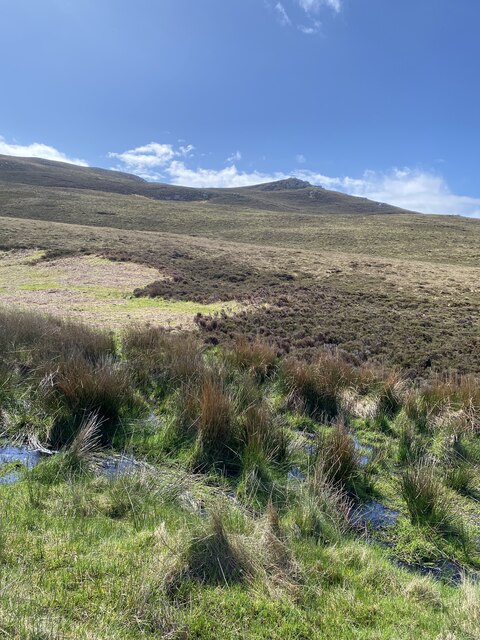
Alt Aithlis is a picturesque coastal area located in Argyllshire, Scotland. Situated on the west coast, it offers breathtaking views of the sea, estuary, and creek. The name "Alt Aithlis" derives from Scottish Gaelic, translating to "stream of the ford."

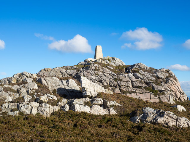
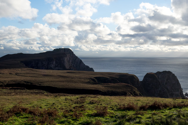
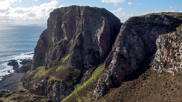
The area is characterized by its stunning natural beauty, with rugged cliffs, golden sandy beaches, and crystal-clear waters. The sea at Alt Aithlis is part of the Atlantic Ocean, providing a dramatic backdrop and a sense of tranquility. The azure waters offer opportunities for various recreational activities such as swimming, kayaking, and sailing.

The estuary at Alt Aithlis is formed where a river meets the sea, creating a unique ecosystem that supports a rich diversity of marine life. It is an ideal spot for birdwatching, as numerous species of birds can be spotted nesting and foraging in the surrounding wetlands.

A charming creek meanders through Alt Aithlis, providing a serene and peaceful environment. It is a perfect spot for leisurely walks, allowing visitors to immerse themselves in the beauty of the surrounding nature. The creek is also popular among anglers, who can enjoy fishing for a variety of fish species.

Alt Aithlis is a haven for nature lovers, offering a tranquil escape from the hustle and bustle of city life. Its captivating landscapes, idyllic beaches, and abundant wildlife make it a truly remarkable destination for outdoor enthusiasts and those seeking a rejuvenating experience in the heart of nature.

If you have any feedback on the listing, please let us know in the comments section below.

Alt Aithlis Images

Images are sourced within 2km of 55.580321/-6.2796868 or Grid Reference NR3040. Thanks to Geograph Open Source API. All images are credited.

Three white rocks on heather The rocks are on heather moorland north-west of Beinn Mhòr which is the distant hill.
Three white rocks on heather
The rocks are on heather moorland north-west of Beinn Mhòr which is the distant hill.
Trig point atop rock plinth The triangulation column is at the summit of Beinn Mhòr on The Oa peninsula, of Islay.
Trig point atop rock plinth
The triangulation column is at the summit of Beinn Mhòr on The Oa peninsula, of Islay.
Heather moorland beyond bracken Beyond the heather lies Beinn Mhòr and Dùn Athad is to the right of the notch against the sea.
Heather moorland beyond bracken
Beyond the heather lies Beinn Mhòr and Dùn Athad is to the right of the notch against the sea.
East face of Dùn Athad Dùn Athad is a striking feature of the south coast of The Oa.
It's attached to the bulk of the peninsula by a narrow neck of land which is possible, with care, to cross safely so to reach the summit; there's not the vertical rock step that might be suspected from the image.
East face of Dùn Athad
Dùn Athad is a striking feature of the south coast of The Oa. It's attached to the bulk of the peninsula by a narrow neck of land which is possible, with care, to cross safely so to reach the summit; there's not the vertical rock step that might be suspected from the image.
View towards Dun Athad from near the Mull of Oa
Trigpoint, Beinn Mhor, Islay
Loch na Beinne View of Loch na Beinne from the west on high ground.
Loch na Beinne
View of Loch na Beinne from the west on high ground.
Beinn Mhor Fourth Marilyn and second trig of the day after the American Monument with vaste wide views at 20:00. 
Name: Beinn Mhor
Hill number: 1471
Height: 202m / 663ft
Area: 20B: Islay
Class: Ma
Grid ref: NR 29481 40455
Summit feature: trig point
Drop: 177m
Col: 25m  NR347477
Beinn Mhor
Fourth Marilyn and second trig of the day after the American Monument with vaste wide views at 20:00. Name: Beinn Mhor Hill number: 1471 Height: 202m / 663ft Area: 20B: Islay Class: Ma Grid ref: NR 29481 40455 Summit feature: trig point Drop: 177m Col: 25m NR347477
Dùn Athad Seen from across Port nan Gallan on the path from the American Monument to Upper Killeyan, with Beinn Mhòr on the left.
Dùn Athad
Seen from across Port nan Gallan on the path from the American Monument to Upper Killeyan, with Beinn Mhòr on the left.
Beinn Mhòr, Islay Viewed from the sea. Beinn Mhòr (Big Mountain) is one of Islay's seven marilyns - A Marilyn is a mountain or hill in the United Kingdom, Republic of Ireland or Isle of Man with a relative height of at least 150 metres (492 ft), regardless of absolute height or other merit. (Wikipedia) It is also adorned by one of Islay's 35 trigpoints.
Beinn Mhòr, Islay
Viewed from the sea. Beinn Mhòr (Big Mountain) is one of Islay's seven marilyns - A Marilyn is a mountain or hill in the United Kingdom, Republic of Ireland or Isle of Man with a relative height of at least 150 metres (492 ft), regardless of absolute height or other merit. (Wikipedia) It is also adorned by one of Islay's 35 trigpoints.
Dùn Athad A dun on a promontory which is linked to the mainland by a natural causeway. 
For an aerial photo see: <span class="nowrap"><a title="http://www.scotlandsplaces.gov.uk/record/rcahms/37290/islay-dun-athad/rcahms" rel="nofollow ugc noopener" href="http://www.scotlandsplaces.gov.uk/record/rcahms/37290/islay-dun-athad/rcahms">Link</a><img style="margin-left:2px;" alt="External link" title="External link - shift click to open in new window" src="https://s1.geograph.org.uk/img/external.png" width="10" height="10"/></span>
Dùn Athad
A dun on a promontory which is linked to the mainland by a natural causeway. For an aerial photo see: LinkExternal link
Beinn Mhor summit, The Oa, Islay View from Beinn Mhor summit, The Oa, Islay looking in a westerly direction along the coast to the American Monument in the far distance.
Beinn Mhor summit, The Oa, Islay
View from Beinn Mhor summit, The Oa, Islay looking in a westerly direction along the coast to the American Monument in the far distance.
Views to Dun Athad and Mull of Oa
Onwards and upwards towards Beinn Mhor
Nearly there Beinn Mhor in the distance
Beinn Mhor Trig Point from a distance
Views from Beinn Mhor
Beinn Mhor Trig Point
Show me another place!

Alt Aithlis is located at Grid Ref: NR3040 (Lat: 55.580321, Lng: -6.2796868)

Unitary Authority: Argyll and Bute

Police Authority: Argyll and West Dunbartonshire

What 3 Words

///coconuts.starfish.index. Near Port Ellen, Argyll & Bute

Related Wikis

Eas Mòr, upper

Eas Mor is a waterfall is a waterfall on the Abhainn Ghil on the island of Islay in Scotland. It lies on The Oa peninsula south of Giol and west of Lenavore...

The Oa

The Oa ( OH) (Scottish Gaelic: An Obha) is a rocky peninsula in the southwest of the island of Islay, in Argyll, Scotland. It is an RSPB nature reserve...

Eas Mòr, lower

Eas Mor (lower) is a waterfall on the Abhainn Ghil on the island of Islay, in Scotland. It lies on the west coast of The Oa peninsula north of Lower Killeyan...

Port Ellen distillery

Port Ellen distillery is located in Port Ellen on the isle of Islay, Scotland. It initially operated between 1825 and 1983 when production shut down....

Have you been to Alt Aithlis?

Leave your review of Alt Aithlis below (or comments, questions and feedback).