Alt a' Chlèibh

Sea, Estuary, Creek in Argyllshire

Scotland

Alt a' Chlèibh

Lines of boulders on the Mull of Oa The boulder lines are indicated on OS maps, suggestive of walls but they're clearly not there as such now; perhaps they never were. If that's so it's hard to explain why effort would have been expended in their creation.
Lines of boulders on the Mull of Oa Credit: Trevor Littlewood

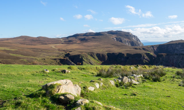
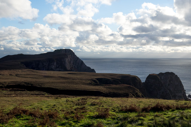
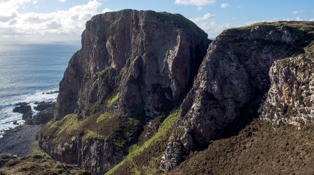
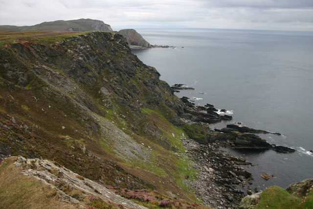
Alt a' Chlèibh is a picturesque coastal inlet located in Argyllshire, Scotland. Nestled within the stunning Scottish Highlands, this sea, estuary, and creek offers visitors a unique blend of natural beauty and tranquility.

The inlet is known for its crystal-clear turquoise waters and stunning panoramic views of the surrounding landscape. Its location within Argyllshire provides a diverse ecosystem, attracting a wide range of marine life and bird species. Visitors can expect to encounter various species of fish, seals, and seabirds during their visit.

Alt a' Chlèibh is a popular spot for water activities such as kayaking, sailing, and fishing. Its calm waters and gentle currents make it an ideal location for beginners and those looking for a peaceful day on the water. The creek offers a sheltered environment, making it perfect for exploring by small boat or canoe.

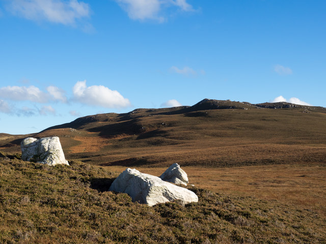
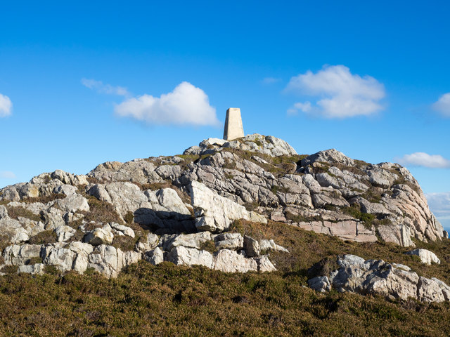
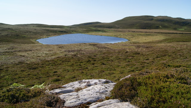
The surrounding area of Alt a' Chlèibh is rich in history and culture. Nearby, visitors can explore ancient ruins, castles, and archaeological sites that date back centuries. The rugged coastline and rolling hills provide ample opportunities for hiking, with trails that offer breathtaking views of the inlet and its surroundings.

For those seeking a tranquil retreat, Alt a' Chlèibh offers a peaceful and idyllic setting. Its untouched natural beauty and rich biodiversity make it a must-visit destination for nature enthusiasts and those looking to escape the hustle and bustle of everyday life.

If you have any feedback on the listing, please let us know in the comments section below.

Alt a' Chlèibh Images

Images are sourced within 2km of 55.580908/-6.2975663 or Grid Reference NR2940. Thanks to Geograph Open Source API. All images are credited.

Lines of boulders on the Mull of Oa The boulder lines are indicated on OS maps, suggestive of walls but they're clearly not there as such now; perhaps they never were. If that's so it's hard to explain why effort would have been expended in their creation.
Lines of boulders on the Mull of Oa
The boulder lines are indicated on OS maps, suggestive of walls but they're clearly not there as such now; perhaps they never were. If that's so it's hard to explain why effort would have been expended in their creation.
Three white rocks on heather The rocks are on heather moorland north-west of Beinn Mhòr which is the distant hill.
Three white rocks on heather
The rocks are on heather moorland north-west of Beinn Mhòr which is the distant hill.
Trig point atop rock plinth The triangulation column is at the summit of Beinn Mhòr on The Oa peninsula, of Islay.
Trig point atop rock plinth
The triangulation column is at the summit of Beinn Mhòr on The Oa peninsula, of Islay.
Heather moorland beyond bracken Beyond the heather lies Beinn Mhòr and Dùn Athad is to the right of the notch against the sea.
Heather moorland beyond bracken
Beyond the heather lies Beinn Mhòr and Dùn Athad is to the right of the notch against the sea.
East face of Dùn Athad Dùn Athad is a striking feature of the south coast of The Oa.
It's attached to the bulk of the peninsula by a narrow neck of land which is possible, with care, to cross safely so to reach the summit; there's not the vertical rock step that might be suspected from the image.
East face of Dùn Athad
Dùn Athad is a striking feature of the south coast of The Oa. It's attached to the bulk of the peninsula by a narrow neck of land which is possible, with care, to cross safely so to reach the summit; there's not the vertical rock step that might be suspected from the image.
Cliffs on the Mull of Oa The path runs alongside these steep cliffs as it leads to the American Monument on the Mull of Oa.
Cliffs on the Mull of Oa
The path runs alongside these steep cliffs as it leads to the American Monument on the Mull of Oa.
On the Oa The rugged coastline of the southern tip of Islay - the Oa has some quite spectacular cliffs and inaccessible bays.
On the Oa
The rugged coastline of the southern tip of Islay - the Oa has some quite spectacular cliffs and inaccessible bays.
From The Mull Of Oa The spectacular cliffs on the Mull of Oa, Islay’s southern point. This misty view looks towards Clèit a’ Glaisrig, then Sgeiran Buidhe and, in the distance, Beinn Mhor.
From The Mull Of Oa
The spectacular cliffs on the Mull of Oa, Islay’s southern point. This misty view looks towards Clèit a’ Glaisrig, then Sgeiran Buidhe and, in the distance, Beinn Mhor.
View towards Dun Athad from near the Mull of Oa
Trigpoint, Beinn Mhor, Islay
Caves at Port nan Gallan, Islay
Upper Killeyan Farm A farm close to the Mull of Oa.
Upper Killeyan Farm
A farm close to the Mull of Oa.
Port  nan Gallan Spectacular coastal scenery near the Mull of Oa.
Port nan Gallan
Spectacular coastal scenery near the Mull of Oa.
Sheep on the edge Sheep on the cliff edge above Port nan Gallan on the south coast of the Oa peninsula.
Sheep on the edge
Sheep on the cliff edge above Port nan Gallan on the south coast of the Oa peninsula.
Upper Killeyan Farm Highland cattle and other beef breeds at Upper Killeyan Farm.
Upper Killeyan Farm
Highland cattle and other beef breeds at Upper Killeyan Farm.
Loch na Beinne View of Loch na Beinne from the west on high ground.
Loch na Beinne
View of Loch na Beinne from the west on high ground.
Highland cow in Kinnabus Loch Cow standing in shallow water of Kinnabus Loch
Highland cow in Kinnabus Loch
Cow standing in shallow water of Kinnabus Loch
Beinn Mhor Fourth Marilyn and second trig of the day after the American Monument with vaste wide views at 20:00. 
Name: Beinn Mhor
Hill number: 1471
Height: 202m / 663ft
Area: 20B: Islay
Class: Ma
Grid ref: NR 29481 40455
Summit feature: trig point
Drop: 177m
Col: 25m  NR347477
Beinn Mhor
Fourth Marilyn and second trig of the day after the American Monument with vaste wide views at 20:00. Name: Beinn Mhor Hill number: 1471 Height: 202m / 663ft Area: 20B: Islay Class: Ma Grid ref: NR 29481 40455 Summit feature: trig point Drop: 177m Col: 25m NR347477
Show me another place!

Alt a' Chlèibh is located at Grid Ref: NR2940 (Lat: 55.580908, Lng: -6.2975663)

Unitary Authority: Argyll and Bute

Police Authority: Argyll and West Dunbartonshire

What 3 Words

///reseller.overlooks.imply. Near Port Ellen, Argyll & Bute

Related Wikis

Eas Mòr, upper

Eas Mor is a waterfall is a waterfall on the Abhainn Ghil on the island of Islay in Scotland. It lies on The Oa peninsula south of Giol and west of Lenavore...

Eas Mòr, lower

Eas Mor (lower) is a waterfall on the Abhainn Ghil on the island of Islay, in Scotland. It lies on the west coast of The Oa peninsula north of Lower Killeyan...

The Oa

The Oa ( OH) (Scottish Gaelic: An Obha) is a rocky peninsula in the southwest of the island of Islay, in Argyll, Scotland. It is an RSPB nature reserve...

Port Ellen distillery

Port Ellen distillery is located in Port Ellen on the isle of Islay, Scotland. It initially operated between 1825 and 1983 when production shut down....

Nearby Amenities

Located within 500m of 55.580908,-6.2975663
Beinn Mhòr
Corbett: no
Ele: 202
Graham: no
Marilyn: yes
Munro: no
Natural: peak
Prominence: 177
Lat/Long: 55.5824705/-6.2941358
The data included in this document is from www.openstreetmap.org. The data is made available under ODbL.

Have you been to Alt a' Chlèibh?

Leave your review of Alt a' Chlèibh below (or comments, questions and feedback).