Alt na h-Innse

Sea, Estuary, Creek in Argyllshire

Scotland

Alt na h-Innse

Lines of boulders on the Mull of Oa The boulder lines are indicated on OS maps, suggestive of walls but they're clearly not there as such now; perhaps they never were. If that's so it's hard to explain why effort would have been expended in their creation.
Lines of boulders on the Mull of Oa Credit: Trevor Littlewood

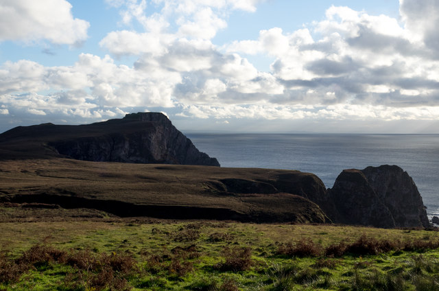
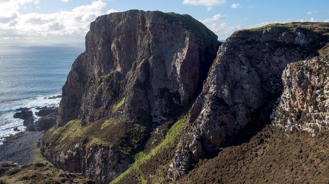
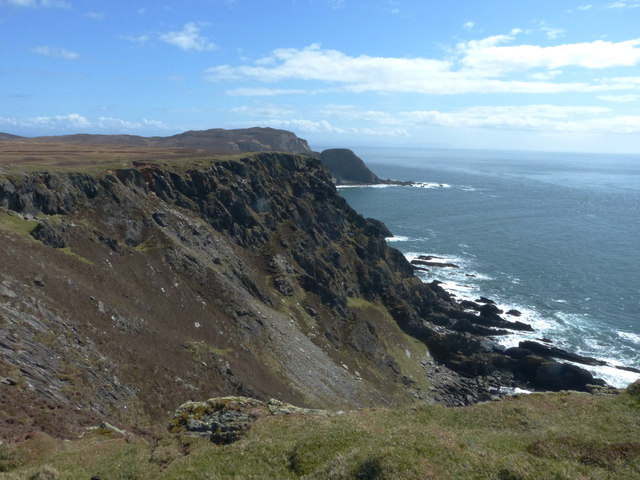
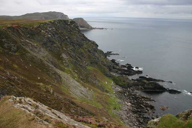
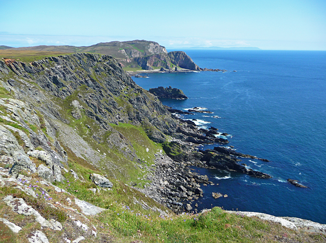
Alt na h-Innse is a picturesque sea inlet located in Argyllshire, Scotland. Situated along the western coast of Scotland, this estuary is known for its stunning natural beauty and diverse marine ecosystems. The name "Alt na h-Innse" translates to "the estuary of the meadow" in Gaelic, which is a fitting description of the area's lush greenery and abundant wildlife.

The estuary is formed by the convergence of several small creeks and rivers, creating a unique and ever-changing landscape. The tides play a significant role in shaping the estuary, causing the water levels to rise and fall dramatically throughout the day. This tidal action also creates a rich and fertile environment for a wide array of plant and animal life.

Alt na h-Innse is renowned for its diverse bird population, attracting avid birdwatchers from around the world. The estuary provides a vital habitat for numerous species, including waterfowl, wading birds, and migratory birds. The mudflats and salt marshes that surround the estuary serve as feeding grounds for these birds, offering an abundance of food sources.

The estuary is also a popular destination for outdoor enthusiasts and nature lovers. Its tranquil atmosphere, combined with the stunning coastal scenery, makes it an ideal location for activities such as kayaking, boating, and fishing. The surrounding area offers several walking trails and viewpoints, allowing visitors to explore and appreciate the natural beauty of Alt na h-Innse.

In conclusion, Alt na h-Innse is a captivating sea estuary in Argyllshire, Scotland, characterized by its scenic landscapes, diverse wildlife, and recreational opportunities. Whether one is a nature enthusiast, birdwatcher, or simply seeking a peaceful coastal retreat, Alt na h-Innse offers a truly enchanting experience.

If you have any feedback on the listing, please let us know in the comments section below.

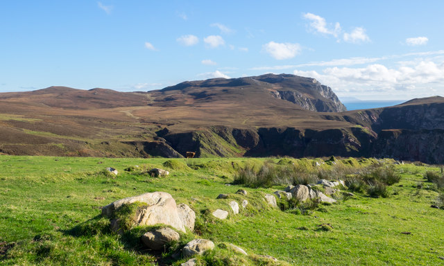
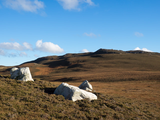
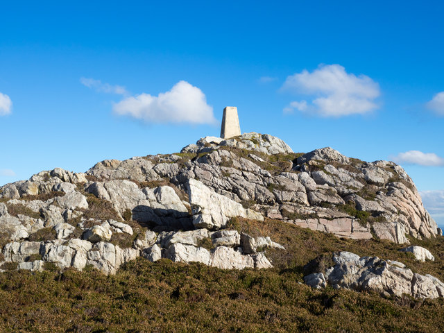
Alt na h-Innse Images

Images are sourced within 2km of 55.58204/-6.3004214 or Grid Reference NR2940. Thanks to Geograph Open Source API. All images are credited.

Lines of boulders on the Mull of Oa The boulder lines are indicated on OS maps, suggestive of walls but they're clearly not there as such now; perhaps they never were. If that's so it's hard to explain why effort would have been expended in their creation.
Lines of boulders on the Mull of Oa
The boulder lines are indicated on OS maps, suggestive of walls but they're clearly not there as such now; perhaps they never were. If that's so it's hard to explain why effort would have been expended in their creation.
Three white rocks on heather The rocks are on heather moorland north-west of Beinn Mhòr which is the distant hill.
Three white rocks on heather
The rocks are on heather moorland north-west of Beinn Mhòr which is the distant hill.
Trig point atop rock plinth The triangulation column is at the summit of Beinn Mhòr on The Oa peninsula, of Islay.
Trig point atop rock plinth
The triangulation column is at the summit of Beinn Mhòr on The Oa peninsula, of Islay.
Heather moorland beyond bracken Beyond the heather lies Beinn Mhòr and Dùn Athad is to the right of the notch against the sea.
Heather moorland beyond bracken
Beyond the heather lies Beinn Mhòr and Dùn Athad is to the right of the notch against the sea.
East face of Dùn Athad Dùn Athad is a striking feature of the south coast of The Oa.
It's attached to the bulk of the peninsula by a narrow neck of land which is possible, with care, to cross safely so to reach the summit; there's not the vertical rock step that might be suspected from the image.
East face of Dùn Athad
Dùn Athad is a striking feature of the south coast of The Oa. It's attached to the bulk of the peninsula by a narrow neck of land which is possible, with care, to cross safely so to reach the summit; there's not the vertical rock step that might be suspected from the image.
Old field boundary Grassed over dyke, Upper Killeyan.
Old field boundary
Grassed over dyke, Upper Killeyan.
Coastline at the Mull of Oa This view looks east a little way from the American Monument on the Mull of Oa.
Coastline at the Mull of Oa
This view looks east a little way from the American Monument on the Mull of Oa.
Cliffs on the Mull of Oa The path runs alongside these steep cliffs as it leads to the American Monument on the Mull of Oa.
Cliffs on the Mull of Oa
The path runs alongside these steep cliffs as it leads to the American Monument on the Mull of Oa.
On the Oa The rugged coastline of the southern tip of Islay - the Oa has some quite spectacular cliffs and inaccessible bays.
On the Oa
The rugged coastline of the southern tip of Islay - the Oa has some quite spectacular cliffs and inaccessible bays.
From The Mull Of Oa The spectacular cliffs on the Mull of Oa, Islay’s southern point. This misty view looks towards Clèit a’ Glaisrig, then Sgeiran Buidhe and, in the distance, Beinn Mhor.
From The Mull Of Oa
The spectacular cliffs on the Mull of Oa, Islay’s southern point. This misty view looks towards Clèit a’ Glaisrig, then Sgeiran Buidhe and, in the distance, Beinn Mhor.
View towards Dun Athad from near the Mull of Oa
Trigpoint, Beinn Mhor, Islay
Caves at Port nan Gallan, Islay
Cliffs south of the Mull of Oa
Upper Killeyan Farm A farm close to the Mull of Oa.
Upper Killeyan Farm
A farm close to the Mull of Oa.
Port  nan Gallan Spectacular coastal scenery near the Mull of Oa.
Port nan Gallan
Spectacular coastal scenery near the Mull of Oa.
Sheep on the edge Sheep on the cliff edge above Port nan Gallan on the south coast of the Oa peninsula.
Sheep on the edge
Sheep on the cliff edge above Port nan Gallan on the south coast of the Oa peninsula.
Upper Killeyan Farm Highland cattle and other beef breeds at Upper Killeyan Farm.
Upper Killeyan Farm
Highland cattle and other beef breeds at Upper Killeyan Farm.
Show me another place!

Alt na h-Innse is located at Grid Ref: NR2940 (Lat: 55.58204, Lng: -6.3004214)

Unitary Authority: Argyll and Bute

Police Authority: Argyll and West Dunbartonshire

What 3 Words

///funnels.landmark.spearing. Near Port Ellen, Argyll & Bute

Related Wikis

Eas Mòr, upper

Eas Mor is a waterfall is a waterfall on the Abhainn Ghil on the island of Islay in Scotland. It lies on The Oa peninsula south of Giol and west of Lenavore...

Eas Mòr, lower

Eas Mor (lower) is a waterfall on the Abhainn Ghil on the island of Islay, in Scotland. It lies on the west coast of The Oa peninsula north of Lower Killeyan...

The Oa

The Oa ( OH) (Scottish Gaelic: An Obha) is a rocky peninsula in the southwest of the island of Islay, in Argyll, Scotland. It is an RSPB nature reserve...

Port Ellen distillery

Port Ellen distillery is located in Port Ellen on the isle of Islay, Scotland. It initially operated between 1825 and 1983 when production shut down....

Nearby Amenities

Located within 500m of 55.58204,-6.3004214
Beinn Mhòr
Corbett: no
Ele: 202
Graham: no
Marilyn: yes
Munro: no
Natural: peak
Prominence: 177
Lat/Long: 55.5824705/-6.2941358
The data included in this document is from www.openstreetmap.org. The data is made available under ODbL.

Have you been to Alt na h-Innse?

Leave your review of Alt na h-Innse below (or comments, questions and feedback).