Alt nan Ròn

Sea, Estuary, Creek in Argyllshire

Scotland

Alt nan Ròn

Grasdale, The Oa, Islay There are many ruined villages and buildings on the Oa peninsula in south-west Islay. The population of this part of the island in 1830 was around 1500 - there's probably about a tenth of that number now! It is a very poignant experience to wander round this lonely, but beautiful, peninsula and think of times past and yet see the current living world all around which hasn't changed for centuries.
Grasdale, The Oa, Islay Credit: Becky Williamson

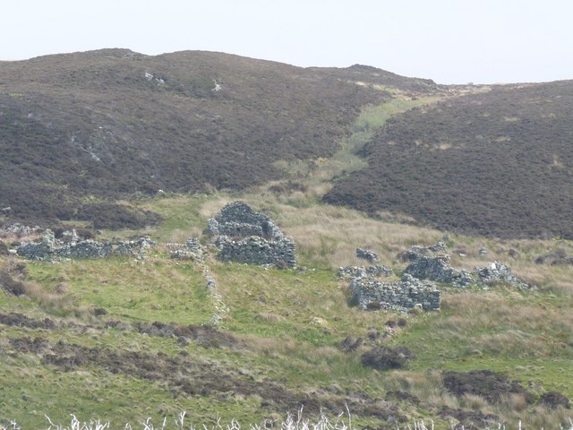
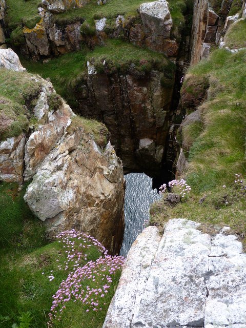
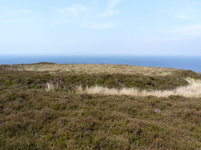
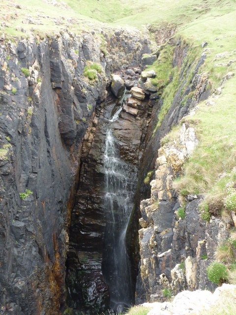
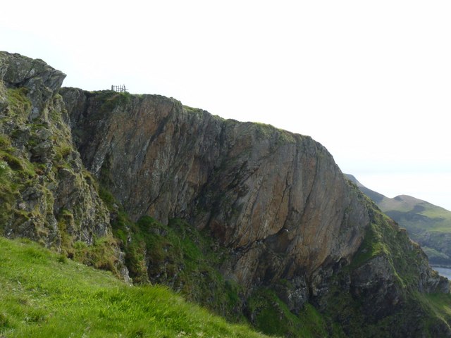
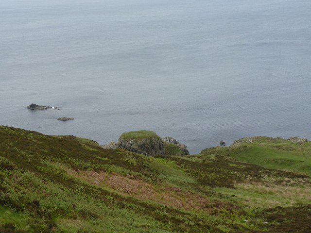
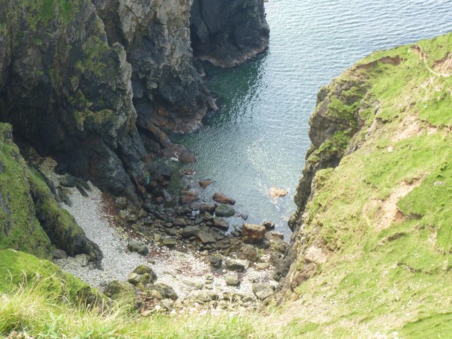
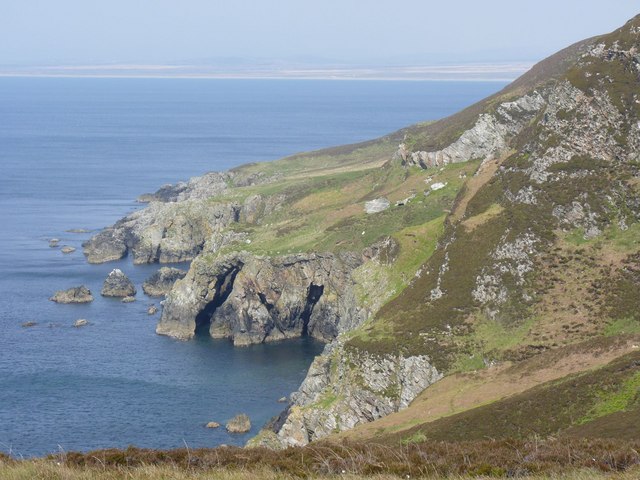
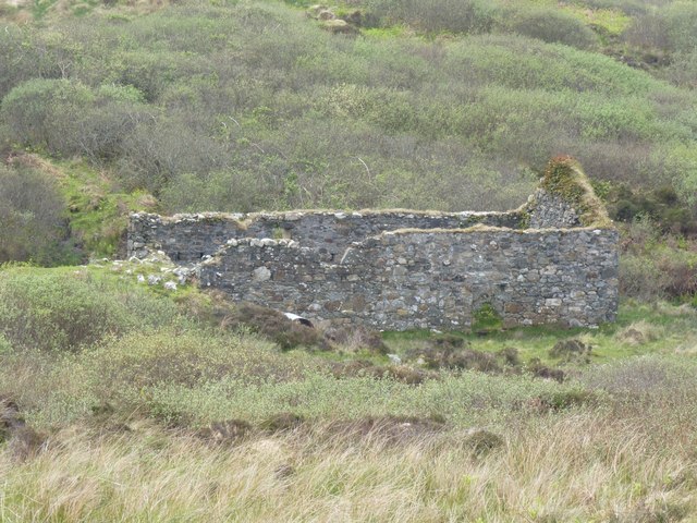
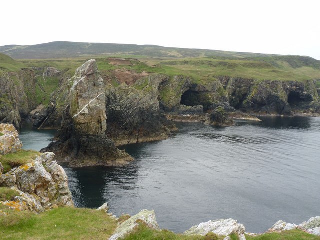
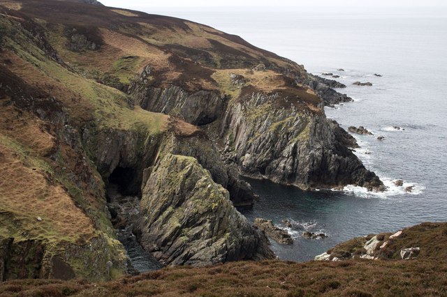
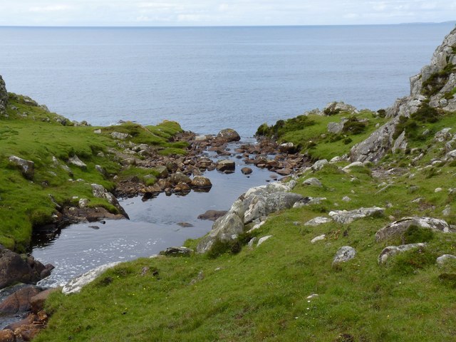
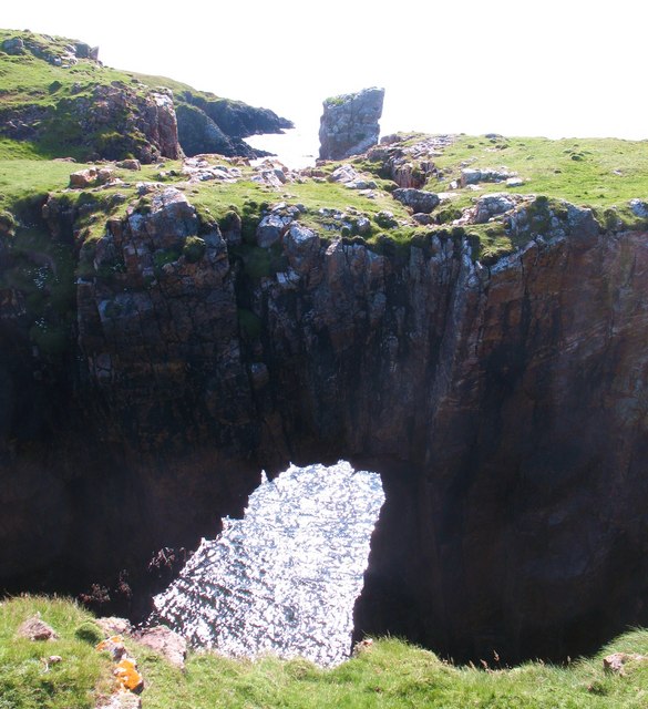
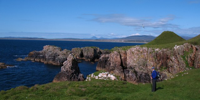
Alt nan Ròn is a picturesque sea inlet located in the region of Argyllshire, Scotland. This tranquil waterway, also referred to as a sea loch, estuary, or creek, stretches for approximately 2 kilometers and is flanked by stunning landscapes on either side.

The name "Alt nan Ròn" translates to "Stream of the Seals" in Gaelic, which is fitting as the area is known for its diverse marine wildlife. Seals can often be spotted basking on the rocky shores or gracefully swimming in the crystal-clear waters.

The inlet is surrounded by verdant hills and mountains, creating a dramatic backdrop that adds to its allure. Lush forests and vibrant vegetation thrive along its banks, providing a rich habitat for a variety of bird species, including herons, oystercatchers, and cormorants.

Alt nan Ròn is a haven for outdoor enthusiasts, attracting visitors who enjoy activities such as kayaking, boating, and fishing. The calm waters are perfect for exploring by boat or indulging in a peaceful paddle. Anglers are drawn to the area for its abundant fish population, including salmon, trout, and sea bass.

The surrounding area offers several walking trails, allowing visitors to immerse themselves in the breathtaking natural beauty of Argyllshire. The peacefulness and tranquility of Alt nan Ròn make it an ideal destination for those seeking a retreat from the hustle and bustle of everyday life.

Overall, Alt nan Ròn is a hidden gem in Argyllshire, offering a unique blend of stunning scenery, diverse wildlife, and recreational opportunities for nature lovers to enjoy.

If you have any feedback on the listing, please let us know in the comments section below.
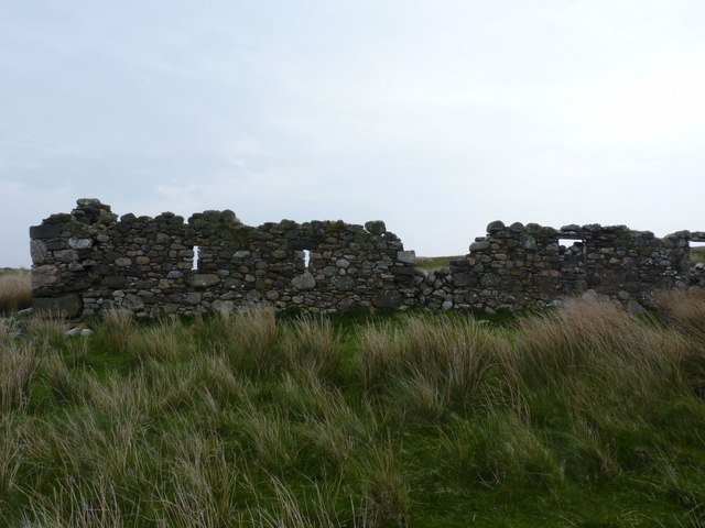
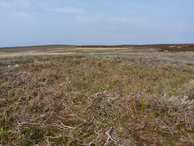
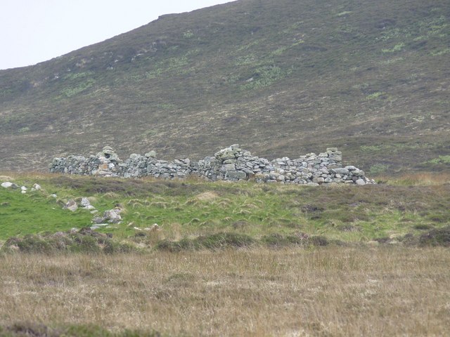
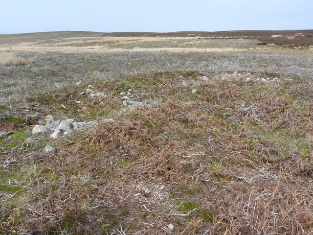
Alt nan Ròn Images

Images are sourced within 2km of 55.640847/-6.3103567 or Grid Reference NR2847. Thanks to Geograph Open Source API. All images are credited.

Grasdale, The Oa, Islay There are many ruined villages and buildings on the Oa peninsula in south-west Islay. The population of this part of the island in 1830 was around 1500 - there's probably about a tenth of that number now! It is a very poignant experience to wander round this lonely, but beautiful, peninsula and think of times past and yet see the current living world all around which hasn't changed for centuries.
Grasdale, The Oa, Islay
There are many ruined villages and buildings on the Oa peninsula in south-west Islay. The population of this part of the island in 1830 was around 1500 - there's probably about a tenth of that number now! It is a very poignant experience to wander round this lonely, but beautiful, peninsula and think of times past and yet see the current living world all around which hasn't changed for centuries.
Hut Circle in Glen Astle, Islay Quite difficult to see unless taken from the air.
Hut Circle in Glen Astle, Islay
Quite difficult to see unless taken from the air.
Disused shieling on the Oa, Islay
Part of the Hut Circle in Glen Astle, Islay
Lower Glenastle, Islay There are many ruined villages and buildings on the Oa peninsula in south-west Islay. The population of this part of the island in 1830 was around 1500 - there's probably about a tenth of that number now! It is a very poignant experience to wander round this lonely, but beautiful, peninsula and think of times past and yet see the current living world all around which hasn't changed for centuries.
Lower Glenastle, Islay
There are many ruined villages and buildings on the Oa peninsula in south-west Islay. The population of this part of the island in 1830 was around 1500 - there's probably about a tenth of that number now! It is a very poignant experience to wander round this lonely, but beautiful, peninsula and think of times past and yet see the current living world all around which hasn't changed for centuries.
Natural Arch near Soldier's Rock, Islay Viewed from above. It is possible to walk across this archway.
Natural Arch near Soldier's Rock, Islay
Viewed from above. It is possible to walk across this archway.
Earthwork near Bun an Easa, The Oa, Islay
Waterfall near Soldier's Rock, Islay
The end of the fence, the Oa, Islay Sea cliffs on Islay's magnificent Oa peninsula. The fence we crossed can be seen at the top of the cliff. I'm glad we didn't realise how close to the edge we were at the time!
The end of the fence, the Oa, Islay
Sea cliffs on Islay's magnificent Oa peninsula. The fence we crossed can be seen at the top of the cliff. I'm glad we didn't realise how close to the edge we were at the time!
Coastline on the Oa peninsula, Islay
Tiny beach at foot of precipitous cliffs on the Oa peninsula, Islay
Natural Arch on the Oa peninsula, Islay
Watermill, Glenastle, Islay There are many ruined villages and buildings on the Oa peninsula in south-west Islay. The population of this part of the island in 1830 was around 1500 - there's probably about a tenth of that number now! It is a very poignant experience to wander round this lonely, but beautiful, peninsula and think of times past and yet see the current living world all around which hasn't changed for centuries.
Watermill, Glenastle, Islay
There are many ruined villages and buildings on the Oa peninsula in south-west Islay. The population of this part of the island in 1830 was around 1500 - there's probably about a tenth of that number now! It is a very poignant experience to wander round this lonely, but beautiful, peninsula and think of times past and yet see the current living world all around which hasn't changed for centuries.
Soldier's Rock and Caves, The Oa, Islay
Caves at Bun an Easa, Islay
Abhainn Alt Astail The Astle River/Burn on the Oa Peninsula, Islay - where it drops into the sea.
Abhainn Alt Astail
The Astle River/Burn on the Oa Peninsula, Islay - where it drops into the sea.
Natural arch and Soldier's Rock A fascinating stretch of coast on the north side of the Oa. The stack of Soldier's Roch is seen over the top of the natural arch - one of many around Islay's coastline.
Natural arch and Soldier's Rock
A fascinating stretch of coast on the north side of the Oa. The stack of Soldier's Roch is seen over the top of the natural arch - one of many around Islay's coastline.
North Oa coastline The coastline of the Oa near to Soldier's Rock. The small conical hill in the picture makes a near perfect threesome with the Paps of Jura, which are visible in the distance.
North Oa coastline
The coastline of the Oa near to Soldier's Rock. The small conical hill in the picture makes a near perfect threesome with the Paps of Jura, which are visible in the distance.
Show me another place!

Alt nan Ròn is located at Grid Ref: NR2847 (Lat: 55.640847, Lng: -6.3103567)

Unitary Authority: Argyll and Bute

Police Authority: Argyll and West Dunbartonshire

What 3 Words

///currently.jolly.fuss. Near Port Ellen, Argyll & Bute

Related Wikis

The Oa

The Oa ( OH) (Scottish Gaelic: An Obha) is a rocky peninsula in the southwest of the island of Islay, in Argyll, Scotland. It is an RSPB nature reserve...

Eas Mòr, lower

Eas Mor (lower) is a waterfall on the Abhainn Ghil on the island of Islay, in Scotland. It lies on the west coast of The Oa peninsula north of Lower Killeyan...

Eas Mòr, upper

Eas Mor is a waterfall is a waterfall on the Abhainn Ghil on the island of Islay in Scotland. It lies on The Oa peninsula south of Giol and west of Lenavore...

Machrie golf course

The Machrie Golf Course, or "The Machrie Links", is located on Islay, in Scotland. The word "machrie" is a corruption of the Scottish Gaelic machair, which...

Islay Airport

Islay Airport (IATA: ILY, ICAO: EGPI) (also known as Glenegedale Airport) (Scottish Gaelic: Port-adhair Ìle) is located 4.5 nautical miles (8.3 kilometres...

River Laggan

The River Laggan is a small river on the Scottish island of Islay. Having gathered the waters of the Kilennan River, Barr River and Duich River / Torra...

Port Ellen distillery

Port Ellen distillery is located in Port Ellen on the isle of Islay, Scotland. It initially operated between 1825 and 1983 when production shut down....

St John's Church, Port Ellen

St John's Church, Port Ellen is a Category B listed building in Port Ellen, Islay, Argyll and Bute, Scotland. == History == The memorial stone for the...

Have you been to Alt nan Ròn?

Leave your review of Alt nan Ròn below (or comments, questions and feedback).