Suil an Iar

Sea, Estuary, Creek in Ross-shire

Scotland

Suil an Iar

Croft near Breasclete
Croft near Breasclete Credit: David Dixon

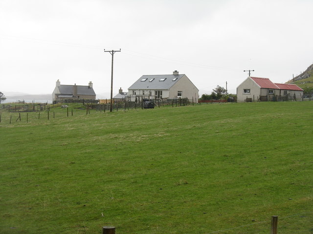
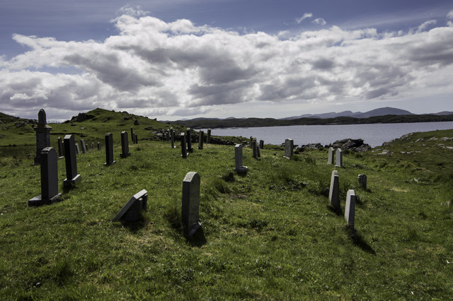
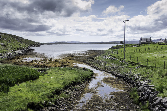
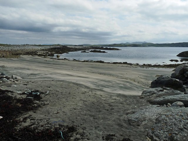
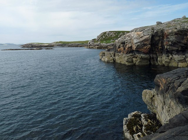
Suil an Iar is a picturesque coastal area located in Ross-shire, Scotland. Nestled between the stunning Highlands and the tranquil waters of the sea, it offers breathtaking views and a peaceful retreat for visitors and locals alike. The name "Suil an Iar" translates to "eye of the west" in Gaelic, perfectly capturing the area's captivating beauty.

This coastal region is characterized by its vast estuary and meandering creeks, which are home to a diverse range of flora and fauna. The estuary provides a vital habitat for a variety of bird species, making it a popular destination for birdwatching enthusiasts. Visitors can spot an array of wading birds, such as curlews, oystercatchers, and herons, as well as seabirds like gannets and terns.

The creek itself offers opportunities for recreational activities such as kayaking and boating, allowing visitors to explore the area's hidden coves and inlets. The crystal-clear waters are perfect for swimming on warm summer days, and the sandy shores provide a peaceful spot for sunbathing or picnicking.

Surrounded by lush green hills and rolling countryside, Suil an Iar is also a fantastic location for hiking and walking. There are numerous trails and paths that wind through the rugged landscape, offering panoramic views of the sea and the surrounding countryside.

With its stunning natural beauty, abundant wildlife, and outdoor recreational opportunities, Suil an Iar is a must-visit destination for those seeking a tranquil coastal escape in the heart of Ross-shire.

If you have any feedback on the listing, please let us know in the comments section below.

Suil an Iar Images

Images are sourced within 2km of 58.226606/-6.7944849 or Grid Reference NB1836. Thanks to Geograph Open Source API. All images are credited.

Croft near Breasclete
Old hardstandings at Tob Blar Meadha Abandoned lobster loading hardstandings at the lobster pond.
Old hardstandings at Tob Blar Meadha
Abandoned lobster loading hardstandings at the lobster pond.
Craft workshop in Kirkibost One of the old shellfish processing factories at Kirkibost (Circeabost) is now reborn as a craftshop.
Craft workshop in Kirkibost
One of the old shellfish processing factories at Kirkibost (Circeabost) is now reborn as a craftshop.
Cleibh ghiomaich aig cidhe Chirceabost Lobster creels at Kirkibost harbour
Cleibh ghiomaich aig cidhe Chirceabost
Lobster creels at Kirkibost harbour
Port a' Chaoil Stream flowing from Loch a' Bhaile enters Loch Rog an Ear, a sea loch, at Aird na Moine.
Port a' Chaoil
Stream flowing from Loch a' Bhaile enters Loch Rog an Ear, a sea loch, at Aird na Moine.
Loch a' Bhaile The narrow loch, hemmed in by steep hillsides, flows out into Loch Rog an Ear, a sea loch, via a short river.
Loch a' Bhaile
The narrow loch, hemmed in by steep hillsides, flows out into Loch Rog an Ear, a sea loch, via a short river.
Tolstachaolais: along the shore of Loch a' Bhaile Looking across the loch, which runs alongside the road through the village. However, this is the far side that we are looking along.
Tolstachaolais: along the shore of Loch a' Bhaile
Looking across the loch, which runs alongside the road through the village. However, this is the far side that we are looking along.
View towards Circebost Pier
Tolstachaolais: postbox № HS2 62 This postbox stands more or less in the centre of the village, in front of a house that is set particularly well back from the road. The larger-scale map still marks that house as a post office, although it has actually (as reflected in the 1:50,000 and 1:25,000 map) relocated just over a kilometre to the north - see <a href="https://www.geograph.org.uk/photo/3086624">NB1939 : Tolstachaolais: the post office</a>.
Tolstachaolais: postbox № HS2 62
This postbox stands more or less in the centre of the village, in front of a house that is set particularly well back from the road. The larger-scale map still marks that house as a post office, although it has actually (as reflected in the 1:50,000 and 1:25,000 map) relocated just over a kilometre to the north - see NB1939 : Tolstachaolais: the post office.
Tolstachaolais: hillside cows and Bernera view Looking across the sound separating the eastern side of Bernera from the Lewis mainland, beyond three cows grazing on the slopes to the south of Tolstachaolais village.
Tolstachaolais: hillside cows and Bernera view
Looking across the sound separating the eastern side of Bernera from the Lewis mainland, beyond three cows grazing on the slopes to the south of Tolstachaolais village.
Outlet from Loch a' Bhaile into Port a' Chaoil At the crofting community of Tolastadh a' Chaolais.
Outlet from Loch a' Bhaile into Port a' Chaoil
At the crofting community of Tolastadh a' Chaolais.
Loch a' Bhaile In the crofting community of Tolastadh a' Chaolais.
Loch a' Bhaile
In the crofting community of Tolastadh a' Chaolais.
Cnoc Feoal Part of the crofting community of Tolastadh a' Chaolais on the shores of Loch Ròg an Ear.
Cnoc Feoal
Part of the crofting community of Tolastadh a' Chaolais on the shores of Loch Ròg an Ear.
Burial ground at Tolsta Carloway
Loch a' Bhaile becomes the sea
Tràigh Shanndaig, Isle of Lewis Tràigh Shanndaig is a small beach on Loch Ròg an Ear.
Tràigh Shanndaig, Isle of Lewis
Tràigh Shanndaig is a small beach on Loch Ròg an Ear.
Coastline near Tolastadh Chaolais, Isle of Lewis Looking along Loch Ròg an Ear towards <a href="https://www.geograph.org.uk/photo/1965130">NB1143 : Seanna Chnoc (Seana Bheinn) behind Bearasaigh</a> on the horizon.
Coastline near Tolastadh Chaolais, Isle of Lewis
Looking along Loch Ròg an Ear towards NB1143 : Seanna Chnoc (Seana Bheinn) behind Bearasaigh on the horizon.
Croftland, Circebost, Great Bernera Looking across Loch Ròg an Ear (East Loch Roag) towards Eilean Chearstaigh.
Croftland, Circebost, Great Bernera
Looking across Loch Ròg an Ear (East Loch Roag) towards Eilean Chearstaigh.
Show me another place!

Suil an Iar is located at Grid Ref: NB1836 (Lat: 58.226606, Lng: -6.7944849)

Unitary Authority: Na h-Eileanan an Iar

Police Authority: Highlands and Islands

What 3 Words

///palaces.amphibian.manhole. Near Carloway, Na h-Eileanan Siar

Related Wikis

Ceabhaigh

Ceabhaigh is a small island in an arm of Loch Ròg on the west coast of Lewis in the Outer Hebrides of Scotland. It is about 25 hectares (62 acres) in extent...

Tolsta Chaolais

Tolsta Chaolais (also Tolastadh Chaolais, Tolstadh a' Chaolais) is a village on the Isle of Lewis, Scotland. It consists of about forty houses, clustered...

Breaclete

Breacleit (or Roulanish; Scottish Gaelic: Breacleit; Old Norse: Breiðiklettr) is the central village on Great Bernera in the Outer Hebrides, Scotland....

Callanish VIII

The Callanish VIII stone setting is one of many megalithic structures around the better-known (and larger) Calanais I on the west coast of the Isle of...

Nearby Amenities

Located within 500m of 58.226606,-6.7944849
Leisure: slipway
Source: Bing
Lat/Long: 58.2233329/-6.7974459
Suil an Ear
Natural: bay
Lat/Long: 58.2266926/-6.7923215
Suil an Iar
Natural: bay
Lat/Long: 58.2265965/-6.7945316
The data included in this document is from www.openstreetmap.org. The data is made available under ODbL.

Have you been to Suil an Iar?

Leave your review of Suil an Iar below (or comments, questions and feedback).