Camas an t-Seilisdeir

Sea, Estuary, Creek in Inverness-shire

Scotland

Camas an t-Seilisdeir

Tràigh Losgaintir at low tide
Tràigh Losgaintir at low tide Credit: Sandy Gerrard

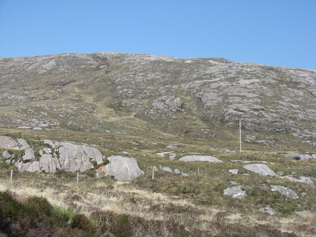
Camas an t-Seilisdeir, located in Inverness-shire, Scotland, is a picturesque coastal area characterized by its stunning sea views, estuary, and creek. Nestled between the stunning Scottish Highlands and the Moray Firth, this idyllic location offers a range of natural beauty and recreational opportunities.

The sea in Camas an t-Seilisdeir provides visitors with breathtaking vistas of the North Sea. The crystal-clear waters are home to a diverse range of marine life, making it a popular spot for fishing enthusiasts and wildlife observers. The sea also offers opportunities for various water sports, such as kayaking, sailing, and surfing.

The estuary in Camas an t-Seilisdeir is a prominent feature, where a river meets the sea. This convergence creates a unique ecosystem, supporting a rich array of flora and fauna. The estuary is an excellent place for birdwatching, as it attracts a variety of seabirds and wading birds throughout the year.

Within Camas an t-Seilisdeir, a tranquil creek winds its way through the landscape. This meandering waterway provides a serene environment for visitors to relax and enjoy the peaceful ambiance of the area. The creek is also an ideal spot for boating and canoeing, allowing visitors to explore the scenic surroundings at their own pace.

Overall, Camas an t-Seilisdeir in Inverness-shire is a haven for nature lovers and outdoor enthusiasts. Whether you are seeking a quiet retreat to enjoy the beauty of the sea, estuary, and creek or looking to engage in various activities, this coastal area offers a truly remarkable experience for all who visit.

If you have any feedback on the listing, please let us know in the comments section below.

Camas an t-Seilisdeir Images

Images are sourced within 2km of 57.870644/-6.911799 or Grid Reference NG0897. Thanks to Geograph Open Source API. All images are credited.

Tràigh Losgaintir at low tide
Double Rainbow at Seilebost
Coastline of Harris
Coastline of Harris
Coast of Harris
Coast of Harris
Tràigh Losgaintir Looking across the beach from the south side of the estuary.
Tràigh Losgaintir
Looking across the beach from the south side of the estuary.
Tràigh Losgaintir and Taransay Looking west to the island of Taransay, beyond the dunes of Luskentyre.
Tràigh Losgaintir and Taransay
Looking west to the island of Taransay, beyond the dunes of Luskentyre.
Abhainn Gil an Tàilleir runs through Tràigh Losgaintir The burn draining An Coileach runs into the estuary. Beyond is the rocky land of Frith Losgaintir.
Abhainn Gil an Tàilleir runs through Tràigh Losgaintir
The burn draining An Coileach runs into the estuary. Beyond is the rocky land of Frith Losgaintir.
Frith Losgaintir Seen from across the head of the Luskentyre estuary. Note the foreground covered with lugworm casts <a href="https://www.geograph.org.uk/photo/4991997">NG0897 : Lugworm casts at Luskentyre</a>.
Frith Losgaintir
Seen from across the head of the Luskentyre estuary. Note the foreground covered with lugworm casts NG0897 : Lugworm casts at Luskentyre.
Lugworm casts at Luskentyre Lugworms [polychaete worms - Arenicola marina] live in U-shaped, mucus lined burrows in sand. The depressions in the sand mark the entrance to a burrow, where sand is taken in; after processing to extract nutrients the sand is excreted as a cast at the other end. They occurred in abundance in the sands near the head of the Luskentyre estuary <a href="https://www.geograph.org.uk/photo/4991983">NG0897 : Frith Losgaintir</a>.
Lugworm casts at Luskentyre
Lugworms [polychaete worms - Arenicola marina] live in U-shaped, mucus lined burrows in sand. The depressions in the sand mark the entrance to a burrow, where sand is taken in; after processing to extract nutrients the sand is excreted as a cast at the other end. They occurred in abundance in the sands near the head of the Luskentyre estuary NG0897 : Frith Losgaintir.
Marks in the sand at Luskentyre Caused by the siphons of a bivalve mollusc, the Peppery Furrow Shell [Scrobicularia plana]. Digging down would reveal the animals at the centre of the radiating depressions left by the inhalant and exhalant tubes.
Marks in the sand at Luskentyre
Caused by the siphons of a bivalve mollusc, the Peppery Furrow Shell [Scrobicularia plana]. Digging down would reveal the animals at the centre of the radiating depressions left by the inhalant and exhalant tubes.
Tràigh Losgaintir Looking west, across the estuary of Losgaintir, with the isle of Taransay/Tarasaigh in the distance.
Tràigh Losgaintir
Looking west, across the estuary of Losgaintir, with the isle of Taransay/Tarasaigh in the distance.
Tràigh Losgaintir Looking out over the estuary. A wide estuary, but not created by any large rivers - the catchment from An Coileach  and four other small peaks is fairly small.
Tràigh Losgaintir
Looking out over the estuary. A wide estuary, but not created by any large rivers - the catchment from An Coileach and four other small peaks is fairly small.
The road from Luskentyre With the upper reaches of the estuary beyond.
The road from Luskentyre
With the upper reaches of the estuary beyond.
Rocky coast at Luskentyre Looking south east across the estuary to the hills of Harris.
Rocky coast at Luskentyre
Looking south east across the estuary to the hills of Harris.
The head of the Luskentyre estuary Looking south, across to buildings on the south shore, associated with a trout fishery on Loch Fincastle, which is out of sight on the left. For a reciprocal view see Mike Pennington's picture <a href="https://www.geograph.org.uk/photo/2550261">NG0997 : Loch Fincastle, Luskentyre</a>.
The head of the Luskentyre estuary
Looking south, across to buildings on the south shore, associated with a trout fishery on Loch Fincastle, which is out of sight on the left. For a reciprocal view see Mike Pennington's picture NG0997 : Loch Fincastle, Luskentyre.
Holm Beag A rocky projection from the north shore into Camas an t-Seilisdeir at the head of the Luskentyre estuary.
Holm Beag
A rocky projection from the north shore into Camas an t-Seilisdeir at the head of the Luskentyre estuary.
Frith Losgaintir Looking across Gleann Tobhtan 'ic Fannan to Sròn Godamuil. Part of a large area of rocky grassland in North Harris.
Frith Losgaintir
Looking across Gleann Tobhtan 'ic Fannan to Sròn Godamuil. Part of a large area of rocky grassland in North Harris.
Start of the coffin road
Show me another place!

Camas an t-Seilisdeir is located at Grid Ref: NG0897 (Lat: 57.870644, Lng: -6.911799)

Unitary Authority: Na h-Eileanan an Iar

Police Authority: Highlands and Islands

What 3 Words

///producing.dock.expiring. Near Tarbert, Na h-Eileanan Siar

Related Wikis

Luskentyre

Luskentyre (Scottish Gaelic: Losgaintir) is a sparse settlement on the west coast of Harris, in the Outer Hebrides, Scotland. Luskentyre is situated within...

Borve, Harris

Borve (Scottish Gaelic: Na Buirgh) is a village in Harris in the Outer Hebrides, Scotland. Borve is also within the parish of Harris, and is on the A859...

West Loch Tarbert

West Loch Tarbert (Scottish Gaelic: Loch A Siar) is a sea loch that separates the northern and southern parts of Harris in the Outer Hebrides of Scotland...

Harris, Outer Hebrides

Harris (Scottish Gaelic: Na Hearadh, pronounced [nə ˈhɛɾəɣ] ) is the southern and more mountainous part of Lewis and Harris, the largest island in the...

Nearby Amenities

Located within 500m of 57.870644,-6.911799
Passing Place
Lat/Long: 57.8711409/-6.9066759
Passing Place
Lat/Long: 57.8733582/-6.9157349
Passing Place
Lat/Long: 57.87275/-6.9138788
Passing Place
Lat/Long: 57.8725579/-6.9130618
Passing Place
Lat/Long: 57.8723119/-6.9110937
Passing Place
Lat/Long: 57.8718171/-6.9085964
Passing Place
Lat/Long: 57.8711181/-6.9052785
Parking
Capacity: 4
Fee: no
Lat/Long: 57.8722657/-6.9110881
Passing Place
Lat/Long: 57.8679933/-6.9054813
Material: wood
Power: pole
Lat/Long: 57.8740237/-6.9163143
Passing Place
Lat/Long: 57.8714213/-6.9042665
Passing Place
Lat/Long: 57.8680294/-6.907873
Passing Place
Lat/Long: 57.8680159/-6.907162
Passing Place
Lat/Long: 57.8671178/-6.9142388
Power: pole
Lat/Long: 57.8682693/-6.9048563
Power: pole
Lat/Long: 57.871922/-6.9038423
Power: pole
Lat/Long: 57.8721232/-6.9052506
Power: pole
Lat/Long: 57.8723142/-6.9066856
Power: pole
Lat/Long: 57.8724983/-6.908048
Power: pole
Lat/Long: 57.8727094/-6.9094992
Power: pole
Lat/Long: 57.8731916/-6.9130156
Power: pole
Lat/Long: 57.8729005/-6.9109771
Power: pole
Lat/Long: 57.8665746/-6.9083577
Power: pole
Lat/Long: 57.8669528/-6.9078456
Power: pole
Lat/Long: 57.8674649/-6.9071848
Barrier: bollard
Lat/Long: 57.8723877/-6.9097911
The data included in this document is from www.openstreetmap.org. The data is made available under ODbL.

Have you been to Camas an t-Seilisdeir?

Leave your review of Camas an t-Seilisdeir below (or comments, questions and feedback).