Camas a' Bhuic

Sea, Estuary, Creek in Inverness-shire

Scotland

Camas a' Bhuic

Horsanais Point Quite a prominent headland in West Loch Tarbert. Ben Luskentyre centre and Isle Taransay to right of frame.
Horsanais Point Credit: JJM

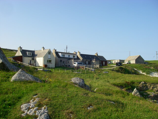
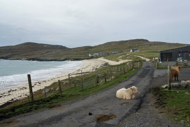
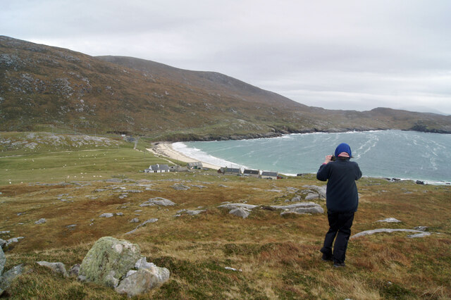
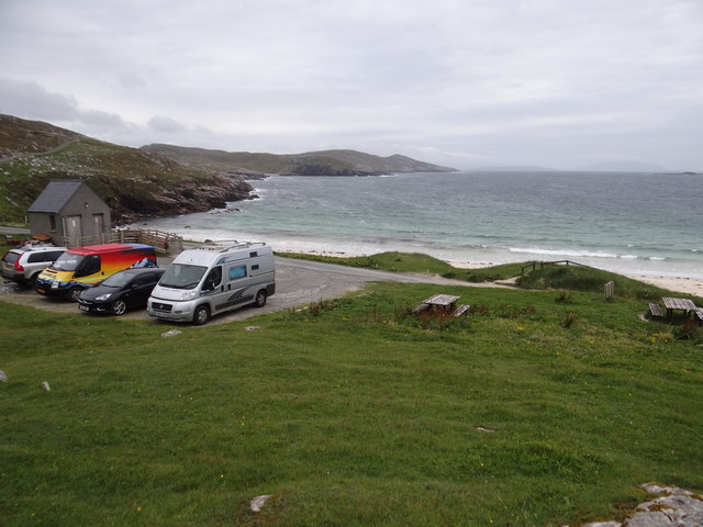
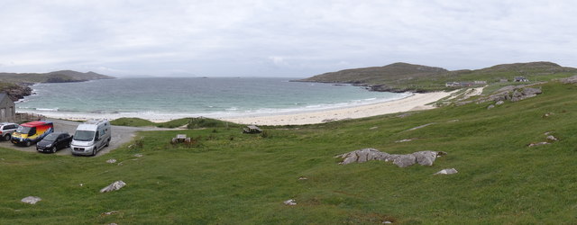
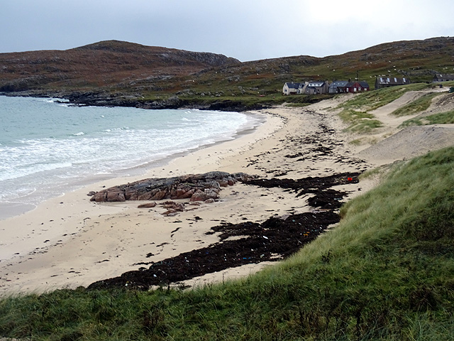
Camas a' Bhuic is a charming coastal area located in Inverness-shire, Scotland. Nestled between the dramatic Highlands and the serene Moray Firth, this area is renowned for its breathtaking sea views, tranquil estuary, and meandering creek.

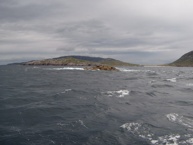
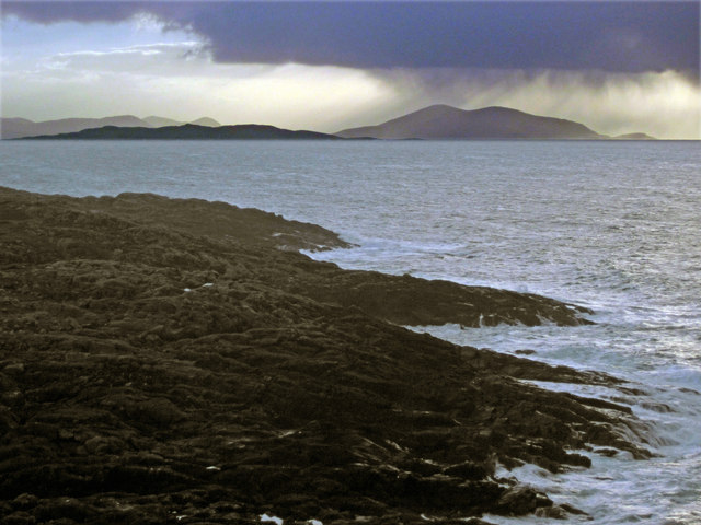
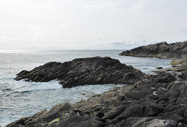
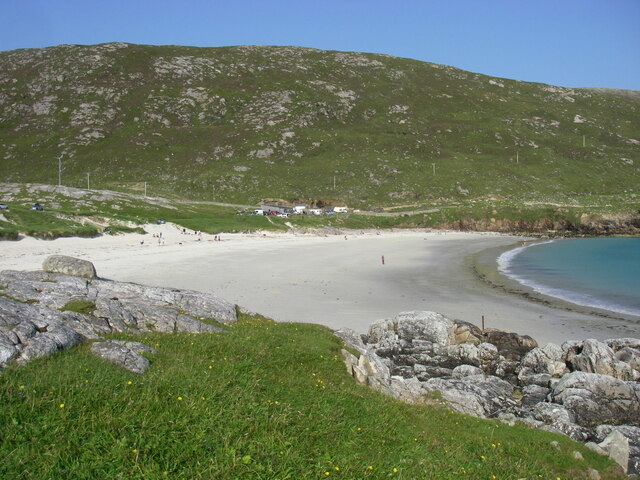
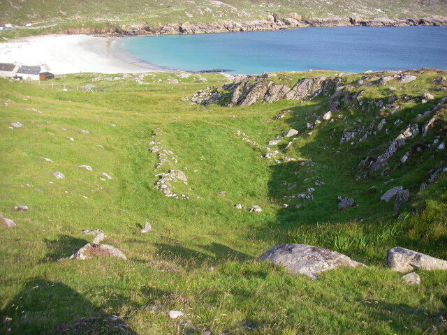
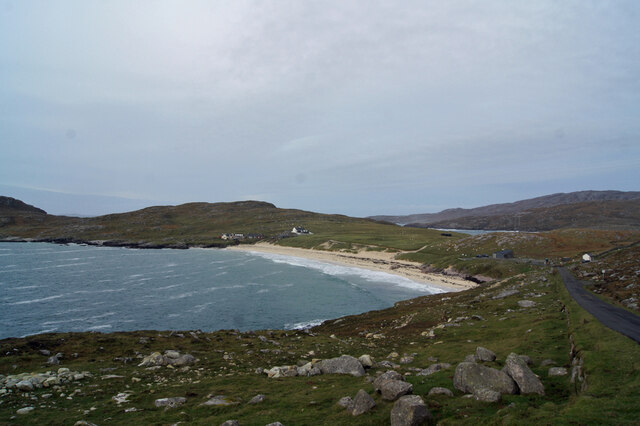
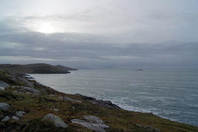
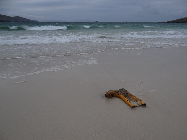
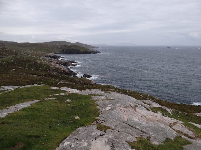
The sea at Camas a' Bhuic is a prominent feature, with its crystal-clear waters and ever-changing tides. The coastline is dotted with rocky cliffs and sandy beaches, offering visitors a diverse range of landscapes to explore. The sea is home to a variety of marine life, including seals, dolphins, and a myriad of seabirds, making it a popular spot for wildlife enthusiasts.

The estuary at Camas a' Bhuic is formed by the confluence of several rivers, creating a unique ecosystem that supports a rich diversity of plant and animal species. The estuary is characterized by its vast mudflats, salt marshes, and tidal channels. It provides an important habitat for numerous migratory birds, such as wading birds and waterfowl, which flock here during the winter months.

A small creek winds its way through the landscape, adding to the charm of Camas a' Bhuic. The creek is a haven for small fish and invertebrates, attracting otters and other predators. Visitors can follow the meandering path of the creek, immersing themselves in the tranquility of the surrounding scenery.

Overall, Camas a' Bhuic offers a picturesque and diverse coastal experience. Whether you're exploring the rugged coastline, observing the abundant wildlife, or simply enjoying the peaceful ambiance, this area in Inverness-shire is a true gem for nature lovers.

If you have any feedback on the listing, please let us know in the comments section below.

Camas a' Bhuic Images

Images are sourced within 2km of 57.980321/-7.0828192 or Grid Reference NA9910. Thanks to Geograph Open Source API. All images are credited.

Horsanais Point Quite a prominent headland in West Loch Tarbert. Ben Luskentyre centre and Isle Taransay to right of frame.
Horsanais Point
Quite a prominent headland in West Loch Tarbert. Ben Luskentyre centre and Isle Taransay to right of frame.
Gloraig Huisinis Some might say the 'dreaded Huisinis Gloraigs' Strong tides prevail here and it does not take much strength of westerly wind to raise a nasty sea. The white sands of Huisinis Beach are prominent to the right of the frame and the Island of Scarp skyline can be seen in distance.
Gloraig Huisinis
Some might say the 'dreaded Huisinis Gloraigs' Strong tides prevail here and it does not take much strength of westerly wind to raise a nasty sea. The white sands of Huisinis Beach are prominent to the right of the frame and the Island of Scarp skyline can be seen in distance.
Looking south across Baralob to Toe Head The dark rocks around Baralob are run through by trenches of redder rocks
Looking south across Baralob to Toe Head
The dark rocks around Baralob are run through by trenches of redder rocks
Horsanish coastline
Horsanish coastline
Hùisinis beach from the west
Barrow or old hut foundations west of Hùisinis
Houses at Hùisinis
Houses at Hùisinis
Postbox at Hùisinis
Postbox at Hùisinis
Approaching Huisinis Fourteen miles of scenic, twisting single-track road ends at this tiny settlement and beach.
Approaching Huisinis
Fourteen miles of scenic, twisting single-track road ends at this tiny settlement and beach.
Coast of North Harris Looking south from the side of the B887 just east of Huisinis.
Coast of North Harris
Looking south from the side of the B887 just east of Huisinis.
Huisinis Seaweed on the beach had been left by a recent storm.
The calf in the road would not budge, and had to be driven round in order to get to the car park which is just beyond the cattle grid.
Huisinis
Seaweed on the beach had been left by a recent storm. The calf in the road would not budge, and had to be driven round in order to get to the car park which is just beyond the cattle grid.
View over Huisinis Looking east over the rooftops of the few dwellings in this remote settlement.
View over Huisinis
Looking east over the rooftops of the few dwellings in this remote settlement.
Water pipe access covers by the outflow of an unnamed loch on Àirde Beaga
Lost at sea One yellow wellie.  Anyone?
Lost at sea
One yellow wellie. Anyone?
Happy campers Having driven the switchback road to get to this lovely spot, most of the inhabitants in the camper vans were happy.  Except yours truly whose wife had had to endure the white knuckle ride, including bumps and encounters with aggressive "coos" along the way <a href="https://www.geograph.org.uk/photo/4675179">NB0109 : Whit you lookin it?</a>.  But the view was worth it!
Happy campers
Having driven the switchback road to get to this lovely spot, most of the inhabitants in the camper vans were happy. Except yours truly whose wife had had to endure the white knuckle ride, including bumps and encounters with aggressive "coos" along the way NB0109 : Whit you lookin it?. But the view was worth it!
Beitearsaig Bay and Rubh' an Tothain headland If you forgot to look the other way from Huisinis and its lovely beach from this point, here's what you would have seen.
Beitearsaig Bay and Rubh' an Tothain headland
If you forgot to look the other way from Huisinis and its lovely beach from this point, here's what you would have seen.
Panorama of Bagh Huisinis View from a vantage point above the bay.
Panorama of Bagh Huisinis
View from a vantage point above the bay.
The beach at Huisinis
Show me another place!

Camas a' Bhuic is located at Grid Ref: NA9910 (Lat: 57.980321, Lng: -7.0828192)

Unitary Authority: Na h-Eileanan an Iar

Police Authority: Highlands and Islands

What 3 Words

///squeaks.pelted.loom. Near Tarbert, Na h-Eileanan Siar

Related Wikis

Hushinish

Huisinish or Hushinish (Scottish Gaelic Hùisinis) is a remote place on the west coast of Harris in the Outer Hebrides of Scotland. It lies at the end of...

Amhuinnsuidhe

Amhuinnsuidhe (Scottish Gaelic: Abhainn Suidhe) is a settlement on Harris, in the Outer Hebrides, Scotland. The settlement is also within the parish of...

Scarp, Scotland

Scarp (Scottish Gaelic: An Sgarp) is an uninhabited island in the Outer Hebrides of Scotland, west of Hushinish on Harris. Once inhabited, the island was...

Amhuinnsuidhe Castle

Amhuinnsuidhe Castle is a large 19th-century private country house on Harris, one of the Western Isles of Scotland. It was designated as a Category A listed...

Tiorga Mor

Tiorga Mor (679 m) is a mountain in Harris, in the Outer Hebrides of Scotland. The most westerly peak of the high mountains of Harris, it is a very rugged...

Chliostair Hydro-Electric Scheme

Chliostair Hydro-Electric Scheme is a small scheme promoted by the North of Scotland Hydro-Electric Board on Harris, Outer Hebrides. It consists of a single...

Soay Beag

Soay Beag (Scottish Gaelic: Sòdhaigh Beag) is a small, uninhabited tidal island in West Loch Tarbert, between the northern and southern parts of Harris...

Soay Sound

Soay Sound (Scottish Gaelic: Caolas Shòdhaigh) is a strait separating the islands of Soay Mòr and Soay Beag from the northern part of Harris. The sound...

Have you been to Camas a' Bhuic?

Leave your review of Camas a' Bhuic below (or comments, questions and feedback).