Strom

Sea, Estuary, Creek in Inverness-shire

Scotland

Strom

Crogearraidh na Thobha Boggy hill top on the east coast of North Uist.
Crogearraidh na Thobha Credit: Richard Webb

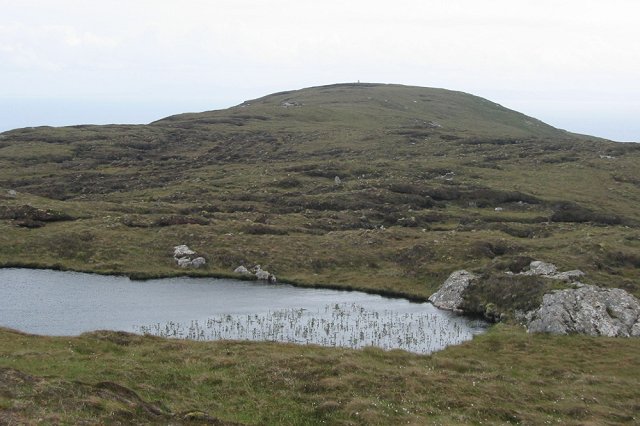
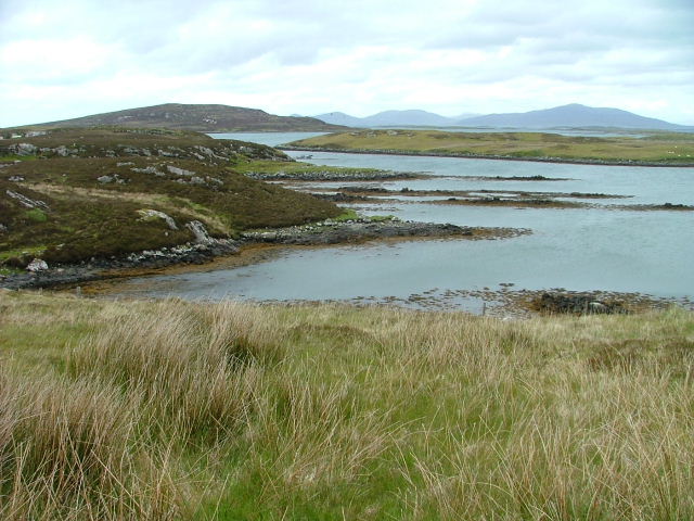
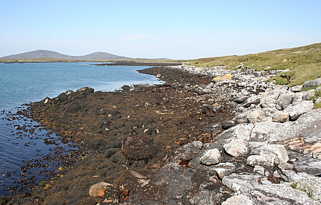
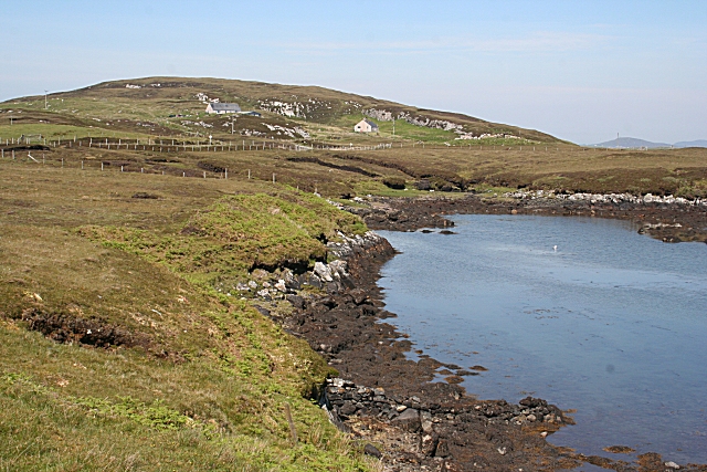
Strom is a small coastal village located in Inverness-shire, Scotland. Situated along the northeastern coast of the country, Strom offers breathtaking views of the sea, estuary, and creek that surround it.

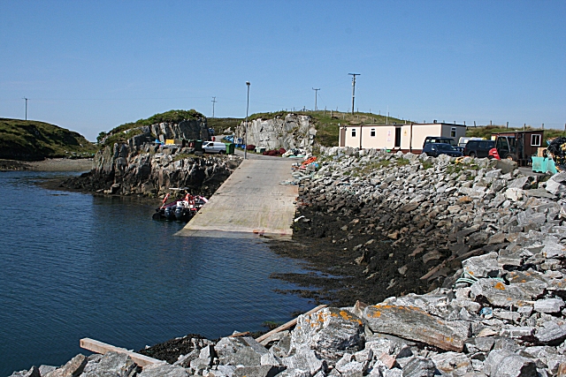
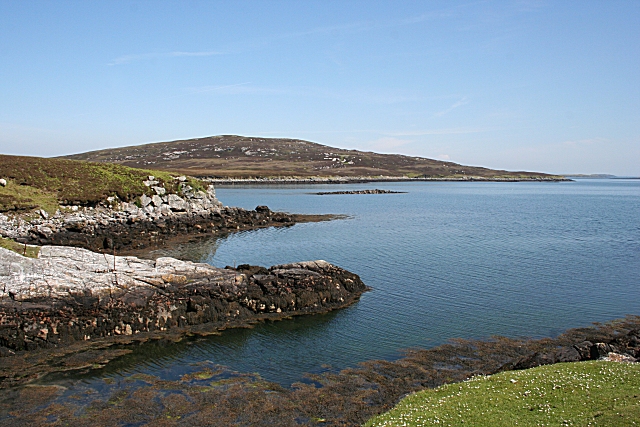
The village is nestled within a picturesque landscape, boasting rugged cliffs, sandy beaches, and lush greenery. The sea that borders Strom is part of the North Sea, providing residents and visitors with opportunities for various water activities such as fishing, swimming, and boating. The sea also offers stunning views of the horizon, especially during sunrise and sunset.

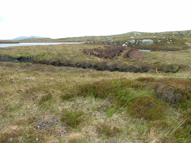
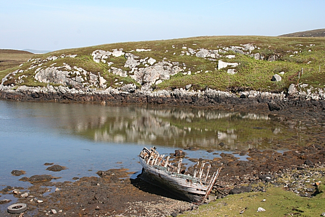
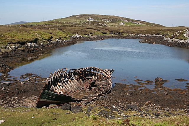
Strom is also known for its estuary, where a river meets the sea. This natural phenomenon creates a diverse ecosystem, attracting a wide range of wildlife, including birds, fish, and other marine creatures. The estuary is a popular spot for birdwatching, as numerous species can be spotted throughout the year.

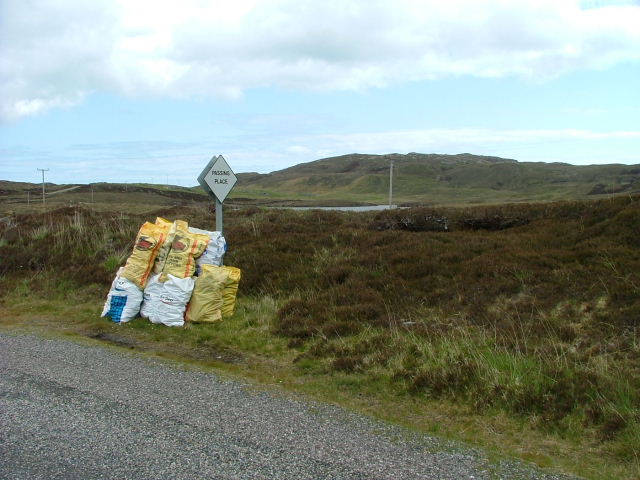
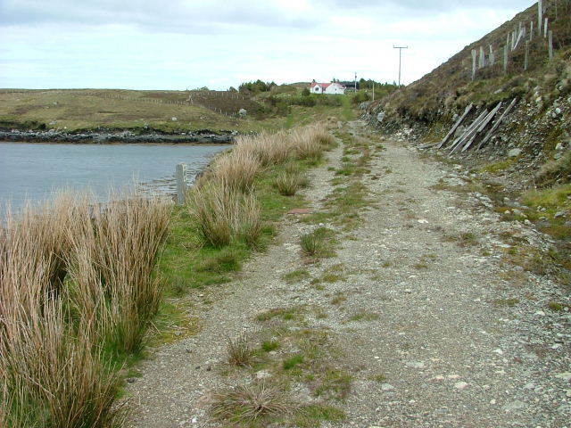
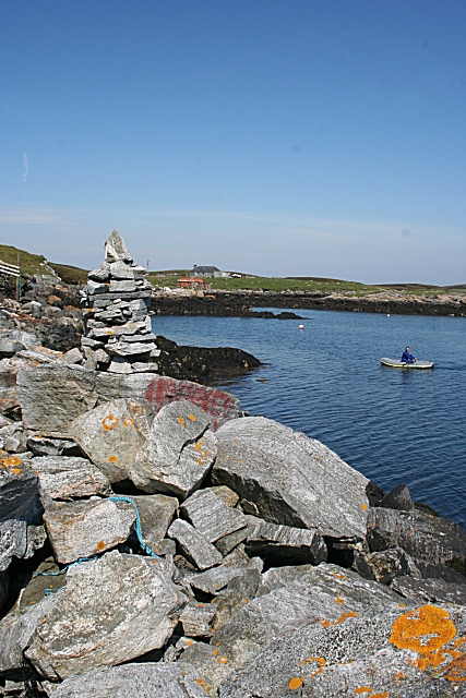
In addition to the sea and estuary, a creek runs through Strom, adding to the village's charm. The creek provides a tranquil setting and is a favorite spot for locals and visitors to relax and enjoy the peaceful atmosphere.

Strom's coastal location also offers a pleasant climate, with mild temperatures and relatively low rainfall. This makes it an ideal destination for outdoor enthusiasts and nature lovers.

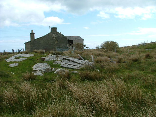
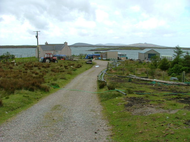
Overall, Strom in Inverness-shire is a picturesque coastal village that boasts stunning views of the sea, estuary, and creek. With its diverse ecosystem, outdoor activities, and serene atmosphere, it is a captivating destination for anyone seeking a peaceful coastal getaway.

If you have any feedback on the listing, please let us know in the comments section below.

Strom Images

Images are sourced within 2km of 57.651171/-7.0928213 or Grid Reference NF9673. Thanks to Geograph Open Source API. All images are credited.

Crogearraidh na Thobha Boggy hill top on the east coast of North Uist.
Crogearraidh na Thobha
Boggy hill top on the east coast of North Uist.
Cut Peat Laid out to dry before bagging.
Cut Peat
Laid out to dry before bagging.
Bagged Peat Awaiting uplift.
Bagged Peat
Awaiting uplift.
Deserted Crofthouse At Bàgh Chàise, a small crofting settlement on North Uist.
Deserted Crofthouse
At Bàgh Chàise, a small crofting settlement on North Uist.
Inlet on The Sound of Harris North of Bàgh Chàise, a small crofting settlement.
Inlet on The Sound of Harris
North of Bàgh Chàise, a small crofting settlement.
Strom. Looking towards Orasaigh Island.
Strom.
Looking towards Orasaigh Island.
Track and House On Bágh a' Cháise.
Track and House
On Bágh a' Cháise.
Croft at the Road End Overlooking Loch Amhlasaraigh.
Croft at the Road End
Overlooking Loch Amhlasaraigh.
Ruined Crofthouse At Tobha Beag.
Ruined Crofthouse
At Tobha Beag.
Rubha an Daimh 'Rubha' means 'headland' and 'damh' is 'deer', so the headland at the far end of this bay is the headland of the deer. The distant hills are Beinn Mhòr and Beinn Bhreac.
Rubha an Daimh
'Rubha' means 'headland' and 'damh' is 'deer', so the headland at the far end of this bay is the headland of the deer. The distant hills are Beinn Mhòr and Beinn Bhreac.
Cheese Bay Looking north from the harbour wall at Cheese Bay. This style of tall cairn seems popular in the Hebrides.
Cheese Bay
Looking north from the harbour wall at Cheese Bay. This style of tall cairn seems popular in the Hebrides.
Bàgh a'Chàise A fisherman rows ashore from his boat, moored close to the Cheese Bay harbour wall. On the right is the island of Taghaidh, in the next square.
Bàgh a'Chàise
A fisherman rows ashore from his boat, moored close to the Cheese Bay harbour wall. On the right is the island of Taghaidh, in the next square.
Cheese Bay Looking past the south end of the island of Taghaigh towards the distant mountains of South Harris.
Cheese Bay
Looking past the south end of the island of Taghaigh towards the distant mountains of South Harris.
Cheese Bay Slipway This slipway is used by Marine Harvest for access of the fish farms they operate in Bàgh a'Chàise and further offshore.
Cheese Bay Slipway
This slipway is used by Marine Harvest for access of the fish farms they operate in Bàgh a'Chàise and further offshore.
Going Nowhere The hulk of a boat lies rotting in a tidal inlet near Tigh-na-Hoe.
Going Nowhere
The hulk of a boat lies rotting in a tidal inlet near Tigh-na-Hoe.
Tobha Beag Not to be confused with the similarly named, and much better known, place in South Uist, this is almost the end of the road.
Tobha Beag
Not to be confused with the similarly named, and much better known, place in South Uist, this is almost the end of the road.
Island of Taghaigh There is not much of land on the North Uist shore in this square, but this side of the offshore island of Taghaigh, in the background here, is in square.
Island of Taghaigh
There is not much of land on the North Uist shore in this square, but this side of the offshore island of Taghaigh, in the background here, is in square.
Going Nowhere This is the same boat as in <a href="https://www.geograph.org.uk/photo/1343501">NF9574 : Going Nowhere</a>, with the houses at Tobha Beag in the background beyond the tidal inlet.
Going Nowhere
This is the same boat as in NF9574 : Going Nowhere, with the houses at Tobha Beag in the background beyond the tidal inlet.
Show me another place!

Strom is located at Grid Ref: NF9673 (Lat: 57.651171, Lng: -7.0928213)

Unitary Authority: Na h-Eileanan an Iar

Police Authority: Highlands and Islands

What 3 Words

///sweetened.jumpy.alarming. Near Lochmaddy, Na h-Eileanan Siar

Nearby Locations

Strom Bàgh a' Chàise

Related Wikis

Tahay

Tahay (Scottish Gaelic: Taghaigh) is an island in the Outer Hebrides of Scotland. The name originates from the Old Norse tagg-øy meaning island with a...

Sursaigh

Sursaigh (Scottish Gaelic: Sursaigh) is an island off North Uist in the Sound of Harris, Scotland. It lies 8 kilometres (5.0 mi) northeast of the village...

Hermetray

Hermetray (Scottish Gaelic: Theàrnatraigh) is an uninhabited island off North Uist, in the Outer Hebrides of Scotland. == Geography and geology == Hermetray...

Stromay

Stromay (Scottish Gaelic: Sròmaigh) is a tidal island off North Uist in the Sound of Harris, Scotland. The low island of Stromay lies between two wide...

Nearby Amenities

Located within 500m of 57.651171,-7.0928213
Passing Place
Lat/Long: 57.6494546/-7.0987864
Turning Circle
Lat/Long: 57.6517447/-7.0966841
Taigh na Thobha
Name En: Tigh-na-hoe
Name Gd: Taigh na Thobha
Place: isolated_dwelling
Lat/Long: 57.6491096/-7.0980692
Power: pole
Lat/Long: 57.6468343/-7.0947243
Power: pole
Lat/Long: 57.6485612/-7.0983975
Power: pole
Lat/Long: 57.6478447/-7.0984261
Power: pole
Lat/Long: 57.6493707/-7.0983358
Passing Place
Lat/Long: 57.6502907/-7.0990619
Power: pole
Lat/Long: 57.6502906/-7.0982871
Power: pole
Lat/Long: 57.6510159/-7.0982841
Power: pole
Lat/Long: 57.6513915/-7.098957
Power: pole
Lat/Long: 57.6518841/-7.0998153
Power: pole
Lat/Long: 57.6523835/-7.1006833
Power: pole
Lat/Long: 57.6517458/-7.0979902
Power: pole
Lat/Long: 57.6518391/-7.0972667
Power: pole
Lat/Long: 57.6535172/-7.0993469
Power: pole
Lat/Long: 57.6537752/-7.0984011
Telephone
Booth: K6
Covered: booth
Operator: BT
Operator Wikidata: Q593786
Phone: +44 1876 500360
Lat/Long: 57.649229/-7.0987992
Passing Place
Lat/Long: 57.652269/-7.0983534
Passing Place
Lat/Long: 57.652518/-7.0998416
Power: pole
Lat/Long: 57.6502015/-7.0969389
Power: pole
Lat/Long: 57.6500968/-7.0954289
Power: pole
Lat/Long: 57.6500523/-7.0948173
The data included in this document is from www.openstreetmap.org. The data is made available under ODbL.

Have you been to Strom?

Leave your review of Strom below (or comments, questions and feedback).