Battle

Settlement in Brecknockshire
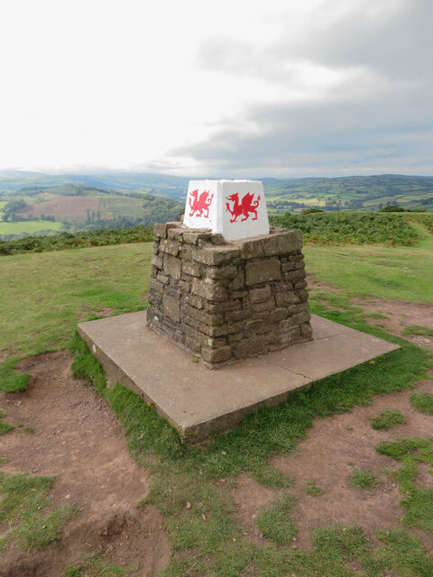
Wales

Battle

Road down from the southern end of Aberysgir Common
Road down from the southern end of Aberysgir Common Credit: peter robinson

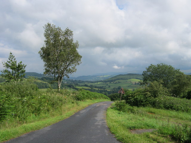
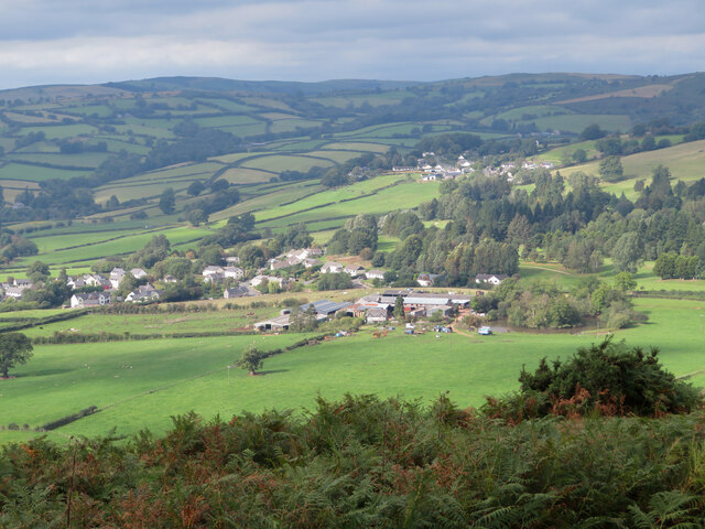
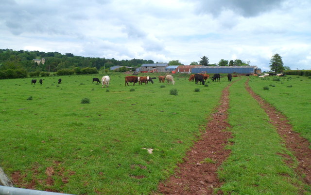
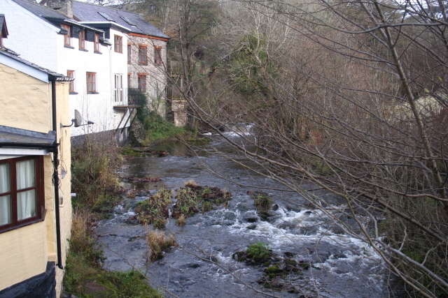
Battle is a small village located in the historic county of Brecknockshire, Wales. Situated in the heart of the Brecon Beacons National Park, this picturesque settlement offers breathtaking natural beauty and a rich cultural heritage.

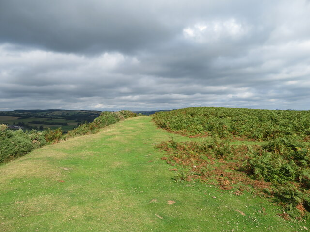
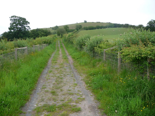
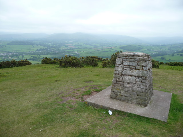
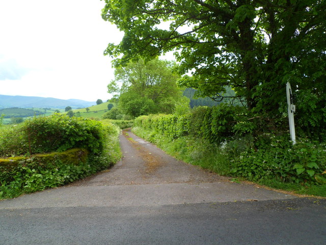
With a population of just over 300 residents, Battle boasts a tranquil and close-knit community. The village is nestled amidst rolling hills, lush green fields, and meandering streams, making it an ideal destination for nature enthusiasts and outdoor adventurers. Visitors can enjoy a range of activities such as hiking, cycling, and birdwatching, as well as exploring the nearby waterfalls and caves.

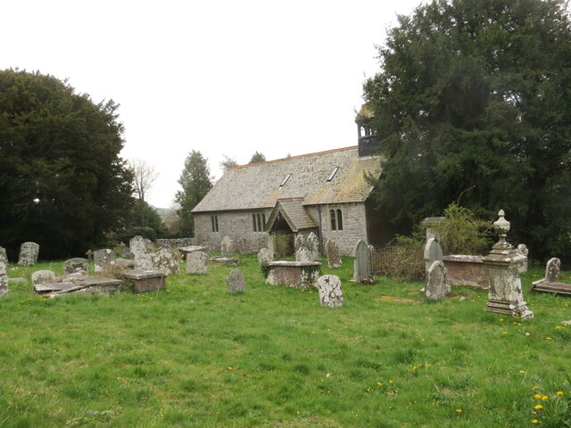
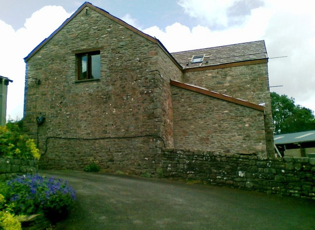
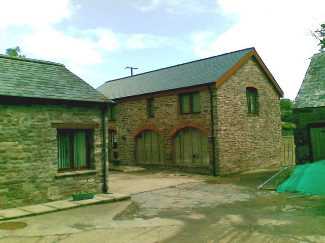
The village itself is known for its charming and well-preserved architecture, with traditional stone houses and cottages lining its narrow streets. The local church, St. Mary's, is a prominent feature and dates back to the 13th century. Its medieval stained glass windows and intricate woodwork are a testament to the area's historical significance.

Battle is also home to a handful of amenities, including a village hall, a primary school, and a local pub. The pub, dating back to the 17th century, offers a cozy atmosphere and serves traditional Welsh dishes, providing a taste of the region's culinary delights.

For those seeking a peaceful retreat in an idyllic setting, Battle, Brecknockshire offers a quintessential Welsh experience. Its natural beauty, historical charm, and warm community make it a hidden gem within the breathtaking landscapes of the Brecon Beacons.

If you have any feedback on the listing, please let us know in the comments section below.

Battle Images

Images are sourced within 2km of 51.968782/-3.441513 or Grid Reference SO0131. Thanks to Geograph Open Source API. All images are credited.

Road down from the southern end of Aberysgir Common
Trig point on Pen-y-crug
Looking north on Pen-y-crug
View towards Pysgodlyn Farm from Pen-y-crug
View towards Penoyre House from Pen-y-crug
Eglwys Sant Cadog, Y Batel / St Cadog's Church, Battle Mae Eglwys Blwyfol Y Batel wedi ei chysegru i Sant Cadog ac fe'i hailadeiladwyd yn 1880. Yn anffodus, mae'r eglwys wed cau ers peth amser.

St Cadog's Parish Church located in the tiny village of Battle. Rebuilt in 1880 the church, sadly, is no longer open for worship.
Eglwys Sant Cadog, Y Batel / St Cadog's Church, Battle
Mae Eglwys Blwyfol Y Batel wedi ei chysegru i Sant Cadog ac fe'i hailadeiladwyd yn 1880. Yn anffodus, mae'r eglwys wed cau ers peth amser. St Cadog's Parish Church located in the tiny village of Battle. Rebuilt in 1880 the church, sadly, is no longer open for worship.
Access path to Pen-y-crug hillfort near Brecon It is a steepish ascent to the summit but the footpath is wide and undulates and curves in an interesting fashion. Parking is available at a recycling pull-in opposite on the road.
Access path to Pen-y-crug hillfort near Brecon
It is a steepish ascent to the summit but the footpath is wide and undulates and curves in an interesting fashion. Parking is available at a recycling pull-in opposite on the road.
The summit trig point of Pen-y-crug near Brecon On a clearer day this spot commands excellent views of the Beacons and is an excellent alternative place to walk to admire the mountains. An Iron Age hillfort was established on the summit and the multivallate ditches and ramparts are well preserved. Ferns obstruct the site in high summer.
The summit trig point of Pen-y-crug near Brecon
On a clearer day this spot commands excellent views of the Beacons and is an excellent alternative place to walk to admire the mountains. An Iron Age hillfort was established on the summit and the multivallate ditches and ramparts are well preserved. Ferns obstruct the site in high summer.
Glanyscir, built 1830 What a devastatingly handsome property, classy, understated and in a beautiful riverside setting. Beautiful gardens and lawns too.
Glanyscir, built 1830
What a devastatingly handsome property, classy, understated and in a beautiful riverside setting. Beautiful gardens and lawns too.
Barn conversion, Pentwyn
Barn conversion, Danycrug
Lane to Gludy and Gludy Cottage near Cradoc Viewed from Cradoc Road. Gludy and Gludy Cottage are about 300 metres away.
Lane to Gludy and Gludy Cottage near Cradoc
Viewed from Cradoc Road. Gludy and Gludy Cottage are about 300 metres away.
Parc Lodge near Cradoc Viewed from Cradoc Road. Parc Lodge was formerly the SE lodge at the entrance to the grounds of Penoyre House, a mid-Victorian mansion located a kilometre to the NW.
Parc Lodge near Cradoc
Viewed from Cradoc Road. Parc Lodge was formerly the SE lodge at the entrance to the grounds of Penoyre House, a mid-Victorian mansion located a kilometre to the NW.
Pysgodlyn Farm, Cradoc Twin tracks across a field lead north from a Cradoc Road gate to Pysgodlyn Farm.
Pysgodlyn Farm, Cradoc
Twin tracks across a field lead north from a Cradoc Road gate to Pysgodlyn Farm.
Diamond Jubilee announcements at the SE boundary of Cradoc The road from Brecon reaches the SE boundary of the hamlet of Cradoc.
Three notices announce that Queen Elizabeth II's Diamond Jubilee celebrations
are taking place today, Monday June 4th 2012, in Aberyscir Hill.
Diamond Jubilee announcements at the SE boundary of Cradoc
The road from Brecon reaches the SE boundary of the hamlet of Cradoc. Three notices announce that Queen Elizabeth II's Diamond Jubilee celebrations are taking place today, Monday June 4th 2012, in Aberyscir Hill.
Oakfield Park, Cradoc Oakfield Park is a residential cul-de-sac at the SE edge of the hamlet, bordering fields.
Oakfield Park, Cradoc
Oakfield Park is a residential cul-de-sac at the SE edge of the hamlet, bordering fields.
Signpost and phone box on a grass triangle, Cradoc The signpost points left towards Aberyscir, Pontfaen and Merthyr Cynog, right towards the golf course, Lower Chapel and Upper Chapel. The third arm points past the camera towards Brecon.
Signpost and phone box on a grass triangle, Cradoc
The signpost points left towards Aberyscir, Pontfaen and Merthyr Cynog, right towards the golf course, Lower Chapel and Upper Chapel. The third arm points past the camera towards Brecon.
Road to Cradoc Golf Course Viewed from opposite this grass triangle. <a title="https://www.geograph.org.uk/photo/2980171" href="https://www.geograph.org.uk/photo/2980171">Link</a>
Road to Cradoc Golf Course
Viewed from opposite this grass triangle. Link
Show me another place!

Battle is located at Grid Ref: SO0131 (Lat: 51.968782, Lng: -3.441513)

Unitary Authority: Powys

Police Authority: Dyfed Powys

Also known as: Y Batel

What 3 Words

///ratty.trunk.wage. Near Brecon, Powys

Nearby Locations

Battle Y Batel

Related Wikis

Battle, Powys

Battle (Welsh: Y Batel) is a village in the community of Yscir, Powys, Wales, which is 36 miles (57 km) from Cardiff and 145 miles (234 km) from London...
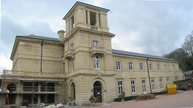
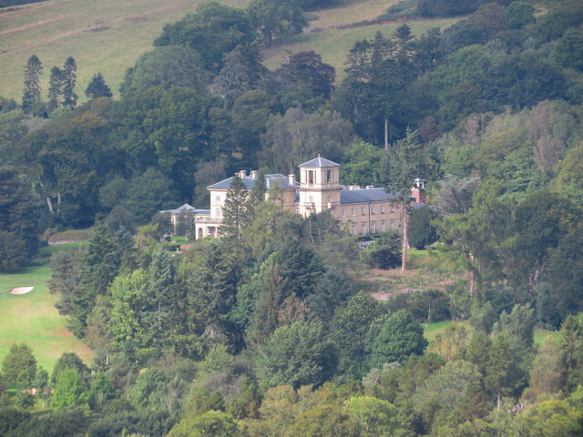
Penoyre House

Penoyre House, Battle, Powys, Wales is a nineteenth century country house. Designed by Anthony Salvin for Colonel John Lloyd Vaughan Watkins, it was built...
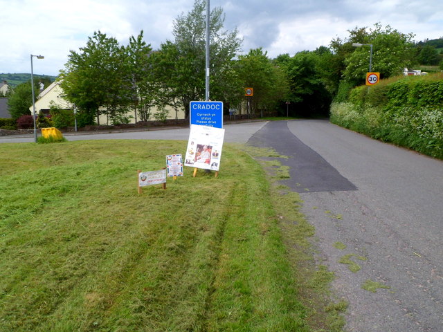
Cradoc, Powys

Cradoc is a small village, about two miles northwest of Brecon, Wales. It lies within the administrative community of Yscir and partly within the Brecon...

Cradoc railway station

Cradoc railway station served the village of Cradoc, in the historical county of Breconshire, Wales, from 1877 to 1962 on the Neath and Brecon Railway...

Yscir

Yscir (or Ysgir) is a community in the county of Powys, Wales (the historic county of Brecknockshire) and is 35.3 miles (56.7 km) from Cardiff.Cradoc and...

Y Gaer

Y Gaer (Latin: Cicucium) is a Roman fort situated near modern-day Brecon in Mid Wales, United Kingdom. Y Gaer is located at grid reference SO00332966...
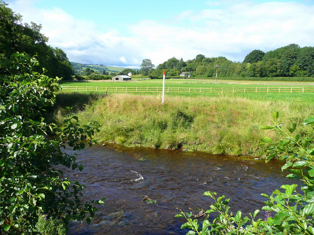
Afon Ysgir

The Afon Ysgir is a river which rises on the southern slopes of Mynydd Epynt in Powys, Wales. The tributaries known as Ysgir Fawr and Ysgir Fechan flow...

Aberyscir

Aberyscir (Welsh: Aberysgir) is a village in the community of Yscir, Powys, Wales, which is 4 miles (6.4 km) west of Brecon, 35 miles (56 km) from Cardiff...

Nearby Amenities

Located within 500m of 51.968782,-3.441513
Battle
Name Cy: Y Batel
Place: hamlet
Wikidata: Q13132454
Lat/Long: 51.968787/-3.4426325
Direction: 185
Generator Method: photovoltaic
Generator Output Electricity: yes
Generator Solar Modules: 10
Generator Source: solar
Generator Type: solar_photovoltaic_panel
Location: roof
Power: generator
Lat/Long: 51.9682632/-3.4415531
Direction: 195
Generator Method: photovoltaic
Generator Output Electricity: yes
Generator Solar Modules: 14
Generator Source: solar
Generator Type: solar_photovoltaic_panel
Location: roof
Power: generator
Lat/Long: 51.9687556/-3.4433998
The data included in this document is from www.openstreetmap.org. The data is made available under ODbL.

Have you been to Battle?

Leave your review of Battle below (or comments, questions and feedback).