Llandogo

Settlement in Monmouthshire

Wales

Llandogo

Picnic area in Bargain Wood, Llandogo This is the picnic area mentioned in <a href="https://www.geograph.org.uk/photo/494194">SO5202 : Whitestone amenity area</a> which in 2014 had a permanent BBQ. It is so "off-the-beaten-track" that one day in August, at the height of the holiday season, we were the only people there.
Picnic area in Bargain Wood, Llandogo Credit: Mike Dodman

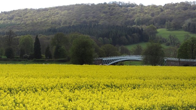
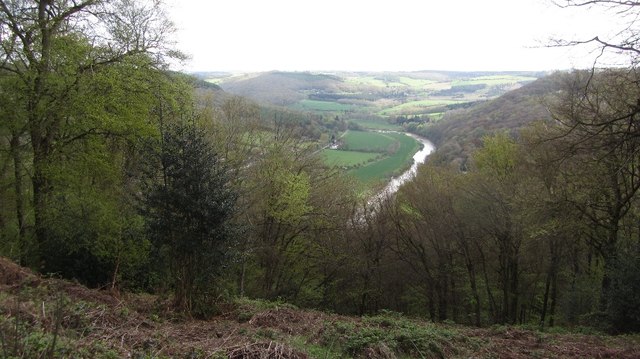
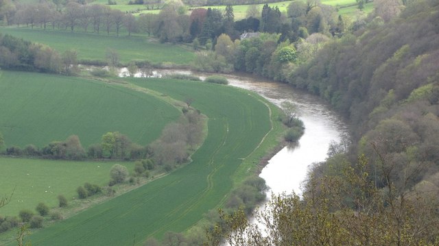
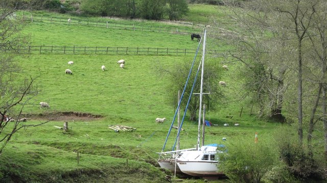
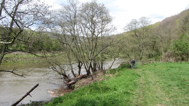
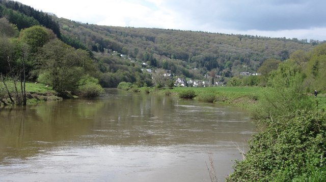
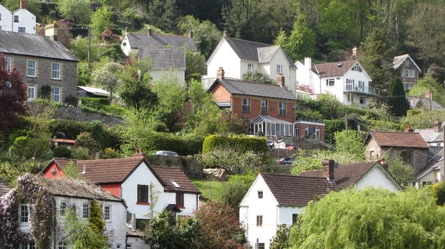
Llandogo is a small village located in the county of Monmouthshire, Wales. Situated on the eastern bank of the River Wye, it is nestled within the beautiful Wye Valley, which is known for its stunning landscapes and scenic beauty. Llandogo is approximately 5 miles south of Monmouth, the county town.

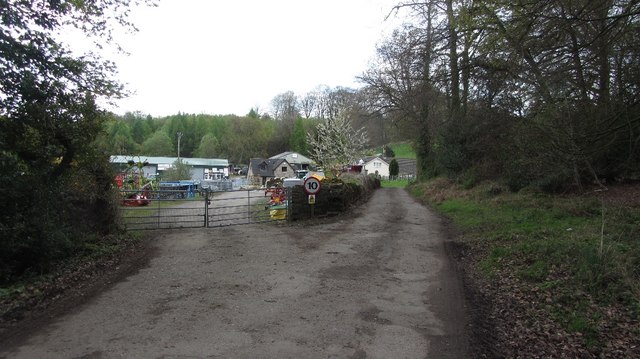
The village boasts a rich history, with evidence of human habitation dating back to the Neolithic period. It was once a prominent industrial area, renowned for its ironworks, wireworks, and coal mining activities during the 18th and 19th centuries. Today, Llandogo is a tranquil and picturesque village, attracting visitors with its historic charm and natural attractions.

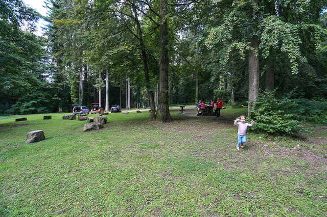
One of the notable landmarks in the village is St. Oudoceus Church, which dates back to the 13th century. This medieval church is renowned for its distinctive tower, which offers panoramic views of the surrounding countryside. The village also has a village hall, a primary school, and a few local businesses, including a pub and a post office.

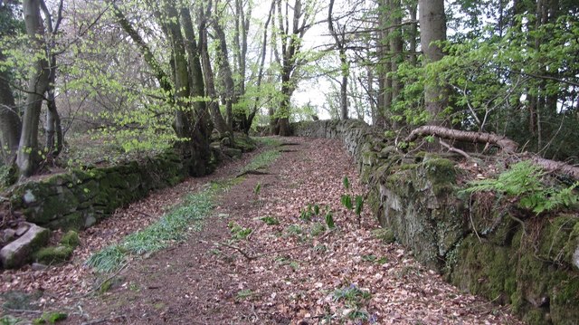
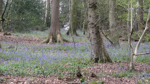
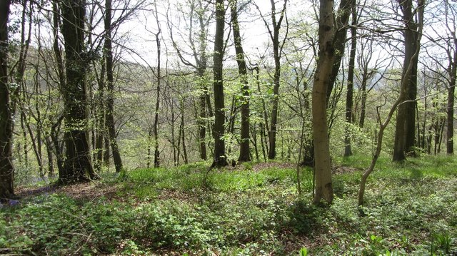
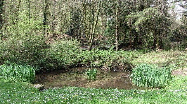
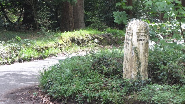
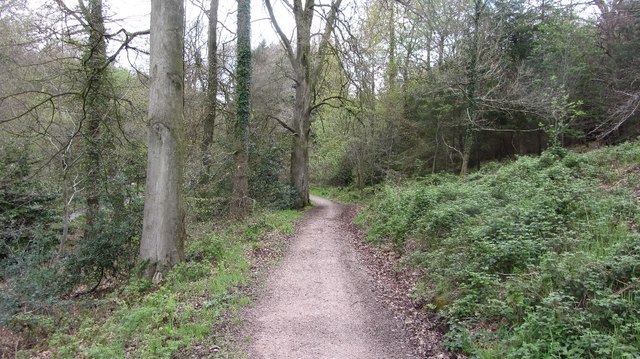
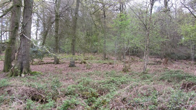
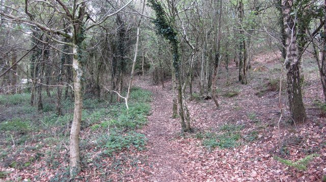
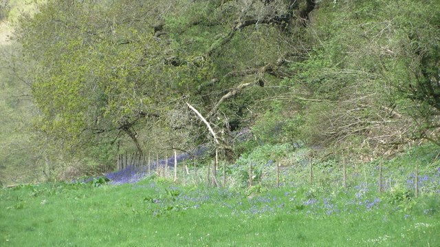
The Wye Valley, with its lush greenery and breathtaking views, provides ample opportunities for outdoor activities such as hiking, cycling, and fishing. Llandogo is a popular destination for those seeking a peaceful retreat or a base for exploring the surrounding countryside. The village is also a gateway to the Wye Valley Area of Outstanding Natural Beauty, which stretches for 58 miles along the river and offers abundant wildlife, ancient woodlands, and magnificent viewpoints.

Overall, Llandogo is a charming village that combines historical significance with natural beauty, making it an ideal destination for nature lovers and history enthusiasts alike.

If you have any feedback on the listing, please let us know in the comments section below.

Llandogo Images

Images are sourced within 2km of 51.73235/-2.693429 or Grid Reference SO5203. Thanks to Geograph Open Source API. All images are credited.

Picnic area in Bargain Wood, Llandogo This is the picnic area mentioned in <a href="https://www.geograph.org.uk/photo/494194">SO5202 : Whitestone amenity area</a> which in 2014 had a permanent BBQ. It is so "off-the-beaten-track" that one day in August, at the height of the holiday season, we were the only people there.
Picnic area in Bargain Wood, Llandogo
This is the picnic area mentioned in SO5202 : Whitestone amenity area which in 2014 had a permanent BBQ. It is so "off-the-beaten-track" that one day in August, at the height of the holiday season, we were the only people there.
Bigsweir Bridge View over oilseed rape on the west side of the Wye.
Bigsweir Bridge
View over oilseed rape on the west side of the Wye.
Old road, Cleddon The walls suggest that this was once a more important route than today's path.
Old road, Cleddon
The walls suggest that this was once a more important route than today's path.
A view down the Wye View from the plateau edge in Bargain Wood.
A view down the Wye
View from the plateau edge in Bargain Wood.
River Wye View down from Bargain Wood.
River Wye
View down from Bargain Wood.
Bluebells, Bargain Wood
Bargain Wood Near the steep slope down to the Wye.
Bargain Wood
Near the steep slope down to the Wye.
Pond, Bargain Wood Beside the car park.
Pond, Bargain Wood
Beside the car park.
Signpost, Bargain Wood
Path, Creigiau Wood
Path, Creigiau Wood
Road to Whyte Lye
Road to Whyte Lye
Wyes Wood
Wyes Wood
Woodland, Whitelye
Woodland, Whitelye
Fields above the Wye The boat is far up the tidal part of the river.
Fields above the Wye
The boat is far up the tidal part of the river.
Wyeside bluebells At the foot of a very steep wood.
Wyeside bluebells
At the foot of a very steep wood.
Path beside the Wye A riverside alternative route of the Offa's Dyke Path.
Path beside the Wye
A riverside alternative route of the Offa's Dyke Path.
River Wye Upstream of the Coed-ithel Weir.
River Wye
Upstream of the Coed-ithel Weir.
Llandogo View from over the river.
Llandogo
View from over the river.
Show me another place!

Llandogo is located at Grid Ref: SO5203 (Lat: 51.73235, Lng: -2.693429)

Unitary Authority: Monmouthshire

Police Authority: Gwent

What 3 Words

///gladiator.cashier.hampers. Near Tintern, Monmouthshire

Related Wikis

Llandogo

Llandogo (Welsh: Llaneuddogwy) is a small village in Monmouthshire, south Wales, between Monmouth and Chepstow in the lower reaches of the Wye Valley AONB...

Llandogo Halt railway station

Llandogo Halt was a request stop on the former Wye Valley Railway. It was opened on 9 March 1927 to serve the village of Llandogo. It was closed in 1959...

Church of St Oudoceus, Llandogo

The Church of St Oudoceus, Llandogo, Monmouthshire is a parish church built in 1859–1861. The church is dedicated to St Oudoceus (Euddogwy), an early Bishop...

Cleddon Hall

Cleddon Hall, formerly known as Ravenscroft, is a 19th-century Victorian country house in Trellech, Monmouthshire, Wales. In the later 19th century it...

Cleddon Bog

Cleddon Bog (grid reference SO509039) is a bog in the vice-county of Monmouthshire which has been notified as a biological Site of Special Scientific Interest...

The Hudnalls

The Hudnalls (SO533030 & SO540042 & SO545046 ) is a 94.4-hectare (233-acre) biological Site of Special Scientific Interest in Gloucestershire, notified...

Trellech United

Trellech United is a community and electoral ward in the county of Monmouthshire, Wales. It lies south of the county town of Monmouth next to the Wales...

Catbrook

Catbrook (Welsh: Catffrwd) is a village in Monmouthshire, south east Wales, United Kingdom. The population in 2011 was 412. == Location == Catbrook is...

Related Videos

The Ruins of Tintern Abbey

Come walk with us through the ruins of Tintern Abbey, where flowers carpet the grounds of what was once a grand building.

Boardgames team on a walk.

Sunday relaxing hike. Tintern, 14/01/24.

Nearby Amenities

Located within 500m of 51.73235,-2.693429
Llandogo
Alt Name Cy: Llaneuddogwy
Is In: Monmouthshire
Name Cy: Llandogo
Place: village
Source: NPE
Wikidata: Q6661217
Lat/Long: 51.7336903/-2.6875211
Llandogo
Historic Railway: station
Railway: site
Wikidata: Q6661208
Wikipedia: en:Llandogo Halt railway station
Lat/Long: 51.7323377/-2.6870528
Ford: yes
Lat/Long: 51.7326857/-2.693683
Post Box
Operator: Royal Mail
Post Box Type: lamp
Ref: NP25 383
Lat/Long: 51.7335063/-2.6901089
Post Box
Ref: NP25 455D
Royal Cypher: EIIR
Royal Cypher Wikidata: Q33102113
Lat/Long: 51.7341058/-2.6872134
Bus Stop
Penrhos
Bus: yes
Departures Board: timetable
Operator: https://www.philanslowcoaches.co.uk/
Public Transport: platform
Shelter: no
Lat/Long: 51.7322224/-2.6886381
Bus Stop
Bus: yes
Naptan AtcoCode: 5330AWB31276
Naptan NaptanCode: gweapjg
Public Transport: platform
Lat/Long: 51.7337841/-2.6877759
Historic: memorial
Memorial: war_memorial
Lat/Long: 51.7338138/-2.6873893
Waterway: waterfall
Lat/Long: 51.732097/-2.6964392
Bench
Lat/Long: 51.732315/-2.6963873
Information: guidepost
Tourism: information
Lat/Long: 51.732364/-2.6920854
Tourism: picnic_site
Lat/Long: 51.731578/-2.6978302
Give Way
Direction: backward
Lat/Long: 51.7342255/-2.6869404
Give Way
Direction: backward
Lat/Long: 51.7336531/-2.690482
Barrier: cycle_barrier
Bicycle: dismount
Foot: yes
Horse: no
Motor Vehicle: no
Lat/Long: 51.731921/-2.6887508
Information: guidepost
Tourism: information
Lat/Long: 51.7318855/-2.6896767
Information: guidepost
Tourism: information
Lat/Long: 51.7303717/-2.6886842
Barrier: kissing_gate
Centralkey: nks
Foot: designated
Kissing Gate: large_circular_profile
Material: metal
Wheelchair: yes
Lat/Long: 51.7330417/-2.6872164
Waste Basket
Waste: dog_excrement
Lat/Long: 51.733185/-2.6875316
Vending Machine
Vending: excrement_bags
Lat/Long: 51.7331846/-2.6875307
Waste Basket
Lat/Long: 51.7341388/-2.6872004
Grit Bin
Lat/Long: 51.7342501/-2.6873721
Crossing
Lat/Long: 51.7339658/-2.6872879
Information: guidepost
Tourism: information
Lat/Long: 51.7315184/-2.6918917
Post Box
Post Box Type: lamp
Ref: NP25 823
Royal Cypher: EIIR
Royal Cypher Wikidata: Q33102113
Lat/Long: 51.7313934/-2.6923014
Bench
Backrest: yes
Material: wood
Lat/Long: 51.733834/-2.6872513
Bench
Backrest: yes
Material: wood
Lat/Long: 51.7336446/-2.6873774
Bench
Backrest: yes
Material: wood
Lat/Long: 51.7335192/-2.6876671
Flag Type: national
Man Made: flagpole
Lat/Long: 51.7337684/-2.6872902
Cleddon
Name Cy: Cledan
Place: village
Lat/Long: 51.7324307/-2.7003282
Tourism: viewpoint
Lat/Long: 51.7284395/-2.6936594
Bench
Lat/Long: 51.7284245/-2.6936956
Direction: 75
Generator Method: photovoltaic
Generator Output Electricity: yes
Generator Solar Modules: 14
Generator Source: solar
Generator Type: solar_photovoltaic_panel
Location: roof
Power: generator
Lat/Long: 51.730889/-2.6908055
Direction: 125
Generator Method: photovoltaic
Generator Output Electricity: yes
Generator Solar Modules: 10
Generator Source: solar
Generator Type: solar_photovoltaic_panel
Location: roof
Power: generator
Lat/Long: 51.7318791/-2.6894832
Direction: 100
Generator Method: photovoltaic
Generator Output Electricity: yes
Generator Solar Modules: 8
Generator Source: solar
Generator Type: solar_photovoltaic_panel
Location: roof
Power: generator
Lat/Long: 51.7328111/-2.6887295
Direction: 175
Generator Method: photovoltaic
Generator Output Electricity: yes
Generator Solar Modules: 16
Generator Source: solar
Generator Type: solar_photovoltaic_panel
Location: roof
Power: generator
Lat/Long: 51.7339207/-2.6893303
Direction: ESE
Generator Method: photovoltaic
Generator Output Electricity: yes
Generator Solar Modules: 16
Generator Source: solar
Generator Type: solar_photovoltaic_panel
Location: roof
Power: generator
Lat/Long: 51.7351549/-2.6946129
Direction: 100
Generator Method: photovoltaic
Generator Output Electricity: yes
Generator Solar Modules: 10
Generator Source: solar
Generator Type: solar_photovoltaic_panel
Location: roof
Power: generator
Lat/Long: 51.734086/-2.6917496
The data included in this document is from www.openstreetmap.org. The data is made available under ODbL.

Have you been to Llandogo?

Leave your review of Llandogo below (or comments, questions and feedback).