Aberdaugleddyf

Sea, Estuary, Creek in Pembrokeshire

Wales

Aberdaugleddyf

Angle Point View from Angle Point looking east towards the Texaco refinery
Angle Point Credit: John Smitten

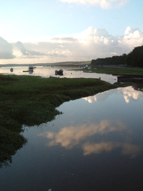
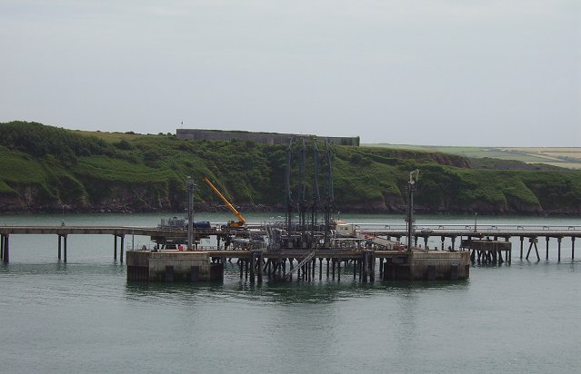
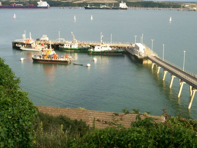
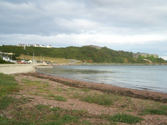
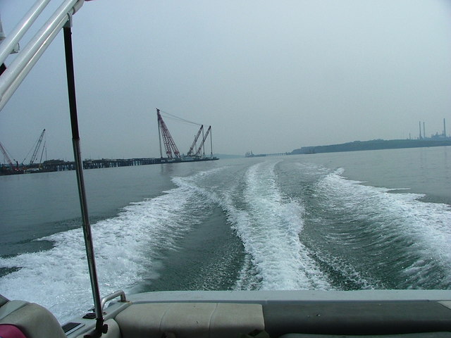
Aberdaugleddyf, located in the county of Pembrokeshire, Wales, is a small coastal village situated between Fishguard and Newport. The name Aberdaugleddyf translates to "mouth of the two rivers" in Welsh, aptly describing its geographical features. The village is nestled where two rivers, the Gwaun and the Nevern, meet the sea, creating a picturesque estuary and creek.

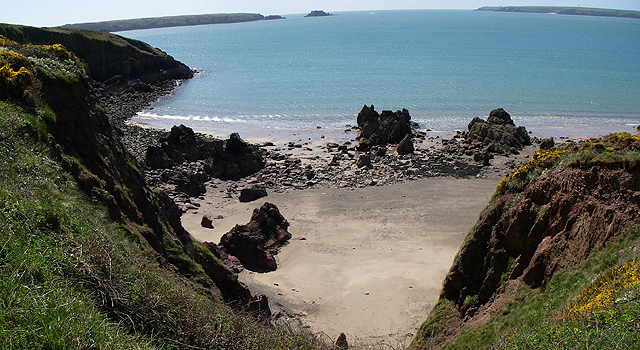
The main attraction of Aberdaugleddyf is its stunning natural beauty. The estuary offers a tranquil setting, with calm waters gently flowing into the sea. The surrounding landscape is characterized by rolling green hills, providing a scenic backdrop to the village. The area is a haven for wildlife, with various bird species and marine life often spotted in the estuary and creek.

For outdoor enthusiasts, Aberdaugleddyf offers a range of activities. The estuary is ideal for kayaking, paddleboarding, and boating, providing visitors with an opportunity to explore the serene waters and observe the abundant wildlife. The area is also popular for fishing, with both the estuary and the sea offering opportunities to catch a variety of fish.

Aberdaugleddyf is a peaceful retreat, perfect for those seeking a quiet escape. The village itself is small and charming, with a few local amenities such as a pub and a small shop. Visitors can enjoy leisurely walks along the estuary, taking in the breathtaking views and immersing themselves in the tranquility of the surroundings.

Overall, Aberdaugleddyf is a hidden gem along the Pembrokeshire coast, offering a unique blend of natural beauty, outdoor activities, and a peaceful atmosphere.

If you have any feedback on the listing, please let us know in the comments section below.

Aberdaugleddyf Images

Images are sourced within 2km of 51.698473/-5.0756262 or Grid Reference SM8704. Thanks to Geograph Open Source API. All images are credited.

Angle Point View from Angle Point looking east towards the Texaco refinery
Angle Point
View from Angle Point looking east towards the Texaco refinery
Angle Bay An inlet of Angle Bay near the village of Angle.
Angle Bay
An inlet of Angle Bay near the village of Angle.
Kilroom Bay I'd love to know where this name comes from.
Kilroom Bay
I'd love to know where this name comes from.
Jetty The jetty and pipelines at SM 874 052.
Jetty
The jetty and pipelines at SM 874 052.
Pipeline The pipeline at SM 885 052.
Pipeline
The pipeline at SM 885 052.
Stack Rock Skerry occupied by a fort/gun emplacement defending Milford Haven. Completed in 1871 replacing an older emplacement built after the defeat of the original Napoleon.
Stack Rock
Skerry occupied by a fort/gun emplacement defending Milford Haven. Completed in 1871 replacing an older emplacement built after the defeat of the original Napoleon.
Former refinery pier, Milford Haven Pier that supplied the closed Exxon refinery. Much activity here now, including work on pipes. Unsure if demolition work or that the pier is now used by another enterprise. Stack Rock fort in the distance.
Former refinery pier, Milford Haven
Pier that supplied the closed Exxon refinery. Much activity here now, including work on pipes. Unsure if demolition work or that the pier is now used by another enterprise. Stack Rock fort in the distance.
Pier, Exxon refinery The refinery has closed and been dismantled, only two Milford Haven refineries remain. There is a lot of activity on the pier, possibly demolition work. If so, this square could soon be "all at sea" again.
Pier, Exxon refinery
The refinery has closed and been dismantled, only two Milford Haven refineries remain. There is a lot of activity on the pier, possibly demolition work. If so, this square could soon be "all at sea" again.
Old refinery pier Pipe sections on the old Exxon refinery pier. There is a lot of work going on here, floating cranes, hard hats swarming over the remains of the loading pier. Not sure if it's being demolished, or used for another purpose.  My guess is that these sections are awaiting offloading.
Milford Haven is a very fine deepwater harbour, hence the oil industry. A pier like this could find new uses, but as there is nearly 3km of it, upkeep could be a problem without the backing of "Big Oil".
Old refinery pier
Pipe sections on the old Exxon refinery pier. There is a lot of work going on here, floating cranes, hard hats swarming over the remains of the loading pier. Not sure if it's being demolished, or used for another purpose. My guess is that these sections are awaiting offloading. Milford Haven is a very fine deepwater harbour, hence the oil industry. A pier like this could find new uses, but as there is nearly 3km of it, upkeep could be a problem without the backing of "Big Oil".
Oil terminal, Popton Point One of the two Texaco piers.
Oil terminal, Popton Point
One of the two Texaco piers.
Tanker, Popton point Smallish tanker, probably loading with refined products from the Texaco refinery
Tanker, Popton point
Smallish tanker, probably loading with refined products from the Texaco refinery
Oil jetty Loading/unloading for the Total refinery, Milford Haven
Oil jetty
Loading/unloading for the Total refinery, Milford Haven
Jetty at Hakin With Milford Haven pilots.
Jetty at Hakin
With Milford Haven pilots.
Across Gelliswick Bay With the disused Fort Hubberston occupying the headland.
Across Gelliswick Bay
With the disused Fort Hubberston occupying the headland.
Angle Church
Angle Church
Stackrock fort Beautifully constructed fort
Stackrock fort
Beautifully constructed fort
Seals on rocks at Stackrock Fort Seals regularly bask here
Seals on rocks at Stackrock Fort
Seals regularly bask here
Floating cranes constructing LNG jetty Huge floating cranes constructing new jetty at the LNG (liquefied natural gas ) terminal.
Floating cranes constructing LNG jetty
Huge floating cranes constructing new jetty at the LNG (liquefied natural gas ) terminal.
Show me another place!

Aberdaugleddyf is located at Grid Ref: SM8704 (Lat: 51.698473, Lng: -5.0756262)

Unitary Authority: Pembrokeshire

Police Authority: Dyfed Powys

Also known as: Milford Haven

What 3 Words

///fixated.prompting.dissolves. Near Milford Haven, Pembrokeshire

Related Wikis

South Hook Fort

South Hook Fort, on the northern shore of Milford Haven, Pembrokeshire, is a Grade II*-listed building which belongs to a series of forts built as part...
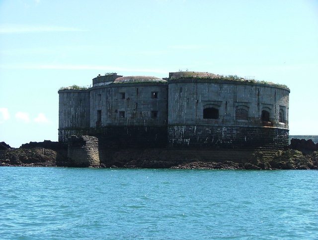
Stack Rock Fort

Stack Rock Fort is a fort built on a small island in the Milford Haven Waterway, Pembrokeshire, Wales. A 3-gun fort was built between 1850 and 1852, and...

Angle Lifeboat Station

Angle Lifeboat Station, Angle, Pembrokeshire, Wales, first opened in 1868 after a request from the local Coastguard for a lifeboat station to be opened...

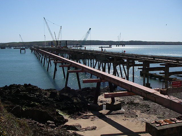
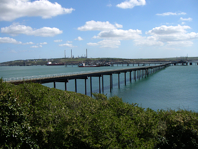
Esso Refinery, Milford Haven

The Esso Refinery at Milford Haven was an oil refinery situated on the Pembrokeshire coast in Wales. Construction started in 1957 and the refinery was...

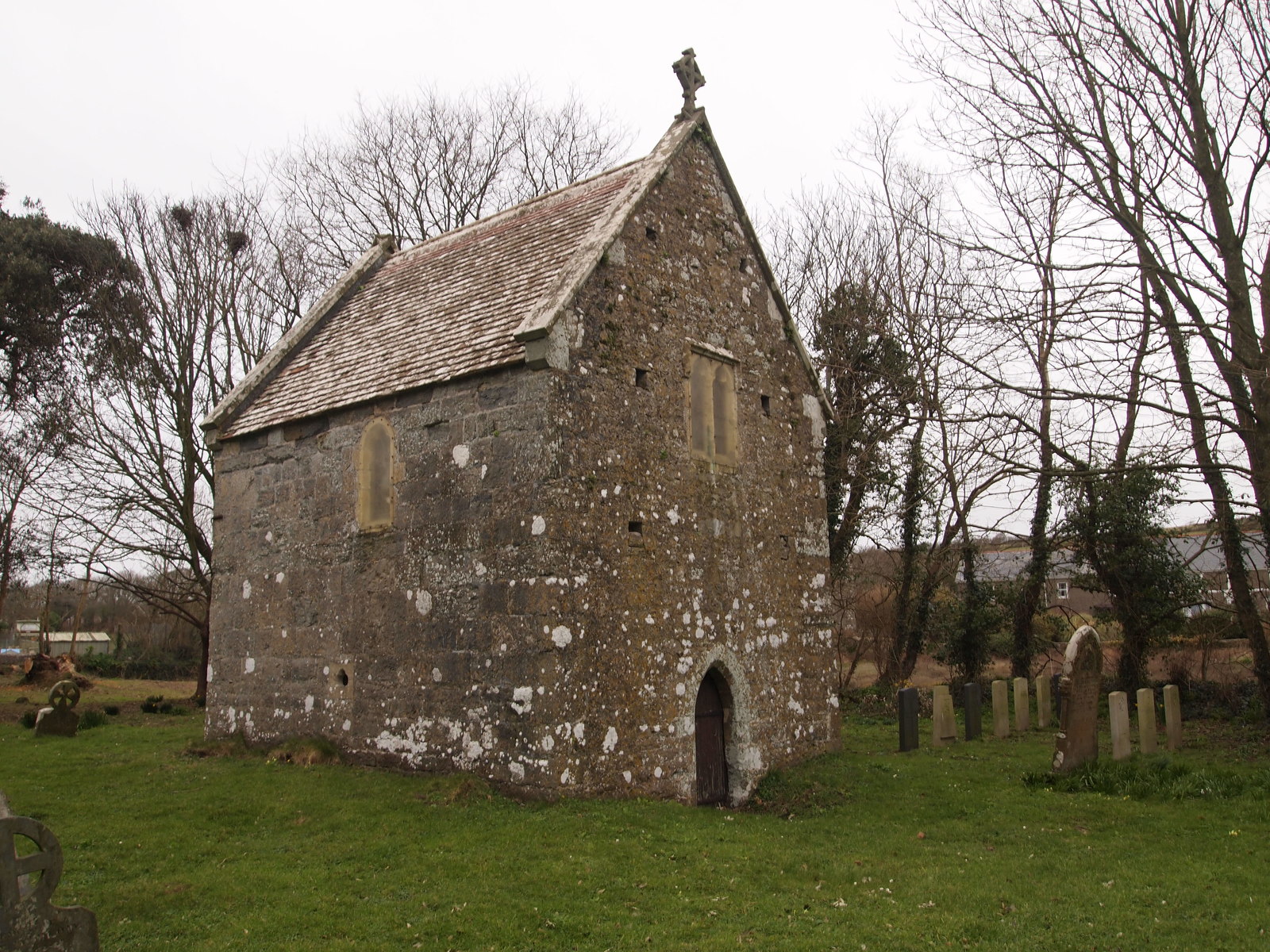
Sailors' Chapel, Angle

Sailors' Chapel, Seamen's Chapel or Fishermen's Chapel is a Grade I listed building in Angle, Pembrokeshire, Wales. The chapel, which is dedicated to St...
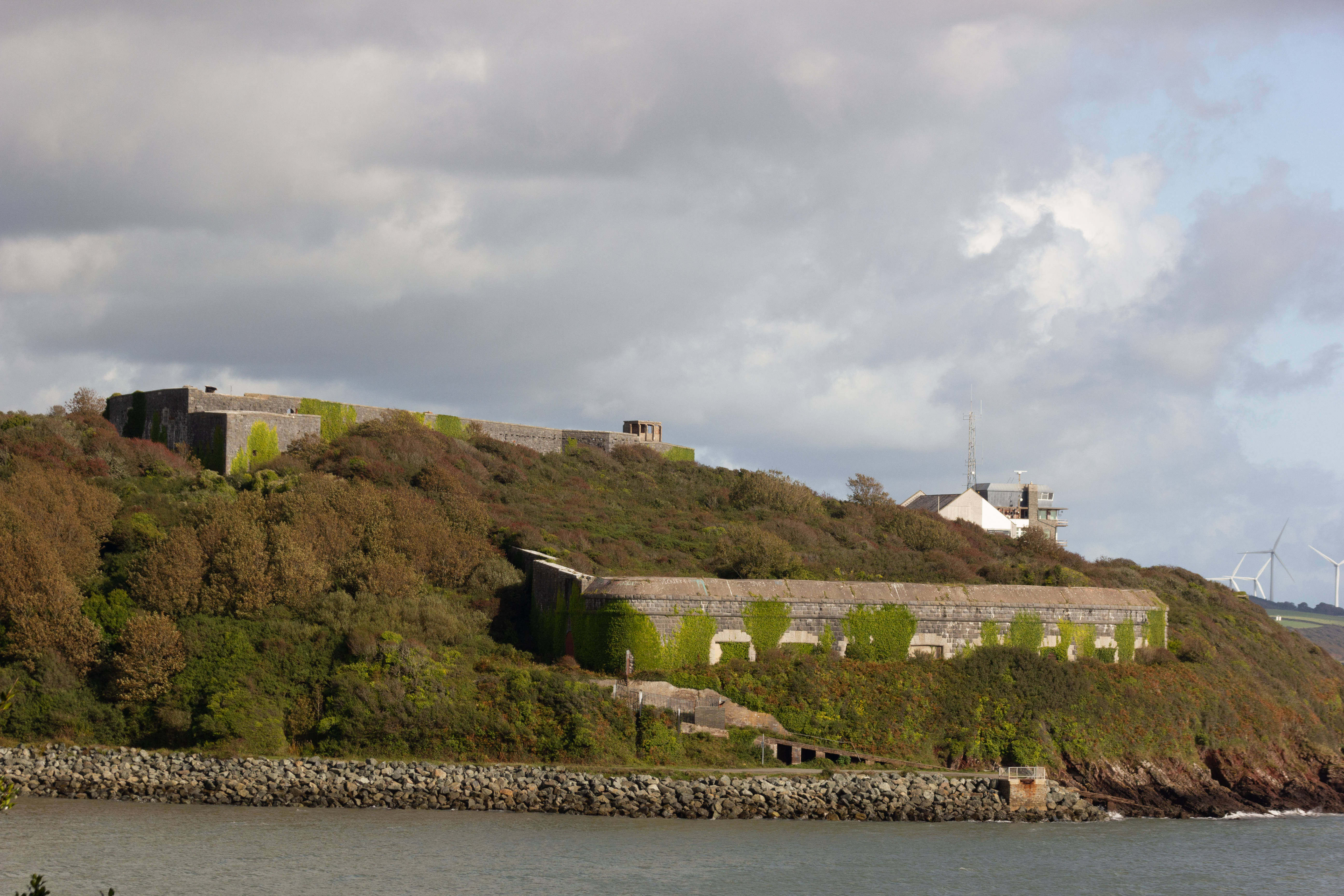
Fort Hubberstone

Fort Hubberstone, on the west side of Milford Haven, Pembrokeshire, is a Grade II* Listed Building which belongs to a series of forts built as part of...

Chapel Bay Fort

Chapel Bay Fort is located on the southern shore of the Milford Haven Waterway, Pembrokeshire, Wales. The fort is approximately 1 mile (1.6 km) from the...

Angle, Pembrokeshire

Angle (Welsh: Angl) is a village, parish and community on the southern side of the entrance to the Milford Haven Waterway in Pembrokeshire, Wales. The...

Nearby Amenities

Located within 500m of 51.698473,-5.0756262
Seamark Buoy Lateral Category: starboard
Seamark Buoy Lateral Colour: green
Seamark Buoy Lateral Shape: conical
Seamark Light Character: Fl
Seamark Light Colour: green
Seamark Light Group: 3
Seamark Light Period: 10
Seamark Name: East Angle
Seamark Type: buoy_lateral
Lat/Long: 51.6954312/-5.0706217
The data included in this document is from www.openstreetmap.org. The data is made available under ODbL.

Have you been to Aberdaugleddyf?

Leave your review of Aberdaugleddyf below (or comments, questions and feedback).