Jarvis' Landing Hole

Sea, Estuary, Creek in Yorkshire Scarborough

England

Jarvis' Landing Hole

Port Mulgrave seen from Rosedale Wyke A harbour was built in 1856-27 on Rosedale Wyke to ship ironstone from Charles Palmer's nearby mine. When the mine at Rosedale Wyke began to give out a mine (Grinkle Mine) was established three miles inland near Dalehouse. The ore was moved from the mine to the port along a tramway which finished in a tunnel a mile long emerging 10m above the sea in the cliff above the harbour. Ships were loaded from a gantry on the east harbour wall.
In 1916 Grinkle Mine was linked to the railway network and the harbour at Port Mulgrave began to fall into decay. The west harbour wall was destroyed by the army in World War II to prevent it being used by a potential German invasion.
Fishing cabins made mostly from flotsam and other found materials now line the base of the cliffs.
Port Mulgrave seen from Rosedale Wyke Credit: habiloid

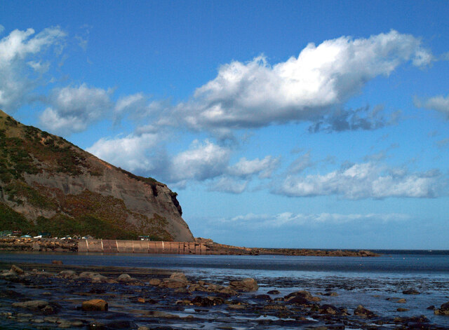
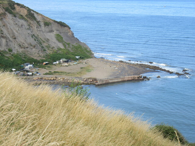
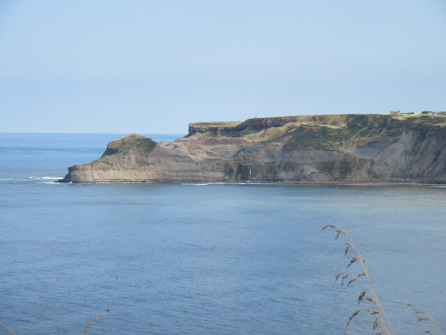
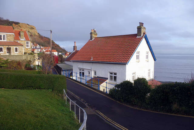
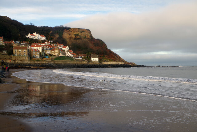
Jarvis' Landing Hole is a small coastal inlet located in Yorkshire, England. It is situated along the North Sea, specifically in the East Riding of Yorkshire. This natural feature is often referred to as a creek or an estuary due to its unique characteristics.

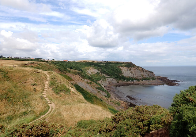
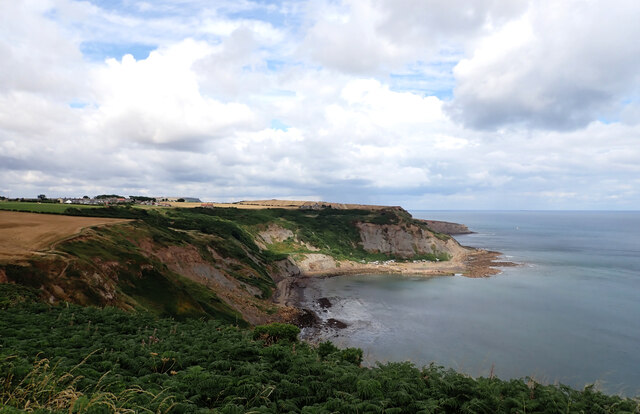
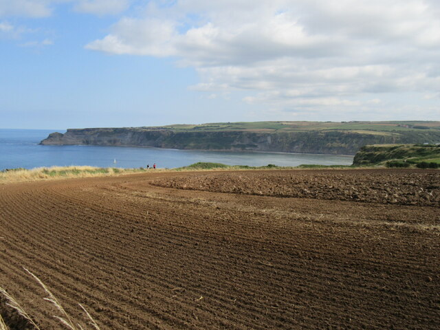
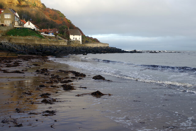
The landing hole is surrounded by picturesque rolling hills and cliffs, creating a stunning backdrop for visitors. The area is known for its rugged beauty and is a popular destination for nature enthusiasts and photographers alike. The coastline around Jarvis' Landing Hole is also home to a diverse range of wildlife, including various species of birds, seals, and other marine life.

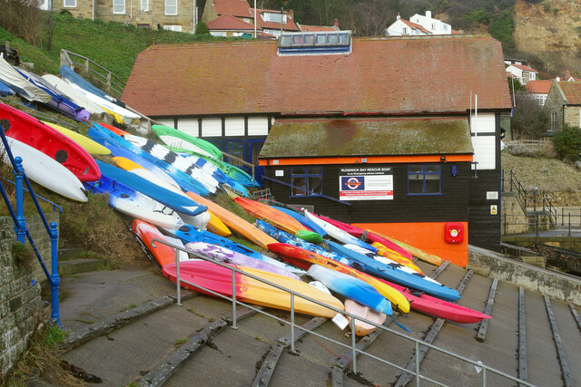
The landing hole itself is a sheltered body of water that offers a safe haven for boats and small vessels. It is often used as a mooring point for local fishermen and pleasure craft. The calm waters and gentle tides make it an ideal spot for recreational activities such as fishing, kayaking, and boating.

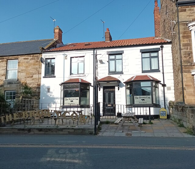
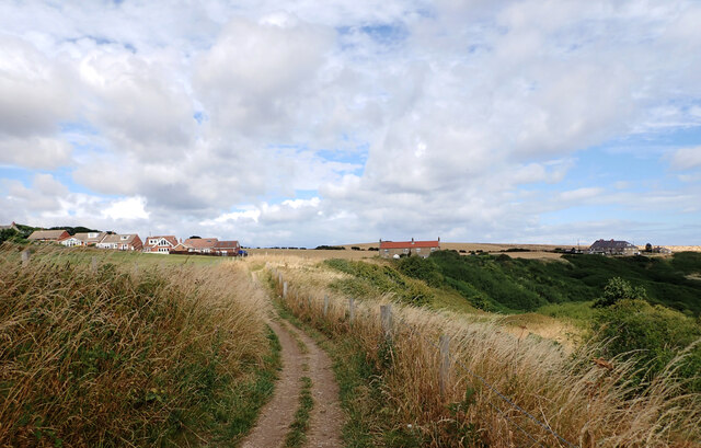
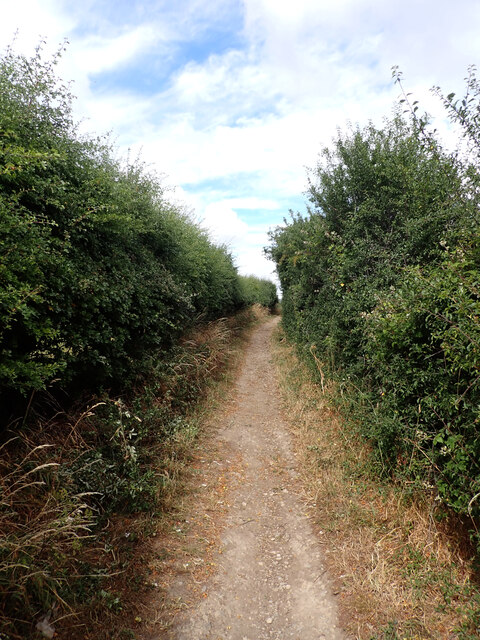
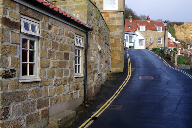
The surrounding area of Jarvis' Landing Hole is home to several quaint villages and towns, providing visitors with the opportunity to explore the local culture and heritage. The nearby coastal paths offer stunning views of the sea and the surrounding countryside, making it a popular spot for hikers and nature lovers.

Overall, Jarvis' Landing Hole is a hidden gem along the Yorkshire coast, offering a peaceful and scenic escape for those seeking natural beauty and outdoor adventure.

If you have any feedback on the listing, please let us know in the comments section below.

Jarvis' Landing Hole Images

Images are sourced within 2km of 54.534455/-0.74650697 or Grid Reference NZ8116. Thanks to Geograph Open Source API. All images are credited.

Port Mulgrave seen from Rosedale Wyke A harbour was built in 1856-27 on Rosedale Wyke to ship ironstone from Charles Palmer's nearby mine. When the mine at Rosedale Wyke began to give out a mine (Grinkle Mine) was established three miles inland near Dalehouse. The ore was moved from the mine to the port along a tramway which finished in a tunnel a mile long emerging 10m above the sea in the cliff above the harbour. Ships were loaded from a gantry on the east harbour wall.
In 1916 Grinkle Mine was linked to the railway network and the harbour at Port Mulgrave began to fall into decay. The west harbour wall was destroyed by the army in World War II to prevent it being used by a potential German invasion.
Fishing cabins made mostly from flotsam and other found materials now line the base of the cliffs.
Port Mulgrave seen from Rosedale Wyke
A harbour was built in 1856-27 on Rosedale Wyke to ship ironstone from Charles Palmer's nearby mine. When the mine at Rosedale Wyke began to give out a mine (Grinkle Mine) was established three miles inland near Dalehouse. The ore was moved from the mine to the port along a tramway which finished in a tunnel a mile long emerging 10m above the sea in the cliff above the harbour. Ships were loaded from a gantry on the east harbour wall. In 1916 Grinkle Mine was linked to the railway network and the harbour at Port Mulgrave began to fall into decay. The west harbour wall was destroyed by the army in World War II to prevent it being used by a potential German invasion. Fishing cabins made mostly from flotsam and other found materials now line the base of the cliffs.
Port Mulgrave The pier was damaged to prevent Germans from using it to land during WW2.
Port Mulgrave
The pier was damaged to prevent Germans from using it to land during WW2.
Hinderwell-The Brown Cow Public House on High Street.
Hinderwell-The Brown Cow
Public House on High Street.
The Cleveland Way entering Port Mulgrave The Cleveland Way runs 110 miles (177 km) between Helmsley and the Brigg at Filey, skirting the North York Moors National Park. Its highest point is at Urra Moor, 1,489 ft (454 m).
The Cleveland Way entering Port Mulgrave
The Cleveland Way runs 110 miles (177 km) between Helmsley and the Brigg at Filey, skirting the North York Moors National Park. Its highest point is at Urra Moor, 1,489 ft (454 m).
The Cleveland Way above Rosedale Cliffs The Cleveland Way runs 110 miles (177 km) between Helmsley and the Brigg at Filey, skirting the North York Moors National Park. Its highest point is at Urra Moor, 1,489 ft (454 m).
The Cleveland Way above Rosedale Cliffs
The Cleveland Way runs 110 miles (177 km) between Helmsley and the Brigg at Filey, skirting the North York Moors National Park. Its highest point is at Urra Moor, 1,489 ft (454 m).
The Cleveland Way and Port Mulgrave Harbour The Cleveland Way runs 110 miles (177 km) between Helmsley and the Brigg at Filey, skirting the North York Moors National Park. Its highest point is at Urra Moor, 1,489 ft (454 m).
The Cleveland Way and Port Mulgrave Harbour
The Cleveland Way runs 110 miles (177 km) between Helmsley and the Brigg at Filey, skirting the North York Moors National Park. Its highest point is at Urra Moor, 1,489 ft (454 m).
Rosedale Wyke seen from Lingrow Cliffs, Hinderwell
Lingrow Cliffs Looking east on Lingrow Cliffs.
Lingrow Cliffs
Looking east on Lingrow Cliffs.
Looking towards Kettleness From the Cleveland Way near Runswick Bay.
Looking towards Kettleness
From the Cleveland Way near Runswick Bay.
Runswick Bay Sailing Club Next to Calais Beck.
Runswick Bay Sailing Club
Next to Calais Beck.
Runswick Bay Public Comveniences The Car Park in Bank Top Lane.
Runswick Bay Public Comveniences
The Car Park in Bank Top Lane.
A view from the pier, Port Mulgrave A harbour was built in 1856-27 on Rosedale Wyke to ship ironstone from Charles Palmer's nearby mine. When the mine at Rosedale Wyke began to give out a mine (Grinkle Mine) was established three miles inland near Dalehouse. The ore was moved from the mine to the port along a tramway which finished in a tunnel a mile long emerging 10m above the sea in the cliff above the harbour. Ships were loaded from a gantry on the east harbour wall.
In 1916 Grinkle Mine was linked to the railway network and the harbour at Port Mulgrave began to fall into decay. The west harbour wall was destroyed by the army in World War II to prevent it being used by a potential German invasion.
Fishing cabins made mostly from flotsam and other found materials now line the base of the cliffs.
A view from the pier, Port Mulgrave
A harbour was built in 1856-27 on Rosedale Wyke to ship ironstone from Charles Palmer's nearby mine. When the mine at Rosedale Wyke began to give out a mine (Grinkle Mine) was established three miles inland near Dalehouse. The ore was moved from the mine to the port along a tramway which finished in a tunnel a mile long emerging 10m above the sea in the cliff above the harbour. Ships were loaded from a gantry on the east harbour wall. In 1916 Grinkle Mine was linked to the railway network and the harbour at Port Mulgrave began to fall into decay. The west harbour wall was destroyed by the army in World War II to prevent it being used by a potential German invasion. Fishing cabins made mostly from flotsam and other found materials now line the base of the cliffs.
Lane up from the beach at Runswick Bay The lane becomes steep as it heads for the upper part of the village. The entrance to a public car park (pay and display in summer, free in winter) can be seen on the left; this is the only facility for visitors but there are also car parks for residents and members of the sailing club. Parking is not allowed on the road, enforced with double yellow lines.
Lane up from the beach at Runswick Bay
The lane becomes steep as it heads for the upper part of the village. The entrance to a public car park (pay and display in summer, free in winter) can be seen on the left; this is the only facility for visitors but there are also car parks for residents and members of the sailing club. Parking is not allowed on the road, enforced with double yellow lines.
Runswick Bay A former fishing village, now very much a holiday destination (many of the properties here are holiday lets), the village at Runswick Bay huddles around the north end of the beach. It was in fact relocated to this site in 1682 after the original village was destroyed in a landslip. This is one of the best-loved locations on the Yorkshire coast.
Runswick Bay
A former fishing village, now very much a holiday destination (many of the properties here are holiday lets), the village at Runswick Bay huddles around the north end of the beach. It was in fact relocated to this site in 1682 after the original village was destroyed in a landslip. This is one of the best-loved locations on the Yorkshire coast.
Runswick Bay This narrow lane passes through the lower village above the beach. The Royal Hotel, actually the village pub, is just ahead on the left (but out of shot).
Runswick Bay
This narrow lane passes through the lower village above the beach. The Royal Hotel, actually the village pub, is just ahead on the left (but out of shot).
Runswick Bay: Kayaks and Rescue Boat Station A number of colourful kayaks are stored here just above the beach and behind them is the Runswick Bay Rescue Boat Station. This inshore facility operates independently of the RNLI and was established in 1982 after the lifeboat was moved to Staithes.
Runswick Bay: Kayaks and Rescue Boat Station
A number of colourful kayaks are stored here just above the beach and behind them is the Runswick Bay Rescue Boat Station. This inshore facility operates independently of the RNLI and was established in 1982 after the lifeboat was moved to Staithes.
Runswick Bay Showing the north end of the beach where the village tumbles down to the sea.
Runswick Bay
Showing the north end of the beach where the village tumbles down to the sea.
Runswick Bay Beach The tide is out making it easy to walk the full length of the beach. Runswick Bay village can be seen in the background.
Runswick Bay Beach
The tide is out making it easy to walk the full length of the beach. Runswick Bay village can be seen in the background.
Show me another place!

Jarvis' Landing Hole is located at Grid Ref: NZ8116 (Lat: 54.534455, Lng: -0.74650697)

Division: North Riding

Administrative County: North Yorkshire

District: Scarborough

Police Authority: North Yorkshire

What 3 Words

///starlight.offhand.speaking. Near Loftus, North Yorkshire

Related Wikis

Runswick Bay Lifeboat Station

Runswick Bay Lifeboat Station was a Royal National Lifeboat Institution (RNLI) lifeboat station located in Runswick Bay in North Yorkshire, England. The...

Runswick Bay

Runswick Bay is a bay in the Scarborough Borough of North Yorkshire, England. It is also the name of a village located on the western edge of the bay...

Hob Holes

The Hob Holes are caves in the cliffs of Runswick Bay, Scarborough, England which resulted from mining for jet – fossilised wood which is valuable as a...

Hinderwell railway station

Hinderwell railway station was a railway station on the Whitby Redcar and Middlesbrough Union Railway. It was opened on 3 December 1883, and served the...

Kettleness

Kettleness, is a hamlet in the Scarborough District of North Yorkshire, England. The settlement only consists of half-a-dozen houses, but up until the...

Ellerby, North Yorkshire

Ellerby is a village and civil parish in the Scarborough district of North Yorkshire, England, located within the North York Moors National Park. According...

Kettleness railway station

Kettleness was a railway station on the Whitby, Redcar and Middlesbrough Union Railway from 1883 to 1958 serving the remote village of Kettleness. The...

Hinderwell

Hinderwell is a village and civil parish in the Scarborough district of North Yorkshire, England which lies within the North York Moors National Park,...

Nearby Amenities

Located within 500m of 54.534455,-0.74650697
Source: PGS
Lat/Long: 54.530258/-0.7473155
Source: PGS
Lat/Long: 54.531937/-0.7491233
Source: PGS
Lat/Long: 54.5323083/-0.7489406
Source: PGS
Lat/Long: 54.5331047/-0.749797
Source: PGS
Lat/Long: 54.5338312/-0.7489023
Source: PGS
Lat/Long: 54.5339464/-0.7485783
Source: PGS
Lat/Long: 54.5344662/-0.7479963
Source: PGS
Lat/Long: 54.5347697/-0.7480929
Source: PGS
Lat/Long: 54.5350498/-0.7479372
Source: PGS
Lat/Long: 54.5351525/-0.7476852
Source: PGS
Lat/Long: 54.5356785/-0.7471219
Source: PGS
Lat/Long: 54.5359929/-0.7470307
Source: PGS
Lat/Long: 54.5364473/-0.7470522
Source: PGS
Lat/Long: 54.5369267/-0.7475108
Source: PGS
Lat/Long: 54.5373235/-0.7478675
Source: PGS
Lat/Long: 54.5375366/-0.7485166
Source: PGS
Lat/Long: 54.5379941/-0.7491926
Source: PGS
Lat/Long: 54.5383832/-0.7493187
Runswick Bay
Place: village
Wikidata: Q24638325
Wikipedia: en:Runswick Bay
Lat/Long: 54.5327493/-0.7503506
Source: PGS
Lat/Long: 54.5333831/-0.7496367
Post Box
Collection Times: Mo-Fr 16:15; Sa 09:30
Post Box Type: lamp
Ref: TS13 515
Royal Cypher: EIIR
Royal Cypher Wikidata: Q33102113
Source: survey
Lat/Long: 54.5334606/-0.7501158
Bench
Lat/Long: 54.5340455/-0.7516466
Telephone
Booth: K6
Covered: booth
Source: survey
Lat/Long: 54.5331099/-0.7503362
Addr Housename: Lilac Cottage
Lat/Long: 54.5332788/-0.7507154
Addr Housename: Seagull Cottage
Lat/Long: 54.5333051/-0.7505959
York Cottage
Addr City: Saltburn-by-the-Sea
Addr Housename: York Cottage
Addr Postcode: TS13 5HT
Addr Suburb: Runswick Bay
Tourism: guest_house
Website: http://www.yorkcottagerunswickbay.com/
Lat/Long: 54.5332621/-0.7508405
Bar
Cliffemount Hotel
Lat/Long: 54.5340264/-0.7521945
Toilets
Lat/Long: 54.5331159/-0.7502499
Mini Roundabout
Lat/Long: 54.532733/-0.7506202
Bench
Lat/Long: 54.5338749/-0.7521293
Bench
Lat/Long: 54.5338695/-0.7520394
Bench
Source: survey
Lat/Long: 54.5326244/-0.7495775
Bench
Source: survey
Lat/Long: 54.5326548/-0.749607
Bench
Source: survey
Lat/Long: 54.5326692/-0.7496654
Bench
Source: survey
Lat/Long: 54.5326937/-0.7496982
Bench
Source: survey
Lat/Long: 54.532698/-0.7497465
Bench
Source: survey
Lat/Long: 54.5327345/-0.7498055
Bench
Source: survey;gps
Lat/Long: 54.5332049/-0.7504606
Bench
Source: survey;gps
Lat/Long: 54.5332217/-0.7504385
Bench
Source: survey;gps
Lat/Long: 54.5340224/-0.7508308
Barrier: stile
Material: wood
Source: survey;gps
Stile: stepover
Lat/Long: 54.535132/-0.7515281
Bench
Backrest: yes
Lat/Long: 54.5331649/-0.7537115
The data included in this document is from www.openstreetmap.org. The data is made available under ODbL.

Have you been to Jarvis' Landing Hole?

Leave your review of Jarvis' Landing Hole below (or comments, questions and feedback).