Knowle End
Coastal Feature, Headland, Point in Yorkshire Scarborough
England
Knowle End
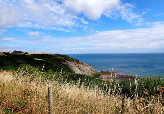
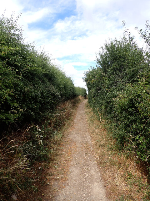
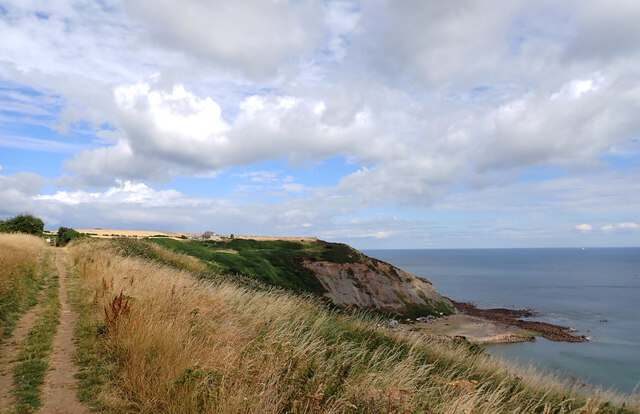
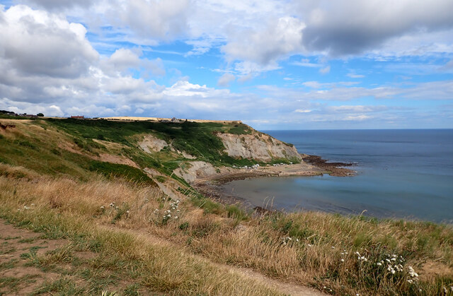
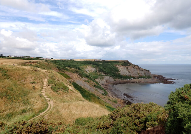
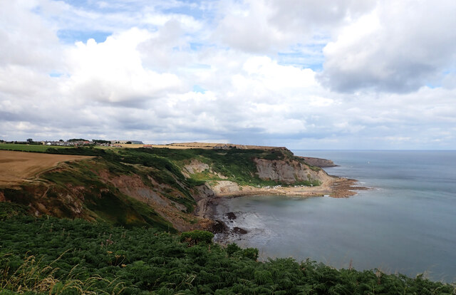
Knowle End is a prominent headland located on the Yorkshire coast in England. Situated in the county of Yorkshire, it is known for its dramatic cliffs and stunning coastal views. The headland juts out into the North Sea, forming a distinct point that is easily recognizable from afar.
The geography of Knowle End is characterized by rugged cliffs that rise steeply above the sea. These cliffs are composed of sedimentary rock, with layers that reveal the area's geological history. The headland is also home to a diverse range of flora and fauna, with various species of seabirds nesting on the cliffs and in the surrounding areas.
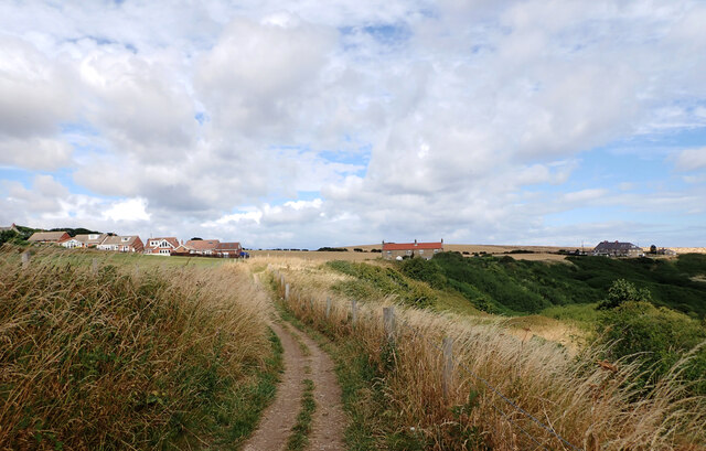
The coastal feature offers visitors a unique and picturesque experience. From the top of Knowle End, one can enjoy panoramic views of the North Sea, with its ever-changing tides and waves crashing against the cliffs below. The headland is a popular spot for birdwatching, as it provides an ideal vantage point to observe the seabirds in their natural habitat.
Knowle End is also known for its rich history. The headland has been inhabited for centuries, with archaeological evidence suggesting human presence dating back to the prehistoric era. The area has witnessed various historical events, including Viking invasions and medieval battles.
Today, Knowle End attracts tourists and locals alike, who come to admire its natural beauty and explore its historical significance. The headland offers a range of recreational activities, including hiking, rock climbing, and coastal walks. It is a must-visit destination for anyone seeking a combination of stunning coastal landscapes and a glimpse into Yorkshire's past.
If you have any feedback on the listing, please let us know in the comments section below.
Knowle End Images
Images are sourced within 2km of 54.534967/-0.74732587 or Grid Reference NZ8116. Thanks to Geograph Open Source API. All images are credited.
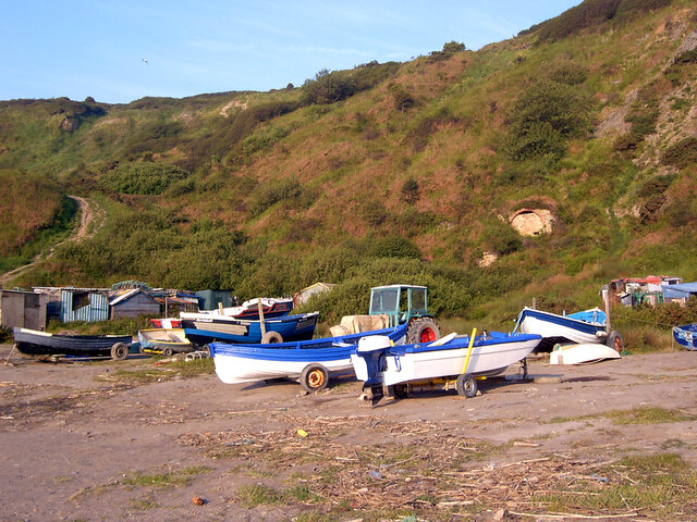
![Port Mulgrave This is Port Mulgrave, once an active harbour east of Staithes, where ironstone was exported to foundries on Tyneside.
There is still no easy way down to the harbour. Once there were steps used by the men to descend every day to work on the quays and gantries, the cranes and tips, and the ships. These steps have long disappeared, and a galvanised metal set of steps that replaced the makeshift path is currently closed due to a landslip. Prior to this there was another landslip in 2016 when I was involved with the National Trust in remedial work to clear the path; see <a title="https://www.geograph.org.uk/snippet/14435" href="https://www.geograph.org.uk/snippet/14435">Link</a>.
Half way along the beach is evidence of another recent landslip.
Port Mulgrave is home to a small community of fishermen, with their huts, boats and tractors. I have often wondered how they got their tractors on the beach. A report from 1995 perhaps provides a clue.
I did say 1995, a year when I was certainly familiar with the harbour, and the report made the national newspapers. But I have no recollection.
72-year-old Walter Walker lived in the village on the cliff top. He had moved from Leeds in the 1950s with the dream of becoming a salmon fisherman. In 1970, he began building is own boat in his back garden, a 20-foot, 17-ton catamaran, named &#039;Stealaway&#039;.
In 1995, his boat was completed but a couple of obstacles stood between him and the sea. Firstly, his garden was only accessible through a cornfield as it had been cut off from the track that led down to the harbour by a development.
The second minor obstacle was the 300-foot cliff face.
The farmer of the field refused permission but Walker moved his boat anyway, dragging it the 400 yards through the cornfield at a rate of 60 yards a day. The farmer just happened to be on holiday at the time. Solicitors&#039; letters followed but Walker thought &quot;What the hell&quot;.
The move was the talk of the village; there was a turn out of 200 onlookers, and a local councillor served drinks.
In order to lower his boat down the cliff, Walker &quot;dug a trench right down the face&quot;. This incurred the wrath of English Nature as it is a Site of Special Scientific Interest because of its layers of rock and fossils. It is &quot;regarded as the standard textbook example of a particular chapter in geological time, the layers date back 180 million years. The site is one of the few where Whitby jet can be seen at the surface.&quot;
I wonder if there is any connection between Mr. Walker&#039;s trench and the recent landslips.
Taken from my daily blog <span class="nowrap"><a title="http://www.fhithich.uk/?p=27045" rel="nofollow ugc noopener" href="http://www.fhithich.uk/?p=27045">Link</a><img style="margin-left:2px;" alt="External link" title="External link - shift click to open in new window" src="https://s1.geograph.org.uk/img/external.png" width="10" height="10"/></span>.
Sources:
&#039;Fisherman&#039;s voyage round the corn&#039; (1995) Daily Mail, 11 Jul, 21, available: <span class="nowrap"><a title="https://link-gale-com.ezproxy.is.ed.ac.uk/apps/doc/EE1860958166/GDCS?u=ed_itw&amp;sid=bookmark-GDCS&amp;xid=7c83ff3b" rel="nofollow ugc noopener" href="https://link-gale-com.ezproxy.is.ed.ac.uk/apps/doc/EE1860958166/GDCS?u=ed_itw&amp;sid=bookmark-GDCS&amp;xid=7c83ff3b">Link</a><img style="margin-left:2px;" alt="External link" title="External link - shift click to open in new window" src="https://s1.geograph.org.uk/img/external.png" width="10" height="10"/></span> [accessed 19 Dec 2021].
&#039;Old man&#039;s short cut to the sea mars geology site&#039; (1995) Times, 07 Sep, 5, available: <span class="nowrap"><a title="https://link-gale-com.ezproxy.is.ed.ac.uk/apps/doc/IF0503412648/GDCS?u=ed_itw&amp;sid=bookmark-GDCS&amp;xid=2893a381" rel="nofollow ugc noopener" href="https://link-gale-com.ezproxy.is.ed.ac.uk/apps/doc/IF0503412648/GDCS?u=ed_itw&amp;sid=bookmark-GDCS&amp;xid=2893a381">Link</a><img style="margin-left:2px;" alt="External link" title="External link - shift click to open in new window" src="https://s1.geograph.org.uk/img/external.png" width="10" height="10"/></span> [accessed 19 Dec 2021].](https://s3.geograph.org.uk/geophotos/07/04/85/7048539_3912d4ae.jpg)

Knowle End is located at Grid Ref: NZ8116 (Lat: 54.534967, Lng: -0.74732587)
Division: North Riding
Administrative County: North Yorkshire
District: Scarborough
Police Authority: North Yorkshire
What 3 Words
///necklaces.blocks.cape. Near Loftus, North Yorkshire
Nearby Locations
Related Wikis

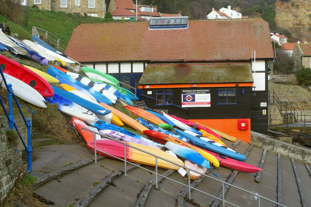
Runswick Bay Lifeboat Station
Runswick Bay Lifeboat Station was a Royal National Lifeboat Institution (RNLI) lifeboat station located in Runswick Bay in North Yorkshire, England. The...

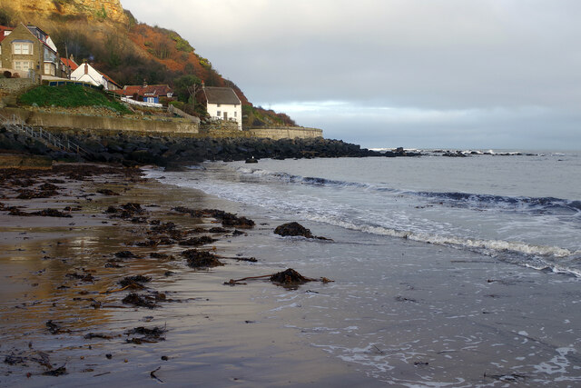
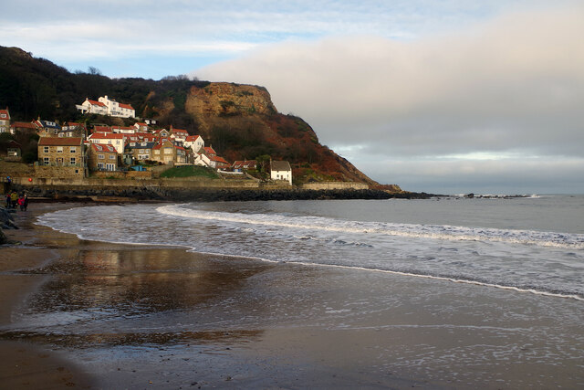
Runswick Bay
Runswick Bay is a bay in North Yorkshire, England. It is also the name of a village located on the western edge of the bay (although the village is sometimes...

Hob Holes
The Hob Holes are caves in the cliffs of Runswick Bay, Scarborough, England which resulted from mining for jet – fossilised wood which is valuable as a...

Hinderwell railway station
Hinderwell railway station was a railway station on the Whitby Redcar and Middlesbrough Union Railway. It was opened on 3 December 1883, and served the...
Nearby Amenities
Located within 500m of 54.534967,-0.74732587Have you been to Knowle End?
Leave your review of Knowle End below (or comments, questions and feedback).