Broad Sound

Sea, Estuary, Creek in Pembrokeshire

Wales

Broad Sound

Caves at Jack Sound Three large caves and impressive rock folding in a small promontory. Wooltack Point in the background.
Caves at Jack Sound Credit: Trevor Rickard

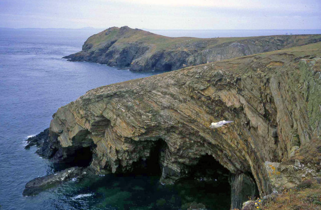
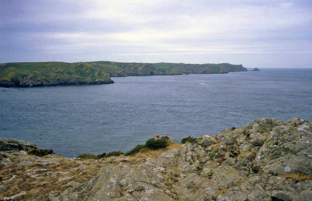
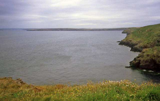
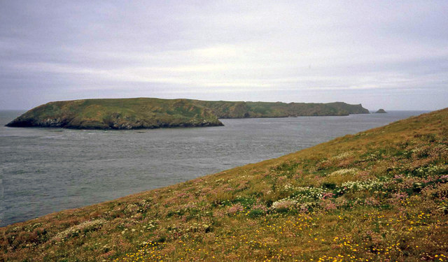
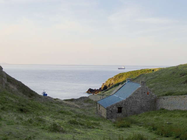
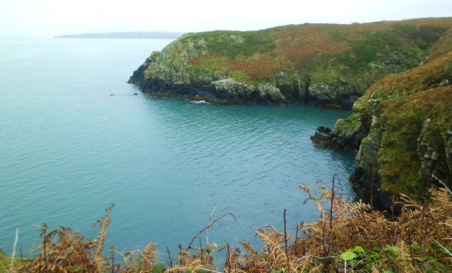
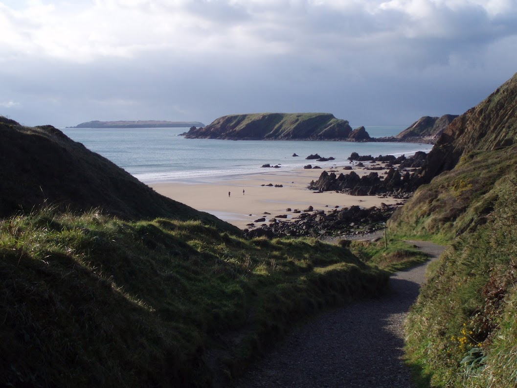
Broad Sound is a picturesque body of water located in the county of Pembrokeshire, Wales. It is a combination of a sea, estuary, and creek, offering a diverse and unique landscape for both locals and tourists to enjoy.

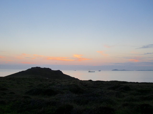
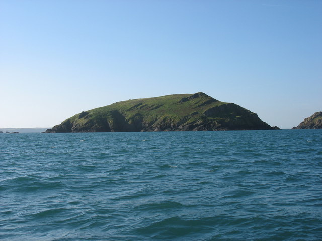
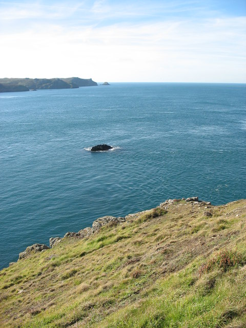
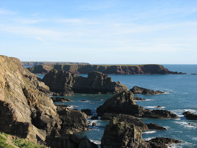
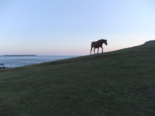
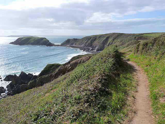
Situated along the western coast of Wales, Broad Sound is a broad stretch of water that connects the Celtic Sea to the estuaries of the Cleddau Rivers. The area is known for its stunning natural beauty, with a mixture of sandy beaches, rocky cliffs, and lush green hillsides surrounding the water.

The sea within Broad Sound is a part of the vast Celtic Sea, which is renowned for its rich marine life and diverse ecosystem. It provides a habitat for a wide range of species, including seals, dolphins, and various types of fish. The clear blue waters are ideal for water activities such as swimming, snorkeling, and sailing.

The estuary within Broad Sound is formed by the meeting of the Western Cleddau and Eastern Cleddau Rivers. As the rivers flow into the open sea, they create a unique mix of saltwater and freshwater, resulting in a brackish environment. This estuarine ecosystem supports a variety of bird species, including herons, egrets, and wading birds, making it a popular spot for birdwatching.

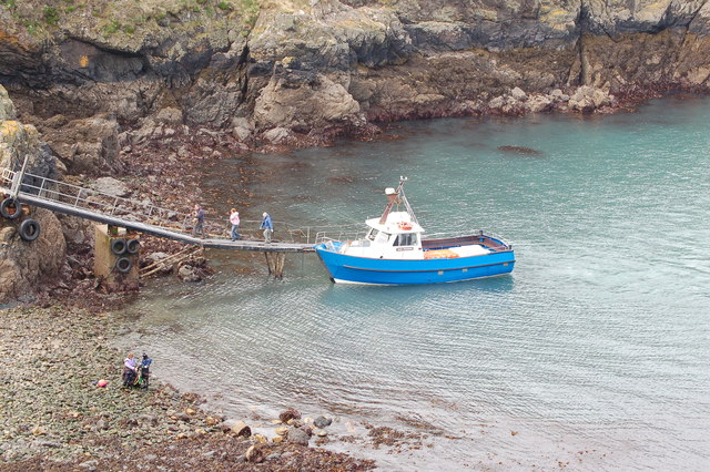
Within Broad Sound, there are also several creeks, smaller inlets of water that branch off from the main body. These creeks provide sheltered areas for wildlife and are often used by local fishermen for crabbing and angling.

Overall, Broad Sound is a captivating and diverse coastal area, offering a range of natural wonders and recreational opportunities for visitors to explore and enjoy.

If you have any feedback on the listing, please let us know in the comments section below.

Broad Sound Images

Images are sourced within 2km of 51.72854/-5.2427403 or Grid Reference SM7608. Thanks to Geograph Open Source API. All images are credited.

Caves at Jack Sound Three large caves and impressive rock folding in a small promontory. Wooltack Point in the background.
Caves at Jack Sound
Three large caves and impressive rock folding in a small promontory. Wooltack Point in the background.
Wooltack Point Looking westwards towards Skomer island with the Garland Stone offshore on the right.
Wooltack Point
Looking westwards towards Skomer island with the Garland Stone offshore on the right.
Coastline east of Haven Point From the grassy top of Haven Point looking east across the bay to the cliffs between Marloes and St Brides.
Coastline east of Haven Point
From the grassy top of Haven Point looking east across the bay to the cliffs between Marloes and St Brides.
Wild Flowers on Wooltack Point Looking west to Skomer. Plenty of spring blooms on the clifftop here, including thrift and sea campion.
Wild Flowers on Wooltack Point
Looking west to Skomer. Plenty of spring blooms on the clifftop here, including thrift and sea campion.
Evening at Martin's Haven
Evening at Wooltack Point, Pembrokeshire In the foreground the rocky headland of Wooltack Point, beyond it ships at anchor in St Bride's Bay, with a distant view of Ramsey Island.
Evening at Wooltack Point, Pembrokeshire
In the foreground the rocky headland of Wooltack Point, beyond it ships at anchor in St Bride's Bay, with a distant view of Ramsey Island.
Midland Isle Between Skomer Island and the mainland at Martin's Haven.
Midland Isle
Between Skomer Island and the mainland at Martin's Haven.
Wooltack Point and Tusker Rock Looking towards Skomer Island, with Garland Stone about 3.5 kilometres away in line with Tusker Rock.
This visit in 2007 had poignant memories for me, as five years earlier I had scattered my aunt's ashes at the tip of Wooltack Point. She had requested this spot as, for her, it was "where earth met heaven". When I first went there, I could see what she meant.
Wooltack Point and Tusker Rock
Looking towards Skomer Island, with Garland Stone about 3.5 kilometres away in line with Tusker Rock. This visit in 2007 had poignant memories for me, as five years earlier I had scattered my aunt's ashes at the tip of Wooltack Point. She had requested this spot as, for her, it was "where earth met heaven". When I first went there, I could see what she meant.
Gateholm Island Gateholm is a tidal island, i.e. cut off at high tide but not at low tide. However from this perspective it seems that it would be difficult to climb to its plateau (about 40m high) even when access from Marloes Sands is easy.
Gateholm Island
Gateholm is a tidal island, i.e. cut off at high tide but not at low tide. However from this perspective it seems that it would be difficult to climb to its plateau (about 40m high) even when access from Marloes Sands is easy.
The Pembrokeshire coast south of Martin's Haven The flat-topped land in the middle distance is Gateholm Island (and this photo suggests that a few earlier photos in the square have been wrongly located, though the evidence is not strong enough to suggest a change). The more distant (and rather higher) land is the peninsula leading to St Anne's Head.
The Pembrokeshire coast south of Martin's Haven
The flat-topped land in the middle distance is Gateholm Island (and this photo suggests that a few earlier photos in the square have been wrongly located, though the evidence is not strong enough to suggest a change). The more distant (and rather higher) land is the peninsula leading to St Anne's Head.
Pony near Wooltack Point, on a midsummer's evening This pony had been grazing much lower down, and when it decided to head up the slope I had just a few seconds to catch this silhouette against the evening sky.  Shot taken at 21.08, a few days after midsummer.

I am posting this shot several months after the event - to celebrate the completion of my first thousand images on Geograph.
Pony near Wooltack Point, on a midsummer's evening
This pony had been grazing much lower down, and when it decided to head up the slope I had just a few seconds to catch this silhouette against the evening sky. Shot taken at 21.08, a few days after midsummer. I am posting this shot several months after the event - to celebrate the completion of my first thousand images on Geograph.
Skomer ferry arrives back at Martin's Haven
The path from Marloes Sands The building on the right is the Youth Hostel <a href="https://www.geograph.org.uk/gridref/SM7708">SM7708</a>.
The path from Marloes Sands
The building on the right is the Youth Hostel SM7708.
Gateholm Island The Pembrokeshire Coast Path traverses the cliff top at the western end of Marloes Sands. Ahead is the tidal Gateholm Island. Skokholm Island <a href="https://www.geograph.org.uk/gridref/SM7305">SM7305</a> lies on the horizon.
Gateholm Island
The Pembrokeshire Coast Path traverses the cliff top at the western end of Marloes Sands. Ahead is the tidal Gateholm Island. Skokholm Island SM7305 lies on the horizon.
Marloes Sands Youth Hostel The upper floor of the near building is the "Hayloft" - warden's quarters - as occupied by me on a couple of occasions in the distant past.
Marloes Sands Youth Hostel
The upper floor of the near building is the "Hayloft" - warden's quarters - as occupied by me on a couple of occasions in the distant past.
The courtyard of Marloes Sands Youth Hostel Manned by volunteer wardens.
The courtyard of Marloes Sands Youth Hostel
Manned by volunteer wardens.
Marloes Sands The sandy beach of Marloes Sands is pierced by many outcrops of rock.
Marloes Sands
The sandy beach of Marloes Sands is pierced by many outcrops of rock.
The coast at High Point The view from the coast path east of Martins Haven.
The coast at High Point
The view from the coast path east of Martins Haven.
Show me another place!

Broad Sound is located at Grid Ref: SM7608 (Lat: 51.72854, Lng: -5.2427403)

Unitary Authority: Pembrokeshire

Police Authority: Dyfed Powys

What 3 Words

///workshop.eyelashes.critic. Near Dale, Pembrokeshire

Related Wikis

Martin's Haven

Martin's Haven is a small bay in Pembrokeshire, Wales, UK, on the Dale Peninsula, with views across St Bride's Bay towards St David's. Its shingle beach...

Jack Sound

Jack Sound is a treacherous body of water about 800 metres (2,600 ft) wide between the island of Skomer and the Pembrokeshire mainland that contains numerous...

Marloes Mere

Marloes Mere is a Site of Special Scientific Interest (or SSSI) in Pembrokeshire, South Wales. It has been designated as a Site of Special Scientific Interest...

Gateholm

Gateholm or Gateholm Island is a small tidal island off the south west coast of Pembrokeshire, in the community of Marloes and St Brides, in the south...

Middleholm

Middleholm, also known as Midland Isle, is a small island lying off southwest Pembrokeshire in Wales, between the island of Skomer and the mainland in...

Skomer Marine Conservation Zone

Skomer Marine Conservation Zone is an underwater marine nature reserve located off the coast of Pembrokeshire in Wales. The nature reserve completely surrounds...

Marloes Sands

Marloes Sands (Welsh: Traeth Marloes) is an approx. 1.5 kilometres (0.93 mi) long remote sandy beach in Pembrokeshire, Wales, near the village of Marloes...

Marloes

Marloes is a village and parish in Pembrokeshire, Wales, on the Marloes Peninsula 7 miles (11 km) west of Milford Haven and forms the western tip of the...

Nearby Amenities

Located within 500m of 51.72854,-5.2427403
The data included in this document is from www.openstreetmap.org. The data is made available under ODbL.

Have you been to Broad Sound?

Leave your review of Broad Sound below (or comments, questions and feedback).