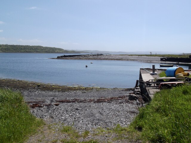
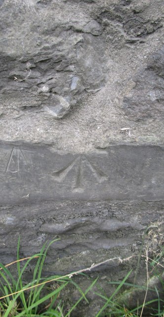
Shuna Sound

Sea, Estuary, Creek in Argyllshire

Scotland

Shuna Sound

Luing - Kilchatton - Ruined church and associated graveyard This ruined church stands in its graveyard near to a road junction in the midst of the Isle of Luing just northwest of the village of Toberonochy.
The ruins of the church are a Designated Ancient Monument <span class="nowrap"><a title="http://portal.historicenvironment.scot/designation/SM3808" rel="nofollow ugc noopener" href="http://portal.historicenvironment.scot/designation/SM3808">Link</a><img style="margin-left:2px;" alt="External link" title="External link - shift click to open in new window" src="https://s1.geograph.org.uk/img/external.png" width="10" height="10"/></span> while the graveyard is Category 'B' listed <span class="nowrap"><a title="http://portal.historicenvironment.scot/designation/LB12196" rel="nofollow ugc noopener" href="http://portal.historicenvironment.scot/designation/LB12196">Link</a><img style="margin-left:2px;" alt="External link" title="External link - shift click to open in new window" src="https://s1.geograph.org.uk/img/external.png" width="10" height="10"/></span>
Canmore website information: <span class="nowrap"><a title="https://canmore.org.uk/site/22552/luing-kilchattan-old-parish-church" rel="nofollow ugc noopener" href="https://canmore.org.uk/site/22552/luing-kilchattan-old-parish-church">Link</a><img style="margin-left:2px;" alt="External link" title="External link - shift click to open in new window" src="https://s1.geograph.org.uk/img/external.png" width="10" height="10"/></span>
See also:
<a href="https://www.geograph.org.uk/photo/7258575">NM7409 : Luing - Kilchatton - Ruined church from its graveyard</a>
<a href="https://www.geograph.org.uk/photo/7258583">NM7409 : Luing - Kilchatton ruined church - grave slabs</a>
<a href="https://www.geograph.org.uk/photo/7258588">NM7409 : Luing - Kilchatton - Interior of ruined church</a>
<a href="https://www.geograph.org.uk/photo/7258592">NM7409 : Luing - Kilchatton - Graveyard to the west of ruined church</a>
Luing - Kilchatton - Ruined church and associated graveyard Credit: Rob Farrow

The requested URL returned error: 429 Too Many Requests

If you have any feedback on the listing, please let us know in the comments section below.
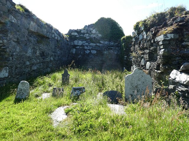
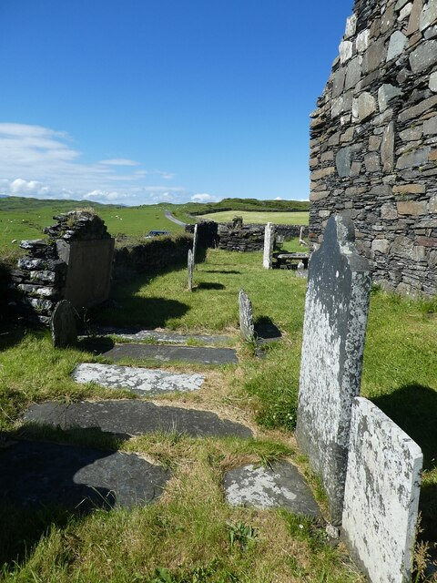
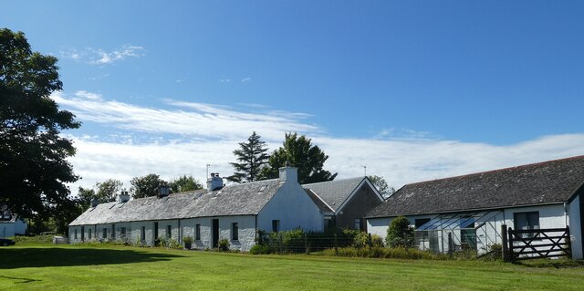
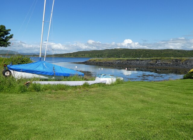
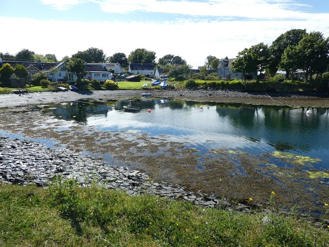
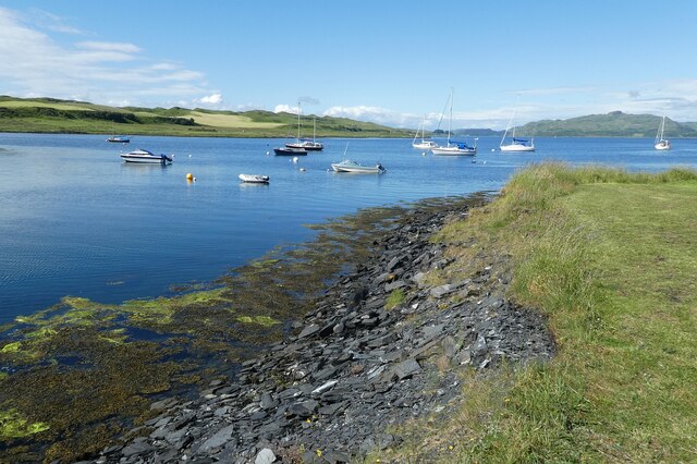
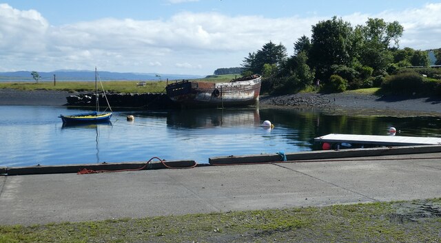
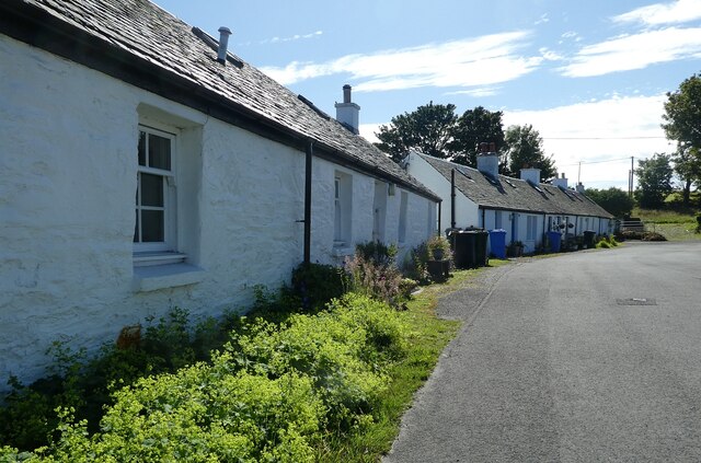
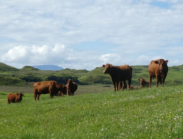
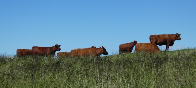
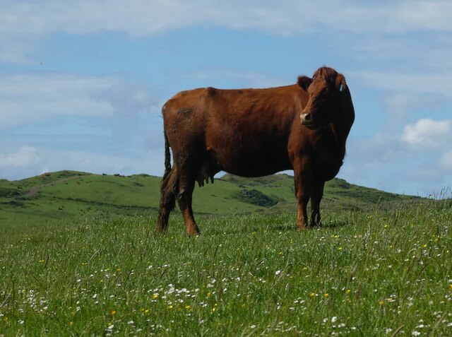
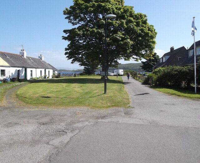
Shuna Sound Images

Images are sourced within 2km of 56.21309/-5.6208425 or Grid Reference NM7508. Thanks to Geograph Open Source API. All images are credited.

Luing - Kilchatton - Ruined church and associated graveyard This ruined church stands in its graveyard near to a road junction in the midst of the Isle of Luing just northwest of the village of Toberonochy.
The ruins of the church are a Designated Ancient Monument <span class="nowrap"><a title="http://portal.historicenvironment.scot/designation/SM3808" rel="nofollow ugc noopener" href="http://portal.historicenvironment.scot/designation/SM3808">Link</a><img style="margin-left:2px;" alt="External link" title="External link - shift click to open in new window" src="https://s1.geograph.org.uk/img/external.png" width="10" height="10"/></span> while the graveyard is Category 'B' listed <span class="nowrap"><a title="http://portal.historicenvironment.scot/designation/LB12196" rel="nofollow ugc noopener" href="http://portal.historicenvironment.scot/designation/LB12196">Link</a><img style="margin-left:2px;" alt="External link" title="External link - shift click to open in new window" src="https://s1.geograph.org.uk/img/external.png" width="10" height="10"/></span>
Canmore website information: <span class="nowrap"><a title="https://canmore.org.uk/site/22552/luing-kilchattan-old-parish-church" rel="nofollow ugc noopener" href="https://canmore.org.uk/site/22552/luing-kilchattan-old-parish-church">Link</a><img style="margin-left:2px;" alt="External link" title="External link - shift click to open in new window" src="https://s1.geograph.org.uk/img/external.png" width="10" height="10"/></span>
See also:
<a href="https://www.geograph.org.uk/photo/7258575">NM7409 : Luing - Kilchatton - Ruined church from its graveyard</a>
<a href="https://www.geograph.org.uk/photo/7258583">NM7409 : Luing - Kilchatton ruined church - grave slabs</a>
<a href="https://www.geograph.org.uk/photo/7258588">NM7409 : Luing - Kilchatton - Interior of ruined church</a>
<a href="https://www.geograph.org.uk/photo/7258592">NM7409 : Luing - Kilchatton - Graveyard to the west of ruined church</a>
Luing - Kilchatton - Ruined church and associated graveyard
This ruined church stands in its graveyard near to a road junction in the midst of the Isle of Luing just northwest of the village of Toberonochy. The ruins of the church are a Designated Ancient Monument LinkExternal link while the graveyard is Category 'B' listed LinkExternal link Canmore website information: LinkExternal link See also: NM7409 : Luing - Kilchatton - Ruined church from its graveyard NM7409 : Luing - Kilchatton ruined church - grave slabs NM7409 : Luing - Kilchatton - Interior of ruined church NM7409 : Luing - Kilchatton - Graveyard to the west of ruined church
Luing - Kilchatton - Ruined church from its graveyard Looking at the ruined church at Kilchatton near Toberonochy from the north.
The ruins of the church are a Designated Ancient Monument <span class="nowrap"><a title="http://portal.historicenvironment.scot/designation/SM3808" rel="nofollow ugc noopener" href="http://portal.historicenvironment.scot/designation/SM3808">Link</a><img style="margin-left:2px;" alt="External link" title="External link - shift click to open in new window" src="https://s1.geograph.org.uk/img/external.png" width="10" height="10"/></span> while the graveyard is Category 'B' listed <span class="nowrap"><a title="http://portal.historicenvironment.scot/designation/LB12196" rel="nofollow ugc noopener" href="http://portal.historicenvironment.scot/designation/LB12196">Link</a><img style="margin-left:2px;" alt="External link" title="External link - shift click to open in new window" src="https://s1.geograph.org.uk/img/external.png" width="10" height="10"/></span>
Canmore website information: <span class="nowrap"><a title="https://canmore.org.uk/site/22552/luing-kilchattan-old-parish-church" rel="nofollow ugc noopener" href="https://canmore.org.uk/site/22552/luing-kilchattan-old-parish-church">Link</a><img style="margin-left:2px;" alt="External link" title="External link - shift click to open in new window" src="https://s1.geograph.org.uk/img/external.png" width="10" height="10"/></span>
See also:
<a href="https://www.geograph.org.uk/photo/7218376">NM7409 : Luing - Kilchatton - Ruined church and associated graveyard</a>
<a href="https://www.geograph.org.uk/photo/7258583">NM7409 : Luing - Kilchatton ruined church - grave slabs</a>
<a href="https://www.geograph.org.uk/photo/7258588">NM7409 : Luing - Kilchatton - Interior of ruined church</a>
<a href="https://www.geograph.org.uk/photo/7258592">NM7409 : Luing - Kilchatton - Graveyard to the west of ruined church</a>
Luing - Kilchatton - Ruined church from its graveyard
Looking at the ruined church at Kilchatton near Toberonochy from the north. The ruins of the church are a Designated Ancient Monument LinkExternal link while the graveyard is Category 'B' listed LinkExternal link Canmore website information: LinkExternal link See also: NM7409 : Luing - Kilchatton - Ruined church and associated graveyard NM7409 : Luing - Kilchatton ruined church - grave slabs NM7409 : Luing - Kilchatton - Interior of ruined church NM7409 : Luing - Kilchatton - Graveyard to the west of ruined church
Luing - Kilchatton - Interior of ruined church Looking from the open eastern end of the ruined church at Kilchatton near Toberonochy on the Isle of Luing. The gravestones must post-date the ruination of the church.
See also:
<a href="https://www.geograph.org.uk/photo/7218376">NM7409 : Luing - Kilchatton - Ruined church and associated graveyard</a>
<a href="https://www.geograph.org.uk/photo/7258575">NM7409 : Luing - Kilchatton - Ruined church from its graveyard</a>
<a href="https://www.geograph.org.uk/photo/7258583">NM7409 : Luing - Kilchatton ruined church - grave slabs</a>
<a href="https://www.geograph.org.uk/photo/7258592">NM7409 : Luing - Kilchatton - Graveyard to the west of ruined church</a>
Luing - Kilchatton - Interior of ruined church
Looking from the open eastern end of the ruined church at Kilchatton near Toberonochy on the Isle of Luing. The gravestones must post-date the ruination of the church. See also: NM7409 : Luing - Kilchatton - Ruined church and associated graveyard NM7409 : Luing - Kilchatton - Ruined church from its graveyard NM7409 : Luing - Kilchatton ruined church - grave slabs NM7409 : Luing - Kilchatton - Graveyard to the west of ruined church
Luing - Kilchatton - Graveyard to the west of ruined church Looking along the western end of the ruined church at Kilchatton near Toberonochy on the Isle of Luing, with numerous gravestones between the church and the graveyard wall.
See also:
<a href="https://www.geograph.org.uk/photo/7218376">NM7409 : Luing - Kilchatton - Ruined church and associated graveyard</a>
<a href="https://www.geograph.org.uk/photo/7258575">NM7409 : Luing - Kilchatton - Ruined church from its graveyard</a>
<a href="https://www.geograph.org.uk/photo/7258583">NM7409 : Luing - Kilchatton ruined church - grave slabs</a>
<a href="https://www.geograph.org.uk/photo/7258588">NM7409 : Luing - Kilchatton - Interior of ruined church</a>
Luing - Kilchatton - Graveyard to the west of ruined church
Looking along the western end of the ruined church at Kilchatton near Toberonochy on the Isle of Luing, with numerous gravestones between the church and the graveyard wall. See also: NM7409 : Luing - Kilchatton - Ruined church and associated graveyard NM7409 : Luing - Kilchatton - Ruined church from its graveyard NM7409 : Luing - Kilchatton ruined church - grave slabs NM7409 : Luing - Kilchatton - Interior of ruined church
Luing - Toberonochy - Cottages Most of the older cottages in Toberonochy are Category 'B' listed, including this row of rubble-built cottages.
See listing here: <span class="nowrap"><a title="http://portal.historicenvironment.scot/designation/LB12198" rel="nofollow ugc noopener" href="http://portal.historicenvironment.scot/designation/LB12198">Link</a><img style="margin-left:2px;" alt="External link" title="External link - shift click to open in new window" src="https://s1.geograph.org.uk/img/external.png" width="10" height="10"/></span>
Pretty-much the whole of Toberonochy is a conservation area - see <span class="nowrap"><a title="https://www.argyll-bute.gov.uk/sites/default/files/planning-and-environment/Toberonochy%20Conservation%20Area.pdf" rel="nofollow ugc noopener" href="https://www.argyll-bute.gov.uk/sites/default/files/planning-and-environment/Toberonochy%20Conservation%20Area.pdf">Link</a><img style="margin-left:2px;" alt="External link" title="External link - shift click to open in new window" src="https://s1.geograph.org.uk/img/external.png" width="10" height="10"/></span>
Luing - Toberonochy - Cottages
Most of the older cottages in Toberonochy are Category 'B' listed, including this row of rubble-built cottages. See listing here: LinkExternal link Pretty-much the whole of Toberonochy is a conservation area - see LinkExternal link
Luing - Toberonochy - Beached dinghies A couple of dinghies hauled up beside one of several inlets or quays on the coast by the village of Toberonochy, Luing's second largest settlement after Cullipool.
Luing - Toberonochy - Beached dinghies
A couple of dinghies hauled up beside one of several inlets or quays on the coast by the village of Toberonochy, Luing's second largest settlement after Cullipool.
Luing - Toberonochy - Northern harbour There is quite a large parking area with inlets on either side of it which form Toberonochy Harbour. Houses on the end of this northern inlet have a very pleasant outlook.
Cf. <a href="https://www.geograph.org.uk/photo/7259159">NM7508 : Luing - Toberonochy - Southern harbour</a>
Luing - Toberonochy - Northern harbour
There is quite a large parking area with inlets on either side of it which form Toberonochy Harbour. Houses on the end of this northern inlet have a very pleasant outlook. Cf. NM7508 : Luing - Toberonochy - Southern harbour
Luing - Looking up Shuna Sound from Toberonochy This is a view along the northern section of Shuna Sound from beside Toberonochy Harbour. The land on the left is part of the Isle of Luing, while that on the right is the very lightly populated Isle of Shuna. Although Shuna has just three permanent residents (or some references say one!), there are several holiday properties that can be hired there - see <span class="nowrap"><a title="http://www.islandofshuna.co.uk/Cottages.html" rel="nofollow ugc noopener" href="http://www.islandofshuna.co.uk/Cottages.html">Link</a><img style="margin-left:2px;" alt="External link" title="External link - shift click to open in new window" src="https://s1.geograph.org.uk/img/external.png" width="10" height="10"/></span>
Shuna has an area of 451ha (1,114 acres), taking its population as 3, it has a population density of just 0.7/km2 (1.8/sq mi). Its highest point is Druim na Dubh Ghlaic at 90m (295')
Luing - Looking up Shuna Sound from Toberonochy
This is a view along the northern section of Shuna Sound from beside Toberonochy Harbour. The land on the left is part of the Isle of Luing, while that on the right is the very lightly populated Isle of Shuna. Although Shuna has just three permanent residents (or some references say one!), there are several holiday properties that can be hired there - see LinkExternal link Shuna has an area of 451ha (1,114 acres), taking its population as 3, it has a population density of just 0.7/km2 (1.8/sq mi). Its highest point is Druim na Dubh Ghlaic at 90m (295')
Luing - Toberonochy - Southern harbour The hull of an old boat leans against the western bank of the southern harbour at Toberonochy. Cf. <a href="https://www.geograph.org.uk/photo/7259140">NM7408 : Luing - Toberonochy - Northern harbour</a>
Luing - Toberonochy - Southern harbour
The hull of an old boat leans against the western bank of the southern harbour at Toberonochy. Cf. NM7408 : Luing - Toberonochy - Northern harbour
Luing - Toberonochy - The road out of the village Looking along the street that leads out of the picturesque little village of Toberonochy on the Isle of Luing. Almost the entire village is HES Category 'B' listed - see <span class="nowrap"><a title="http://portal.historicenvironment.scot/designation/LB12198" rel="nofollow ugc noopener" href="http://portal.historicenvironment.scot/designation/LB12198">Link</a><img style="margin-left:2px;" alt="External link" title="External link - shift click to open in new window" src="https://s1.geograph.org.uk/img/external.png" width="10" height="10"/></span>
Luing - Toberonochy - The road out of the village
Looking along the street that leads out of the picturesque little village of Toberonochy on the Isle of Luing. Almost the entire village is HES Category 'B' listed - see LinkExternal link
Luing - Luing Cattle - a small herd A little group of the good-looking Luing Cattle a breed named after the island. The breed is three quarters Beef Shorthorn and one quarter Highland. They are a very hardy beef cow that can raise their calves in harsh conditions.
See Wikipedia article here: <span class="nowrap"><a title="https://en.wikipedia.org/wiki/Luing_cattle" rel="nofollow ugc noopener" href="https://en.wikipedia.org/wiki/Luing_cattle">Link</a><img style="margin-left:2px;" alt="External link" title="External link - shift click to open in new window" src="https://s1.geograph.org.uk/img/external.png" width="10" height="10"/></span>
Luing Cattle Society webpage here: <span class="nowrap"><a title="https://luingcattlesociety.co.uk" rel="nofollow ugc noopener" href="https://luingcattlesociety.co.uk">Link</a><img style="margin-left:2px;" alt="External link" title="External link - shift click to open in new window" src="https://s1.geograph.org.uk/img/external.png" width="10" height="10"/></span>
See also:
<a href="https://www.geograph.org.uk/photo/7259236">NM7409 : Luing - A small herd of Luing cattle on a ridge</a>
<a href="https://www.geograph.org.uk/photo/7259238">NM7409 : Luing - A Luing cow</a>
Luing - Luing Cattle - a small herd
A little group of the good-looking Luing Cattle a breed named after the island. The breed is three quarters Beef Shorthorn and one quarter Highland. They are a very hardy beef cow that can raise their calves in harsh conditions. See Wikipedia article here: LinkExternal link Luing Cattle Society webpage here: LinkExternal link See also: NM7409 : Luing - A small herd of Luing cattle on a ridge NM7409 : Luing - A Luing cow
Luing - A small herd of Luing cattle on a ridge This little group of the Luing Cattle were moving slowly across the ridge north of the lane from Blackmillbay to Toberonochy on the island from which they get their name.
The breed is three quarters Beef Shorthorn and one quarter Highland. They are a very hardy beef cow that can raise their calves in harsh conditions.
See Wikipedia article here: <span class="nowrap"><a title="https://en.wikipedia.org/wiki/Luing_cattle" rel="nofollow ugc noopener" href="https://en.wikipedia.org/wiki/Luing_cattle">Link</a><img style="margin-left:2px;" alt="External link" title="External link - shift click to open in new window" src="https://s1.geograph.org.uk/img/external.png" width="10" height="10"/></span>
Luing Cattle Society webpage here: <span class="nowrap"><a title="https://luingcattlesociety.co.uk" rel="nofollow ugc noopener" href="https://luingcattlesociety.co.uk">Link</a><img style="margin-left:2px;" alt="External link" title="External link - shift click to open in new window" src="https://s1.geograph.org.uk/img/external.png" width="10" height="10"/></span>
See also:
<a href="https://www.geograph.org.uk/photo/7259232">NM7409 : Luing - Luing Cattle - a small herd</a>
<a href="https://www.geograph.org.uk/photo/7259238">NM7409 : Luing - A Luing cow</a>
Luing - A small herd of Luing cattle on a ridge
This little group of the Luing Cattle were moving slowly across the ridge north of the lane from Blackmillbay to Toberonochy on the island from which they get their name. The breed is three quarters Beef Shorthorn and one quarter Highland. They are a very hardy beef cow that can raise their calves in harsh conditions. See Wikipedia article here: LinkExternal link Luing Cattle Society webpage here: LinkExternal link See also: NM7409 : Luing - Luing Cattle - a small herd NM7409 : Luing - A Luing cow
Luing - A Luing cow This fine beast was munching on the grassland of the Isle of Luing from which the breed gets its name.
The breed is three quarters Beef Shorthorn and one quarter Highland. They are a very hardy beef cow that can raise their calves in harsh conditions.
See Wikipedia article here: <span class="nowrap"><a title="https://en.wikipedia.org/wiki/Luing_cattle" rel="nofollow ugc noopener" href="https://en.wikipedia.org/wiki/Luing_cattle">Link</a><img style="margin-left:2px;" alt="External link" title="External link - shift click to open in new window" src="https://s1.geograph.org.uk/img/external.png" width="10" height="10"/></span>
Luing Cattle Society webpage here: <span class="nowrap"><a title="https://luingcattlesociety.co.uk" rel="nofollow ugc noopener" href="https://luingcattlesociety.co.uk">Link</a><img style="margin-left:2px;" alt="External link" title="External link - shift click to open in new window" src="https://s1.geograph.org.uk/img/external.png" width="10" height="10"/></span>
See also:
<a href="https://www.geograph.org.uk/photo/7259232">NM7409 : Luing - Luing Cattle - a small herd</a>
<a href="https://www.geograph.org.uk/photo/7259236">NM7409 : Luing - A small herd of Luing cattle on a ridge</a>
Luing - A Luing cow
This fine beast was munching on the grassland of the Isle of Luing from which the breed gets its name. The breed is three quarters Beef Shorthorn and one quarter Highland. They are a very hardy beef cow that can raise their calves in harsh conditions. See Wikipedia article here: LinkExternal link Luing Cattle Society webpage here: LinkExternal link See also: NM7409 : Luing - Luing Cattle - a small herd NM7409 : Luing - A small herd of Luing cattle on a ridge
Kilchatton Church and graveyard
Toberonochty A beautiful day
Toberonochty
A beautiful day
The harbour, Toberonochty
Ordnance Survey Cut Mark This OS cut mark can be found on the NE face of the farmhouse.
Ordnance Survey Cut Mark
This OS cut mark can be found on the NE face of the farmhouse.
Show me another place!

Shuna Sound is located at Grid Ref: NM7508 (Lat: 56.21309, Lng: -5.6208425)

Unitary Authority: Argyll and Bute

Police Authority: Argyll and West Dunbartonshire

What 3 Words

///clap.shadowed.wrenching. Near Lochbuie, Argyll & Bute

Related Wikis

Shuna, Slate Islands

Shuna (Scottish Gaelic: Siuna) is one of the Slate Islands lying east of Luing on the west coast of Scotland. == History == In 1815, James Yates, a Glasgow...

Ardinamir

Ardinamir is an anchorage and small settlement on the island of Luing in Argyll and Bute, Scotland. == References ==

Luing

Luing ( LING; Scottish Gaelic: Luinn) is one of the Slate Islands, Firth of Lorn, in the west of Argyll in Scotland, about 16 miles (26 km) south of Oban...

Craobh Haven

Craobh Haven Scottish Gaelic pronunciation: [kɾɯːv] is a small purpose-built village and sailing port on the west coast of Argyll and Bute, Scotland. It...

Nearby Amenities

Located within 500m of 56.21309,-5.6208425
Port nan Sèa-ràmhach
Natural: bay
Lat/Long: 56.2138403/-5.6173181
The data included in this document is from www.openstreetmap.org. The data is made available under ODbL.

Have you been to Shuna Sound?

Leave your review of Shuna Sound below (or comments, questions and feedback).