An Oitir Mhòr

Sea, Estuary, Creek in Inverness-shire

Scotland

An Oitir Mhòr

The island of Greanamul The low lying small isle is viewed here from the Barra to Eriskay ferry which happens to be routed through the same grid square.
The island of Greanamul Credit: John Lucas

An Oitir Mhòr is a picturesque coastal area located in Inverness-shire, Scotland. Nestled along the shores of the sea, this region is known for its stunning natural beauty and diverse ecological landscape.

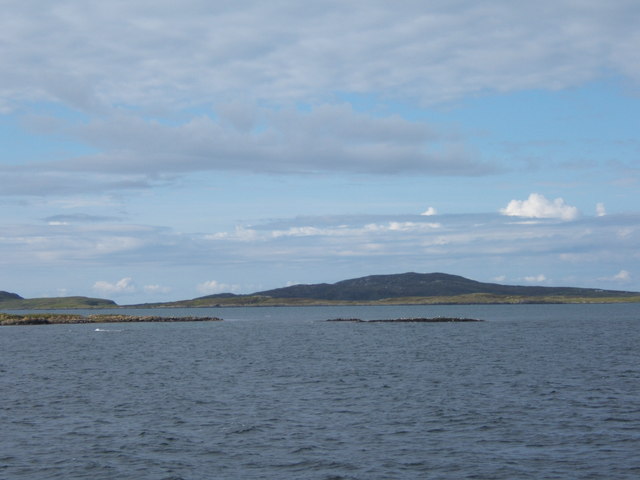
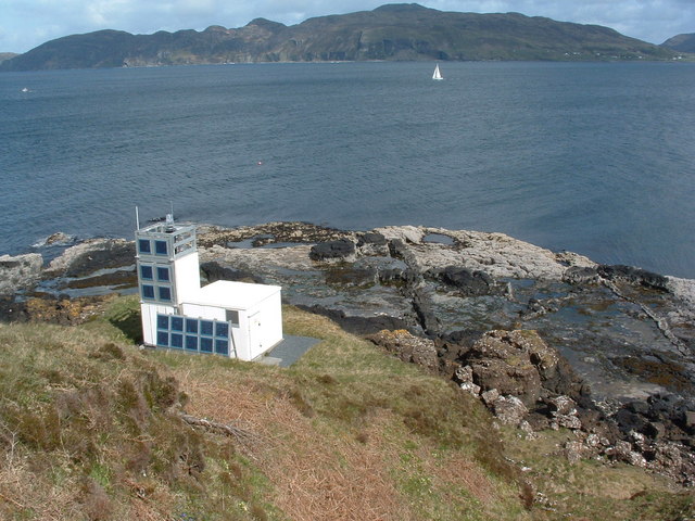
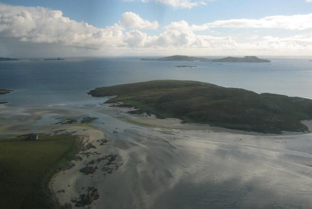
The highlight of An Oitir Mhòr is its expansive sea, which stretches out as far as the eye can see. The sparkling blue waters are home to a variety of marine life, including dolphins, seals, and various species of fish. The sea also offers ample opportunities for water sports enthusiasts, who can enjoy activities such as sailing, kayaking, and fishing.

Alongside the sea is an estuary, where the river meets the ocean. This estuary is a vital ecosystem, serving as a breeding ground for numerous bird species. Birdwatchers flock to An Oitir Mhòr to catch a glimpse of these feathered creatures, which include herons, oystercatchers, and sandpipers.

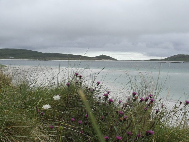
In addition to the sea and estuary, An Oitir Mhòr is also home to a serene creek. This narrow waterway winds its way through the lush countryside, offering a tranquil setting for leisurely walks and peaceful picnics. The creek is often lined with vibrant wildflowers, adding a splash of color to the landscape.

An Oitir Mhòr is a true haven for nature lovers, providing a unique opportunity to immerse oneself in the beauty of Scotland's coastal wilderness. Whether one seeks to explore the sea, observe the diverse birdlife, or simply enjoy the serenity of the creek, this area offers a delightful escape from the bustling city life.

If you have any feedback on the listing, please let us know in the comments section below.

An Oitir Mhòr Images

Images are sourced within 2km of 57.026693/-7.380538 or Grid Reference NF7305. Thanks to Geograph Open Source API. All images are credited.

The island of Greanamul The low lying small isle is viewed here from the Barra to Eriskay ferry which happens to be routed through the same grid square.
The island of Greanamul
The low lying small isle is viewed here from the Barra to Eriskay ferry which happens to be routed through the same grid square.
Sgeir Meall na Hoe East Cardinal Buoy This yellow/black/yellow buoy emits three very quick white flashes every five seconds at night.
Sgeir Meall na Hoe East Cardinal Buoy
This yellow/black/yellow buoy emits three very quick white flashes every five seconds at night.
Grianamul west cardinal buoy This yellow/black/yellow buoy emits nine quick white flashes every fifteen seconds at night.
Grianamul west cardinal buoy
This yellow/black/yellow buoy emits nine quick white flashes every fifteen seconds at night.
Sgeir Meall Na Hoe Buoy viewed on the crossing from Eriskay to Barra
Greanamul Buoy and skerries complete with wildlife
Skerry north off Lingeigh-Fhada
Greanamul An island in the Sound of Harris surrounded by skerries.
Greanamul
An island in the Sound of Harris surrounded by skerries.
Marker for the skerry off Lingeigh-Fhada
Greanamul and surrounding skerries
West cardinal buoy by Geanamul From the ferry to Barra from Eriskay.
West cardinal buoy by Geanamul
From the ferry to Barra from Eriskay.
The Greanamul Buoy
The Greanamul Buoy
Leaving Barra View from the ferry between Barra and Eriskay (the whisky galore Island). The long white building is the fish processing plant at Aird Mhidhinis
Leaving Barra
View from the ferry between Barra and Eriskay (the whisky galore Island). The long white building is the fish processing plant at Aird Mhidhinis
View south on take off from Barra Airport Spent a lot of time with Anquet Maps 'Virtual Landscape' to check where we were when this was taken!  The island immediately below is Garbh Lingeigh with Fuidheigh immediately behind it and to the left.  Unusually, take off was west to east from this amazing beach runway.
View south on take off from Barra Airport
Spent a lot of time with Anquet Maps 'Virtual Landscape' to check where we were when this was taken! The island immediately below is Garbh Lingeigh with Fuidheigh immediately behind it and to the left. Unusually, take off was west to east from this amazing beach runway.
The crossing to Barra A June morning, mirror-smooth crossing from Eriskay to Barra. The Greanamul Buoy has just gone by; Barra airport is on the beach straight across the Oitir Mhòr.
The crossing to Barra
A June morning, mirror-smooth crossing from Eriskay to Barra. The Greanamul Buoy has just gone by; Barra airport is on the beach straight across the Oitir Mhòr.
Bogha nan Sgeirean Mora This translates as "Bow/Curve of the Great Skerries".
Bogha nan Sgeirean Mora
This translates as "Bow/Curve of the Great Skerries".
Skerry north of Lingeigh-Fhada This tiny skerry is popular as a resting-site for cormorants and gulls.
Skerry north of Lingeigh-Fhada
This tiny skerry is popular as a resting-site for cormorants and gulls.
Greanamul Greanamul is the low-lying island just beyond the buoy. In the background are Healasaigh and Gioghaigh.
Greanamul
Greanamul is the low-lying island just beyond the buoy. In the background are Healasaigh and Gioghaigh.
Greanamul Another angle on the low-lying island of Greanamul, in this view with Fuidheidh in the distance.
Greanamul
Another angle on the low-lying island of Greanamul, in this view with Fuidheidh in the distance.
Show me another place!

An Oitir Mhòr is located at Grid Ref: NF7305 (Lat: 57.026693, Lng: -7.380538)

Unitary Authority: Na h-Eileanan an Iar

Police Authority: Highlands and Islands

What 3 Words

///micro.chefs.complies. Near CastleBay, Na h-Eileanan Siar

Related Wikis

Hellisay

Hellisay (Scottish Gaelic: Theiliseigh) is a currently uninhabited island and is one of ten islands in the Sound of Barra, a Site of Community Importance...

Ardmore, Barra

Ardmhor (Scottish Gaelic: Aird Mhòr) is a small village in the north east of the Isle of Barra in the Outer Hebrides, Scotland. In 2002 a small ferry port...

Orosay

Orosay (Scottish Gaelic: Orasaigh) is a small uninhabited tidal island in the Sound of Barra lying at the north end of Traigh Mhòr, the "big beach" on...

Fuday

Fuday (Scottish Gaelic: Fùideigh) is an uninhabited island of about 232 hectares (570 acres) and is one of ten islands in the Sound of Barra, a Site of...

Have you been to An Oitir Mhòr?

Leave your review of An Oitir Mhòr below (or comments, questions and feedback).