Broad Water

Sea, Estuary, Creek in Merionethshire

Wales

Broad Water

Minor road towards Bryncrug
Minor road towards Bryncrug Credit: Steven Brown

Broad Water is a prominent natural feature located in Merionethshire, Wales. Situated along the country's western coastline, it is a picturesque area that encompasses a sea, estuary, and creek. The name "Broad Water" aptly describes the expansive body of water that characterizes this region.

The sea at Broad Water provides a stunning backdrop with its vast expanse of shimmering blue waters. Its tidal nature means that the water level fluctuates throughout the day, creating an ever-changing landscape. The sea is home to a rich ecosystem, supporting a diverse range of marine life, including fish, shellfish, and seabirds.

Adjacent to the sea, the estuary at Broad Water is formed by the confluence of several rivers, including the Mawddach and Dyfi. The estuary serves as an important habitat for various species of birds and fish, particularly during the breeding and migratory seasons. The intertidal mudflats and salt marshes found here provide valuable feeding grounds for wading birds, such as curlews and redshanks.

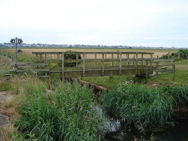
Further inland, the creek at Broad Water meanders its way through the countryside, offering a tranquil setting for boating and fishing enthusiasts. The creek's calm waters and lush surroundings make it an ideal spot for leisurely walks and picnics.

Overall, Broad Water in Merionethshire presents a captivating blend of sea, estuary, and creek, showcasing the natural beauty and biodiversity Wales has to offer. Whether one seeks a peaceful escape or a chance to observe marine and avian life, this area provides a captivating experience for visitors and locals alike.

If you have any feedback on the listing, please let us know in the comments section below.

Broad Water Images

Images are sourced within 2km of 52.603914/-4.1023349 or Grid Reference SH5702. Thanks to Geograph Open Source API. All images are credited.

Minor road towards Bryncrug
Minor road Tal-y-gareg
Entrance to Tonfanau Quarry
Road at Tonfanau Army Camp (disused)
Promenade and sea defences at Tywyn
Groyne on the beach at Tywyn
Beach and sea defences at Tywyn
Promenade and beach at Tywyn
Beach at Tywyn Here is the seaside at Tywyn, with the sand beach seen in the distance.
Beach at Tywyn
Here is the seaside at Tywyn, with the sand beach seen in the distance.
Beach at Tywyn Here is the seaside at Tywyn, with the sand beach seen in the distance.
Beach at Tywyn
Here is the seaside at Tywyn, with the sand beach seen in the distance.
Seaside at Tywyn Here is the seaside at Tywyn, with the sand beach seen in the distance.
Seaside at Tywyn
Here is the seaside at Tywyn, with the sand beach seen in the distance.
Houses by the promenade at Tywyn Closest to the camera is a caravan park, and they have a great view of Tywyn beach and the seaside, along with the five colourful houses in the distance <a href="https://www.geograph.org.uk/photo/6974916">SH5700 : Houses by the promenade at Tywyn</a>.
Houses by the promenade at Tywyn
Closest to the camera is a caravan park, and they have a great view of Tywyn beach and the seaside, along with the five colourful houses in the distance SH5700 : Houses by the promenade at Tywyn.
Promenade at Tywyn Here is the promenade at Tywyn, with many mid-late 20th century housing overlooking the seaside. My brother Dylan is seen walking in this view.
Promenade at Tywyn
Here is the promenade at Tywyn, with many mid-late 20th century housing overlooking the seaside. My brother Dylan is seen walking in this view.
Houses by the beach at Tywyn The house closest to the camera looks Georgian, and it is by a caravan park.
Houses by the beach at Tywyn
The house closest to the camera looks Georgian, and it is by a caravan park.
Seaside at Tywyn Here is the seaside at Tywyn, with the ocean seen in the distance.
Seaside at Tywyn
Here is the seaside at Tywyn, with the ocean seen in the distance.
Sea at Tywyn Here is the sea at Tywyn, taken from the rocks here <a href="https://www.geograph.org.uk/photo/6974935">SH5700 : Seaside at Tywyn</a>.
Sea at Tywyn
Here is the sea at Tywyn, taken from the rocks here SH5700 : Seaside at Tywyn.
Rocks at Tywyn beach Tens of rocks seen here at Tywyn beach.
Rocks at Tywyn beach
Tens of rocks seen here at Tywyn beach.
Beach at Tywyn Here is the seaside at Tywyn, with the sand beach seen in the distance.
Beach at Tywyn
Here is the seaside at Tywyn, with the sand beach seen in the distance.
Show me another place!

Broad Water is located at Grid Ref: SH5702 (Lat: 52.603914, Lng: -4.1023349)

Unitary Authority: Gwynedd

Police Authority: North Wales

What 3 Words

///elections.animates.column. Near Tywyn, Gwynedd

Nearby Locations

Broad Water Broad Water

Related Wikis

Broad Water

Broad Water, or Broadwater (Welsh: Aber Dysynni) is a salt water lagoon near Tywyn, Wales formed from the silted up estuary of the River Dysynni. In the...

RAF Towyn

Royal Air Force Towyn, or more simply RAF Towyn, is a former Royal Air Force airfield located 10.3 miles (16.6 km) west of Machynlleth, Powys and 12.2...

River Dysynni

The River Dysynni (Welsh: Afon Dysynni) is a river in mid Wales. Its source is the Tal-y-llyn Lake (Welsh: Llyn Mwyngil) just south of the Cadair Idris...

Tonfanau

Tonfanau is a coastal village in the community of Llangelynnin, in Gwynedd (formerly Merionethshire), Wales. It is 2.4 miles (3.9 km) north of Tywyn. The...

Nearby Amenities

Located within 500m of 52.603914,-4.1023349
Broad Water
Natural: bay
Wikidata: Q4971987
Wikipedia: en:Broad Water
Lat/Long: 52.6038236/-4.0997153
The data included in this document is from www.openstreetmap.org. The data is made available under ODbL.

Have you been to Broad Water?

Leave your review of Broad Water below (or comments, questions and feedback).