Rectory Meadow
Urban Greenspace in Middlesex
England
Rectory Meadow
Rectory Meadow, located in Middlesex, is an urban greenspace that offers a haven of tranquility amidst the bustling city. Spanning across a generous area, this picturesque meadow is a cherished natural retreat for both residents and visitors alike.
The meadow boasts an assortment of lush greenery, including tall grasses, wildflowers, and a variety of trees, lending an enchanting appeal to the surroundings. A gentle stream meanders through the meadow, creating a serene ambiance that soothes the senses. The rippling waters provide a habitat for various species of aquatic life, adding to the ecological diversity of the area.
Rectory Meadow is a haven for wildlife enthusiasts, with a wide range of fauna making it their home. Birdwatchers can delight in the sight of numerous species of birds, from the melodious songbirds perched on branches to the graceful swans gliding across the water. Additionally, squirrels and rabbits can often be spotted scurrying through the undergrowth, adding a touch of vibrancy to the landscape.
The meadow also offers a host of recreational activities for visitors. Walking and cycling trails wind through the area, providing ample opportunities for outdoor exercise and exploration. Picnic spots are scattered across the meadow, inviting families and friends to gather and enjoy a leisurely day out in nature.
Rectory Meadow, with its harmonious blend of flora and fauna, offers a respite from the urban chaos. Its natural beauty and diverse ecosystem make it a cherished greenspace, where visitors can immerse themselves in the tranquility and serenity of the outdoors.
If you have any feedback on the listing, please let us know in the comments section below.
Rectory Meadow Images
Images are sourced within 2km of 51.433022/-0.39716248 or Grid Reference TQ1171. Thanks to Geograph Open Source API. All images are credited.


Rectory Meadow is located at Grid Ref: TQ1171 (Lat: 51.433022, Lng: -0.39716248)
Unitary Authority: Hounslow
Police Authority: Metropolitan
What 3 Words
///motion.stop.emerge. Near Feltham, London
Nearby Locations
Related Wikis

Hanworth Villa F.C.
Hanworth Villa Football Club is a football club based in Hanworth, London Borough of Hounslow, England. They are currently members of the Isthmian League...
London Samurai Rovers F.C.
London Samurai Rovers Football Club is a football club based in Hanworth, London, England. They are currently members of the Combined Counties League Division...
PFC Victoria London
PFC Victoria London is a football club based in Hanworth, London, England. They are currently members of the Middlesex County League Premier Division and...

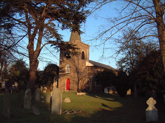
St George's Church, Hanworth
St George's Church, Hanworth, is a Church of England parish church based in Hanworth, London. It is dedicated to Saint George and has Grade II* listed...
Nearby Amenities
Located within 500m of 51.433022,-0.39716248Have you been to Rectory Meadow?
Leave your review of Rectory Meadow below (or comments, questions and feedback).