Hog Common

Urban Greenspace in Berkshire

England

Hog Common

Closure Notice at Santander Bank, Windsor This photo shows the closure notice at the Santander Bank branch in Peascod Street. It has the following wording:

   Important Information

 We're sorry that this branch is permanently 
 closing on 5 August 2021

 Your nearest Santander branch(es):
 . 48 The Observatory, High Street, Slough SL1 1DL
 . 46-48 High Street, Staines TW18 4DY

 We look forward to welcoming you there.
Closure Notice at Santander Bank, Windsor Credit: David Hillas

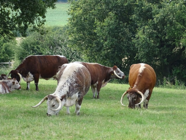
Hog Common is a picturesque urban greenspace located in Berkshire, England. Covering an area of approximately 10 acres, it is a popular destination for locals and visitors alike seeking a peaceful retreat from the bustling city life. The common is surrounded by lush greenery and boasts a diverse range of flora and fauna, making it an ideal spot for nature enthusiasts.

The main attraction of Hog Common is its well-maintained walking trails that wind through the park, offering visitors the opportunity to explore the natural beauty of the area. The trails are suitable for all fitness levels and provide a pleasant and relaxing experience. The common also features several picnic areas, where families and friends can gather to enjoy a meal amidst the tranquil surroundings.

One of the notable features of Hog Common is its large pond, which serves as a habitat for various waterfowl species. Visitors can observe ducks, swans, and other aquatic birds in their natural habitat, adding to the overall charm of the greenspace. The pond also provides a peaceful ambiance and is a favorite spot for photographers and nature lovers.

In addition to its natural beauty, Hog Common offers recreational facilities for visitors. There is a children's play area with swings and slides, providing entertainment for young visitors. Dog owners can also take advantage of the designated dog walking areas, allowing them to enjoy the common with their furry companions.

Hog Common is easily accessible, with ample parking available nearby. The greenspace is open to the public throughout the year, offering a serene escape for those seeking a break from the urban hustle and bustle. Whether for a leisurely stroll, a family picnic, or birdwatching, Hog Common provides a peaceful and enjoyable experience for all who visit.

If you have any feedback on the listing, please let us know in the comments section below.

Hog Common Images

Images are sourced within 2km of 51.467463/-0.60848454 or Grid Reference SU9675. Thanks to Geograph Open Source API. All images are credited.

Closure Notice at Santander Bank, Windsor This photo shows the closure notice at the Santander Bank branch in Peascod Street. It has the following wording:

   Important Information

 We're sorry that this branch is permanently 
 closing on 5 August 2021

 Your nearest Santander branch(es):
 . 48 The Observatory, High Street, Slough SL1 1DL
 . 46-48 High Street, Staines TW18 4DY

 We look forward to welcoming you there.
Closure Notice at Santander Bank, Windsor
This photo shows the closure notice at the Santander Bank branch in Peascod Street. It has the following wording: Important Information We're sorry that this branch is permanently closing on 5 August 2021 Your nearest Santander branch(es): . 48 The Observatory, High Street, Slough SL1 1DL . 46-48 High Street, Staines TW18 4DY We look forward to welcoming you there.
Santander Bank branch in Windsor (1) Located at 97 Peascod Street SL4 1AZ, this bank is due for closure on Thursday 5th August 2021 as indicated by the notice in the window <a title="https://www.geograph.org.uk/photo/6916357" href="https://www.geograph.org.uk/photo/6916357">Link</a> refers. It is one of 111 such branches due for closure in the Summer 2021.
Santander Bank branch in Windsor (1)
Located at 97 Peascod Street SL4 1AZ, this bank is due for closure on Thursday 5th August 2021 as indicated by the notice in the window Link refers. It is one of 111 such branches due for closure in the Summer 2021.
Santander Bank branch in Windsor (2) This photo shows the Santander Bank branch in Peascod Street which is due to close permanently on Thursday 5th August 2021. To the right of the photo, people can be seen enjoying themselves seated under the white parasols. A sign perhaps of the Covid-19 restrictions having been relaxed recently.
Santander Bank branch in Windsor (2)
This photo shows the Santander Bank branch in Peascod Street which is due to close permanently on Thursday 5th August 2021. To the right of the photo, people can be seen enjoying themselves seated under the white parasols. A sign perhaps of the Covid-19 restrictions having been relaxed recently.
Windsor Castle
Windsor Castle
View along The Long Walk
View towards Windsor Castle
Long-horned cattle
Long-horned cattle
View towards Windsor Castle
Tree stump
Tree stump
Gate to Windsor Castle
Information Board in Windsor High Street This information board is located in the High Street near the junction with Peascod Street, its postcode being SL4 1LH. It has the title "The Queen's Walkway" and was unveiled by Her Majesty the Queen on the 21st April 2016 which was her ninetieth birthday.
 In the top row are illustrations of from left to right, Windsor Castle, Queen Victoria's Statue, The Guildhall and Windsor Parish Church. In the lower row are illustrations of from left to right, Queen Elizabeth II, Queen Victoria, Windsor Castle, The Guildhall Windsor and Windsor Parish Church. The lettering of these titles are also indicated in the Braille language for those people who have little or no vision. Both end columns have wording to describe the Queen's Walkway and what to see on it.
Information Board in Windsor High Street
This information board is located in the High Street near the junction with Peascod Street, its postcode being SL4 1LH. It has the title "The Queen's Walkway" and was unveiled by Her Majesty the Queen on the 21st April 2016 which was her ninetieth birthday. In the top row are illustrations of from left to right, Windsor Castle, Queen Victoria's Statue, The Guildhall and Windsor Parish Church. In the lower row are illustrations of from left to right, Queen Elizabeth II, Queen Victoria, Windsor Castle, The Guildhall Windsor and Windsor Parish Church. The lettering of these titles are also indicated in the Braille language for those people who have little or no vision. Both end columns have wording to describe the Queen's Walkway and what to see on it.
Part of the Information Board in Windsor High Street (1) The left column of this information board has the following wording:

 The Queen's Walkway

 The Queen and the Duke of Edinburgh have enjoyed a long association with Windsor. The Queen and her sister, Princess Margaret, spent most of the Second World War in the Castle. After King George VI died in February 1952, the Queen and the Duke of Edinburgh opened some rooms in the Castle, and it soon became their weekend retreat from London. They are there for the Easter Court, for the Garter Ceremony and Royal Ascot in June, and since 1969 there have been occasional State Visits to Windsor, with the procession passing this spot.
 Since 1917 Windsor has also been the name of the Royal House.
 In ancient times, the Anglo-Saxon Kings held court in a palace at Old Windsor, but William the Conqueror saw the advantage of building a tower on high land above the Thames to help guard London. His son, Henry I built a residence within the Castle walls and first held court there in 1110. Most
sovereigns have lived in the Castle since then, and many Kings and Queens of
England are buried in St George's Chapel.
 The Queen's Walkway celebrates the town of Windsor. The original town was largely laid out by 1170. "New Windsor" had rights as a free borough and was made into a royal borough under a charter of Edward I in 1277.
 William Shakespeare knew Windsor well and it inspired his play, The Merry Wives of Windsor. The present Guildhall (to the right) was built between 1687 and 1691, and since 1778 when George III moved to Windsor, the town has profited from its royal associations. Since the English Civil War, Windsor has been a garrison town with a military presence that continues to this day. Windsor Bridge formed a permanent link to Eton in 1822 and the arrival of the Great Western Railway in 1849 made Windsor more accessible to London.
 The Queen's Walkway will help you explore this historic town with its theatre, its churches, its parks and gardens, its elegant residential streets, its many historic monuments, its railway stations, and the River Thames.
                                  
                        Unveiled by 
                      Her Majesty The Queen 
                   On the occasion of her 90th Birthday
                         21st April 2016

 To the right of the photo can be seen illustrations of people cheering with
 Union Jack flags and of Queen Elizabeth II.
Part of the Information Board in Windsor High Street (1)
The left column of this information board has the following wording: The Queen's Walkway The Queen and the Duke of Edinburgh have enjoyed a long association with Windsor. The Queen and her sister, Princess Margaret, spent most of the Second World War in the Castle. After King George VI died in February 1952, the Queen and the Duke of Edinburgh opened some rooms in the Castle, and it soon became their weekend retreat from London. They are there for the Easter Court, for the Garter Ceremony and Royal Ascot in June, and since 1969 there have been occasional State Visits to Windsor, with the procession passing this spot. Since 1917 Windsor has also been the name of the Royal House. In ancient times, the Anglo-Saxon Kings held court in a palace at Old Windsor, but William the Conqueror saw the advantage of building a tower on high land above the Thames to help guard London. His son, Henry I built a residence within the Castle walls and first held court there in 1110. Most sovereigns have lived in the Castle since then, and many Kings and Queens of England are buried in St George's Chapel. The Queen's Walkway celebrates the town of Windsor. The original town was largely laid out by 1170. "New Windsor" had rights as a free borough and was made into a royal borough under a charter of Edward I in 1277. William Shakespeare knew Windsor well and it inspired his play, The Merry Wives of Windsor. The present Guildhall (to the right) was built between 1687 and 1691, and since 1778 when George III moved to Windsor, the town has profited from its royal associations. Since the English Civil War, Windsor has been a garrison town with a military presence that continues to this day. Windsor Bridge formed a permanent link to Eton in 1822 and the arrival of the Great Western Railway in 1849 made Windsor more accessible to London. The Queen's Walkway will help you explore this historic town with its theatre, its churches, its parks and gardens, its elegant residential streets, its many historic monuments, its railway stations, and the River Thames. Unveiled by Her Majesty The Queen On the occasion of her 90th Birthday 21st April 2016 To the right of the photo can be seen illustrations of people cheering with Union Jack flags and of Queen Elizabeth II.
Part of the Information Board in Windsor High Street (2) This photo shows the middle part of the Queen's Walkway information board in Windsor High Street. The top level has illustrations of Windsor Castle and Queen Victoria's Statue with people waving their Union Jack flags and a band of guardsmen marching in procession. Below are illustrations of Queen Elizabeth II, Queen Victoria and Windsor Castle. Braille lettering can be seen below the names.
Part of the Information Board in Windsor High Street (2)
This photo shows the middle part of the Queen's Walkway information board in Windsor High Street. The top level has illustrations of Windsor Castle and Queen Victoria's Statue with people waving their Union Jack flags and a band of guardsmen marching in procession. Below are illustrations of Queen Elizabeth II, Queen Victoria and Windsor Castle. Braille lettering can be seen below the names.
Part of the Information Board in Windsor High Street (3) This photo shows the right hand side of the information board in the High Street near Peascod Street. The left half has illustrations of The Guildhall and Windsor Parish Church with people waving their Union Jack flags and taking photos. On the right half is a map of The Queen's Walkway in Windsor with the following wording:

 The Queen's Walkway is 6.37km,
 representing the 63 years and 7 months
 of Britain's longest reigning monarch,
 Queen Victoria, a record superseded
 by Her Majesty Queen Elizabeth II
 some time after 5.30pm on 
 9 September 2015.
 The Walkway takes approximately
 two hours to complete. There are
 63 points of interest marked along
 the way which can be explored
 by visiting
 <span class="nowrap"><a title="www.outdoortrust.com" rel="nofollow ugc noopener" href="http://www.outdoortrust.com">Link</a><img style="margin-left:2px;" alt="External link" title="External link - shift click to open in new window" src="https://s1.geograph.org.uk/img/external.png" width="10" height="10"/></span>.

 The wording below the map mentions The Outdoor Trust who would like to thank the many supporters who have helped create The Queen's Walkway including generous donations. Incidentally, 6.37km is 3.96 miles in imperial measurement.
Part of the Information Board in Windsor High Street (3)
This photo shows the right hand side of the information board in the High Street near Peascod Street. The left half has illustrations of The Guildhall and Windsor Parish Church with people waving their Union Jack flags and taking photos. On the right half is a map of The Queen's Walkway in Windsor with the following wording: The Queen's Walkway is 6.37km, representing the 63 years and 7 months of Britain's longest reigning monarch, Queen Victoria, a record superseded by Her Majesty Queen Elizabeth II some time after 5.30pm on 9 September 2015. The Walkway takes approximately two hours to complete. There are 63 points of interest marked along the way which can be explored by visiting LinkExternal link. The wording below the map mentions The Outdoor Trust who would like to thank the many supporters who have helped create The Queen's Walkway including generous donations. Incidentally, 6.37km is 3.96 miles in imperial measurement.
Passageway under the railway in Goswell Road
Pedestrianised area in Peascod Street The main shopping area in Windsor.
Pedestrianised area in Peascod Street
The main shopping area in Windsor.
86 & 87 Peascod Street A C16/17th Grade II listed building.
86 & 87 Peascod Street
A C16/17th Grade II listed building.
Windsor & Eton Central station
Show me another place!

Hog Common is located at Grid Ref: SU9675 (Lat: 51.467463, Lng: -0.60848454)

Unitary Authority: Windsor and Maidenhead

Police Authority: Thames Valley

What 3 Words

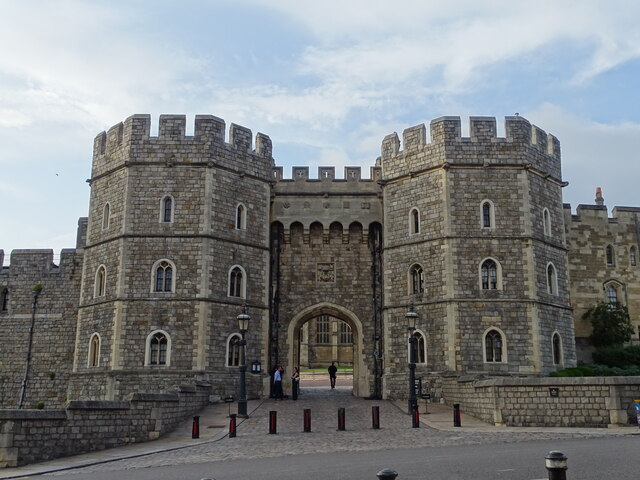
///stir.nest.blocks. Near Windsor, Berkshire

Nearby Locations

Hog Common

Related Wikis

Queensmead School Windsor

Queensmead School Windsor was a Catholic non-selective private day school for boys and girls aged 2 to 18 in Windsor, Berkshire, England, located at the...

Shaw Farm, Windsor

Shaw Farm is on the royal estate at Windsor. Originally a home farm for Windsor Castle, by the early 19th century it came into the ownership of Princess...

A308 road

The A308 is a road in England in two parts. The first part runs from Central London to Putney Bridge. The second part runs from just beyond Putney Heath...

Combermere Barracks

Combermere Barracks, Windsor is a British Army installation 0.9 miles (1.4 km) from Windsor Castle. == History == The original barracks, known as Clewer...

Royal Burial Ground, Frogmore

The Royal Burial Ground is a cemetery used by the British royal family. Consecrated on 23 October 1928 by the Bishop of Oxford, it is adjacent to the Royal...

Windsor & Eton F.C.

Windsor & Eton F.C. was an English association football club based in Windsor, Berkshire, last playing in the Southern League Premier Division in 2010...

Windsor F.C. (2011)

Windsor Football Club is an English football club formed in 2011 after Windsor & Eton folded. The club are current members of the Combined Counties League...

Virginia Water F.C.

Virginia Water Football Club is a football club based in Virginia Water, Surrey, England. They are currently members of the Combined Counties League Premier...

Nearby Amenities

Located within 500m of 51.467463,-0.60848454
Queen Anne Gate
Building: yes
Source: npe
Lat/Long: 51.4657436/-0.6119768
Bus Stop
Queen Annes Gate
Naptan AtcoCode: 036006001271
Naptan Bearing: NE
Naptan CommonName: Queen Annes Gate
Naptan Indicator: opp Almshouses
Naptan Landmark: Queen Annes Road
Naptan NaptanCode: winapdg
Naptan PlusbusZoneRef: WINDSEC
Naptan Street: Kings Road
Naptan Verified: no
Public Transport: platform
Source: naptan_import
Lat/Long: 51.4670271/-0.6114444
Bus Stop
Brigidine School
Bus: yes
Naptan AtcoCode: 036006001272
Naptan Bearing: NE
Naptan BusStopType: CUS
Naptan CommonName: Brigidine School
Naptan Indicator: adj
Naptan Landmark: Bolton Road
Naptan NaptanCode: winadgt
Naptan PlusbusZoneRef: WINDSEC
Naptan Street: Kings Road
Naptan Verified: no
Public Transport: platform
Shelter: no
Source: naptan_import
Lat/Long: 51.470681/-0.6079067
Bus Stop
Queen Annes Gate
Bus: yes
Naptan AtcoCode: 036006002271
Naptan Bearing: SW
Naptan BusStopType: CUS
Naptan CommonName: Queen Annes Gate
Naptan Indicator: o/s Almshouses
Naptan Landmark: Queen Annes Road
Naptan NaptanCode: winadwt
Naptan PlusbusZoneRef: WINDSEC
Naptan Street: Kings Road
Naptan Verified: no
Public Transport: platform
Shelter: no
Source: naptan_import
Lat/Long: 51.466864/-0.6113342
Bus Stop
Brigidine School
Bus: yes
Naptan AtcoCode: 036006002272
Naptan Bearing: SW
Naptan BusStopType: CUS
Naptan CommonName: Brigidine School
Naptan Indicator: opp
Naptan Landmark: Bolton Road
Naptan NaptanCode: winagad
Naptan PlusbusZoneRef: WINDSEC
Naptan Street: Kings Road
Naptan Verified: no
Public Transport: platform
Shelter: no
Source: naptan_import
Lat/Long: 51.4706602/-0.6076626
Royal Slurry Tank
Man Made: storage_tank
Lat/Long: 51.4687405/-0.6017272
Crossing
Crossing: traffic_signals
Lat/Long: 51.470498/-0.6058355
Doubles Gate
Place: locality
Lat/Long: 51.4631907/-0.6064605
Hog Common
Place: locality
Lat/Long: 51.4668181/-0.6078059
Queen Anne's Gate
Place: locality
Lat/Long: 51.4661368/-0.6123143
Queens Gate
Place: locality
Lat/Long: 51.4664998/-0.6100732
Post Box
Post Box Type: wall
Ref: SL4 50
Royal Cypher: EVIIR
Royal Cypher Wikidata: Q33102324
Lat/Long: 51.4715101/-0.6104972
Barrier: kissing_gate
Lat/Long: 51.4632186/-0.6064399
Direction: 225
Generator Method: photovoltaic
Generator Output Electricity: yes
Generator Solar Modules: 14
Generator Source: solar
Generator Type: solar_photovoltaic_panel
Location: roof
Power: generator
Lat/Long: 51.4687159/-0.6106309
Direction: 120
Generator Method: photovoltaic
Generator Output Electricity: yes
Generator Solar Modules: 8
Generator Source: solar
Generator Type: solar_photovoltaic_panel
Location: roof
Power: generator
Lat/Long: 51.4689361/-0.611537
Direction: 215
Generator Method: photovoltaic
Generator Output Electricity: yes
Generator Solar Modules: 12
Generator Source: solar
Generator Type: solar_photovoltaic_panel
Location: roof
Power: generator
Lat/Long: 51.468801/-0.6122521
Direction: 120
Generator Method: photovoltaic
Generator Output Electricity: yes
Generator Solar Modules: 12
Generator Source: solar
Generator Type: solar_photovoltaic_panel
Location: roof
Power: generator
Lat/Long: 51.4696182/-0.6112285
Direction: 215
Generator Method: photovoltaic
Generator Output Electricity: yes
Generator Solar Modules: 10
Generator Source: solar
Generator Type: solar_photovoltaic_panel
Location: roof
Power: generator
Lat/Long: 51.4696578/-0.6108303
Traffic Calming: hump
Lat/Long: 51.4696087/-0.6123552
Traffic Calming: hump
Lat/Long: 51.4703271/-0.611746
Traffic Calming: hump
Lat/Long: 51.4709223/-0.6119795
Traffic Calming: hump
Lat/Long: 51.4709479/-0.6107648
Traffic Calming: hump
Lat/Long: 51.4709818/-0.6095075
Direction: 180
Generator Method: photovoltaic
Generator Output Electricity: yes
Generator Solar Modules: 14
Generator Source: solar
Generator Type: solar_photovoltaic_panel
Location: roof
Power: generator
Lat/Long: 51.4706643/-0.6129728
Traffic Signals
Traffic Signals Direction: backward
Lat/Long: 51.4704659/-0.6058092
Traffic Signals
Traffic Signals Direction: forward
Lat/Long: 51.4705402/-0.605874
Communication Lpwan: yes
Height: 12
Man Made: tower
Note: Attached to existing lamp standard
Tower Construction: steel
Tower Type: communication
Lat/Long: 51.471239/-0.6061727
The data included in this document is from www.openstreetmap.org. The data is made available under ODbL.

Have you been to Hog Common?

Leave your review of Hog Common below (or comments, questions and feedback).