Merton Field

Urban Greenspace in Oxfordshire Oxford

England

Merton Field

Ferry Hinksey Road Spine road for the Osney Mead insutrial estate.
Ferry Hinksey Road Credit: Peter Whatley

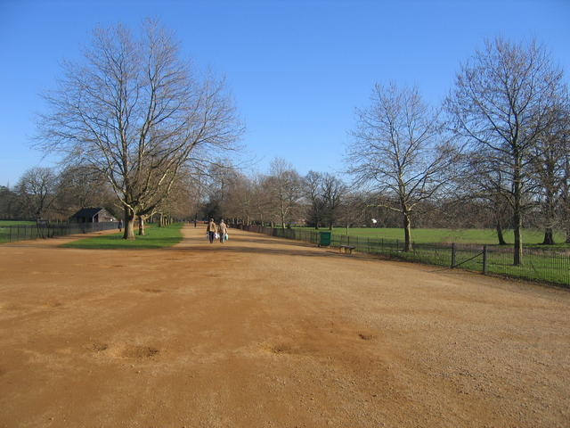
Merton Field, located in Oxfordshire, is an urban greenspace that encompasses an area of approximately 10 acres. It is nestled within the town of Merton, offering a serene and natural atmosphere for visitors to enjoy. The field is easily accessible to both residents and tourists, with nearby parking facilities and public transportation options.

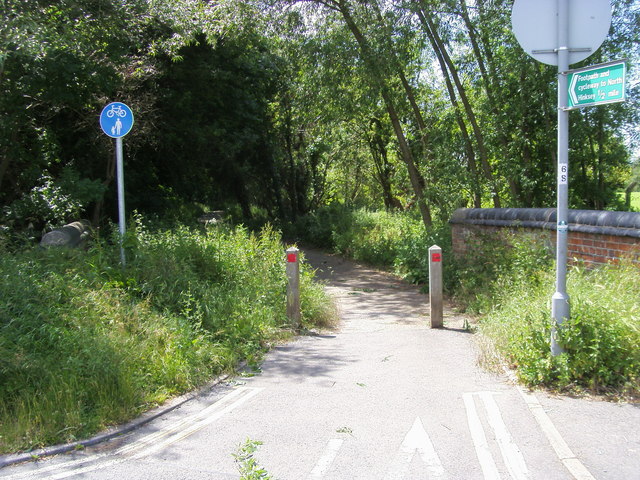
The field boasts a mix of open grassland, scattered trees, and well-maintained footpaths that crisscross the area. These footpaths are perfect for leisurely strolls, jogging, or walking dogs. The well-kept grass provides ample space for recreational activities such as picnics, frisbee, or even a game of football.

Merton Field is a popular spot for nature enthusiasts, as it supports a diverse range of wildlife. Visitors may encounter various bird species, including robins, blackbirds, and thrushes, along with occasional sightings of small mammals like rabbits and squirrels. The natural beauty of the field is further enhanced by the presence of wildflowers, which bloom vibrantly during the spring and summer months.

The field also features several benches and picnic tables, allowing visitors to relax and soak in the tranquil surroundings. Additionally, there are waste disposal facilities and bins available to maintain cleanliness.

Merton Field serves as a vital green lung within the town, providing a peaceful retreat for residents and an opportunity to connect with nature. Whether one seeks active recreation or simply wishes to unwind amidst natural beauty, Merton Field offers a refreshing and accessible greenspace for all to enjoy.

If you have any feedback on the listing, please let us know in the comments section below.

Merton Field Images

Images are sourced within 2km of 51.750082/-1.2508988 or Grid Reference SP5105. Thanks to Geograph Open Source API. All images are credited.

Ferry Hinksey Road Spine road for the Osney Mead insutrial estate.
Ferry Hinksey Road
Spine road for the Osney Mead insutrial estate.
Restoration Church, Helen Road, Osney Only a few years ago this was the Elim Chapel <a href="https://www.geograph.org.uk/photo/6217755">SP4906 : Elim Chapel, Helen Road</a> but it was probably not built as a church, as the 1921 map labels it a 'hall'. The style looks to be late 19th / early 20th century.
Restoration Church, Helen Road, Osney
Only a few years ago this was the Elim Chapel SP4906 : Elim Chapel, Helen Road but it was probably not built as a church, as the 1921 map labels it a 'hall'. The style looks to be late 19th / early 20th century.
Shops on Botley Road Currently comprising a cycle sales / repair business, high quality greengrocer and an antique shop specialising in Tuscan pottery. All very Oxford.
Shops on Botley Road
Currently comprising a cycle sales / repair business, high quality greengrocer and an antique shop specialising in Tuscan pottery. All very Oxford.
Stream at Botley Park This stream links Seacourt Stream with the Isis.  The photograph is taken at the end of Henry Road where a small bridge crosses into Botley Park.
Stream at Botley Park
This stream links Seacourt Stream with the Isis. The photograph is taken at the end of Henry Road where a small bridge crosses into Botley Park.
Helen Road - Oxford Junction of Helen Road with the Botley Road. On the corner is the Elim Pentecostal Church.
Helen Road - Oxford
Junction of Helen Road with the Botley Road. On the corner is the Elim Pentecostal Church.
Alexandra Road - Oxford Junction of Alexandra Road with the Botley Road.
Alexandra Road - Oxford
Junction of Alexandra Road with the Botley Road.
Oatlands Road - Oxford Junction of Oatlands Road with the Botley Road.
Oatlands Road - Oxford
Junction of Oatlands Road with the Botley Road.
Harley Road - Oxford Junction of Harley Road with the Botley Road
Harley Road - Oxford
Junction of Harley Road with the Botley Road
Footpath and Cycleway to North Hinksey Footpath and Cycleway to North Hinksey off Ferry Hinksey Road
Footpath and Cycleway to North Hinksey
Footpath and Cycleway to North Hinksey off Ferry Hinksey Road
Houses at New Botley Row of houses on the Botley road near Osney; not changed much over the years other than the corner shops. The corner shop up in the far right used to be called Scootique back in the 1960's, only went there once but it sold scooters and accessories. By the time I started work at Osney mead in 1972 the place had gone.
Houses at New Botley
Row of houses on the Botley road near Osney; not changed much over the years other than the corner shops. The corner shop up in the far right used to be called Scootique back in the 1960's, only went there once but it sold scooters and accessories. By the time I started work at Osney mead in 1972 the place had gone.
Footpath to Hinksey This footpath leads to North Hinksey and over the years has been improved to a cycleway.
Footpath to Hinksey
This footpath leads to North Hinksey and over the years has been improved to a cycleway.
Sign to Hinksey The bridge over the ditch that leads to North Hinksey
Sign to Hinksey
The bridge over the ditch that leads to North Hinksey
Office block on the corner This block of units and offices was built back in the late 1970s.
Office block on the corner
This block of units and offices was built back in the late 1970s.
Osney Mead Road through Osney Mead Industrial Estate.
Osney Mead
Road through Osney Mead Industrial Estate.
Sports field in the gloom I should have checked on the name of this sports field which is just off Ferry Hinksey road. During the floods the whole place is like a lake.
Sports field in the gloom
I should have checked on the name of this sports field which is just off Ferry Hinksey road. During the floods the whole place is like a lake.
Footpath along the back This footpath leads along the back or the housing along the Botley Road eventually coming out near Toys R Us.
Footpath along the back
This footpath leads along the back or the housing along the Botley Road eventually coming out near Toys R Us.
Pollarded willows Pollarded willows line the edge of the playing fields by Ferry Hinksey Road.
Pollarded willows
Pollarded willows line the edge of the playing fields by Ferry Hinksey Road.
Botley Road, Oxford
Botley Road, Oxford
Show me another place!

Merton Field is located at Grid Ref: SP5105 (Lat: 51.750082, Lng: -1.2508988)

Administrative County: Oxfordshire

District: Oxford

Police Authority: Thames Valley

What 3 Words

///slower.legal.shell. Near Oxford, Oxfordshire

Related Wikis

Timeline of Oxford

The following is a timeline of the history of the city, university and colleges of Oxford, England. == Pre-history == Activity from the Mesolithic period...
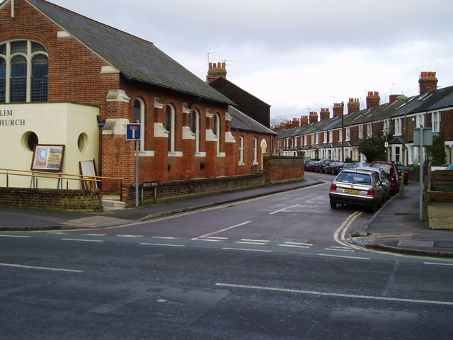
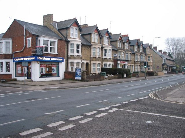
Oxford

Oxford () is the only city in Oxfordshire, England, of which it is the county town. It had a population of 162,100 at the 2021 census. It is 56 miles...

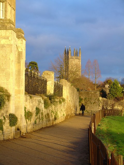
Dead Man's Walk, Oxford

Dead Man's Walk (or Deadman's Walk) is a footpath running east–west in central Oxford, England, situated immediately to the south of Merton College and...

Merton College, Oxford

Merton College (in full: The House or College of Scholars of Merton in the University of Oxford) is one of the constituent colleges of the University of...

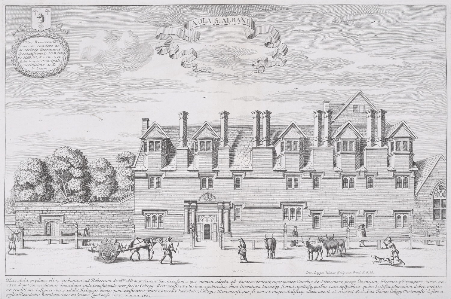
St Alban Hall, Oxford

St Alban Hall, sometimes known as St Alban's Hall or Stubbins, was one of the medieval halls of the University of Oxford, and one of the longest-surviving...

Merton College Library

Merton College Library (in Merton College, Oxford) is one of the earliest libraries in England and one of the oldest academic library in the world still...

Mob Quad

Mob Quad is a four-sided group of buildings from the 13th and 14th centuries in Merton College, Oxford, surrounding a small lawn. It is often claimed to...

Broad Walk

Broad Walk is a wide walkway running east–west on the north side of Christ Church Meadow and south of Merton Field in central Oxford, England.The walkway...

Nearby Amenities

Located within 500m of 51.750082,-1.2508988
Traffic Signals
Lat/Long: 51.7523412/-1.2487532
Barrier: bollard
Bollard: removable
Motor Vehicle: no
Note: site until recently had a metal gate. during last weeks filming this had been removed and the rubber brick-cobble mats lain over. a metal fence and gate was fitted under the building arch a few m to North on flush to north side of arch and ballon
Note 2: floated over the topunder blankets to keep out stray light. today I suveyed a string of bollards in place survey date just after 5ish on the 12 April 2016
Lat/Long: 51.7540913/-1.2525222
Post Office
Oxford Post Office
Addr Housenumber: 102
Addr Postcode: OX1 1ZZ
Addr Street: St Aldate's
Opening Hours: Mo,We-Sa 09:00-17:30; Tu 09:30-17:30
Ref Pol Id: 17920
Source Addr Postcode: pol_branch_list_2018-02
Source Opening Hours: pol_branch_list_2018-02
Lat/Long: 51.7510114/-1.2573992
Barrier: bollard
Bollard: fixed
Lat/Long: 51.7492448/-1.2575883
Transun Travel Limited
Addr City: Oxford
Addr Housenumber: 1a
Addr Postcode: OX4 1EA
Addr Street: Iffley Road
Office: travel_agent
Lat/Long: 51.7495245/-1.2436897
Crossing
Button Operated: yes
Crossing: traffic_signals
Crossing Island: no
Crossing Ref: pelican
Tactile Paving: yes
Traffic Signals Sound: yes
Traffic Signals Vibration: no
Lat/Long: 51.7522077/-1.2561704
Learning: oxford_college
Operator: Christ Church
Lat/Long: 51.7512079/-1.2554415
Barrier: bollard
Bicycle: yes
Bollard: removable
Foot: yes
Motorcar: no
Source: local_knowledge
Lat/Long: 51.7516582/-1.2546111
Post Box
Brand: Royal Mail
Brand Wikidata: Q638098
Brand Wikipedia: en:Royal Mail
Collection Times: Mo-Fr 18:30; Sa 11:30
Operator: Royal Mail
Operator Wikidata: Q638098
Post Box Type: pillar
Ref: OX1 574
Royal Cypher: GVIR
Royal Cypher Wikidata: Q33102169
Source: photograph, local_knowledge
Survey Date: 2013-03-13
Lat/Long: 51.7528498/-1.2505571
Bicycle Parking
Access: discouraged
Capacity: 30
Note: These stands are not advised for long term parking as they are regular suspended and removed by the council for various puposes like filming and road repurposing.
Source: gps_survey
Lat/Long: 51.7535929/-1.254647
Pub
The Wheatsheaf
Addr City: Oxford
Addr Housenumber: 129
Addr Postcode: OX1 4DF
Addr Street: High Street
Outdoor Seating: no
Phone: +44 1865 721156
Source: gps_survey
Toilets Wheelchair: no
Wheelchair: limited
Lat/Long: 51.75174/-1.256298
Bar
House Bar
Addr Postcode: OX1 4EE
Addr Street: Blue Boar Street
Bar: cocktail_bar
Source: gps_survey
Website: https://www.housebar.co.uk/
Lat/Long: 51.7514837/-1.2561956
Bicycle Parking
Capacity: 12
Source: gps_survey
Lat/Long: 51.7514647/-1.255955
Bicycle Parking
Bicycle Parking: stands
Capacity: 12
Covered: no
Source: gps_survey
Lat/Long: 51.7521699/-1.2547272
Post Box
Check Date Collection Times: 2019-03-08
Collection Times: Mo-Fr 18:30; Sa 11:30
Colour: red
Post Box Type: pillar
Ref: OX1 59
Royal Cypher: GVIR
Royal Cypher Wikidata: Q33102169
Source: gps_survey
Lat/Long: 51.7523049/-1.2547025
Barrier: kissing_gate
Lat/Long: 51.7503112/-1.2529337
Crossing
Button Operated: yes
Crossing: traffic_signals
Crossing Island: yes
Crossing Ref: pelican
Tactile Paving: yes
Traffic Signals Sound: no
Traffic Signals Vibration: yes
Lat/Long: 51.7523599/-1.2488711
Crossing
Button Operated: yes
Crossing: traffic_signals
Crossing Island: no
Crossing Ref: puffin
Source: local_knowledge
Tactile Paving: yes
Traffic Signals Sound: yes
Traffic Signals Vibration: yes
Lat/Long: 51.75262/-1.2533315
Barrier: bollard
Bicycle: yes
Foot: yes
Motorcar: no
Source: local_knowledge
Lat/Long: 51.7523921/-1.2533976
Post Box
Addr Street: St Aldate's
Collection Times: Mo-Fr 17:30; Sa 12:00
Post Box Type: pillar
Ref: OX1 173
Royal Cypher: EVIIR
Royal Cypher Wikidata: Q33102324
Lat/Long: 51.7478/-1.2563627
Museum of Oxford
Addr City: Oxford
Addr Housename: Oxford Town Hall
Addr Postcode: OX1 1BX
Addr Street: St Aldate's
Museum: local
Opening Hours: Mo-Sa 10:00-17:00
Phone: +44 1865 252761
Source: local_knowledge
Tourism: museum
Website: http://www.museumofoxford.org.uk/
Wikidata: Q15260377
Lat/Long: 51.7513841/-1.2571096
Pub
Old Tom
Addr City: Oxford
Addr Housenumber: 101
Addr Postcode: OX1 1BT
Addr Street: St Aldate's
Brewery: yes
Cuisine: thai
Diet Vegetarian: yes
Email: info@oldtomoxford.com
Fhrs Id: 269312
Opening Hours: Mo-Su 12:00-23:00
Opening Hours Kitchen: Mo-Su 12:00-14:45,17:00-21:45
Opening Hours Url: https://www.oldtomoxford.com/location
Phone: +44 1865 243034
Reservation: yes
Source: gps_survey;yahoo_imagery
Website: https://www.oldtomoxford.com/
Website Menu: https://www.oldtomoxford.com/menu-2
Lat/Long: 51.7508932/-1.2572754
Telephone
Booth: K6
Covered: booth
Listed Status: Grade II
Man Made: telephone_box
Old Phone: +44 1865 793357
Phone: +44 1865 793357
Lat/Long: 51.7528252/-1.2521189
Restaurant
Keepers Kitchen & Bar
Addr City: Oxford
Addr Housenumber: 73
Addr Postcode: OX1 4BE
Addr Street: High Street
Check Date: 2022-10-15
Diet Vegan: yes
Diet Vegetarian: yes
Payment Credit Cards: yes
Payment Debit Cards: yes
Website: https://www.keeperskitchenandbar.co.uk/keepers-oxford
Lat/Long: 51.7523108/-1.2492587
Post Box
Collection Times: Mo-Fr 18:30; Sa 12:00
Post Box Type: wall
Ref: OX1 123
Royal Cypher: VR
Royal Cypher Wikidata: Q33102356
Source: gps_survey
Lat/Long: 51.7515089/-1.2505537
Barrier: swing_gate
Bicycle: yes
Motorcar: no
Source: survey
Lat/Long: 51.7516342/-1.2539955
Bicycle Parking
Bicycle Parking: stands
Capacity: 64
Covered: no
Source: survey
Lat/Long: 51.7514832/-1.2542687
Opening Hours: Mo-Th 11:00-23:00, Fr,Sa 11:00-24:00, Su 11:00-10:30
Lat/Long: 51.7523602/-1.2560803
Cafe
Queen's Lane Coffee House
Addr Housenumber: 40
Addr Postcode: OX1 4AP
Addr Street: High Street
Check Date: 2024-04-18
Wikidata: Q5954426
Lat/Long: 51.7527285/-1.2504504
Cafe
The Grand Café
Addr Postcode: OX1 4BG
Check Date: 2023-09-04
Website: https://www.thegrandcafe.co.uk/
Lat/Long: 51.7524796/-1.2505775
Shelley Memorial
Artwork Type: statue
Historic: memorial
Source: local_knowledgle
Tourism: artwork
Wheelchair: yes
Wikidata: Q7493800
Wikipedia: en:Shelley Memorial
Lat/Long: 51.7525813/-1.2524494
Waterfield's Booksellers
Created By: osm2go v0.6-8
Shop: books
Lat/Long: 51.7525478/-1.249314
Crossing
Crossing: zebra
Source: Bing
Lat/Long: 51.7497905/-1.244571
Victoria Fountain
Historic: monument
Wikidata: Q26650773
Lat/Long: 51.750277/-1.2444754
Bicycle Parking
Capacity: 20
Covered: no
Lat/Long: 51.7517509/-1.2574391
Bicycle Parking
Bicycle Parking: stands
Capacity: 12
Covered: no
Fee: no
Lat/Long: 51.750209/-1.257141
Bicycle Parking
Bicycle Parking: stands
Capacity: 34
Covered: no
Fee: no
Lat/Long: 51.750468/-1.257715
Bicycle Parking
Bicycle Parking: stands
Capacity: 28
Check Date: 2024-05-10
Covered: no
Source: Bing
Lat/Long: 51.7530399/-1.2505142
Bicycle Parking
Bicycle Parking: stands
Capacity: 34
Check Date: 2024-05-10
Covered: no
Source: Bing
Lat/Long: 51.753144/-1.2503829
Bus Stop
The Plain
Bus: yes
Local Ref: SE-Bound
Naptan AtcoCode: 340001126CS
Naptan NaptanCode: oxfgwdmg
Public Transport: platform
Tour Bus Only: yes
Lat/Long: 51.7504311/-1.2445887
Bus Stop
Police Station
Bench: no
Bin: no
Bus: yes
Covered: no
Local Ref: P2
Naptan AtcoCode: 340001993P2
Naptan Bearing: N
Naptan CommonName: Police Station
Naptan Indicator: Stop P2
Naptan Landmark: Stop P2
Naptan NaptanCode: oxfgjmja
Naptan PlusbusZoneRef: OXFD
Naptan Street: St Aldates
Park And Ride: 300
Passenger Information Display: no
Public Transport: platform
Ref: 69345652
Route Ref: X1;NX1;46;15;300;43;U5;X2;X3;X32
Shelter: no
Source: naptan_import
Lat/Long: 51.7480582/-1.2565803
Bus Stop
St Aldates
Bench: yes
Bin: no
Bus: yes
Lit: yes
Local Ref: H2
Naptan AtcoCode: 340000004H2
Naptan Bearing: S
Naptan CommonName: St Aldates
Naptan Indicator: Stop H2
Naptan Landmark: Stop H2
Naptan NaptanCode: oxfamgpa
Naptan PlusbusZoneRef: OXFD
Naptan Street: St Aldates
Public Transport: platform
Ref: 69326472
Route Ref: 35
Shelter: yes
Source: naptan_import;survey
Tactile Paving: no
Lat/Long: 51.7508237/-1.2569556
Bus Stop
St Aldates
Bench: yes
Bin: yes
Bus: yes
Lit: yes
Local Ref: H3
Naptan AtcoCode: 340000004H3
Naptan Bearing: S
Naptan CommonName: St Aldates
Naptan Indicator: Stop H3
Naptan Landmark: Stop H3
Naptan NaptanCode: oxfamgmw
Naptan PlusbusZoneRef: OXFD
Naptan Street: St Aldates
Public Transport: platform
Ref: 69326469
Route Ref: X32;X1;34;280;X8
Shelter: yes
Source: naptan_import;survey
Lat/Long: 51.7506597/-1.256882
Bus Stop
St Aldates
Bench: yes
Bin: yes
Bus: yes
Lit: yes
Local Ref: H5
Naptan AtcoCode: 340000004H5
Naptan Bearing: S
Naptan CommonName: St Aldates
Naptan Indicator: Stop H5
Naptan Landmark: Stop H5
Naptan NaptanCode: oxfamjgd
Naptan PlusbusZoneRef: OXFD
Naptan Street: St Aldates
Public Transport: platform
Route Ref: X70;X80;X90;Tube
Set Down Only: yes
Shelter: yes
Source: naptan_import
Lat/Long: 51.7504062/-1.2567972
Bus Stop
St Aldates
Bench: yes
Bin: yes
Bus: yes
Covered: yes
Lit: yes
Local Ref: G2
Naptan AtcoCode: 340000004G2
Naptan Bearing: N
Naptan CommonName: St Aldates
Naptan Indicator: Stop G2
Naptan Landmark: Stop G2
Naptan NaptanCode: oxfamgpw
Naptan PlusbusZoneRef: OXFD
Naptan Street: St Aldates
Passenger Information Display: yes
Public Transport: platform
Ref: 69326479
Route Ref: 15
Shelter: yes
Short Route Ref: 15
Source: naptan_import;survey
Tactile Paving: no
Lat/Long: 51.7504005/-1.2569514
Bicycle Parking
Access: yes
Bicycle Parking: stands
Capacity: 22
Covered: no
Fee: no
Source: survey
Lat/Long: 51.7498734/-1.2442385
Barrier: bollard
Lat/Long: 51.7489537/-1.2572481
Barrier: bollard
Bollard: fixed
Lat/Long: 51.7530657/-1.253509
Bench
Lyra & Will's bench
Backrest: no
Inscription: In memory of Jane Tomkinson and Mary Monteith
Lat/Long: 51.7499304/-1.2483036
Entrance: main
Lat/Long: 51.7529369/-1.247852
Post Box
Brand: Royal Mail
Brand Wikidata: Q638098
Brand Wikipedia: en:Royal Mail
Collection Times: Mo-Fr 17:15; Sa 11:30
Operator: Royal Mail
Operator Wikidata: Q638098
Post Box Type: wall
Ref: OX1 90
Royal Cypher: VR
Royal Cypher Wikidata: Q33102356
Lat/Long: 51.751148/-1.2540067
Barrier: bollard
Lat/Long: 51.7492479/-1.2555792
Post Box
Collection Times: Mo-Fr 17:15; Sa 12:00
Post Box Type: pillar
Ref: OX4 643
Royal Cypher: GVIR
Royal Cypher Wikidata: Q33102169
Lat/Long: 51.7497528/-1.2444555
Old Phone: +44 1865 203533
Postal Code: OX4 1AS
Removed Amenity: telephone
Lat/Long: 51.7498209/-1.2444197
Post Box
St Aldates Oxford
Brand: Royal Mail
Brand Wikidata: Q638098
Brand Wikipedia: en:Royal Mail
Collection Times: Mo-Fr 19:00; Sa 12:00
Note: There's no collection plate with the ref on
Operator: Royal Mail
Operator Wikidata: Q638098
Post Box Apertures: 3
Post Box Design: wood
Post Box Type: pillar
Royal Cypher: no
Lat/Long: 51.7510444/-1.257303
Restaurant
Saint Clair Valentine Patisserie
Addr Housenumber: 90
Addr Postcode: OX1 4BJ
Addr Street: High Street
Cuisine: dessert
Lat/Long: 51.7525434/-1.2528443
Crossing
Crossing: uncontrolled
Crossing Island: yes
Tactile Paving: yes
Lat/Long: 51.7525495/-1.2500157
Bus Stop
High Street
Alt Name: Carfax
Bench: no
Bin: no
Bus: yes
Covered: no
Local Ref: L3
Naptan AtcoCode: 340000002CAR
Naptan Bearing: W
Naptan CommonName: Carfax
Naptan Indicator: Stop L3
Naptan Landmark: Stop L3
Naptan NaptanCode: oxfamgtj
Naptan PlusbusZoneRef: OXFD
Naptan Street: High Street
Note: no pole; name assumed same as others; route_ref inferred (perhaps it should be removed if not verifiable? -AC); likely set-down only
Passenger Information Display: no
Public Transport: platform
Route Ref: 1;N1;3;N3;8;N8;9;10;12;12C;101;103;104;106;106C;108;116;118;275;U5
Set Down Only: yes
Shelter: no
Source: naptan_import;survey;local knowledge
Tactile Paving: no
Lat/Long: 51.7520038/-1.2572326
High Street
Disused Highway: bus_stop
Local Ref: I
Naptan AtcoCode: 340000002I
Naptan Bearing: W
Naptan CommonName: Carfax
Naptan Indicator: Stop I
Naptan Landmark: Hobbs Outfitters
Naptan NaptanCode: oxfamjaj
Naptan PlusbusZoneRef: OXFD
Naptan Street: High Street
Note: Post and flag still present, but no route information. Maybe a set-down only stop?
Source: naptan_import;survey
Lat/Long: 51.7522835/-1.2551822
Bus Stop
High Street
Bench: no
Bin: no
Bus: yes
Covered: no
Lit: no
Local Ref: L2
Naptan AtcoCode: 340000002I2
Naptan Bearing: W
Naptan CommonName: High Street
Naptan Indicator: Stop L2
Naptan Landmark: Stop L2
Naptan NaptanCode: oxfamgta
Naptan PlusbusZoneRef: OXFD
Naptan Street: High Street
Naptan Verified: no
Park And Ride: 400
Passenger Information Display: no
Public Transport: platform
Ref: 69326482
Route Ref: 1;N1;15;5;13;280;X8;400;NU1;U5;11X
Shelter: no
Short Route Ref: 4 U1
Source: naptan_import;survey
Tactile Paving: no
Lat/Long: 51.752075/-1.2567743
Bus Stop
Turl Street stop T1
Bench: yes
Bin: yes
Bus: yes
Lit: yes
Local Ref: T1
Naptan AtcoCode: 340002074T1
Naptan Bearing: E
Naptan CommonName: High Street
Naptan Crossing: Turl Street
Naptan Indicator: Stop T1
Naptan Landmark: Lincoln College Library
Naptan NaptanCode: oxfgwapm
Naptan PlusbusZoneRef: OXFD
Naptan Street: High Street
Naptan Verified: no
Public Transport: platform
Ref: unknown
Route Ref: 200;275;280;N1;N3;N8;N10;U1;NU1;NU5
Shelter: no
Short Route Ref: U1
Source: naptan_import;survey
Tactile Paving: no
Lat/Long: 51.7523223/-1.2555663
Bus Stop
St Aldates
Bench: yes
Bin: yes
Bus: yes
Covered: yes
Lit: yes
Local Ref: G3
Naptan AtcoCode: 340000004G3
Naptan Bearing: N
Naptan CommonName: St Aldates
Naptan Indicator: Stop G3
Naptan Landmark: Stop G3
Naptan NaptanCode: oxfamgpt
Naptan PlusbusZoneRef: OXFD
Naptan Street: St Aldates
Passenger Information Display: yes
Public Transport: platform
Route Ref: X32;X3
Shelter: yes
Source: naptan_import;survey
Tactile Paving: no
Lat/Long: 51.750834/-1.2571114
Bus Stop
St Aldates
Bench: yes
Bin: yes
Bus: yes
Lit: yes
Local Ref: G4
Naptan AtcoCode: 340000004G4
Naptan Bearing: N
Naptan CommonName: St Aldates
Naptan Indicator: Stop G4
Naptan Landmark: Stop G4
Naptan NaptanCode: oxfamgpm
Naptan PlusbusZoneRef: OXFD
Naptan Street: St Aldates
Public Transport: platform
Ref: 69326476
Route Ref: 10;12;N10;U5;NU1;NU5;16
Shelter: yes
Short Route Ref: 10 12 U5
Source: naptan_import;survey
Tactile Paving: no
Lat/Long: 51.7511879/-1.2573466
Bus Stop
St Aldates
Bench: yes
Bin: yes
Bus: yes
Lit: yes
Local Ref: G5
Naptan AtcoCode: 340000004G5
Naptan Bearing: N
Naptan CommonName: St Aldates
Naptan Indicator: Stop G5
Naptan Landmark: Stop G5
Naptan NaptanCode: oxfamgpj
Naptan PlusbusZoneRef: OXFD
Naptan Street: St Aldates
Public Transport: platform
Ref: 69326475
Route Ref: 1;5;N1
Shelter: yes
Short Route Ref: 1/5
Source: naptan_import;survey
Lat/Long: 51.7514167/-1.2574717
Bus Stop
St Aldates
Bench: no
Bin: no
Bus: yes
Lit: yes
Local Ref: G6
Naptan AtcoCode: 340000004G6
Naptan Bearing: N
Naptan CommonName: St Aldates
Naptan Indicator: Stop G6
Naptan Landmark: Stop G6
Naptan NaptanCode: oxfamgpg
Naptan PlusbusZoneRef: OXFD
Naptan Street: St Aldates
Park And Ride: 400
Public Transport: platform
Ref: 69326474
Route Ref: 400
Shelter: yes
Source: naptan_import;survey
Lat/Long: 51.7516491/-1.2575843
Bus Stop
St Aldates
Bench: yes
Bin: no
Bus: yes
Lit: yes
Local Ref: H1
Naptan AtcoCode: 340000004H1
Naptan Bearing: S
Naptan CommonName: St Aldates
Naptan Indicator: Stop H1
Naptan Landmark: Stop H1
Naptan NaptanCode: oxfamgpd
Naptan PlusbusZoneRef: OXFD
Naptan Street: St Aldates
Public Transport: platform
Ref: 69326473
Route Ref: X2;X3
Shelter: yes
Short Route Ref: X2 X3
Source: naptan_import;survey
Tactile Paving: no
Lat/Long: 51.7509975/-1.2570541
Bus Stop
St Aldates
Bench: yes
Bin: yes
Bus: yes
Lit: yes
Local Ref: H4
Naptan AtcoCode: 340000004H4
Naptan Bearing: S
Naptan CommonName: St Aldates
Naptan Indicator: Stop H4
Naptan Landmark: Stop H4
Naptan NaptanCode: oxfamgmt
Naptan PlusbusZoneRef: OXFD
Naptan Street: St Aldates
Public Transport: platform
Route Ref: 16;16A;S8;S9
Shelter: yes
Short Route Ref: 16 S8 S9
Source: naptan_import
Lat/Long: 51.7505282/-1.2568362
Bus Stop
Speedwell Street
Bench: yes
Bin: yes
Bus: yes
Covered: yes
Local Ref: S1
Naptan AtcoCode: 340001989S1
Naptan Bearing: W
Naptan CommonName: Speedwell Street
Naptan Indicator: Stop S1
Naptan Landmark: Stop S1
Naptan NaptanCode: oxfgjgtm
Naptan PlusbusZoneRef: OXFD
Naptan Street: Speedwell Street
Naptan Verified: no
Park And Ride: yes
Passenger Information Display: yes
Public Transport: platform
Ref: 69345486
Route Ref: 3;3A;N3;33;4A;5;8;280;X8;300;400;S9;NU1
Shelter: yes
Source: naptan_import
Lat/Long: 51.7484316/-1.2575579
Bus Stop
Queens Lane
Bench: yes
Bin: yes
Bus: yes
Covered: no
Local Ref: J1
Naptan AtcoCode: 340001992J1
Naptan Bearing: W
Naptan CommonName: Queens Lane
Naptan Indicator: Stop J1
Naptan Landmark: Stop J1
Naptan NaptanCode: oxfgjmwd
Naptan PlusbusZoneRef: OXFD
Naptan Street: High Street
Passenger Information Display: no
Public Transport: platform
Ref: 69345693
Route Ref: 8;11;N8;Oxford Tube;S5;11X
Shelter: no
Source: naptan_import
Wheelchair: yes
Lat/Long: 51.7525858/-1.2507867
Bus Stop
Queens Lane
Bench: no
Bin: yes
Bus: yes
Lit: yes
Local Ref: J2
Naptan AtcoCode: 340001992J2
Naptan Bearing: W
Naptan CommonName: Queens Lane
Naptan Indicator: Stop J2
Naptan Landmark: Stop J2
Naptan NaptanCode: oxfgjpaw
Naptan PlusbusZoneRef: OXFD
Naptan Street: High Street
Public Transport: platform
Route Ref: 1;N1;3;N3;10;12;12C;275
Shelter: no
Source: naptan_import
Wheelchair: yes
Lat/Long: 51.7526403/-1.2512447
Bus Stop
Queens Lane J3
Bench: yes
Bin: no
Bus: yes
Lit: yes
Local Ref: J3
Naptan AtcoCode: 340001992J3
Naptan Bearing: W
Naptan CommonName: Queens Lane
Naptan Indicator: Stop J3
Naptan Landmark: Stop J3
Naptan NaptanCode: oxfgjmjt
Naptan PlusbusZoneRef: OXFD
Naptan Street: High Street
Park And Ride: 400
Passenger Information Display: no
Public Transport: platform
Ref: 69345658
Route Ref: 3;3A;5;15;280;400;BROOKESbusU1;U5;X3;X8;X32
Shelter: no
Source: naptan_import
Wheelchair: yes
Lat/Long: 51.7526668/-1.251539
Queens Lane
Disused Highway: bus_stop
Local Ref: J4
Naptan AtcoCode: 340001992J4
Naptan Bearing: W
Naptan CommonName: Queens Lane
Naptan Indicator: Stop J4
Naptan Landmark: Stop J4
Naptan NaptanCode: oxfgjmpg
Naptan PlusbusZoneRef: OXFD
Naptan Street: High Street
Naptan Verified: no
Note: Not sure this stop exists any more.
Note Reply: there were only three J stops left when I walked by them about an hour or two ago. Now which actually were removed I'm not sure but I think J3 lines up to K1 but they might have moved those closer to the old J4 stop but then again I'm not cirtain on that
Source: naptan_import
Lat/Long: 51.7526685/-1.2517858
Queens Lane
Local Ref: J5 SET
Naptan AtcoCode: 340001992J5
Naptan Bearing: W
Naptan BusStopType: CUS
Naptan CommonName: Queens Lane
Naptan Indicator: Stop J5 Set Down
Naptan Landmark: Stop J5
Naptan NaptanCode: oxfgjmpj
Naptan PlusbusZoneRef: OXFD
Naptan Street: High Street
Naptan Verified: no
Note: does this stop exist?
Note Reply: j5 dosn't but other moves possible see note:reply on stope j4 to the east of here.
Source: naptan_import
Lat/Long: 51.7526751/-1.2519842
Bus Stop
Queens Lane
Bench: no
Bin: no
Bus: yes
Lit: yes
Local Ref: K1
Naptan AtcoCode: 340001992K1
Naptan Bearing: E
Naptan CommonName: Queens Lane
Naptan Indicator: Stop K1
Naptan Landmark: Stop K1
Naptan NaptanCode: oxfgjmtm
Naptan PlusbusZoneRef: OXFD
Naptan Street: High Street
Public Transport: platform
Ref: 69345686
Route Ref: 1;N1;5;10;N10
Shelter: no
Source: naptan_import
Lat/Long: 51.7528189/-1.2515566
Bus Stop
Queens Lane
Bench: yes
Bin: no
Bus: yes
Lit: yes
Local Ref: K2
Naptan AtcoCode: 340001992K2
Naptan Bearing: E
Naptan CommonName: Queens Lane
Naptan Indicator: Stop K2
Naptan Landmark: Stop K2
Naptan NaptanCode: oxfgjmtp
Naptan PlusbusZoneRef: OXFD
Naptan Street: High Street
Public Transport: platform
Ref: 69345687
Route Ref: 3;N3;3B;12;12C;101;103;104;106;106C;115;116
Shelter: no
Source: naptan_import
Lat/Long: 51.7527764/-1.2513593
Bus Stop
Queens Lane K3
Bench: yes
Bin: yes
Bus: yes
Covered: no
Lit: yes
Local Ref: K3
Naptan AtcoCode: 340001992K3
Naptan Bearing: E
Naptan CommonName: Queens Lane
Naptan Indicator: Stop K3
Naptan Landmark: Stop K3
Naptan NaptanCode: oxfgdwmj
Naptan PlusbusZoneRef: OXFD
Naptan Street: High Street
Park And Ride: 400
Passenger Information Display: no
Public Transport: platform
Ref: 69343965
Route Ref: 15;X3;X32;CitySightseeing
Shelter: no
Source: naptan_import
Lat/Long: 51.7527809/-1.2511863
Bus Stop
Queens Lane K4
Alt Name: Queens Lane
Bench: yes
Bin: yes
Bus: yes
Lit: yes
Local Ref: K4
Naptan AtcoCode: 340001992K4
Naptan Bearing: E
Naptan CommonName: Queens Lane
Naptan Indicator: Stop K4
Naptan Landmark: Stop K4
Naptan NaptanCode: oxfgjmwa
Naptan PlusbusZoneRef: OXFD
Naptan Street: High Street
Public Transport: platform
Ref: 69345692
Route Ref: 8;N8;Oxford Tube;400;U5
Shelter: no
Source: naptan_import
Tactile Paving: no
Lat/Long: 51.7527452/-1.2508235
Bus Stop
Queens Lane
Bench: no
Bin: yes
Bus: yes
Lit: no
Local Ref: K5
Naptan AtcoCode: 340001992K5
Naptan Bearing: E
Naptan CommonName: Queens Lane
Naptan Indicator: Stop K5
Naptan Landmark: Stop K5
Naptan NaptanCode: oxfgjpat
Naptan PlusbusZoneRef: OXFD
Naptan Street: High Street
Public Transport: platform
Ref: 69345728
Route Ref: 108;118;200;275;280;737;X70;X80;X90
Shelter: no
Source: naptan_import
Tactile Paving: no
Lat/Long: 51.7527266/-1.2506525
Bus Stop
Police Station
Bench: yes
Bin: yes
Bus: yes
Covered: yes
Local Ref: P1
Naptan AtcoCode: 340001993P1
Naptan Bearing: S
Naptan CommonName: Police Station
Naptan Indicator: Stop P1
Naptan Landmark: Stop P1
Naptan NaptanCode: oxfgjpam
Naptan PlusbusZoneRef: OXFD
Naptan Street: St Aldates
Naptan Verified: no
Park And Ride: 300
Passenger Information Display: no
Public Transport: platform
Ref: 69345726
Route Ref: X1;NX1;46;35;300;43;X2;X3;X32;11X
Shelter: yes
Source: naptan_import
Lat/Long: 51.7480378/-1.2563944
Post Box
Brand: Royal Mail
Brand Wikidata: Q638098
Brand Wikipedia: en:Royal Mail
Collection Times: Mo-Fr 17:15; Sa 12:00
Operator: Royal Mail
Operator Wikidata: Q638098
Post Box Type: pillar
Ref: OX1 100
Royal Cypher: VR
Royal Cypher Wikidata: Q33102356
Lat/Long: 51.7527655/-1.2566422
Cafe
George and Danver
Addr City: Oxford
Addr Housenumber: 94
Addr Postcode: OX1 1BT
Addr Street: St Aldate's
Cuisine: ice_cream
Fhrs Id: 269309
Food: yes
Opening Hours: Mo-Su 08:00-24:00
Operator: G&D's
Phone: +44 1865 245952
Source Addr: FHRS Open Data
Toilets Wheelchair: no
Url: https://www.gdcafe.com/web/
Wheelchair: wheelchair-no
Wikidata: Q5511822
Wikipedia: en:G&D's
Lat/Long: 51.7505344/-1.2570903
Crossing
Crossing: unmarked
Crossing Island: yes
Crossing Markings: no
Kerb: lowered
Tactile Paving: yes
Lat/Long: 51.752032/-1.2574492
Bus Stop
Brasenose College
Bench: no
Bin: no
Bus: yes
Lit: yes
Local Ref: T3
Public Transport: platform
Route Ref: CitySightseeing
Shelter: no
Source: survey
Tactile Paving: no
Tour Bus Only: yes
Lat/Long: 51.7524592/-1.2546584
Addr Housenumber: 127-128
Addr Postcode: OX1 4DF
Addr Street: High Street
Note: Vacant shop (used to be Starbucks)
Lat/Long: 51.7520793/-1.2563386
Cafe
Oxford Rendezvous
Addr Housenumber: 67-68
Addr Postcode: OX1 4BA
Addr Street: High Street
Fhrs Id: 777803
Fixme: check name -- FHRS suggests it's now "High Street Cafe"
Source Addr Postcode: FSA Food Hygiene Ratings Database
Lat/Long: 51.7521975/-1.2486542
Music Venue
Description: Main Hall
Leisure: dance
Source: local_knowledge
Lat/Long: 51.751579/-1.2566545
Boat Rental
Magdalen Bridge Boat House
Addr City: Oxford
Addr Postcode: OX1 4AU
Addr Street: The Old Horse Ford, High Street
Opening Hours: Mo-Su 09:30-(sunset-01:00); Nov-Feb off
Phone: +44 1865 202643
Punt Rental: yes
Url: http://www.oxfordpunting.co.uk/
Lat/Long: 51.7513841/-1.2463244
War Memorial Gardens
Leisure: garden
Source: local_knowledge
Lat/Long: 51.7490333/-1.2560415
Third Quad Gate
Entrance: yes
Lat/Long: 51.7522751/-1.2539563
Sign: no_entry
Lat/Long: 51.7505813/-1.2570219
Antiques on High
Check Date: 2023-09-04
Shop: antiques
Lat/Long: 51.7524948/-1.2506711
Tesco Express
Addr City: Oxford
Addr Housenumber: 75
Addr Postcode: OX1 1RA
Addr Street: St Aldate's
Branch: Oxford St Aldates Express
Brand: Tesco Express
Brand Wikidata: Q98456772
Contact Website: https://www.tesco.com/store-locator/oxford/75-st-aldates
Fhrs Id: 269248
Opening Hours: Mo-Su 07:00-23:00
Phone: +44 845 6746449
Ref: 6167
Shop: convenience
Lat/Long: 51.7486489/-1.2568205
Entrance: main
Lat/Long: 51.7516842/-1.2467015
Barrier: block
Note: this a sacrifical stone placed to protect the fragile stones of the building on this corner. Oxford seems to spend a lot on building and continually rebuilding its buildings out of soft sedimentry rocks.
Lat/Long: 51.7515941/-1.2466919
Staircase 2
Entrance: yes
Lat/Long: 51.7528486/-1.2455594
Staircase 5
Entrance: yes
Lat/Long: 51.7530586/-1.2462374
Bicycle Parking
Bicycle Parking: stands
Capacity: 22
Covered: no
Fee: no
Lat/Long: 51.754116/-1.2484141
Cafe
The Vaults & Garden Café
Addr City: Oxford
Addr Postcode: OX1 4AH
Addr Street: Radcliffe Square
Check Date: 2022-10-16
Diet Vegan: yes
Diet Vegetarian: yes
Indoor Seating: yes
Opening Hours: Mo-Su 9:30-16:30
Outdoor Seating: yes
Payment Credit Cards: yes
Payment Debit Cards: yes
Phone: +44 1865 279 112
Toilets: yes
Toilets Wheelchair: yes
Website: http://www.vaultsandgarden.com/
Wheelchair: yes
Lat/Long: 51.7528606/-1.253455
Barrier: entrance
Lat/Long: 51.7503283/-1.2473968
Sainsbury's Local
Addr Housename: Waynflete Building
Addr Housenumber: 1-8
Addr Postcode: OX4 1DS
Addr Street: St Clements Street
Brand: Sainsbury's Local
Brand Wikidata: Q13218434
Brand Wikipedia: en:Sainsbury's Local
Opening Hours: Mo-Su 07:00-23:00
Phone: +44 1865 448320
Shop: convenience
Website: https://stores.sainsburys.co.uk/4938/oxford-st-clements-local
Lat/Long: 51.7505132/-1.2445209
Barrier: entrance
Lat/Long: 51.7505773/-1.2480523
Barrier: entrance
Lat/Long: 51.7507202/-1.2469828
Historic: gate
Source: Bing
Lat/Long: 51.7544146/-1.2506552
Entrance: yes
Wheelchair: yes
Lat/Long: 51.752788/-1.2510662
Mini Roundabout
Direction: clockwise
Lat/Long: 51.7482686/-1.2461962
Building: university
Learning: oxford_college
Operator: Merton College
Lat/Long: 51.7507706/-1.2514608
Entrance: main
Source: local_knowledge
Lat/Long: 51.7482624/-1.2567574
Atm
Bank of Ireland
Brand: Bank of Ireland
Brand Wikidata: Q806689
Brand Wikipedia: en:Bank of Ireland
Fee: no
Opening Hours: 24/7
Operator: Bank of Ireland
Operator Wikidata: Q806689
Lat/Long: 51.7509618/-1.2572729
Alice's Shop
Addr Street: St Aldate's
Opening Hours: Mo-Su 10:00-18:30
Shop: gift
Wikidata: Q4725683
Lat/Long: 51.7489088/-1.2567968
Crossing
Crossing: unmarked
Crossing Island: yes
Crossing Markings: no
Source: survey
Lat/Long: 51.748333/-1.2565341
Reiss
Brand: Reiss
Brand Wikidata: Q7310479
Brand Wikipedia: en:Reiss (brand)
Shop: clothes
Lat/Long: 51.7520352/-1.2568214
Bench
Backrest: yes
Check Date: 2023-08-27
Material: wood
Lat/Long: 51.7509868/-1.2475873
Toilets
Fee: no
Note: also disabled toilets
Wheelchair: yes
Lat/Long: 51.7511725/-1.2466866
Bench
Backrest: yes
Check Date: 2023-08-27
Material: wood
Lat/Long: 51.7509479/-1.2477884
Bench
Backrest: yes
Check Date: 2023-08-27
Material: wood
Lat/Long: 51.751031/-1.2477255
Bench
Backrest: yes
Check Date: 2023-08-27
Material: wood
Lat/Long: 51.7509079/-1.2476677
Tower of the Five Orders
Man Made: tower
Source: yahoo_imagery
Tourism: attraction
Wheelchair: no
Lat/Long: 51.7540982/-1.2540762
Crossing
Button Operated: yes
Crossing: traffic_signals
Crossing Island: no
Crossing Ref: pelican
Tactile Paving: yes
Traffic Signals Sound: no
Traffic Signals Vibration: yes
Lat/Long: 51.7524225/-1.2487297
Barrier: kerb
Kerb: lowered
Lat/Long: 51.7523176/-1.2488861
Crossing
Crossing: uncontrolled
Crossing Ref: zebra
Lat/Long: 51.7485134/-1.2567451
Crossing
Crossing: uncontrolled
Crossing Markings: yes
Crossing Signals: no
Tactile Paving: yes
Lat/Long: 51.7498457/-1.244014
Crossing
Crossing: uncontrolled
Crossing Island: no
Crossing Markings: yes
Crossing Signals: no
Tactile Paving: yes
Lat/Long: 51.7499236/-1.2438367
Crossing
Crossing: uncontrolled
Crossing Markings: yes
Crossing Signals: no
Tactile Paving: yes
Lat/Long: 51.7498413/-1.2441262
Crossing
Crossing: uncontrolled
Crossing Island: no
Crossing Markings: yes
Crossing Signals: no
Tactile Paving: yes
Lat/Long: 51.7498907/-1.2439046
Crossing
Crossing: unmarked
Crossing Island: no
Crossing Markings: no
Tactile Paving: yes
Lat/Long: 51.7502538/-1.2445505
Crossing
Crossing: unmarked
Crossing Island: no
Crossing Markings: no
Tactile Paving: yes
Lat/Long: 51.7503369/-1.2444442
Crossing
Crossing Island: yes
Crossing Markings: yes
Crossing Signals: no
Tactile Paving: yes
Lat/Long: 51.7499116/-1.2443171
Crossing
Crossing Island: yes
Crossing Markings: yes
Crossing Signals: no
Tactile Paving: yes
Lat/Long: 51.7499434/-1.2443687
Cafe
Georgina's
Check Date: 2024-04-18
Level: 2
Note: This is above Brothers
Source: survey
Wheelchair: no
Lat/Long: 51.7526385/-1.2566566
Waste Basket
Source: survey
Lat/Long: 51.7523507/-1.2569563
Bicycle Parking
Bicycle Parking: stands
Capacity: 16
Covered: yes
Source: survey
Lat/Long: 51.7524476/-1.2563084
Barrier: entrance
Lat/Long: 51.7544342/-1.25139
Crossing
Crossing: unmarked
Crossing Island: no
Crossing Markings: no
Kerb: lowered
Tactile Paving: no
Lat/Long: 51.7527194/-1.2505697
Barrier: bollard
Lat/Long: 51.7525003/-1.2486754
Restaurant
Quod
Addr Housenumber: 92-94
Addr Postcode: OX1 4BJ
Addr Street: High Street
Check Date: 2023-09-24
Contact Phone: +44 1865 202505
Cuisine: english
Toilets: yes
Toilets Wheelchair: yes
Url: https://www.quod.co.uk/
Wheelchair: yes
Lat/Long: 51.7524911/-1.2532889
Atm
Check Date: 2023-11-12
Fee: no
Operator: Sainsbury's
Lat/Long: 51.7504212/-1.2444007
Restaurant
Chiang Mai Kitchen ครัวเชียงใหม่
Addr Housenumber: 130A
Addr Postcode: OX1 4DH
Addr Street: High Street
Cuisine: thai
Name En: Chiang Mai Kitchen
Name Th: ครัวเชียงใหม่
Note: Accessed by Kemp Hall Passage
Opening Hours: Mo-Sa 12:00-22:30, Su 12:00-22:00
Website: https://www.chiangmaikitchen.co.uk/
Wheelchair: limited
Lat/Long: 51.7518719/-1.2564373
Toilets
Lat/Long: 51.7515006/-1.2571157
Cafe
Town Hall Cafe
Addr City: Oxford
Addr Housename: Oxford Town Hall
Addr Postcode: OX1 1BX
Addr Street: St Aldate's
Cuisine: coffee_shop
Internet Access: yes
Internet Access Fee: no
Lat/Long: 51.7515058/-1.2569086
Addr City: Oxford
Addr Housenumber: 43
Addr Street: Pembroke Street
Entrance: yes
Lat/Long: 51.7506376/-1.2576262
Addr Housenumber: 9
Lat/Long: 51.7505946/-1.2577054
Barrier: lift_gate
Lat/Long: 51.7511102/-1.2488805
Barrier: lift_gate
Lat/Long: 51.751498/-1.2485351
Barrier: entrance
Lat/Long: 51.749468/-1.2536491
Toilets
Operator: Christ Church
Lat/Long: 51.7499211/-1.2550632
Fast Food
Chick Pea
Addr Housenumber: 2
Addr Postcode: OX1 4HS
Addr Street: King Edward Street
Cuisine: falafel
Lat/Long: 51.752059/-1.2547745
Barrier: entrance
Lat/Long: 51.7495505/-1.2538493
Barrier: entrance
Lat/Long: 51.7495907/-1.2538708
Cycleway: asl
Lat/Long: 51.7523068/-1.2485857
Entrance: main
Wheelchair: no
Lat/Long: 51.7526344/-1.251999
Artwork Type: bust
Description: Janus
Material: stone
Tourism: artwork
Lat/Long: 51.7510405/-1.2500315
Artwork Type: statue
Description: Griffin
Material: stone
Tourism: artwork
Lat/Long: 51.7509292/-1.2498411
Entrance: yes
Lat/Long: 51.7515039/-1.2513779
Entrance: yes
Source: Bing
Lat/Long: 51.7514059/-1.2521772
Entrance: main
Lat/Long: 51.7508758/-1.2526647
Entrance: yes
Lat/Long: 51.7514235/-1.2520512
Fast Food
Carfax Fish & Chips
Cuisine: fish_and_chips
Opening Hours: Mo-Sa 11:00-21:00; Su 12:00-21:00
Phone: +44 7407260928
Lat/Long: 51.7518696/-1.2569281
Entrance: yes
Source: survey
Wheelchair: yes
Lat/Long: 51.7512516/-1.2470822
Entrance: main
Lat/Long: 51.7486669/-1.2559885
Library
Music Faculty Library
Lat/Long: 51.7487557/-1.25589
Entrance: yes
Wheelchair: yes
Lat/Long: 51.7523962/-1.2495977
Entrance: yes
Wheelchair: yes
Lat/Long: 51.7535917/-1.2536408
Board Type: notice
Information: map
Note: fixed wrong sideing? there may be a much less obvious one on the north west corner too. I'll have to recheck for it.
Source: local_knowledge
Tourism: information
Lat/Long: 51.749869/-1.2442647
Restaurant
At Thai
Cuisine: thai
Fixme: Is this still here?
Opening Hours: Mo-Th 12:00-23:00, Fr,Sa 12:00-23:30
Wheelchair: no
Lat/Long: 51.7520173/-1.256428
Entrance: yes
Wheelchair: yes
Lat/Long: 51.7541541/-1.2536856
Entrance: yes
Wheelchair: yes
Lat/Long: 51.7532158/-1.2482379
Entrance: main
Wheelchair: yes
Lat/Long: 51.7503019/-1.2538802
Entrance: yes
Lat/Long: 51.7530281/-1.2502768
Chapel Door
Entrance: yes
Lat/Long: 51.7530583/-1.2497847
Entrance: yes
Lat/Long: 51.75301/-1.2497039
Entrance: main
Wheelchair: yes
Lat/Long: 51.7530427/-1.2503954
Entrance: main
Lat/Long: 51.7534611/-1.2502232
Entrance: yes
Wheelchair: no
Lat/Long: 51.7530312/-1.2503038
Entrance: yes
Wheelchair: yes
Lat/Long: 51.7525934/-1.2539478
Entrance: yes
Wheelchair: no
Lat/Long: 51.7528969/-1.2537941
Entrance: yes
Wheelchair: no
Lat/Long: 51.7527667/-1.2530417
Entrance: yes
Wheelchair: yes
Lat/Long: 51.7533041/-1.2544855
Entrance: main
Wheelchair: yes
Lat/Long: 51.7533257/-1.2543616
Entrance: yes
Wheelchair: no
Lat/Long: 51.7539847/-1.2534388
Entrance: main
Wheelchair: yes
Lat/Long: 51.751364/-1.2539865
Entrance: yes
Wheelchair: yes
Lat/Long: 51.7513757/-1.2538964
Entrance: main
Lat/Long: 51.7514212/-1.2513739
Entrance: yes
Lat/Long: 51.7512827/-1.2468175
Entrance: yes
Wheelchair: no
Lat/Long: 51.7515961/-1.2507653
Entrance: yes
Wheelchair: yes
Lat/Long: 51.7500479/-1.2552456
Entrance: yes
Wheelchair: on request
Lat/Long: 51.7530393/-1.253444
Entrance: yes
Wheelchair: on request
Lat/Long: 51.7530535/-1.2534268
Entrance: yes
Wheelchair: no
Lat/Long: 51.753316/-1.2544171
Entrance: yes
Wheelchair: yes
Lat/Long: 51.7518126/-1.2508231
Entrance: main
Lat/Long: 51.750175/-1.2578976
Entrance: yes
Wheelchair: on request
Lat/Long: 51.754004/-1.2533523
Elevator
Lat/Long: 51.7523922/-1.2497607
Entrance: yes
Note: also wheelchair access for Ruskin
Wheelchair: yes
Lat/Long: 51.7524112/-1.2497549
Bench
Lat/Long: 51.7481952/-1.2491962
Bench
Lat/Long: 51.7480524/-1.2488769
Bench
Lat/Long: 51.7474341/-1.2487771
Bicycle Parking
Bicycle Parking: stands
Capacity: 12
Covered: no
Lat/Long: 51.7509152/-1.2489305
Turl Street
Building: yes
Operator: Southern Electric Company
Power: substation
Lat/Long: 51.7523319/-1.2558286
Bodleian Library Ticket office
Operator: Bodleian Library, Oxford University
Tourism: attraction
Lat/Long: 51.7541058/-1.2540648
Access: customers
Entrance: main
Level: 0
Wheelchair: yes
Lat/Long: 51.7532926/-1.2539355
Parking
Fee: yes
Parking: lane
Lat/Long: 51.7535789/-1.2484564
Bar
The Oxford Wine Cellar
Addr Housenumber: 108
Addr Postcode: OX1 4BW
Addr Street: High Street
Lat/Long: 51.7522962/-1.2545863
Entrance: yes
Lat/Long: 51.7504617/-1.2571677
Entrance: yes
Lat/Long: 51.7502546/-1.2576326
Toilets
Check Date: 2023-11-10
Fee: no
Wheelchair: yes
Lat/Long: 51.7518296/-1.2459844
Opening Hours: Mo-Sa 09:00-17:30
Lat/Long: 51.752791/-1.2561178
Bicycle Parking
Access: private
Lat/Long: 51.752959/-1.2484231
1-12, 105 St Clements
Entrance: main
Lat/Long: 51.7500491/-1.2437258
Bicycle Parking
Access: private
Bicycle Parking: wall_loops
Covered: yes
Lat/Long: 51.7506315/-1.2573953
Entrance: main
Lat/Long: 51.7506626/-1.2571225
Door: yes
Indoor: door
Level: -1
Lat/Long: 51.7506511/-1.2573212
Access: private
Entrance: emergency
Level: 0
Lat/Long: 51.7506594/-1.2573219
Door: yes
Indoor: door
Level: -1
Lat/Long: 51.7506834/-1.2573226
Mercure Oxford Eastgate Hotel
Addr City: Oxford
Addr Housenumber: 73
Addr Postcode: OX1 4BE
Addr Street: High Street
Bar: yes
Brand: Mercure
Brand Wikidata: Q1709809
Brand Wikipedia: en:Mercure (hotel)
Check Date: 2022-10-15
Internet Access: wlan
Operator: Mercure
Phone: +44 1865 248332
Rooms: 81
Tourism: hotel
Website: https://all.accor.com/hotel/6668/index.en.shtml
Wikidata: Q5330667
Lat/Long: 51.7521415/-1.2493187
Magdalen College 2317173
Building: indoor
Operator: Scotish and Southern Electric
Power: substation
Ref: *2317173*
Lat/Long: 51.7515754/-1.2464585
Leisure: slipway
Lat/Long: 51.7514726/-1.2463644
Catte Street *2317519*
Access: private
Entrance: service
Operator: Scottish and Southern Electric Plc
Power: substation
Ref: Catte Street 2317519
Source: survey
Lat/Long: 51.7527476/-1.2532892
Entrance: main
Lat/Long: 51.7528211/-1.2505082
Building: university
Learning: oxford_college
Operator: Oriel College
Lat/Long: 51.7517937/-1.254003
Building: university
Learning: oxford_college
Operator: Oriel College
Lat/Long: 51.7518267/-1.2533162
O'Brian Gate
Entrance: yes
Lat/Long: 51.7518582/-1.2539961
College
Oxford House College
Entrance: main
Lat/Long: 51.7521473/-1.2545406
Amsterdam
Entrance: yes
Lat/Long: 51.7526135/-1.2548386
Broadgates
Lat/Long: 51.7525834/-1.2547118
High Street Gate
Entrance: yes
Lat/Long: 51.7524687/-1.2546539
Lower Screens Passage
Lat/Long: 51.7530656/-1.2547985
Entrance: yes
Lat/Long: 51.7527612/-1.2545615
Building: university
Learning: oxford_college
Operator: St Edmund Hall
Lat/Long: 51.7529482/-1.249804
SCR Entrance
Entrance: yes
Lat/Long: 51.7540932/-1.251118
Staircase 1
Entrance: yes
Lat/Long: 51.7540195/-1.2522001
Staircase 10
Entrance: yes
Lat/Long: 51.7541171/-1.2507774
Staircase 11
Entrance: yes
Lat/Long: 51.7538659/-1.2506288
Staircase 12
Entrance: yes
Lat/Long: 51.7541507/-1.2505593
Staircase 2
Entrance: yes
Lat/Long: 51.7539746/-1.2520696
Staircase 3
Entrance: yes
Lat/Long: 51.753944/-1.2517681
Staircase 4
Entrance: yes
Lat/Long: 51.7539136/-1.2514676
Staircase 5
Entrance: yes
Lat/Long: 51.7539365/-1.2514459
Staircase 7
Entrance: yes
Lat/Long: 51.7539599/-1.2510907
Staircase 8
Entrance: yes
Lat/Long: 51.754145/-1.2510438
Staircase 9
Entrance: yes
Lat/Long: 51.7539282/-1.2507805
Clock
Display: sundial
Layer: 3
Support: wall_mounted
Lat/Long: 51.7541779/-1.2513207
Entrance: main
Lat/Long: 51.7513763/-1.2539553
Addr Unit: 10
Entrance: staircase
Lat/Long: 51.7520985/-1.2537756
Entrance: main
Lat/Long: 51.7512423/-1.2537605
Entrance: main
Lat/Long: 51.7512474/-1.2535216
Entrance: main
Lat/Long: 51.7513244/-1.2538825
Entrance: main
Lat/Long: 51.7515576/-1.2535139
Entrance: main
Lat/Long: 51.7515965/-1.2533984
Entrance: main
Lat/Long: 51.751727/-1.2537983
Entrance: main
Lat/Long: 51.7517297/-1.253432
Addr Unit: 12
Entrance: staircase
Lat/Long: 51.75223/-1.253504
Addr Unit: 13;14
Entrance: staircase
Lat/Long: 51.7523995/-1.2535812
Addr Unit: 15
Entrance: staircase
Lat/Long: 51.7523664/-1.2538559
Addr Unit: 17
Entrance: staircase
Lat/Long: 51.752208/-1.2538168
Entrance: yes
Lat/Long: 51.7516716/-1.2541007
Addr Unit: 18
Entrance: staircase
Lat/Long: 51.7517885/-1.2542857
Addr Unit: 20
Entrance: staircase
Lat/Long: 51.7518359/-1.2541102
Addr Unit: 19
Entrance: staircase
Lat/Long: 51.7518397/-1.254218
Addr Unit: 34
Entrance: staircase
Lat/Long: 51.7518792/-1.2543555
Addr Unit: 21
Entrance: staircase
Lat/Long: 51.751898/-1.254087
Addr Unit: 22
Entrance: staircase
Lat/Long: 51.7519413/-1.2540856
Addr Unit: 23
Entrance: staircase
Lat/Long: 51.7519832/-1.2540844
Addr Unit: 33
Entrance: staircase
Lat/Long: 51.7519989/-1.2542683
Entrance: yes
Lat/Long: 51.7520119/-1.2546006
Addr Unit: 24
Entrance: staircase
Lat/Long: 51.7520212/-1.2540833
Addr Unit: 25
Entrance: staircase
Lat/Long: 51.7520733/-1.2540829
Addr Unit: 26
Entrance: staircase
Lat/Long: 51.7521329/-1.2540688
Addr Unit: 27
Entrance: staircase
Lat/Long: 51.7521928/-1.2540699
Addr Unit: 32
Entrance: staircase
Lat/Long: 51.7521972/-1.2542878
Addr Unit: 28
Entrance: staircase
Lat/Long: 51.7522245/-1.2540593
Entrance to Gym
Entrance: yes
Lat/Long: 51.7507943/-1.2446015
Staircase 1
Entrance: yes
Lat/Long: 51.7523951/-1.246568
Staircase 1
Entrance: yes
Lat/Long: 51.7527788/-1.2453528
Staircase 1
Entrance: yes
Lat/Long: 51.7533943/-1.2479244
Staircase 1
Entrance: yes
Lat/Long: 51.7535274/-1.2482403
Staircase 2
Entrance: yes
Lat/Long: 51.7524199/-1.2464575
Staircase 2
Entrance: yes
Lat/Long: 51.7534425/-1.2479335
Staircase 2
Entrance: yes
Lat/Long: 51.7536028/-1.248236
Staircase 3
Entrance: yes
Lat/Long: 51.7523811/-1.246334
Staircase 3
Entrance: yes
Lat/Long: 51.7529293/-1.2458252
Staircase 3
Entrance: yes
Lat/Long: 51.7535135/-1.247945
Staircase 3
Entrance: yes
Lat/Long: 51.7536794/-1.2482291
Staircase 4
Entrance: yes
Lat/Long: 51.7523406/-1.2461994
Staircase 4
Entrance: yes
Lat/Long: 51.7529811/-1.2459855
Staircase 4
Entrance: yes
Lat/Long: 51.7537603/-1.2482177
Staircase 5
Entrance: yes
Lat/Long: 51.7522954/-1.2460552
Staircase 6
Entrance: yes
Lat/Long: 51.7522257/-1.2460187
Staircase 6
Entrance: yes
Lat/Long: 51.7531148/-1.2464335
Staircase 7
Entrance: yes
Lat/Long: 51.7521219/-1.2461013
Staircase 8
Entrance: yes
Lat/Long: 51.7520241/-1.2461799
Staircase 9
Entrance: yes
Lat/Long: 51.7519238/-1.246265
Entrance: main
Lat/Long: 51.7504457/-1.2440902
Entrance: main
Lat/Long: 51.7505803/-1.2446755
Entrance: yes
Lat/Long: 51.7505911/-1.2441846
Entrance: yes
Lat/Long: 51.7506265/-1.244264
Entrance: main
Lat/Long: 51.7518143/-1.2469682
Entrance: main
Lat/Long: 51.7519023/-1.2471306
Entrance: main
Lat/Long: 51.7522851/-1.2475209
Entrance: main
Lat/Long: 51.7523216/-1.2476736
Entrance: main
Lat/Long: 51.7523609/-1.2478515
Entrance: main
Lat/Long: 51.7524138/-1.2480172
Entrance: main
Lat/Long: 51.7525022/-1.2479686
Entrance: main
Lat/Long: 51.7526129/-1.2479006
Entrance: main
Lat/Long: 51.7527687/-1.2478082
Entrance: main
Lat/Long: 51.7529845/-1.24804
Entrance: main
Lat/Long: 51.7530287/-1.2482501
Bicycle Parking
Covered: yes
Lat/Long: 51.751628/-1.2481057
Bicycle Parking
Covered: yes
Lat/Long: 51.7517895/-1.2485733
Bicycle Parking
Lat/Long: 51.7518394/-1.2481936
Bicycle Parking
Access: private
Lat/Long: 51.752418/-1.2482436
Bicycle Parking
Lat/Long: 51.7526506/-1.248818
Bicycle Parking
Lat/Long: 51.7528239/-1.2489221
Bicycle Parking
Lat/Long: 51.7530014/-1.2489429
Bicycle Parking
Lat/Long: 51.7530886/-1.2489559
Bicycle Parking
Access: private
Lat/Long: 51.7533907/-1.2482996
Entrance: main
Lat/Long: 51.7498983/-1.2570552
Entrance: main
Lat/Long: 51.7499748/-1.2574422
Entrance: main
Lat/Long: 51.7500122/-1.2572914
Addr Unit: 4
Entrance: staircase
Lat/Long: 51.7499034/-1.2576374
Addr Unit: 5
Entrance: staircase
Lat/Long: 51.7499242/-1.2578582
Addr Unit: 6
Entrance: staircase
Lat/Long: 51.749966/-1.2580606
Addr Unit: 3
Entrance: staircase
Lat/Long: 51.7500051/-1.2576048
Addr Unit: 7
Entrance: staircase
Lat/Long: 51.7500301/-1.2581006
Addr Unit: 2
Entrance: staircase
Lat/Long: 51.7500724/-1.257607
Addr Unit: 1
Entrance: staircase
Lat/Long: 51.7500966/-1.2577984
Entrance: yes
Lat/Long: 51.7501209/-1.2580105
Addr Unit: 8
Entrance: staircase
Lat/Long: 51.7503499/-1.2580442
Addr Unit: 18
Entrance: staircase
Lat/Long: 51.7505476/-1.2580856
Clock
Pelican Sundial
Display: sundial
Start Date: 1581
Support: column
Tourism: artwork
Lat/Long: 51.7508763/-1.2537373
Building: university
Learning: oxford_college
Operator: Corpus Christi College
Lat/Long: 51.7503013/-1.2539911
Entrance: main
Lat/Long: 51.751088/-1.2537172
Entrance: yes
Wheelchair: no
Lat/Long: 51.7539696/-1.2534706
Entrance: main
Wheelchair: yes
Lat/Long: 51.7541389/-1.2537836
Building: university
Learning: oxford_college
Operator: Merton College
Lat/Long: 51.750589/-1.2518929
Building: university
Learning: oxford_college
Operator: Merton College
Lat/Long: 51.7513138/-1.2514976
Catte Street Entrance
Entrance: yes
Lat/Long: 51.7535461/-1.2536676
Entrance: main
Wheelchair: on request
Lat/Long: 51.7527521/-1.2530169
Entrance: main
Wheelchair: yes
Lat/Long: 51.7531632/-1.2560689
Note: Centre of bridge from averaged (and so probably fairly accurate) waypoint.
Lat/Long: 51.7474521/-1.2484284
Penny And Sinclair
Addr Housenumber: 1-4
Addr Postcode: OX4 1AS
Addr Street: The Plain
Check Date: 2023-09-04
Shop: estate_agent
Lat/Long: 51.7501254/-1.2436708
St Philip's Books
Addr City: Oxford
Addr Housenumber: 82
Addr Postcode: OX1 1RA
Addr Street: St Aldate's
Contact Fax: +44 1865 202184
Contact Phone: +44 1865 202182
Contact Website: https://www.stphilipsbooks.co.uk/
Opening Hours: Mo-Sa 10:00-17:00
Second Hand: yes
Shop: books
Lat/Long: 51.7488518/-1.2567866
Entrance: yes
Lat/Long: 51.7524403/-1.2499735
Place Of Worship
Oxford University Catholic Chaplaincy
Addr City: Oxford
Addr Housename: The Old Palace
Addr Postcode: OX1 1RD
Addr Street: Rose Place
Denomination: roman_catholic
Religion: christian
Lat/Long: 51.7491121/-1.2570644
A-plan insurance
Brand: A-Plan Insurance
Brand Wikidata: Q87070013
Insurance: health
Office: insurance
Lat/Long: 51.7523223/-1.2543794
Disused Shop: yes
Lat/Long: 51.7524597/-1.2550013
Disused Shop: yes
Lat/Long: 51.7524863/-1.2488474
Brora
Shop: clothes
Lat/Long: 51.7523912/-1.2540768
Brothers
Shop: hairdresser
Lat/Long: 51.7525059/-1.2489916
Cafe
Caffè Nero
Brand: Caffè Nero
Brand Wikidata: Q675808
Brand Wikipedia: en:Caffè Nero
Check Date: 2023-01-25
Contact Website: https://caffenero.com/uk/store/oxford-high-st-49/
Cuisine: coffee_shop
Internet Access: wlan
Internet Access Fee: customers
Takeaway: yes
Lat/Long: 51.7522437/-1.2564869
Fitrite
Shop: shoes
Lat/Long: 51.7526275/-1.2496621
Disused Shop: yes
Lat/Long: 51.7525416/-1.2492496
Havana House
Addr City: Oxford
Addr Postcode: OX1 4AN
Addr Street: High Street
Shop: tobacco
Lat/Long: 51.7528784/-1.2515703
Youngmans Oxford
Addr City: Oxford
Addr Housenumber: 38
Addr Postcode: OX1 4AN
Addr Street: High Street
Male: yes
Shop: hairdresser
Lat/Long: 51.752879/-1.251511
Honey's of the High
Check Date: 2023-09-24
Shop: convenience
Lat/Long: 51.7526074/-1.2495584
Hoyle's
Check Date: 2022-10-16
Payment Credit Cards: yes
Payment Debit Cards: yes
Shop: games
Website: https://hoylesoxford.com/
Lat/Long: 51.7522879/-1.2489651
Jack Wills
Brand: Jack Wills
Brand Wikidata: Q6115814
Brand Wikipedia: en:Jack Wills
Shop: clothes
Lat/Long: 51.7521883/-1.2570458
Neal's Yard Remedies
Brand: Neal's Yard Remedies
Brand Wikidata: Q6984027
Shop: beauty
Lat/Long: 51.7525188/-1.2490683
Old Bank Hotel
Toilets Wheelchair: yes
Tourism: hotel
Wheelchair: yes
Wikidata: Q7754799
Lat/Long: 51.752499/-1.2531731
Olives
Shop: deli
Lat/Long: 51.7527201/-1.2501555
Oxford Blue
Check Date: 2023-09-24
Shop: tourist
Lat/Long: 51.752455/-1.2550662
Oxford Blue
Shop: tourist
Lat/Long: 51.7525751/-1.2494761
Oxford Bus Company
Check Date: 2023-09-24
Shop: ticket
Ticket: bus
Lat/Long: 51.7526862/-1.2499569
Oxford High Street Souvenirs
Check Date: 2024-04-18
Shop: tourist
Lat/Long: 51.7528771/-1.2518792
Oxford Spires Barbers
Shop: hairdresser
Lat/Long: 51.7522991/-1.249083
College
Oxford Sixth Form College
Addr Housename: 11-14 King Edward street
Lat/Long: 51.7519979/-1.2544941
Pens Plus
Shop: stationery
Stationery: pen
Lat/Long: 51.7522627/-1.2488314
Pia
Shop: jewelry
Lat/Long: 51.7522696/-1.2563472
Babylon
Shop: tourist
Lat/Long: 51.7525155/-1.2507863
Disused Shop: yes
Lat/Long: 51.7525289/-1.2491519
Reginald Davis
Addr City: Oxford
Addr Housenumber: 34
Addr Postcode: OX1 4AN
Addr Street: High Street
Shop: jewelry
Lat/Long: 51.7528839/-1.2517414
Sahara
Brand: Sahara
Brand Wikidata: Q115155933
Check Date: 2023-09-24
Shop: clothes
Lat/Long: 51.75264/-1.2498221
Sanders of Oxford
Shop: art
Wikidata: Q7416148
Lat/Long: 51.7523774/-1.2541648
Bird & Blend
Shop: tea
Lat/Long: 51.752464/-1.2549389
Sidleys
Office: surveyor
Lat/Long: 51.7518159/-1.2546812
Simply Sewing
Shop: tailor
Lat/Long: 51.7527144/-1.2500918
Fast Food
Taylors
Check Date: 2023-09-24
Cuisine: sandwich
Lat/Long: 51.7524538/-1.2551386
Cafe
Taylors
Lat/Long: 51.7524951/-1.2489259
Cafe
Fantastea
Addr City: Oxford
Addr Housenumber: 36
Addr Postcode: OX1 4AN
Addr Street: High Street
Cuisine: bubble_tea
Lat/Long: 51.7528852/-1.2516475
Cafe
The Rose
Toilets Wheelchair: no
Wheelchair: yes
Lat/Long: 51.7525697/-1.2493754
Shop: vacant
Lat/Long: 51.7523522/-1.2543013
Tim's
Shop: newsagent
Lat/Long: 51.7523092/-1.2562245
Toast
Shop: clothes
Lat/Long: 51.7523851/-1.2541215
Unigifts
Shop: gift
Lat/Long: 51.752482/-1.2487658
Whistles
Brand: Whistles
Brand Wikidata: Q7994069
Shop: clothes
Lat/Long: 51.7521839/-1.2568815
Whittard of Chelsea
Brand: Whittard of Chelsea
Brand Wikidata: Q7996831
Check Date: 2023-01-25
Description: Sells tea and coffee and cups and teapots
Shop: tea
Lat/Long: 51.7522629/-1.2563887
Shop: vacant
Lat/Long: 51.752231/-1.2565789
Benny's
Shop: mobile_phone
Lat/Long: 51.7508246/-1.2572364
Sainsbury's Local
Addr City: Oxford
Addr Housenumber: 117-119
Addr Postcode: OX1 1EA
Addr Street: St Aldate's
Brand: Sainsbury's Local
Brand Wikidata: Q13218434
Brand Wikipedia: en:Sainsbury's Local
Fhrs Id: 1015463
Shop: convenience
Source Addr: FHRS Open Data
Lat/Long: 51.7516396/-1.2576986
Globe Newsmarkets
Shop: newsagent
Lat/Long: 51.7507718/-1.2572078
Fast Food
La Croissanterie
Brand: La Croissanterie
Brand Wikidata: Q3207961
Brand Wikipedia: fr:La Croissanterie
Cuisine: sandwich
Takeaway: yes
Lat/Long: 51.7507162/-1.2571813
Ladbrokes
Brand: Ladbrokes
Brand Wikidata: Q1799875
Brand Wikipedia: en:Ladbrokes Coral
Shop: bookmaker
Lat/Long: 51.7512241/-1.2574596
Mathews Comfort & Co
Office: insurance
Lat/Long: 51.7512127/-1.2568715
College
Oxford International Study Centre
Lat/Long: 51.7511436/-1.2568689
Oxford Nails
Shop: beauty
Lat/Long: 51.7518896/-1.2562608
Oxford Tattoo
Shop: tattoo
Lat/Long: 51.7508556/-1.2572439
Tao
Shop: beauty
Lat/Long: 51.7508333/-1.2573034
Trailfinders
Shop: travel_agency
Lat/Long: 51.7511531/-1.2574397
Access: private
Entrance: garage
Lat/Long: 51.747964/-1.2562355
Entrance: main
Lat/Long: 51.7481719/-1.256279
Lost Property Office
Access: customers
Entrance: yes
Lat/Long: 51.7484025/-1.2558642
Access: yes
Entrance: yes
Lat/Long: 51.7485153/-1.2575925
Barrier: bollard
Bicycle: yes
Bollard: fixed
Foot: yes
Motorcar: no
Source: local_knowledge
Lat/Long: 51.7524236/-1.254023
Medieval Jewish Burial Ground
Historic: tomb
Religion: jewish
Lat/Long: 51.751706/-1.2475517
Penicillin Research
Historic: memorial
Memorial: stele
Lat/Long: 51.7515939/-1.247265
Medieval Jewish Cemetery
Historic: memorial
Memorial: plaque
Lat/Long: 51.7515564/-1.2471959
Cafe
Love Coffee Co.
Addr City: Oxford
Addr Housenumber: 130
Addr Postcode: OX1 4DH
Addr Street: High Street
Entrance: main
Note: substreeting present
Wikidata: Q26650733
Lat/Long: 51.7520183/-1.2564868
Direction: w
Ref: 3B
Traffic Sign: UK:610
Lat/Long: 51.7527109/-1.2526764
Direction: E
Ref: 4B
Traffic Sign: UK:610
Lat/Long: 51.7527151/-1.2525857
Direction: 90
Man Made: surveillance
Surveillance Type: ALPR
Surveillance Zone: traffic
Lat/Long: 51.7527156/-1.2525924
Direction: W
Ref: 5B
Traffic Sign: UK:610
Lat/Long: 51.7527651/-1.2524096
Direction: W
Note: I'm going to look up the Goverment number in another edit soon
Ref: 6S
Traffic Sign: yes
Lat/Long: 51.7527654/-1.2524028
Note: I'm going to work out the missing details for this in the next edit..
Ref: 8S
Traffic Sign: yes
Lat/Long: 51.7527746/-1.2522146
Barrier: gate_post
Disused: yes
Lat/Long: 51.7501275/-1.2443416
Barrier: gate_post
Disused: yes
Lat/Long: 51.750115/-1.2443416
Dismantled: yes
Entrance: yes
Note: side pillers removed and wohle side left open in the last 15 years
Lat/Long: 51.7500352/-1.2439301
Barrier: kerb
Kerb: flush
Tactile Paving: no
Lat/Long: 51.7523914/-1.2493229
Direction: w;e
Note: checked ref it rlates to the whole double sided hoop sign stand.
Ref: 13B
Traffic Sign: UK:610
Traffic Sign 2: UK:610
Lat/Long: 51.7526119/-1.2504182
Crossing
Crossing Island: no
Crossing Markings: no
Crossing Signals: no
Tactile Paving: no
Lat/Long: 51.7523937/-1.2493505
Barrier: kerb
Kerb: flush
Tactile Paving: no
Lat/Long: 51.7523998/-1.2493913
Street Lamp
Lamp Type: electric
Level: 0
Ref: 5
Lat/Long: 51.7510442/-1.2458149
Door: yes
Indoor: door
Level: 0
Lat/Long: 51.7506618/-1.2572322
Street Lamp
Lamp Type: electric
Level: 0
Ref: 6
Lat/Long: 51.7509414/-1.2459291
Street Lamp
Lamp Type: electric
Level: 0
Ref: 9
Lat/Long: 51.7507636/-1.2452996
Street Lamp
Lamp Type: electric
Level: 0
Note: note lamps are lined up to the positions of level01 features too.
Ref: 10
Lat/Long: 51.7506636/-1.2454519
Street Lamp
Lamp Type: electric
Level: 0
Ref: 12
Lat/Long: 51.750487/-1.2451542
Street Lamp
Lamp Type: electric
Level: 0
Ref: 11
Lat/Long: 51.7506033/-1.2449909
Street Lamp
Lamp Type: electric
Level: 0
Ref: 8
Lat/Long: 51.7508239/-1.2457231
Street Lamp
Lamp Type: electric
Level: 0
Ref: 3
Lat/Long: 51.7511784/-1.2460641
Street Lamp
Lamp Type: electric
Level: 0
Ref: 4
Lat/Long: 51.7510899/-1.2461976
Street Lamp
Lamp Type: electric
Level: 0
Ref: 2
Lat/Long: 51.7512501/-1.2465066
Street Lamp
Lamp Type: electric
Level: 0
Note: note I lined up all the lamps on this bridge to the features on both 0 and -1 levels.
Ref: 1
Lat/Long: 51.7513444/-1.246383
Taxi Station
101 Taxis Waiting room and amusements
Addr City: Oxford
Addr Housename: 001 Taxis
Addr Housenumber: 108
Addr Parentstreet: St Aldate's
Addr Postcode: OX1 1BU
Addr Street: New Inn Yard
Facebook: https://www.facebook.com/001TaxisOxford
Note: This is the building that this osford taxi firm uses as a central office and has kitted out a customer waiting room with amusment machines an other station facilities.
Operator: 101 Taxi's
Phone: +44 1865 24 00 00
Shop: taxi_station
Website: https://www.001taxis.com/
Lat/Long: 51.7511438/-1.2579089
Leisure: beer_garden
Lat/Long: 51.7508508/-1.2575283
Cafe
Level: 0
Note: linked to cafe
Lat/Long: 51.75072/-1.2580393
Broken Spoke
Access: customers
Entrance: main
Lat/Long: 51.7508607/-1.2578638
Access: customers
Entrance: main
Level: 0.5
Wheelchair: no
Lat/Long: 51.7535673/-1.2540619
Street Lamp
Lamp Type: electric
Level: 0
Ref: 7
Lat/Long: 51.7509207/-1.2455842
Street Lamp
Lamp Mount: straight_mast
Lamp Operator: Oxfordshire County Council
Lamp Type: mercury
Ref: 10
Lat/Long: 51.7485312/-1.2456637
Street Lamp
Lamp Mount: straight_mast
Lamp Operator: Oxfordshire County Council
Lamp Type: mercury
Ref: 9
Source: site_survey
Lat/Long: 51.7486612/-1.2453194
Telephone Pole
Material: metal
Note: The labels have been torn away. When seen 17/12/2015
Lat/Long: 51.7486866/-1.2451148
Street Lamp
Note: labels removed frompoles here. I guess its 8
Lat/Long: 51.7486894/-1.2451075
Man Made: surveillance
Surveillance Type: camera
Lat/Long: 51.7488535/-1.2451248
Man Made: surveillance
Surveillance Type: camera
Lat/Long: 51.7488736/-1.2451193
Telephone Pole
Material: metal
Ref: 82
Lat/Long: 51.7487718/-1.2448882
Street Lamp
Lamp Mount: straight_mast
Lamp Operator: Oxfordshire County Council
Lamp Type: mercury
Ref: 7
Lat/Long: 51.7488185/-1.2448472
Street Lamp
Lamp Mount: straight_mast
Lamp Operator: Oxfordshire County Council
Lamp Type: mercury
Ref: 6
Lat/Long: 51.7490335/-1.2450961
Street Lamp
Lamp Mount: straight_mast
Lamp Operator: Oxfordshire County Council
Lamp Type: mercury
Ref: 5
Lat/Long: 51.7492261/-1.2450743
Street Lamp
Lamp Mount: straight_mast
Lamp Operator: Oxfordshire County Council
Lamp Type: mercury
Ref: 4
Lat/Long: 51.7492878/-1.2448074
Street Lamp
Lamp Mount: straight_mast
Lamp Operator: Oxfordshire County Council
Lamp Type: mercury
Ref: 3
Lat/Long: 51.7494642/-1.2450353
Street Lamp
Highway 2: traffic_sign
Lamp Operator: Oxfordshire County Council
Lamp Type: mercury
Note: This is combernation mounted on one pole to serve the zebra crossing. It consists of 1Z a flashing sperical orange ball "belisha" traffic sign spur mounted to a same time fitted street lamp mast the the street lamp is known as 2A.
Ref: 2A
Ref 2: 1Z
Traffic Sign: yellow_globe
Lat/Long: 51.7497828/-1.2445043
Street Lamp
Highway 2: traffic_sign
Lamp Operator: Oxfordshire County Council
Lamp Type: mercury
Note: This is combernation mounted on one pole to serve the zebra crossing. It consists of 2Z a flashing sperical orange ball "belisha" traffic sign spur mounted to a same time fitted street lamp mast the the street lamp is known as 2B.
Ref: 2B
Ref 2: 2Z
Traffic Sign: yellow_globe
Lat/Long: 51.7498015/-1.2446467
Street Lamp
Lamp Mount: straight_mast
Lamp Operator: Oxford County Council
Lamp Type: mercury
Ref: 2
Lat/Long: 51.7499234/-1.2445303
Street Lamp
Lamp Mount: straight_mast
Lamp Operator: Oxford County Council
Lamp Type: mercury
Ref: 1
Lat/Long: 51.7498315/-1.2444045
Street Lamp
Lamp Mount: straight_mast
Lamp Operator: Oxford County Council
Lamp Type: mercury
Ref: 7
Lat/Long: 51.7498232/-1.2443026
Street Lamp
Lamp Mount: straight_mast
Lamp Operator: Oxford County Council
Lamp Type: mercury
Ref: 8
Lat/Long: 51.7500031/-1.2444524
Toilets
Access: customers
Indoor: yes
Level: 0
Toilets Disposal: flush
Unisex: yes
Wheelchair: yes
Lat/Long: 51.7506646/-1.257292
Entrance: main
Lat/Long: 51.7519696/-1.2474383
Barrier: turnstile
Bicycle: no
Foot: yes
Wheelchair: no
Lat/Long: 51.7508654/-1.2489589
Man Made: surveillance
Lat/Long: 51.7521918/-1.2493855
Man Made: surveillance
Lat/Long: 51.7521483/-1.2494075
Man Made: surveillance
Lat/Long: 51.7523469/-1.2492839
Fountain
Lat/Long: 51.7499131/-1.2548795
Camera Direction: 30
Camera Mount: wall
Camera Type: fixed
Height: 3
Man Made: surveillance
Surveillance: public
Surveillance Type: camera
Lat/Long: 51.7531399/-1.2505648
Man Made: surveillance
Lat/Long: 51.7531105/-1.2503739
Camera Direction: 140
Camera Mount: wall
Camera Type: fixed
Height: 3
Man Made: surveillance
Surveillance: public
Lat/Long: 51.7533226/-1.250501
Camera Direction: 350
Camera Mount: wall
Camera Type: fixed
Height: 4
Man Made: surveillance
Surveillance: public
Lat/Long: 51.7534472/-1.2504244
Camera Angle: 45
Camera Direction: 280
Camera Mount: wall
Height: 3
Man Made: surveillance
Surveillance: public
Lat/Long: 51.7537215/-1.2512202
Camera Mount: wall
Camera Type: fixed
Height: 4
Man Made: surveillance
Surveillance: public
Lat/Long: 51.7541942/-1.2523485
Man Made: surveillance
Lat/Long: 51.7541403/-1.2504903
Man Made: surveillance
Lat/Long: 51.7522186/-1.2485929
Cafe
The Independent Cafe
Addr City: Oxford
Addr Housenumber: 85-87
Addr Postcode: OX1 1RA
Addr Street: St Aldate's
Check Date Opening Hours: 2023-01-29
Opening Hours Signed: no
Lat/Long: 51.7490887/-1.2568183
Camera Direction: 90
Camera Mount: wall
Camera Type: fixed
Height: 4
Man Made: surveillance
Surveillance: public
Lat/Long: 51.7537964/-1.2523266
Bench
Backrest: yes
Material: wood
Lat/Long: 51.751403/-1.2572244
Bench
Backrest: yes
Material: wood
Lat/Long: 51.751374/-1.2572094
Bench
Backrest: yes
Material: wood
Lat/Long: 51.7513493/-1.2571966
Access: permissive
Door: hinged
Entrance: main
Wheelchair: no
Lat/Long: 51.7515582/-1.2573087
Entrance: service
Lat/Long: 51.7506158/-1.2573488
Bar
Formosan Tea Bar
Addr Housenumber: 128A
Addr Street: High Street
Cuisine: tea
Internet Access: wlan
Opening Hours: Mo-Fr 11:00-20:00; Sa 10:00-20:00; Su 11:00-18:00
Phone: +44 1865200911
Website: https://www.formosan.co.uk/
Lat/Long: 51.7517704/-1.2562229
Bicycle Repair Station
Check Date Service Bicycle Pump: 2023-09-24
Fee: no
Operator: Oxford City Council
Service Bicycle Pump: yes
Lat/Long: 51.7504158/-1.2450777
Bicycle Parking
Bicycle Parking: stands
Capacity: 16
Check Date: 2023-09-24
Covered: no
Lat/Long: 51.7504038/-1.2450576
The Mehan Tunnel
Description: Underground tunnel linking the two buildings in Oriel College named after a famous Oriel College alumni.
Lat/Long: 51.7520455/-1.2538791
Bench
Armrest: yes
Backrest: yes
Check Date: 2023-02-04
Material: wood
Lat/Long: 51.7523249/-1.2558279
Bench
Armrest: yes
Backrest: yes
Check Date: 2023-02-04
Material: wood
Lat/Long: 51.7523446/-1.2558
Bench
Armrest: yes
Backrest: yes
Check Date: 2023-02-04
Material: wood
Lat/Long: 51.7523352/-1.2557694
Bus Stop
St Aldates
Bench: no
Bin: no
Bus: yes
Lit: yes
Local Ref: G1
Naptan AtcoCode: 340002074G1
Naptan Bearing: N
Naptan CommonName: St Aldates
Naptan Indicator: Stop G1
Naptan Landmark: Stop G1
Naptan NaptanCode: oxfgwamp
Naptan PlusbusZoneRef: OXFD
Naptan Street: St Aldates
Public Transport: platform
Ref: unknown
Route Ref: CitySightseeing
Shelter: yes
Source: survey
Tour Bus Only: yes
Lat/Long: 51.7499412/-1.25687
Bus Stop
Turl Street stop T2
Bench: yes
Bin: yes
Bus: yes
Covered: no
Lit: yes
Local Ref: T2
Naptan AtcoCode: 340002074T2
Naptan Bearing: E
Naptan CommonName: High Street
Naptan Crossing: Turl Street
Naptan Indicator: Stop T2
Naptan Landmark: Lincoln College Library
Naptan NaptanCode: oxfgwapt
Naptan PlusbusZoneRef: OXFD
Naptan Street: High Street
Naptan Verified: no
Passenger Information Display: yes
Public Transport: platform
Ref: unknown
Route Ref: 3;4;4A;4B;4C;8;9;13;X3
Shelter: no
Short Route Ref: 3 4 8/9 13
Source: naptan_import;survey
Tactile Paving: no
Lat/Long: 51.7523489/-1.2553787
Cafe
JCT In The Gardens
Lat/Long: 51.7509748/-1.2466661
Clock
Display: sundial
Tourism: artwork
Lat/Long: 51.7507882/-1.2510575
Tolkien's Table
Tourism: attraction
Lat/Long: 51.750756/-1.2507952
Restaurant
Shezan
Addr Housenumber: 133
Addr Street: High Street
Cuisine: indian
Lat/Long: 51.7519304/-1.2569297
Door: yes
Indoor: door
Level: 0
Lat/Long: 51.750659/-1.257178
Ballroom Emporium
Addr City: Oxford
Addr Housenumber: 5-6
Addr Postcode: OX4 1AS
Addr Street: The Plain
Clothes: suits;wedding;men;women;dresses;tuxedo;ballgowns;prom_dresses
Opening Hours: Mo-Th 10:00-17:30; Fr 09:30-17:30; Sa 9:15-17:45
Shop: clothes
Lat/Long: 51.749953/-1.2436847
Artwork Type: sculpture
Tourism: artwork
Lat/Long: 51.7500116/-1.2486074
Bench
Backrest: yes
Lat/Long: 51.7498797/-1.2482614
Kirjava & Pantalaimon
Artist Name: Julian Warren
Artwork Type: statue
Material: steel
Source: https://www.obga.ox.ac.uk/daemon-sculpture-lower-garden
Start Date: 2019-05-22
Tourism: artwork
Lat/Long: 51.7499116/-1.2482927
Bench
Backrest: yes
Direction: 30
Lat/Long: 51.7498212/-1.2485893
Bench
Backrest: yes
Direction: 30
Lat/Long: 51.7498123/-1.2485619
Bench
Lat/Long: 51.7502421/-1.2474359
Bench
Backrest: yes
Direction: 210
Lat/Long: 51.7512623/-1.2472695
Bench
Direction: 180
Lat/Long: 51.7513532/-1.2474751
Cecil Rhodes
Artwork Subject: Cecil Rhodes
Artwork Subject Wikidata: Q19825
Artwork Type: statue
Level: 2
Material: stone
Start Date: 1911
Tourism: artwork
Lat/Long: 51.7524854/-1.2537245
Addr City: Oxford
Addr Housename: Macmillan House
Addr Street: St Aldate's
Lat/Long: 51.7478654/-1.2561812
Leisure: outdoor_seating
Operator: The Vaults & Garden Café
Lat/Long: 51.7529654/-1.2536427
Access: private
Entrance: yes
Lat/Long: 51.7524675/-1.2503563
Ivy Williams
Historic: memorial
Inscription: Ivy Williams DCL (1877-1966), first woman to be called to the English Bar and to teach law at Oxford, lived here 1887-1904
Material: metal
Memorial: plaque
Subject Wikidata: Q15487646
Lat/Long: 51.752038/-1.2546099
Bench
Backrest: yes
Material: wood
Lat/Long: 51.7509063/-1.2458893
Bench
Backrest: yes
Material: wood
Lat/Long: 51.7508742/-1.245838
Bench
Backrest: yes
Material: wood
Lat/Long: 51.7508407/-1.2457716
Bench
Backrest: yes
Material: wood
Lat/Long: 51.7510308/-1.24575
Bench
Backrest: yes
Material: wood
Lat/Long: 51.7509993/-1.2456807
Bench
Backrest: yes
Material: wood
Lat/Long: 51.7509605/-1.2456054
Bench
Backrest: yes
Material: wood
Lat/Long: 51.7513216/-1.2466959
Barrier: entrance
Lat/Long: 51.750655/-1.2455179
Library
The Queen's College Library
Operator: The Queen's College
Lat/Long: 51.753548/-1.2513558
Entrance: main
Source: survey
Wheelchair: yes
Lat/Long: 51.7513103/-1.2471486
Entrance: exit
Source: survey
Wheelchair: yes
Lat/Long: 51.7512786/-1.2471777
Cheshire Cat
Artist Name: Julian P. Warren
Artwork Type: statue
Description: From Lewis Carroll’s Alice in Wonderland
Name Ja: チェシャ猫
Tourism: artwork
Lat/Long: 51.7505734/-1.2478203
Bicycle Parking
Access: yes
Bicycle Parking: stands
Capacity: 16
Covered: yes
Fee: no
Operator: Oxford City Council
Operator Type: public
Surveillance: yes
Lat/Long: 51.7504466/-1.2445404
Bicycle Parking
Access: yes
Bicycle Parking: stands
Capacity: 12
Covered: no
Fee: no
Operator: Oxford City Council
Operator Type: public
Lat/Long: 51.7501514/-1.2437875
Common Room
Check Date: 2024-02-04
Club: student
Operator: Christ Church
Lat/Long: 51.7506684/-1.256678
Bicycle Parking
Bicycle Parking: stands
Capacity: 24
Covered: no
Note: new 2020
Source: Oxford City Council
Lat/Long: 51.7485778/-1.256997
Bicycle Parking
Capacity: 24
Note: new 2020
Source: Oxford City Council
Lat/Long: 51.748445/-1.2568094
Entrance: yes
Lat/Long: 51.7520714/-1.2522982
Cafe
Longhorn Café
Lat/Long: 51.7485583/-1.2548651
Information: board
Tourism: information
Lat/Long: 51.7484049/-1.257633
Speedwell House, Oxfordshire County Council
Addr City: Oxford
Addr Housename: Speedwell House
Addr Street: Speedwell Street
Note: Houses amongst other departments the Transport department.
Office: government
Lat/Long: 51.7485968/-1.2576169
Crossing
Crossing: uncontrolled
Crossing Island: yes
Tactile Paving: yes
Lat/Long: 51.7527119/-1.2526338
Turning Circle
Lat/Long: 51.7527238/-1.2524866
Crossing
Crossing: uncontrolled
Crossing Island: yes
Tactile Paving: yes
Lat/Long: 51.7527445/-1.2519973
Turning Circle
Lat/Long: 51.7527433/-1.2521038
Crossing
Crossing: uncontrolled
Crossing Island: yes
Tactile Paving: yes
Lat/Long: 51.7519309/-1.2475561
Crossing
Crossing: unmarked
Crossing Island: yes
Crossing Markings: no
Lat/Long: 51.7516142/-1.2469839
Crossing
Crossing: uncontrolled
Crossing Island: yes
Tactile Paving: yes
Lat/Long: 51.7504646/-1.2448892
Entrance: yes
Lat/Long: 51.7510629/-1.2521064
Entrance: yes
Lat/Long: 51.751676/-1.2509009
Bicycle Parking
Access: private
Lat/Long: 51.7523288/-1.2511147
Christian Cole
Historic: memorial
Inscription: Christian Cole (d. 1885) / The first black African to be awarded an Oxford degree and to practise law in an English court was made a member of University College Oxford in 1877.
Material: metal
Memorial: plaque
Subject Wikidata: Q41599306
Wikimedia Commons: File:Christian Cole (23858938218).jpg
Lat/Long: 51.7523187/-1.2511904
Bench
Lat/Long: 51.7502708/-1.2570743
Bench
Lat/Long: 51.7502898/-1.2571286
Oxford Blue
Addr City: Oxford
Addr Housenumber: 84
Addr Street: St Aldate's
Shop: gift
Lat/Long: 51.7489622/-1.2568003
Boyle and Hooke
Historic: memorial
Inscription: In a house on this site between 1655 and 1668 lived ROBERT BOYLE Here he discovered BOYLE'S LAW and made experiments with an AIR PUMP designed by his assistant ROBERT HOOKE Inventor Scientist and Architect who made a MICROSCOPE [...]
Memorial: plaque
Subject Wikidata: Q43393;Q46830
Wikimedia Commons: File:Boyle-Hooke_plaque,_University_College,_Oxford.JPG
Lat/Long: 51.7526176/-1.2524427
Crossing
Lat/Long: 51.7492625/-1.2544465
Entrance: yes
Lat/Long: 51.7488853/-1.25499
Bar
Sandy's Piano Bar
Addr City: Oxford
Addr Housenumber: 4
Addr Postcode: OX1 4HS
Addr Street: King Edward Street
Website: https://sandyspianobar.co.uk/
Lat/Long: 51.7520224/-1.2547666
Entrance: yes
Lat/Long: 51.750635/-1.2575916
Entrance: main
Lat/Long: 51.7509503/-1.2572669
Ace & Tate
Brand: Ace & Tate
Brand Wikidata: Q110516413
Shop: optician
Lat/Long: 51.7520149/-1.2569367
Bicycle Parking
Access: private
Lat/Long: 51.752042/-1.2509276
Bench
Lat/Long: 51.75233/-1.2506501
Bench
Lat/Long: 51.7523449/-1.2507136
Bench
Lat/Long: 51.7523128/-1.2505822
Bench
Lat/Long: 51.7518243/-1.2529674
Bench
Lat/Long: 51.7518279/-1.2529347
Description: Univ Bar
Entrance: yes
Layer: -1
Wheelchair: no
Lat/Long: 51.7521883/-1.2521609
Barrier: swing_gate
Lat/Long: 51.754177/-1.2524856
Bicycle Parking
Lat/Long: 51.7523166/-1.2556811
Board Type: history
Information: board
Tourism: information
Lat/Long: 51.7523126/-1.2557694
Bicycle Parking
Access: private
Bicycle Parking: shed
Lat/Long: 51.7521328/-1.2527803
Irvine Memorial
Artist Wikipedia: en:Eric_Gill
Artist Name: Eric Gill
Historic: memorial
Inscription: ANDREW COMYN IRVINE 1902-1924 PERISHED NEAR THE SUMMIT OF MOUNT EVEREST JUNE 1924
Material: stone
Subject Wikidata: Q451007
Subject Wikipedia: en:Andrew_Irvine_(mountaineer)
Wikimedia Commons: File:Andrew_Irvine_memorial_Merton_College.jpg
Lat/Long: 51.7504881/-1.252787
Place Of Worship
Campion Hall Chapel
Denomination: roman_catholic
Religion: christian
Lat/Long: 51.749814/-1.2580703
Direction: 175
Generator Method: photovoltaic
Generator Output Electricity: yes
Generator Solar Modules: 52
Generator Source: solar
Generator Type: solar_photovoltaic_panel
Location: roof
Power: generator
Lat/Long: 51.7487209/-1.2568115
Direction: 175
Generator Method: photovoltaic
Generator Output Electricity: yes
Generator Solar Modules: 18
Generator Source: solar
Generator Type: solar_photovoltaic_panel
Location: roof
Power: generator
Lat/Long: 51.7487876/-1.2571612
Crossing
Check Date Tactile Paving: 2023-08-20
Crossing: uncontrolled
Crossing Island: no
Tactile Paving: yes
Lat/Long: 51.7488157/-1.2566101
Direction: 190
Generator Method: photovoltaic
Generator Output Electricity: yes
Generator Solar Modules: 29
Generator Source: solar
Generator Type: solar_photovoltaic_panel
Location: roof
Power: generator
Lat/Long: 51.7521717/-1.2507502
Direction: 190
Generator Method: photovoltaic
Generator Output Electricity: yes
Generator Solar Modules: 30
Generator Source: solar
Generator Type: solar_photovoltaic_panel
Location: roof
Power: generator
Lat/Long: 51.7520504/-1.2507876
Direction: 190
Generator Method: photovoltaic
Generator Output Electricity: yes
Generator Solar Modules: 14
Generator Source: solar
Generator Type: solar_photovoltaic_panel
Location: roof
Power: generator
Lat/Long: 51.7519415/-1.2508413
Booth: K6
Covered: booth
Disused Amenity: telephone
Listed Status: Grade II
Man Made: telephone_box
Operator: The Story Museum
Lat/Long: 51.750641/-1.2577021
Barrier: bollard
Lat/Long: 51.7514887/-1.2558568
Github
Addr City: Oxford
Addr Housenumber: 9
Addr Postcode: OX1 4EH
Addr Street: Alfred Street
Office: it
Lat/Long: 51.7516684/-1.2555925
Waste Basket
Lat/Long: 51.7528267/-1.2565919
Anthony à Wood
Historic: memorial
Inscription: Anthony à Wood 1632-1695 Antiquary was born lived and died at Postmasters' Hall
Material: metal
Memorial: blue_plaque
Lat/Long: 51.7514459/-1.2518906
Bench
Access: private
Backrest: yes
Historic: memorial
Inscription: In memory of|Michael J. Thorburn|1944-1999|College Butler
Material: wood
Memorial: bench
Lat/Long: 51.7508012/-1.2535569
Bench
Access: private
Backrest: yes
Historic: memorial
Inscription: Clare MacCulloch 1989-2004|".... and here I still am"
Material: wood
Memorial: bench
Lat/Long: 51.750887/-1.2535559
Bench
Access: private
Backrest: yes
Historic: memorial
Inscription: 'Take a seat brother'|Chris Foster, Lodge Porter 1952-2017
Material: wood
Memorial: bench
Lat/Long: 51.750888/-1.2538984
Waste Basket
Access: private
Material: metal
Waste: trash;recycling
Lat/Long: 51.7509188/-1.2535601
Waste Basket
Access: private
Material: metal
Waste: trash;recycling
Lat/Long: 51.7508414/-1.2538958
Jacqueline du Pré
Artist Name: Tim Southwell;Gary Dowie
Artwork Type: sculpture
Material: metal;glass
Tourism: artwork
Lat/Long: 51.7474141/-1.2461851
Captain Noel Chavasse
Historic: memorial
Inscription: CAPTAIN NOEL CHAVASSE Royal Army Medical Corps V.C. and BAR 1884–1917 was born in Oxford and attended this school
Material: metal
Memorial: blue_plaque
Lat/Long: 51.7497936/-1.2447401
Addr Housenumber: 2
Addr Street: Cowley Place
Lat/Long: 51.7497207/-1.2449037
Addr Housenumber: 3
Addr Street: Cowley Place
Lat/Long: 51.7497636/-1.2448891
James Sadler
Direction: 210
Historic: memorial
Inscription: James Sadler 1753~1828 First English Aeronaut who in a fire balloon made a successful ascent from near this place ~ 4th October 1784 to land near Woodeaton
Material: metal
Memorial: plaque
Subject Wikidata: Q5935293
Wikimedia Commons: Category:James Sadler plaque, Oxford
Lat/Long: 51.7507756/-1.2493924
Cafe
Jericho Coffee Traders
Cuisine: coffee_shop
Lat/Long: 51.7523706/-1.2542255
Barrier: bollard
Bollard: fixed
Lat/Long: 51.7527062/-1.2532905
Bench
Lat/Long: 51.7504498/-1.2480962
Life Ring
Emergency: life_ring
Lat/Long: 51.7501339/-1.2473111
Information: map
Tourism: information
Lat/Long: 51.7519941/-1.2479564
Bench
Backrest: yes
Direction: 210
Lat/Long: 51.7512528/-1.2472322
Bicycle Parking
Lat/Long: 51.7514727/-1.2471314
Waste Basket
Lat/Long: 51.7516247/-1.2541238
Waste Basket
Lat/Long: 51.7515496/-1.25429
Description: Entrance for main reception.
Entrance: main
Lat/Long: 51.7486729/-1.2451084
Garden Sculpture (Model for 'Meridian')
Artist Name: Barbara Hepworth
Artwork Type: sculpture
Material: bronze
Tourism: artwork
Lat/Long: 51.7538942/-1.248891
Barrier: bollard
Bollard: rising
Lat/Long: 51.7492284/-1.2551506
Bicycle Parking
Access: yes
Bicycle Parking: rack
Capacity: 14
Covered: no
Lat/Long: 51.7503162/-1.2445653
Bicycle Parking
Access: yes
Bicycle Parking: rack
Capacity: 12
Covered: yes
Lat/Long: 51.7504065/-1.2443882
Access: yes
Door: sliding
Indoor: door
Wheelchair: yes
Lat/Long: 51.7517188/-1.2573896
Entrance: yes
Lat/Long: 51.7488334/-1.2562478
Barrier: bollard
Bollard: fixed
Lat/Long: 51.7536351/-1.2540755
Barrier: bollard
Bollard: fixed
Lat/Long: 51.7536306/-1.2541047
Defibrillator
Access: permissive
Defibrillator Location: Porters' Lodge
Emergency: defibrillator
Indoor: yes
Not Ref GB The Circuit: 5A92E4C4-439F-4241-82FF-AEF200D3DF51
Lat/Long: 51.7501436/-1.2579289
Defibrillator
Access: permissive
Defibrillator Location: Hertford College Lodge - Manned 24/7
Emergency: defibrillator
Indoor: yes
Not Ref GB The Circuit: 0E39663C-44CE-428F-BC64-AFCE008EE528
Opening Hours: 24/7
Lat/Long: 51.754161/-1.2537488
Elisabeth Rawson
Historic: memorial
Memorial: plaque
Lat/Long: 51.7504105/-1.2530332
George Best
Historic: memorial
Memorial: plaque
Lat/Long: 51.7504645/-1.2533333
The data included in this document is from www.openstreetmap.org. The data is made available under ODbL.

Have you been to Merton Field?

Leave your review of Merton Field below (or comments, questions and feedback).