Tinkers Green
Urban Greenspace in Warwickshire Tamworth
England
Tinkers Green

Tinkers Green is a charming urban greenspace located in Warwickshire, England. Nestled within a residential area, this tranquil haven offers a peaceful retreat from the bustling city life. Spanning approximately 5 acres, Tinkers Green boasts a variety of natural features and recreational opportunities for visitors of all ages.
The greenspace is characterized by its diverse flora and fauna, with lush green meadows and towering trees providing a picturesque backdrop. The well-maintained pathways meander through the park, inviting visitors to take leisurely strolls and explore the beauty of the surroundings. A small pond adds to the serenity of the area, attracting waterfowl and other aquatic wildlife.
Tinkers Green caters to the recreational needs of the community with its well-equipped playground, featuring swings, slides, and climbing frames that offer endless fun for children. There are also open grassy areas where visitors can engage in various outdoor activities, such as picnics, ball games, or simply lounging on the grass.
The greenspace is popular among fitness enthusiasts, offering a jogging track that winds its way through the park. Additionally, there are fitness stations strategically placed along the trail, providing an opportunity for visitors to engage in strength and cardio exercises.
Tinkers Green is not only a haven for nature lovers and fitness enthusiasts but also a venue for community events and gatherings. The park hosts seasonal festivals, concerts, and outdoor movie screenings, bringing the community together and fostering a sense of camaraderie.
Overall, Tinkers Green is a cherished urban greenspace that offers a delightful escape into nature, recreational opportunities, and a sense of community for the residents of Warwickshire.
If you have any feedback on the listing, please let us know in the comments section below.
Tinkers Green Images
Images are sourced within 2km of 52.603189/-1.6645904 or Grid Reference SK2200. Thanks to Geograph Open Source API. All images are credited.


Tinkers Green is located at Grid Ref: SK2200 (Lat: 52.603189, Lng: -1.6645904)
Administrative County: Staffordshire
District: Tamworth
Police Authority: Staffordshire
What 3 Words
///parts.best.vibrate. Near Fazeley, Staffordshire
Nearby Locations
Related Wikis

The Wilnecote School
The Wilnecote School (formerly Wilnecote High School) is a co-educational secondary school located in Wilnecote (near Tamworth) in the English county of...
Wilnecote
Wilnecote (pronounced Wilncutt) is a suburban area about two miles (3.2 km) south-east of Tamworth, in the Tamworth district, in the county of Staffordshire...
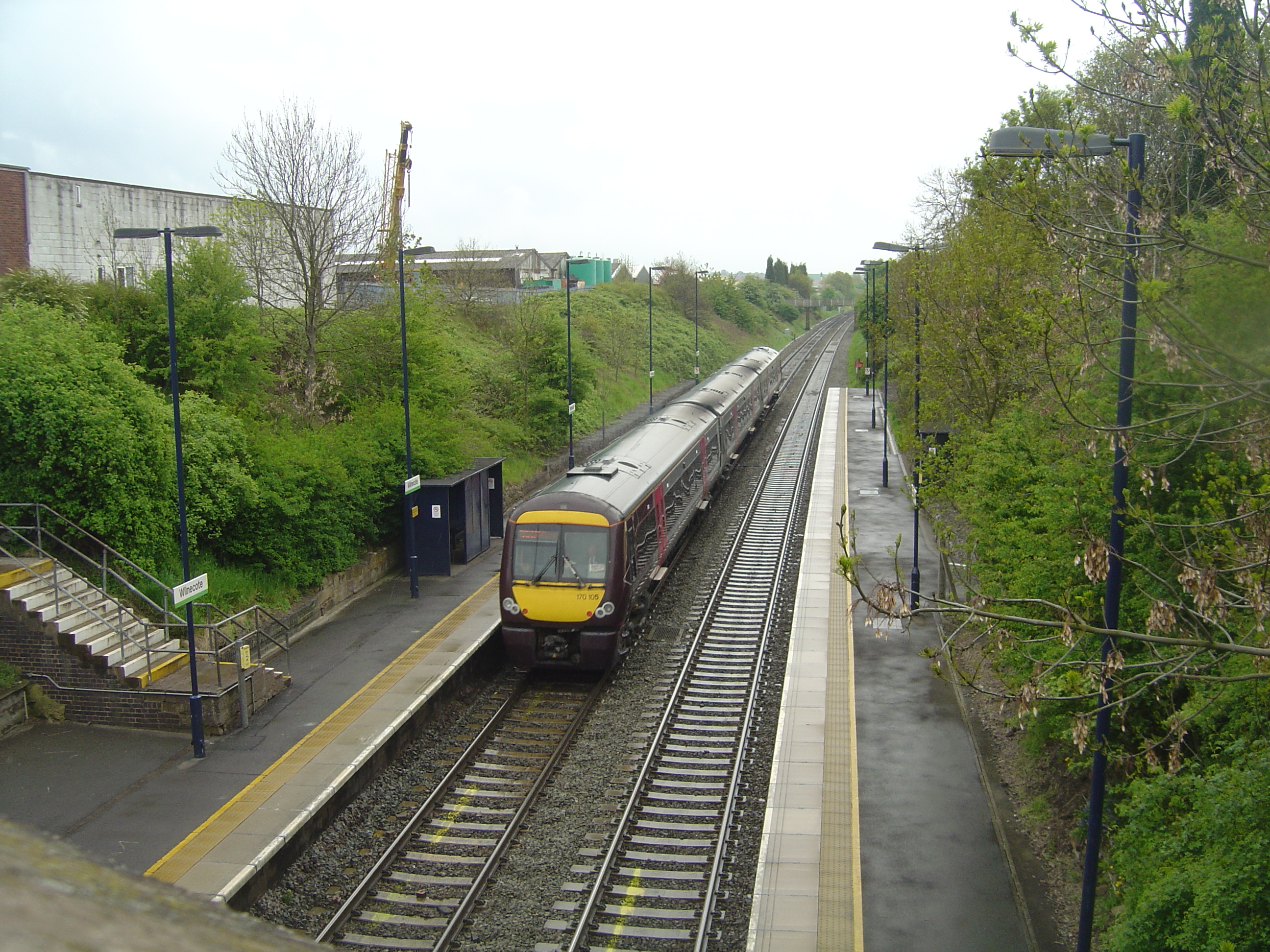
Wilnecote railway station
Wilnecote railway station is a small unmanned station serving Wilnecote 1.5 miles (2 km) south of Tamworth town centre in Staffordshire, England. The station...
Dosthill
Dosthill is an area of Tamworth, Staffordshire, 2.5 miles south of the town centre, and close to the River Tame. The area is mostly residential, centering...
Tamworth Enterprise College
Tamworth Enterprise College (formerly Belgrave High School) is a coeducational secondary school with academy status in Tamworth, Staffordshire, England...
Freasley
Freasley is a small village in Warwickshire, England. It has a church and a Grade II listed Hall. == References == == External links == Media related...
Tamworth services
Tamworth services is a motorway service station on the M42 motorway near Tamworth Staffordshire, England. The border between Staffordshire and Warwickshire...
Stonydelph
Stonydelph is a neighbourhood about 2 miles (3 km) south east of the centre of Tamworth, Staffordshire. A spelling of "Stoneydelph" is sometimes used but...
Nearby Amenities
Located within 500m of 52.603189,-1.6645904Have you been to Tinkers Green?
Leave your review of Tinkers Green below (or comments, questions and feedback).