South Beach

Beach in Suffolk East Suffolk

England

South Beach

Claremont Pier in the snow Not many sunbathers on the beach today.
Claremont Pier in the snow Credit: Richard Woods

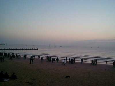
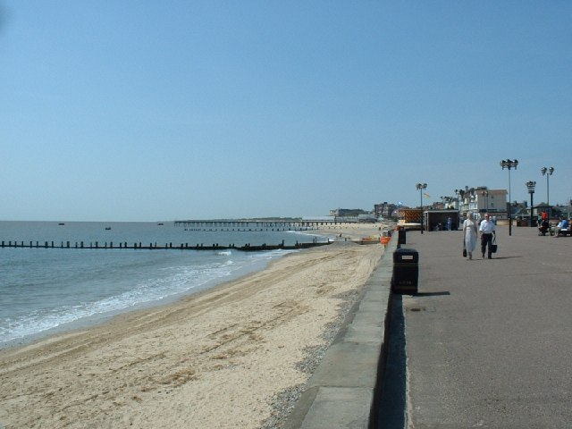
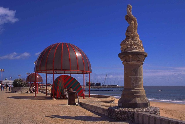
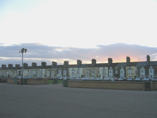
South Beach, Suffolk, commonly referred to as Beach, is a picturesque coastal village located on the east coast of England. Situated in the Suffolk Coastal district, it is part of the larger town of Lowestoft. South Beach is renowned for its stunning sandy beach, which stretches for approximately two miles along the North Sea coast.

The beach at South Beach is a popular destination for both locals and tourists, attracting visitors from all over the country. Its wide expanse of golden sand provides ample space for sunbathing, picnicking, and beach games during the summer months. The clean and well-maintained beach also offers opportunities for swimming, paddling, and exploring the seashore.

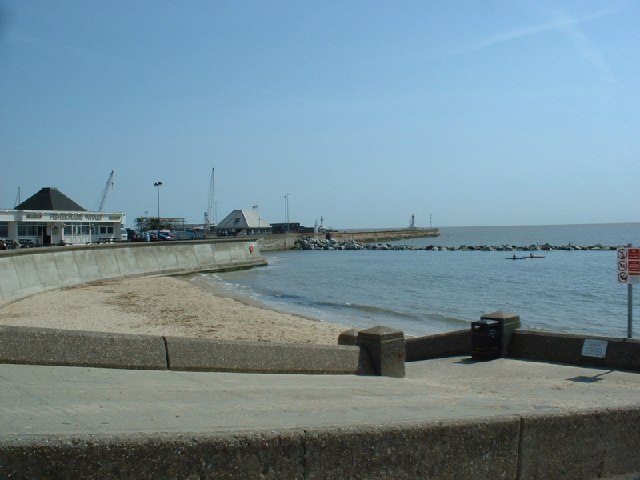
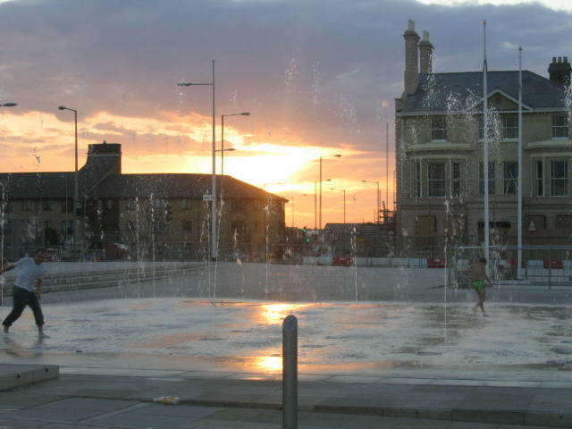
South Beach boasts a vibrant and lively atmosphere, especially during the peak holiday season. The beachfront is lined with a range of amenities, including cafes, restaurants, and ice cream parlors, catering to the needs of beachgoers. The village also has a number of shops and boutiques, offering a variety of souvenirs, beachwear, and locally made crafts.

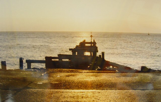
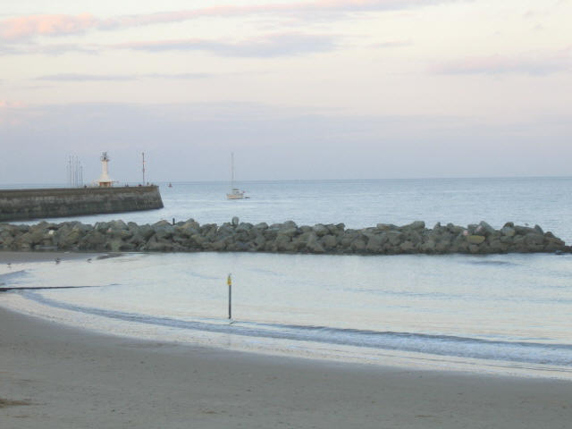
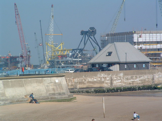
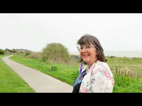
In addition to its natural beauty, South Beach is surrounded by stunning coastal landscapes. Visitors can explore the nearby nature reserves and enjoy scenic walks along the cliffs. The area is also a haven for birdwatchers, with a wide variety of bird species inhabiting the coastline.

South Beach, Suffolk, offers a perfect blend of natural beauty, recreational activities, and coastal charm, making it an ideal destination for those seeking a seaside getaway.

If you have any feedback on the listing, please let us know in the comments section below.

South Beach Images

Images are sourced within 2km of 52.466779/1.7469649 or Grid Reference TM5492. Thanks to Geograph Open Source API. All images are credited.

Claremont Pier in the snow Not many sunbathers on the beach today.
Claremont Pier in the snow
Not many sunbathers on the beach today.
Lowestoft Beach - "Sunrise Coast" on the dawn of the millennium This picture shows some of the people of Lowestoft (most easterly town in the British Isles) waiting to see the sun rise across the North Sea on 1st January 2000. Being at the far east of the country, this coast (depending upon the time of year) is often the first to receive the rays of the rising sun. The tourism local authority use the title of "Sunrise Coast" in their promotional literature.

This particular sunrise was definitely  the "morning after the night before". A proportion of the people here slept on the beach following the 40000 strong millennium eve party that had taken place a few hours earlier. (Seemed like a good idea at the time!)
Lowestoft Beach - "Sunrise Coast" on the dawn of the millennium
This picture shows some of the people of Lowestoft (most easterly town in the British Isles) waiting to see the sun rise across the North Sea on 1st January 2000. Being at the far east of the country, this coast (depending upon the time of year) is often the first to receive the rays of the rising sun. The tourism local authority use the title of "Sunrise Coast" in their promotional literature. This particular sunrise was definitely the "morning after the night before". A proportion of the people here slept on the beach following the 40000 strong millennium eve party that had taken place a few hours earlier. (Seemed like a good idea at the time!)
Plaque at Centre of The EuroScope, Ness Point, Lowestoftness, Lowestoft, Suffolk Lowestoftness is the most easterly point of the British Isles. This auspicious site is marked with a gas holder, frozen food factory, the town dump and a relatively small commemorative piece: the Euroscope. The Euroscope is a large flat indicator set into the concrete of the sea wall structure showing directions and distances to various places. In the centre of the Euroscope is the above plaque. Since this photo was taken (December 2004), the Tallest Wind Turbine in the UK has been built near this point - a long over-due structure to be proud of at one of the cardinal points of these islands
Plaque at Centre of The EuroScope, Ness Point, Lowestoftness, Lowestoft, Suffolk
Lowestoftness is the most easterly point of the British Isles. This auspicious site is marked with a gas holder, frozen food factory, the town dump and a relatively small commemorative piece: the Euroscope. The Euroscope is a large flat indicator set into the concrete of the sea wall structure showing directions and distances to various places. In the centre of the Euroscope is the above plaque. Since this photo was taken (December 2004), the Tallest Wind Turbine in the UK has been built near this point - a long over-due structure to be proud of at one of the cardinal points of these islands
Ness Point, Lowestoft Ness, Lowestoft, Suffolk - Most Easterly Point in the British Isles A view looking east from Ness Point from the position of the (then) future Euroscope (see supplemental picture). This photo was taken soon after sunrise on Easter Morning 1990. A groyne (characteristic of the coastal defences in this area) points defiantly towards Europe like a finger, marking the easternmost point of the kingdom.
Ness Point, Lowestoft Ness, Lowestoft, Suffolk - Most Easterly Point in the British Isles
A view looking east from Ness Point from the position of the (then) future Euroscope (see supplemental picture). This photo was taken soon after sunrise on Easter Morning 1990. A groyne (characteristic of the coastal defences in this area) points defiantly towards Europe like a finger, marking the easternmost point of the kingdom.
South Pier, Lowestoft Lowestoft's South Pier
South Pier, Lowestoft
Lowestoft's South Pier
Lowestoft beach The beach at Lowestoft, looking South from by the East Point Pavilion.
Lowestoft beach
The beach at Lowestoft, looking South from by the East Point Pavilion.
Terraced Houses in Riverside Road, Lowestoft A row of Victorian terrace houses in an industrial part of Lowestoft. These houses are right outside the gate of one of the larger factories (visible in the background): the Co-op canning factory (now no longer in operation). Interestingly, the doors are all painted "Co-op blue", so these may've been factory owned at the time.
Terraced Houses in Riverside Road, Lowestoft
A row of Victorian terrace houses in an industrial part of Lowestoft. These houses are right outside the gate of one of the larger factories (visible in the background): the Co-op canning factory (now no longer in operation). Interestingly, the doors are all painted "Co-op blue", so these may've been factory owned at the time.
Local Council Plaque marking the Easterly Extremity of the British Isles. Mounted on the sea wall adjacent to the Euroscope.
Local Council Plaque marking the Easterly Extremity of the British Isles.
Mounted on the sea wall adjacent to the Euroscope.
The Euroscope at Ness Point at Lowestoft The most easterly point in Britain. I was cycling from Lands End to John O'Groats but taking in the four cardinal points of the British mainland too. Lowestoft is well off the sensible route from LE to JOG, if there is such a thing! The Euroscope is a nice touch - pity it's hidden away behind an industrial estate!
The Euroscope at Ness Point at Lowestoft
The most easterly point in Britain. I was cycling from Lands End to John O'Groats but taking in the four cardinal points of the British mainland too. Lowestoft is well off the sensible route from LE to JOG, if there is such a thing! The Euroscope is a nice touch - pity it's hidden away behind an industrial estate!
Lowestoft Promenade The refurbished promenade at Lowestoft, Suffolk - the sunrise coast.
Lowestoft Promenade
The refurbished promenade at Lowestoft, Suffolk - the sunrise coast.
Lowestoft Fishing Boats 1954
Beach huts near Claremont Pier
Lowestoft Ness This imposing looking structure which stands immediately behind the Euroscope at Lowestoft Ness is not in fact a tourist attraction but part of a new water treatment works
Lowestoft Ness
This imposing looking structure which stands immediately behind the Euroscope at Lowestoft Ness is not in fact a tourist attraction but part of a new water treatment works
Harbour wall The harbour wall with the lighthouse on the end just makes it into <a href="https://www.geograph.org.uk/gridref/TM5592">TM5592</a>.
Harbour wall
The harbour wall with the lighthouse on the end just makes it into TM5592.
Marine Parade at sunset
Fountain at the north end of Marine Parade One of those fountains that consist of several jets that turn on and off apparently at random.  Children were playing among the jets as the sun set.
Fountain at the north end of Marine Parade
One of those fountains that consist of several jets that turn on and off apparently at random. Children were playing among the jets as the sun set.
Lowestoft inner harbour The statue of a fisherman silhouetted against the evening sky on the end of the bridge over the entrance to the inner harbour.
Lowestoft inner harbour
The statue of a fisherman silhouetted against the evening sky on the end of the bridge over the entrance to the inner harbour.
Show me another place!

South Beach is located at Grid Ref: TM5492 (Lat: 52.466779, Lng: 1.7469649)

Administrative County: Suffolk

District: East Suffolk

Police Authority: Suffolk

What 3 Words

///assets.rents.refuse. Near Lowestoft, Suffolk

Nearby Locations

South Beach Royal Green

Related Wikis

Claremont Pier

The Claremont Pier is a traditional seaside pier in Lowestoft in the English county of Suffolk. Opened in 1903 and named after nearby Claremont Road, the...

Royal Norfolk and Suffolk Yacht Club

The Royal Norfolk and Suffolk Yacht Club is a private yacht club based in Lowestoft in Suffolk. It was founded on 9 April 1859. == External links == Official...

Kirkley

Kirkley is an area of the town of Lowestoft in the East Suffolk district of the English county of Suffolk. It is located south of the centre of Lowestoft...

Lowestoft Lifeboat Station

Lowestoft Lifeboat Station is a Royal National Lifeboat Institution (RNLI) operated lifeboat station in the town of Lowestoft in the English county of...

Related Videos

Pakefield holiday park

Pakefield holiday park ( not Pontins ) in Suffolk near Lowestoft.

LOWESTOFT - Tour of holiday seaside town Lowestoft

LOWESTOFT - Tour of holiday seaside town Lowestoft Suffolk A walk along the beach and seafront to see what Lowestoft is like ...

Park Holidays: Broadland Sands Holiday Park, Lowestoft, Suffolk, UK

Philip and Gill take a brief tour of the static caravan holiday park on Sedge Ways / HoverBoards.

LOWESTOFT | Full seaside tour of Lowestoft, Suffolk

We visit Lowestoft Suffolk for a virtual walking tour around this seaside holiday town, known for it's great beaches, the famous ...

Nearby Amenities

Located within 500m of 52.466779,1.7469649
Bus Stop
Lorne Park Road
Bus: yes
Naptan AtcoCode: 390070452
Naptan Bearing: NE
Naptan CommonName: Lorne Park Road
Naptan Indicator: adj
Naptan Landmark: Lorne Park Road
Naptan NaptanCode: sufjagtd
Naptan PlusbusZoneRef: LOWSTFT
Naptan Street: London Road South
Naptan Verified: no
Public Transport: platform
Source: naptan_import
Lat/Long: 52.4655417/1.7426657
Bus Stop
Union Place
Bus: yes
Naptan AtcoCode: 390070453
Naptan Bearing: NE
Naptan CommonName: Union Place
Naptan Indicator: adj
Naptan Landmark: Union Place
Naptan NaptanCode: sufjagtg
Naptan Street: London Road South
Naptan Verified: no
Public Transport: platform
Source: naptan_import
Lat/Long: 52.4671855/1.7441603
Bus Stop
Freemantle Road
Bus: yes
Naptan AtcoCode: 390070454
Naptan Bearing: N
Naptan CommonName: Freemantle Road
Naptan Indicator: adj
Naptan Landmark: Freemantle Road
Naptan NaptanCode: sufjagtj
Naptan Street: London Road South
Naptan Verified: no
Public Transport: platform
Source: naptan_import
Lat/Long: 52.4683417/1.7451423
Bus Stop
Mill Road
Bus: yes
Naptan AtcoCode: 390070455
Naptan Bearing: N
Naptan CommonName: Mill Road
Naptan Indicator: adj
Naptan Landmark: Mill Road
Naptan NaptanCode: sufjagtm
Naptan Street: London Road South
Naptan Verified: no
Public Transport: platform
Source: naptan_import
Lat/Long: 52.4699136/1.746631
East Point Pavilion
Naptan AtcoCode: 390070469
Naptan Bearing: S
Naptan BusStopType: CUS
Naptan CommonName: East Point Pavilion
Naptan Indicator: adj
Naptan Landmark: Coach Stop
Naptan NaptanCode: sufjajap
Naptan Street: Royal Plain
Naptan Verified: no
Source: naptan_import
Lat/Long: 52.4710782/1.7489911
Bus Stop
Waterloo Road
Bus: yes
Naptan AtcoCode: 390070470
Naptan Bearing: S
Naptan CommonName: Waterloo Road
Naptan Indicator: adj
Naptan Landmark: Waterloo Road
Naptan NaptanCode: sufjajat
Naptan Street: Victoria Terrace
Naptan Verified: no
Public Transport: platform
Source: naptan_import
Lat/Long: 52.4679456/1.7462869
Bus Stop
Claremont Pier
Bus: yes
Naptan AtcoCode: 390070471
Naptan Bearing: S
Naptan CommonName: Claremont Pier
Naptan Indicator: o/s
Naptan Landmark: Claremont Pier
Naptan NaptanCode: sufjajaw
Naptan Street: Kirkley Cliff
Naptan Verified: no
Public Transport: platform
Source: naptan_import
Lat/Long: 52.4660738/1.7446108
Bus Stop
Kirkley (Lowestoft), adj London Road South
Bus: yes
Naptan AtcoCode: 390070472
Naptan Bearing: W
Naptan CommonName: London Road South
Naptan Indicator: adj
Naptan Landmark: London Road South
Naptan NaptanCode: sufjajda
Naptan PlusbusZoneRef: LOWSTFT
Naptan Street: Cliff Road
Naptan Verified: no
Public Transport: platform
Source: naptan_import
Lat/Long: 52.4646395/1.7427511
Bus Stop
Cliff Road
Bus: yes
Naptan AtcoCode: 390070473
Naptan Bearing: S
Naptan CommonName: Cliff Road
Naptan Indicator: opp
Naptan Landmark: Cliff Road
Naptan NaptanCode: sufjajdg
Naptan Street: Kirkley Cliff Road
Naptan Verified: no
Public Transport: platform
Source: naptan_import
Lat/Long: 52.4641028/1.7429411
Bus Stop
Mill Road
Bus: yes
Naptan AtcoCode: 390071037
Naptan Bearing: W
Naptan CommonName: Mill Road
Naptan Indicator: opp
Naptan NaptanCode: sufjtgjt
Naptan Street: Mill Road
Naptan Verified: no
Public Transport: platform
Source: naptan_import
Lat/Long: 52.4697765/1.7461333
Traffic Signals
Lat/Long: 52.4648293/1.7421874
Traffic Calming: hump
Lat/Long: 52.4699668/1.7428037
Crossing
Bicycle: yes
Crossing: uncontrolled
Crossing Ref: zebra
Tactile Paving: yes
Lat/Long: 52.4692136/1.7425276
Barrier: bollard
Bicycle: yes
Lat/Long: 52.4700262/1.7444687
Barrier: bollard
Lat/Long: 52.4684085/1.7473042
Seamark Light Character: Fl
Seamark Light Colour: red
Seamark Light Height: 5
Seamark Light Period: 5
Seamark Light Range: 3
Seamark Light Reference: A 2282
Seamark Type: light_minor
Source: US NGA Pub. 114. 2011-04-02
Lat/Long: 52.4651004/1.7479927
Cafe
Desmond's Coffee Shop
Addr City: Lowestoft
Addr Housenumber: 221b
Addr Postcode: NR33 0DS
Addr Street: London Road South
Cuisine: coffee_shop
Internet Access: no
Lat/Long: 52.4669315/1.7439433
Barrier: bollard
Lat/Long: 52.466299/1.7433796
Waste Basket
Lat/Long: 52.4680306/1.7423726
Vending Machine
Vending: parking_tickets
Lat/Long: 52.4680424/1.7423435
Crossing
Crossing: uncontrolled
Lat/Long: 52.4682154/1.7415292
Crossing
Crossing: uncontrolled
Lat/Long: 52.4682601/1.7427085
Crossing
Crossing: uncontrolled
Lat/Long: 52.4684362/1.7427714
Vending Machine
Vending: parking_tickets
Lat/Long: 52.4685778/1.7426292
Crossing
Lat/Long: 52.4687771/1.7427185
Waste Basket
Lat/Long: 52.4688315/1.7424961
Waste Basket
Note: General waste and recycling in a separate split container
Lat/Long: 52.4642929/1.7438597
Bicycle Parking
Bicycle Parking: stands
Capacity: 8
Covered: no
Lat/Long: 52.4643179/1.7437776
Barrier: bollard
Lat/Long: 52.4643348/1.7439297
Bench
Backrest: yes
Colour: gray
Material: metal
Lat/Long: 52.4643548/1.7436583
Bench
Backrest: yes
Colour: gray
Material: metal
Lat/Long: 52.4643703/1.7436094
Bench
Backrest: yes
Material: wood
Lat/Long: 52.464376/1.7440636
Bench
Backrest: no
Colour: gray
Material: metal
Lat/Long: 52.4643852/1.7438939
Bench
Backrest: no
Colour: gray
Material: metal
Lat/Long: 52.4643965/1.743845
Bicycle Parking
Bicycle Parking: stands
Capacity: 8
Covered: no
Lat/Long: 52.4644096/1.7434627
Bench
Backrest: no
Colour: gray
Material: metal
Lat/Long: 52.4644305/1.7437257
Bench
Backrest: no
Colour: gray
Material: metal
Lat/Long: 52.4644478/1.7436778
Bicycle Parking
Bicycle Parking: stands
Capacity: 8
Covered: no
Lat/Long: 52.4644758/1.743581
Bench
Backrest: no
Colour: gray
Material: metal
Lat/Long: 52.4645187/1.7434441
Bench
Backrest: yes
Material: wood
Lat/Long: 52.4646508/1.7442871
Bench
Backrest: yes
Material: wood
Lat/Long: 52.4649034/1.7444905
Bench
Backrest: yes
Material: wood
Lat/Long: 52.4651024/1.7446489
Bench
Backrest: yes
Material: wood
Lat/Long: 52.4653181/1.744825
Bench
Backrest: no
Colour: gray
Material: metal
Lat/Long: 52.4660788/1.7451665
Bench
Backrest: no
Colour: gray
Material: metal
Lat/Long: 52.4661032/1.7451039
Barrier: bollard
Lat/Long: 52.4661446/1.7452829
Bench
Backrest: yes
Colour: gray
Material: metal
Lat/Long: 52.4661491/1.7449582
Bench
Backrest: yes
Colour: gray
Material: metal
Lat/Long: 52.4661616/1.7451557
Bench
Backrest: yes
Colour: gray
Material: metal
Lat/Long: 52.4661705/1.7449025
Bench
Backrest: yes
Colour: gray
Material: metal
Lat/Long: 52.4661777/1.7451127
Waste Basket
Note: General waste and recycling in a separate split container
Lat/Long: 52.4662065/1.7448102
Bench
Backrest: no
Colour: gray
Material: metal
Lat/Long: 52.4662158/1.7449993
Bench
Backrest: yes
Colour: brown
Material: wood
Lat/Long: 52.4662249/1.7451094
Bench
Backrest: no
Colour: gray
Material: metal
Lat/Long: 52.4662337/1.7449553
Waste Basket
Lat/Long: 52.4662443/1.7450457
Bicycle Parking
Bicycle Parking: stands
Lat/Long: 52.466264/1.7448633
Bench
Backrest: yes
Colour: brown
Material: wood
Lat/Long: 52.4662681/1.7449763
Barrier: bollard
Lat/Long: 52.4663039/1.7448229
Bench
Backrest: yes
Material: wood
Lat/Long: 52.4664754/1.7457918
Bench
Backrest: yes
Colour: brown
Material: wood
Lat/Long: 52.4665414/1.7455898
Waste Basket
Lat/Long: 52.4666815/1.74527
Bench
Backrest: yes
Material: wood
Lat/Long: 52.4667126/1.746
Bench
Backrest: yes
Material: wood
Lat/Long: 52.466881/1.7461331
Bench
Backrest: yes
Colour: brown
Material: wood
Lat/Long: 52.4669697/1.7459746
Waste Basket
Lat/Long: 52.4669706/1.7458936
Bench
Backrest: yes
Material: wood
Lat/Long: 52.4670626/1.7462835
Bench
Backrest: yes
Material: wood
Lat/Long: 52.467186/1.7464036
Bench
Backrest: yes
Colour: brown
Material: wood
Lat/Long: 52.4672185/1.7461986
Bench
Backrest: yes
Colour: brown
Material: wood
Lat/Long: 52.4673796/1.7461613
Waste Basket
Lat/Long: 52.4673999/1.7460947
Barrier: bollard
Lat/Long: 52.4674659/1.7463417
Bicycle Parking
Bicycle Parking: stands
Capacity: 8
Covered: no
Lat/Long: 52.4674756/1.7461809
Barrier: bollard
Lat/Long: 52.4675045/1.7459271
Bicycle Parking
Bicycle Parking: stands
Capacity: 8
Covered: no
Lat/Long: 52.4675223/1.7460366
Waste Basket
Note: General waste and recycling in a separate split container
Lat/Long: 52.467526/1.7462984
Bench
Backrest: no
Colour: gray
Material: metal
Lat/Long: 52.4675423/1.7462412
Bench
Backrest: no
Colour: gray
Material: metal
Lat/Long: 52.4675522/1.7462064
Bench
Backrest: yes
Material: wood
Lat/Long: 52.4675799/1.7466116
Bench
Backrest: yes
Colour: gray
Material: metal
Lat/Long: 52.4675784/1.7461113
Telephone
Booth: KX100
Covered: booth
Operator: BT
Payment Coins: yes
Payment Credit Cards: yes
Payment Debit Cards: yes
Lat/Long: 52.4675834/1.7461399
Bench
Backrest: yes
Colour: gray
Material: metal
Lat/Long: 52.4675878/1.7460775
Bench
Backrest: yes
Material: wood
Lat/Long: 52.4676663/1.7468713
Bench
Backrest: yes
Material: wood
Lat/Long: 52.4677328/1.7467528
Post Box
Brand: Royal Mail
Brand Wikidata: Q638098
Brand Wikipedia: en:Royal Mail
Collection Times: Mo-Fr 17:30; Sa 12:30
Operator: Royal Mail
Operator Wikidata: Q638098
Ref: NR33 3300
Lat/Long: 52.4678289/1.7452742
Bench
Backrest: yes
Material: wood
Lat/Long: 52.4678946/1.7470756
Bench
Backrest: no
Colour: black
Material: wood
Lat/Long: 52.468121/1.7472757
Bench
Backrest: yes
Colour: black
Inscription: In memory of Captain Omar Bilal / Royal Jordanian Air Force / 27-7-1997
Material: wood
Lat/Long: 52.4682042/1.7471808
Bench
Backrest: yes
Material: wood
Lat/Long: 52.4694305/1.7482913
Waste Basket
Lat/Long: 52.4695004/1.7474774
Vending Machine
Vending: parking_tickets
Lat/Long: 52.4695076/1.7474842
Bench
Backrest: yes
Material: wood
Lat/Long: 52.4695132/1.7483653
Bench
Backrest: yes
Material: wood
Lat/Long: 52.4697397/1.7485813
Bench
Backrest: yes
Material: wood
Lat/Long: 52.4697782/1.7486168
Bench
Backrest: yes
Material: wood
Lat/Long: 52.4698262/1.7486616
Crossing
Crossing: uncontrolled
Crossing Ref: zebra
Lat/Long: 52.4698622/1.7479416
Bench
Backrest: yes
Material: wood
Lat/Long: 52.4698685/1.748697
Bench
Backrest: yes
Material: wood
Lat/Long: 52.4701101/1.7489374
Crossing
Crossing: uncontrolled
Tactile Paving: yes
Lat/Long: 52.4701459/1.7480875
Bench
Backrest: yes
Material: wood
Lat/Long: 52.4701477/1.7489729
Vending Machine
Vending: parking_tickets
Lat/Long: 52.4701764/1.7481422
Bench
Backrest: yes
Material: wood
Lat/Long: 52.4703611/1.7491673
Bench
Backrest: yes
Material: wood
Lat/Long: 52.4703968/1.7492012
Crossing
Crossing: uncontrolled
Crossing Ref: zebra
Lat/Long: 52.4704536/1.7485043
Vending Machine
Vending: parking_tickets
Lat/Long: 52.4704869/1.7484054
Bench
Backrest: yes
Material: wood
Lat/Long: 52.470643/1.7494357
Bench
Backrest: yes
Material: wood
Lat/Long: 52.4706797/1.7494712
Bench
Backrest: yes
Material: wood
Lat/Long: 52.4707163/1.7495036
Bench
Backrest: yes
Material: wood
Lat/Long: 52.470737/1.7496887
Bench
Backrest: yes
Material: wood
Lat/Long: 52.4707577/1.7495422
Bench
Backrest: yes
Material: wood
Lat/Long: 52.4708234/1.7497767
Crossing
Tactile Paving: yes
Lat/Long: 52.4708696/1.7487867
Bench
Backrest: yes
Material: wood
Lat/Long: 52.4709099/1.7498615
Crossing
Crossing: uncontrolled
Crossing Ref: zebra
Lat/Long: 52.4710766/1.7490924
Vending Machine
Vending: parking_tickets
Lat/Long: 52.4710802/1.749038
Post Box
Brand: Royal Mail
Brand Wikidata: Q638098
Brand Wikipedia: en:Royal Mail
Collection Times: Mo-Fr 09:00; Sa 07:00
Operator: Royal Mail
Operator Wikidata: Q638098
Post Box Type: lamp
Ref: NR33 3309D
Royal Cypher: EIIR
Royal Cypher Wikidata: Q33102113
Lat/Long: 52.4668345/1.7398419
Barrier: bollard
Lat/Long: 52.4683689/1.741776
Post Box
Brand: Royal Mail
Brand Wikidata: Q638098
Brand Wikipedia: en:Royal Mail
Collection Times: Mo-Fr 09:00; Sa 07:00
Operator: Royal Mail
Operator Wikidata: Q638098
Post Box Type: pillar
Ref: NR33 3303D
Royal Cypher: EIIR
Royal Cypher Wikidata: Q33102113
Lat/Long: 52.4644072/1.7416903
Barrier: bollard
Bicycle: yes
Lat/Long: 52.4692414/1.7426171
Crossing
Crossing: traffic_signals
Crossing Ref: pelican
Tactile Paving: yes
Lat/Long: 52.4695734/1.7464885
Crossing
Crossing: traffic_signals
Crossing Ref: pelican
Tactile Paving: yes
Lat/Long: 52.4697194/1.7464976
Post Box
Brand: Royal Mail
Brand Wikidata: Q638098
Brand Wikipedia: en:Royal Mail
Collection Times: Mo-Fr 09:00; Sa 07:00
Operator: Royal Mail
Operator Wikidata: Q638098
Post Box Type: pillar
Ref: NR33 3308D
Royal Cypher: EIIR
Royal Cypher Wikidata: Q33102113
Lat/Long: 52.4699987/1.7458062
Barrier: bollard
Lat/Long: 52.4701962/1.7448452
South Beach Through The Decades
Board Type: history
Information: board
Tourism: information
Lat/Long: 52.4699062/1.7489518
Bench
Lat/Long: 52.4692763/1.7482276
Information: map
Tourism: information
Lat/Long: 52.4692575/1.7482102
Cafe
Tides Reach Ice Cream Parlour
Cuisine: ice_cream
Lat/Long: 52.4689557/1.7478588
Cafe
Pinky's
Cuisine: ice_cream
Takeaway: yes
Lat/Long: 52.4688372/1.7477609
Cafe
Michaels Fish & Chips
Cuisine: fish_and_chips
Takeaway: yes
Lat/Long: 52.4689663/1.7474458
Bench
Lat/Long: 52.468544/1.7477609
Bench
Lat/Long: 52.4685047/1.7477186
Artwork Type: sculpture
Tourism: artwork
Lat/Long: 52.4684165/1.7475973
Barrier: bollard
Foot: yes
Material: concrete
Lat/Long: 52.4654444/1.7418628
Barrier: bollard
Bollard: removable
Foot: yes
Material: metal
Lat/Long: 52.466184/1.7414924
Cheveux Boutique
Addr City: Lowestoft
Addr Country: GB
Addr Housenumber: 185
Addr Postcode: NR33 0DR
Addr Street: London Road South
Facebook: https://en-gb.facebook.com/cheveuxboutiquelowestoft/
Opening Hours: Tu 09:00-17:00; We 09:00-16:00; Th 09:00-20:00; Fr 09:00-17:00,09:00-14:30
Phone: +44 1502 574489
Shop: clothes
Website: http://www.cheveuxboutique.co.uk/
Lat/Long: 52.4677412/1.7446724
Pub
The Blues Bar
Addr City: Lowestoft
Addr Housenumber: 6
Addr Postcode: NR33 0PW
Addr Street: Mill Road
Lat/Long: 52.4701279/1.7456533
Pub
The Drifter
Addr City: Lowestoft
Addr Housenumber: 218
Addr Postcode: NR33 0BE
Addr Street: London Road South
Lat/Long: 52.4664002/1.7438368
Pub
The Plough & Sail
Addr City: Lowestoft
Addr Housenumber: 212
Addr Postcode: NR33 0BB
Addr Street: London Road South
Lat/Long: 52.4667627/1.7441774
Pub
The Royal Oak
Addr City: Lowestoft
Addr Housenumber: 195
Addr Postcode: NR33 0DR
Addr Street: London Road South
Lat/Long: 52.4674759/1.7444248
Pharmacy
East Point Pharmacy
Dispensing: yes
Healthcare: pharmacy
Opening Hours: Mo-Fr 09:00-18:00; Sa 09:00-12:00
Lat/Long: 52.467972/1.742819
Place Of Worship
The Salvation Army - Lowestoft South
Addr City: Lowestoft
Addr Country: GB
Addr Housenumber: 9
Addr Postcode: NR33 0RU
Addr Street: Carlton Road
Denomination: salvation_army
Phone: +44 1502 574815
Religion: christian
Website: https://www.salvationarmy.org.uk/lowestoft-south
Lat/Long: 52.4646516/1.7405981
Barrier: bollard
Lat/Long: 52.4656861/1.7420919
Crossing
Crossing: uncontrolled
Crossing Ref: zebra
Lat/Long: 52.4695556/1.7475267
Defibrillator
Defibrillator Location: On front of co-operative food. Left of entrance door.
Emergency: defibrillator
Indoor: no
Ref: AAA45
Ref GB The Circuit: 2D6EC71B-ECBB-41A7-8E0D-AE2800DB47F3
Lat/Long: 52.4666199/1.7436956
Defibrillator
Defibrillator Location: Fixed to external wall of Hatfield Hotel to the left of the building’s east entrance facing the beach. Cabinet is on hotel property but easily accessible, about 3 meters from the public path.
Emergency: defibrillator
Indoor: no
Operator: Heart 2 Heart Norfolk
Lat/Long: 52.4681733/1.7470908
William Hill
Addr City: Lowestoft
Addr Street: London Road South
Brand: William Hill
Brand Wikidata: Q4053147
Opening Hours: Mo-Sa 09:30-21:30; Su 10:00-20:00
Shop: bookmaker
Lat/Long: 52.4673234/1.7445984
Defibrillator
Defibrillator Location: On exterior wall of Beach Office facing towards the beach. There is a wooden storage shed immediately to the right of the defibrillator.
Emergency: defibrillator
Indoor: no
Lat/Long: 52.4633827/1.7436545
Communication Mobile Phone: yes
Layer: 1
Man Made: mast
Material: metal
Operator: Three UK;EE
Tower Construction: guyed_tube
Tower Type: communication
Lat/Long: 52.4673592/1.7438637
Give Way
Lat/Long: 52.4673853/1.744402
The data included in this document is from www.openstreetmap.org. The data is made available under ODbL.

Have you been to South Beach?

Leave your review of South Beach below (or comments, questions and feedback).