Atwick Sands

Beach in Yorkshire

England

Atwick Sands

The beach at Double Gates
The beach at Double Gates Credit: Ian S

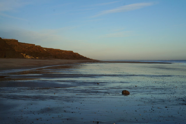
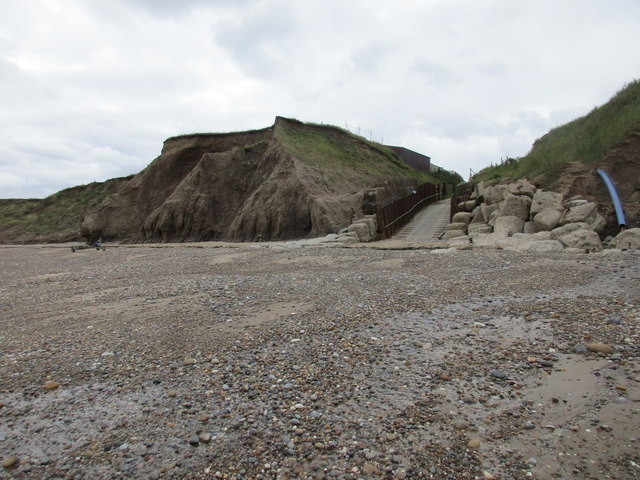
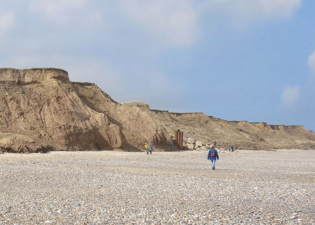
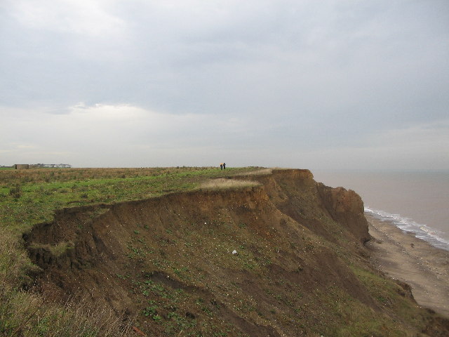
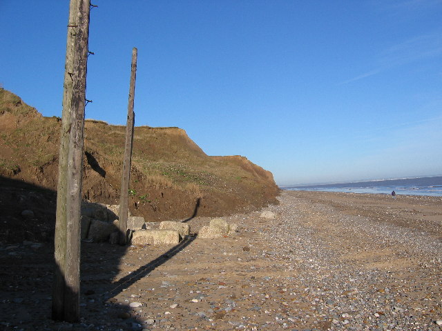
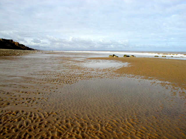
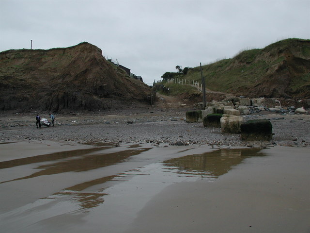
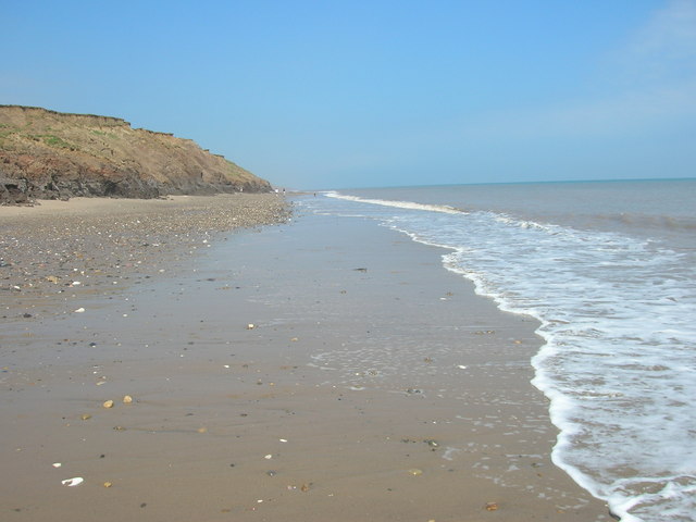
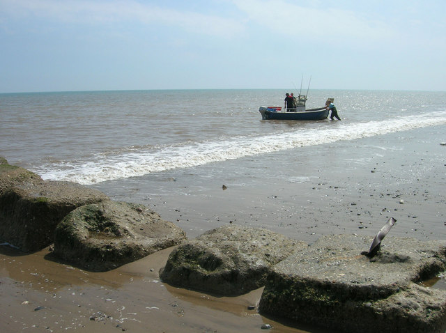
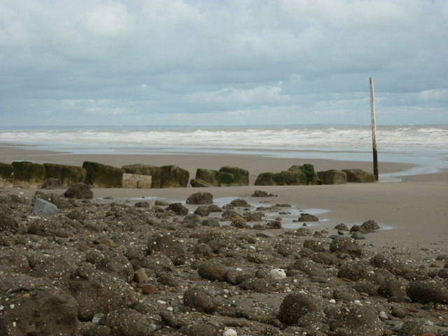
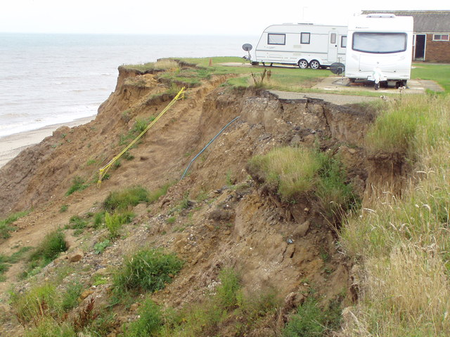
Atwick Sands is a picturesque beach located on the coast of Yorkshire, England. Situated near the village of Atwick, it offers visitors a tranquil and unspoiled natural setting. With its golden sand, clear blue waters, and stunning cliffs, the beach is a popular destination for locals and tourists alike.

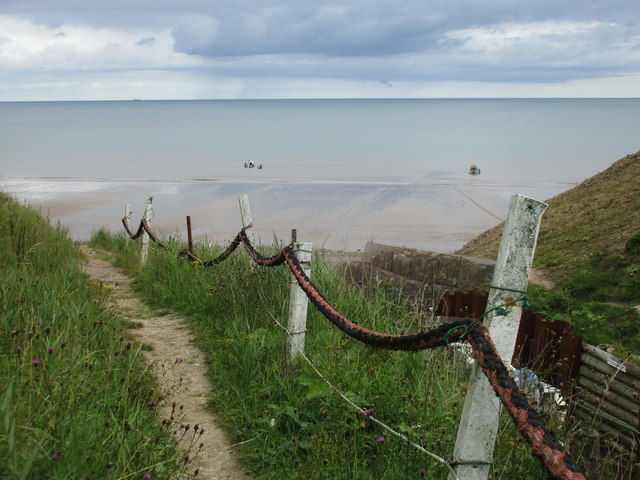
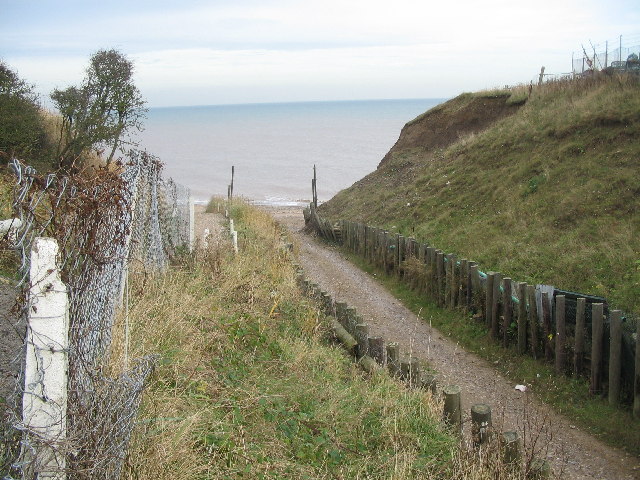
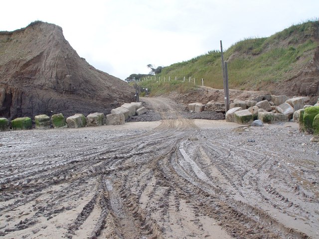
Stretching over half a mile, Atwick Sands provides ample space for sunbathing, picnicking, and leisurely strolls along the shore. The beach is backed by low-lying grassy dunes, providing a natural barrier from the wind and creating a sense of seclusion. It is worth noting that the beach is not lifeguarded, so visitors are advised to take caution when swimming.

The area surrounding Atwick Sands is rich in wildlife, making it a haven for nature enthusiasts. Birdwatchers can spot various species of seabirds, including gulls and terns, while rock pools at low tide reveal a diverse array of marine life, such as crabs, starfish, and small fish.

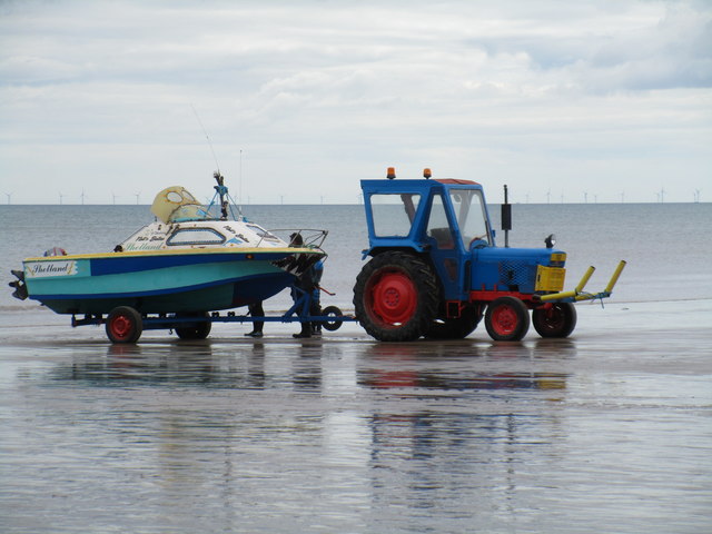
For those seeking a more active experience, Atwick Sands is an excellent spot for water sports. From kayaking and paddleboarding to surfing and windsurfing, the beach offers opportunities for both beginners and experienced enthusiasts.

Facilities at Atwick Sands are limited, with no shops or cafes directly on the beach. However, the nearby village of Atwick provides amenities such as parking, public toilets, and a few local shops and eateries. Overall, Atwick Sands is a hidden gem on the Yorkshire coast, offering a serene and natural escape for beachgoers and nature lovers alike.

If you have any feedback on the listing, please let us know in the comments section below.

Atwick Sands Images

Images are sourced within 2km of 53.943946/-0.17906133 or Grid Reference TA1951. Thanks to Geograph Open Source API. All images are credited.

The beach at Double Gates
Ready to launch This boat has been towed down from the Northcliff Boating Club site on the cliff top and is about to be pushed into the sea.
Ready to launch
This boat has been towed down from the Northcliff Boating Club site on the cliff top and is about to be pushed into the sea.
Beach access, Double Gates For the use of the Northcliff Boating Club. Anyone else has to scramble down the cliff as best they can.
Beach access, Double Gates
For the use of the Northcliff Boating Club. Anyone else has to scramble down the cliff as best they can.
The beach at Double Gates
Beach and Cliffs at Double Gates There is now very little land apart from beach left in TA2050. This is the extreme south west of the square.
Beach and Cliffs at Double Gates
There is now very little land apart from beach left in TA2050. This is the extreme south west of the square.
Double Gates Looking down the sailing club slipway to the area of beach known as Double Gates, although not much beach is visible at high tide! I assume the name comes from the open gates at the bottom of the slip, and the closed gates at the top of the slip, just behind the photographer position.
Double Gates
Looking down the sailing club slipway to the area of beach known as Double Gates, although not much beach is visible at high tide! I assume the name comes from the open gates at the bottom of the slip, and the closed gates at the top of the slip, just behind the photographer position.
Double Gates beach Looking north from the clifftop adjacent to the sailing club slipway at Double Gates, the soft nature of the cliffs can be seen. The section at centre right has been undermined and seems about to collapse onto the beach.
Double Gates beach
Looking north from the clifftop adjacent to the sailing club slipway at Double Gates, the soft nature of the cliffs can be seen. The section at centre right has been undermined and seems about to collapse onto the beach.
Beach  at Double Gates What you see here is just about all of the solid ground in this grid square. This view looking north from the SW corner of the square at TA2001350091. To the left are the twin posts of the North Cliff Boating Club slipway.
Beach at Double Gates
What you see here is just about all of the solid ground in this grid square. This view looking north from the SW corner of the square at TA2001350091. To the left are the twin posts of the North Cliff Boating Club slipway.
Atwick Beach Taken looking northwards towards the Bridlington Bay and Flamborough Head.
Atwick Beach
Taken looking northwards towards the Bridlington Bay and Flamborough Head.
Double Gates Beach The beach at Double Gates on the parish boundary between Atwick and Hornsea, looking southwest towards the boatyard slipway.
Double Gates Beach
The beach at Double Gates on the parish boundary between Atwick and Hornsea, looking southwest towards the boatyard slipway.
Double Gates Slipway and Beach Several craft had been towed by tractor to the water, hence the tyre marks.  The large stone blocks are an attempt to delay the erosion of the clay cliffs.
Double Gates Slipway and Beach
Several craft had been towed by tractor to the water, hence the tyre marks. The large stone blocks are an attempt to delay the erosion of the clay cliffs.
Double Gates Beach
Double Gates Beach
Coastal Defences, Double Gates
The beach at Double Gates
The Black Horse, Atwick
Cliff Road closed Presumably due to coastal erosion.
Cliff Road closed
Presumably due to coastal erosion.
End of the road
End of the road
Who's next to go? Caravan site and road facing erosion
Who's next to go?
Caravan site and road facing erosion
Show me another place!

Atwick Sands is located at Grid Ref: TA1951 (Lat: 53.943946, Lng: -0.17906133)

Division: East Riding

Unitary Authority: East Riding of Yorkshire

Police Authority: Humberside

What 3 Words

///mole.headliner.organist. Near Atwick, East Yorkshire

Nearby Locations

Atwick Sands Atwick Cliff

Related Wikis

Atwick

Atwick is a village and civil parish in Holderness in the East Riding of Yorkshire, England. The village is near the North Sea coast, and 2 miles (3.2...

Skirlington

Skirlington is a hamlet in the Holderness area of the East Riding of Yorkshire, England. It is situated approximately 3.5 miles (5.6 km) north of Hornsea...

Hornsea Cottage Hospital

Hornsea Cottage Hospital is a health facility in Eastgate, Hornsea, East Riding of Yorkshire, England. == History == The facility, which was built as a...

Bewholme Vicarage

Bewholme Vicarage, in the village of Bewholme, East Riding of Yorkshire, England, is a former vicarage designed by the architect William Burges in 1859...

Nearby Amenities

Located within 500m of 53.943946,-0.17906133
Source: PGS
Lat/Long: 53.9429675/-0.1793819
Material: wood
Power: pole
Lat/Long: 53.9404843/-0.1825659
Material: wood
Power: pole
Lat/Long: 53.9408785/-0.1818477
Material: wood
Power: pole
Lat/Long: 53.9413003/-0.1810484
Line Management: termination
Material: wood
Power: pole
Transformer: distribution
Lat/Long: 53.9417099/-0.1802281
The data included in this document is from www.openstreetmap.org. The data is made available under ODbL.

Have you been to Atwick Sands?

Leave your review of Atwick Sands below (or comments, questions and feedback).